The Lake on Mt Ashland

If you know where to look, there is a small lake on southern Oregon’s Mt Ashland.

Top: the lakebed this year. Bottom: the lake full of water on July 4, 2011. The two pictures were taken from about the same place.

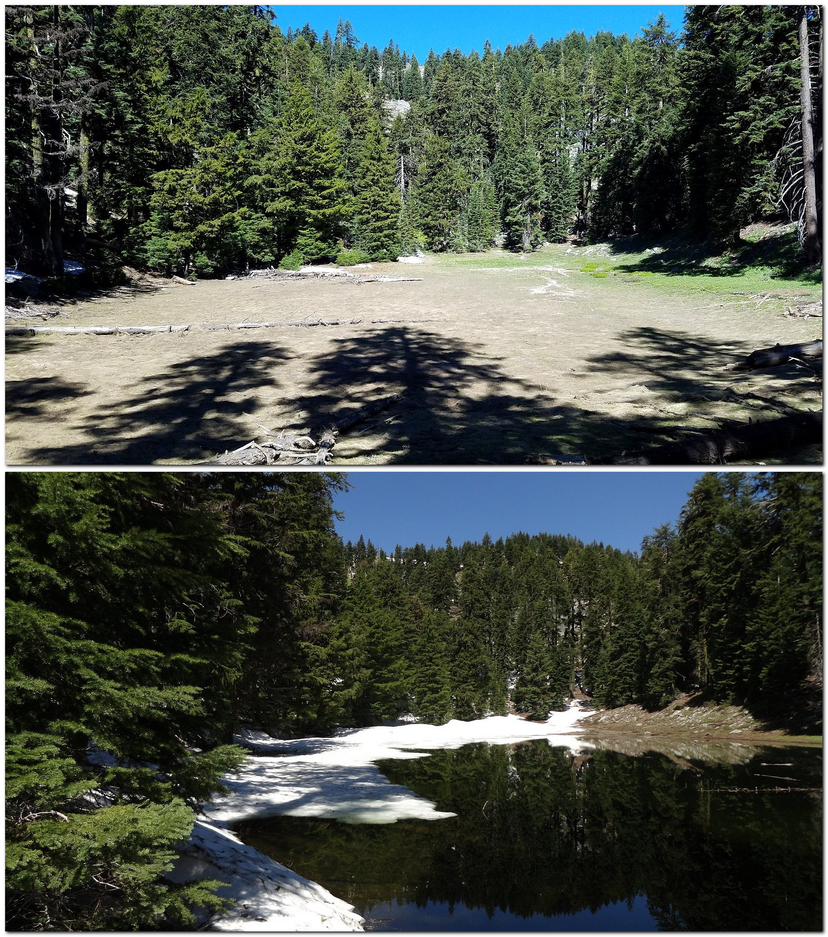
Let me qualify that. It’s not actually a lake, it’s more like a large vernal pool. And it isn’t directly on Mt Ashland, it’s on the west wall of Grouse Gap, the big meadow-filled basin that lies just west of Mt Ashland. Mt Ashland forms Grouse Gap’s east wall. But if you get to the right place at just the right time – most of the way, but not all of the way, through the snowmelt season – there is, in fact, a lake there.

Wednesday of this week wasn’t the right time. We were too late: the lake had come and gone, which is the way we commonly find it. We’ve been able to get there when the lake was full only once. But it’s always fun trying.

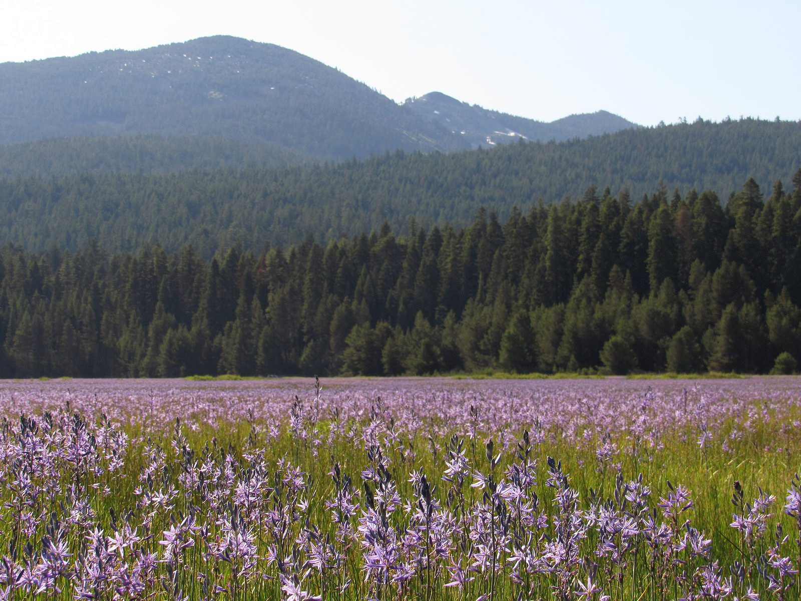
Yesterday’s hike started early, with breakfast at The Breadboard in Ashland shortly after 7:00 AM, followed by a drive up I-5 and the Mt Ashland Ski Road to Forest Road 20, which heads west from the ski area along the crest of the Siskious, a high landscape of rocky peaks, lingering snow, and wildflower meadows – but very few lakes – to Dutchman’s Peak. By 10:00, following a couple of stops and some really slow driving along heavily-potholed Road 20, we were ready to walk.

Mt Shasta from Grouse Gap.

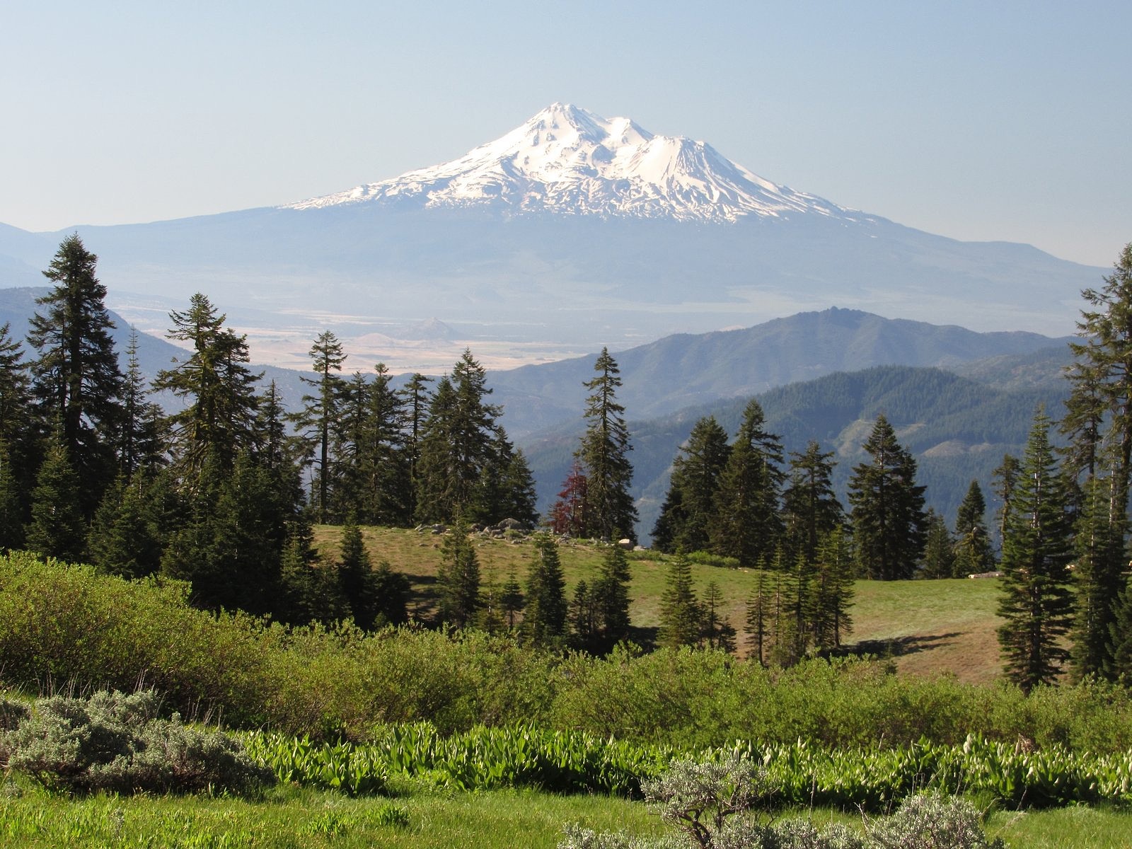
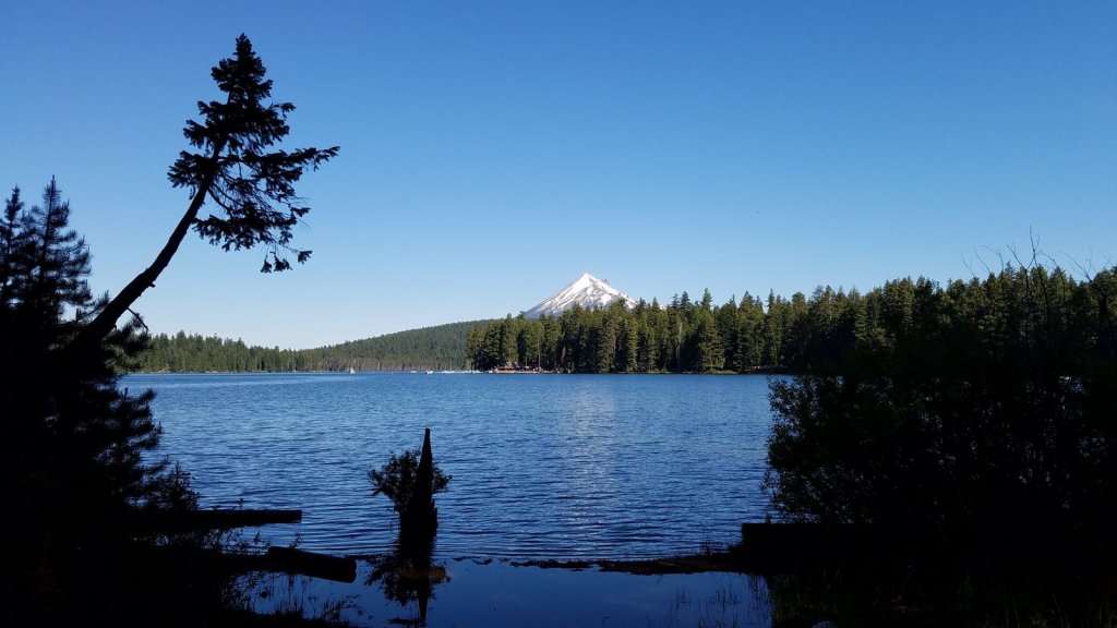
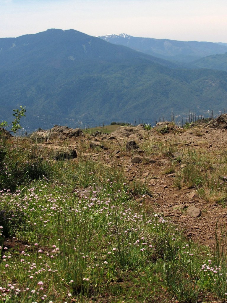
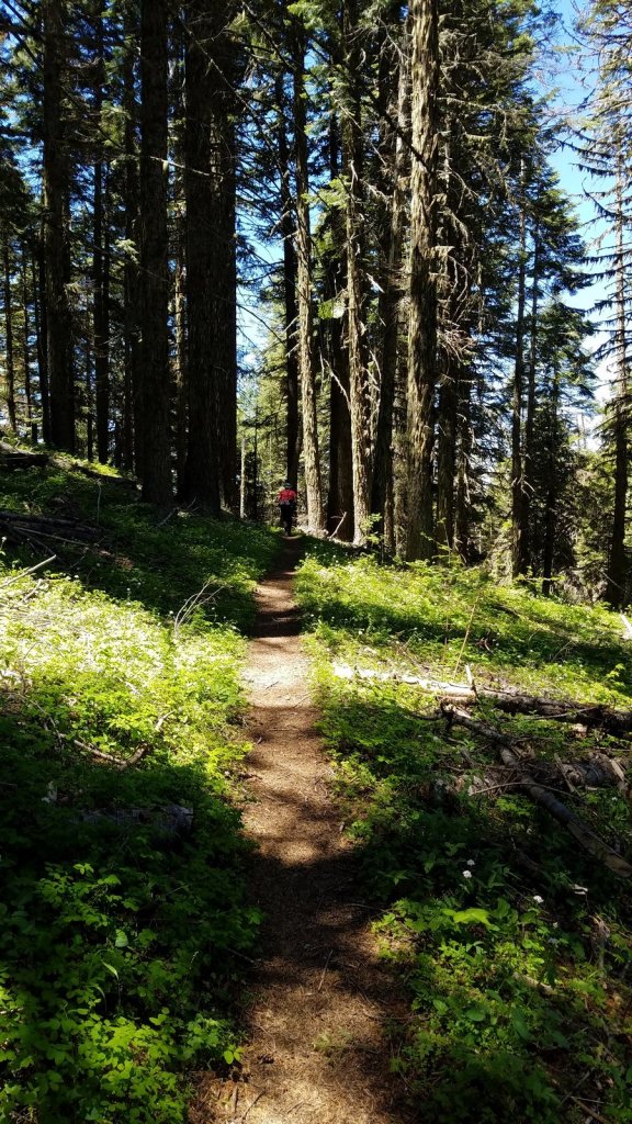
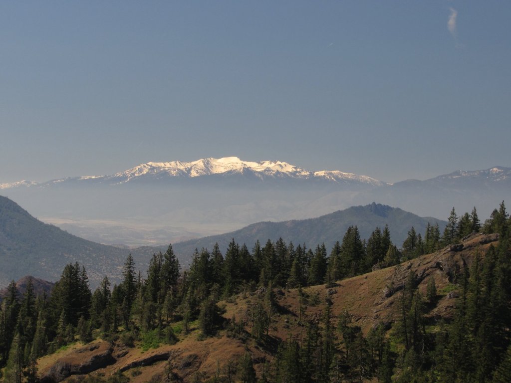
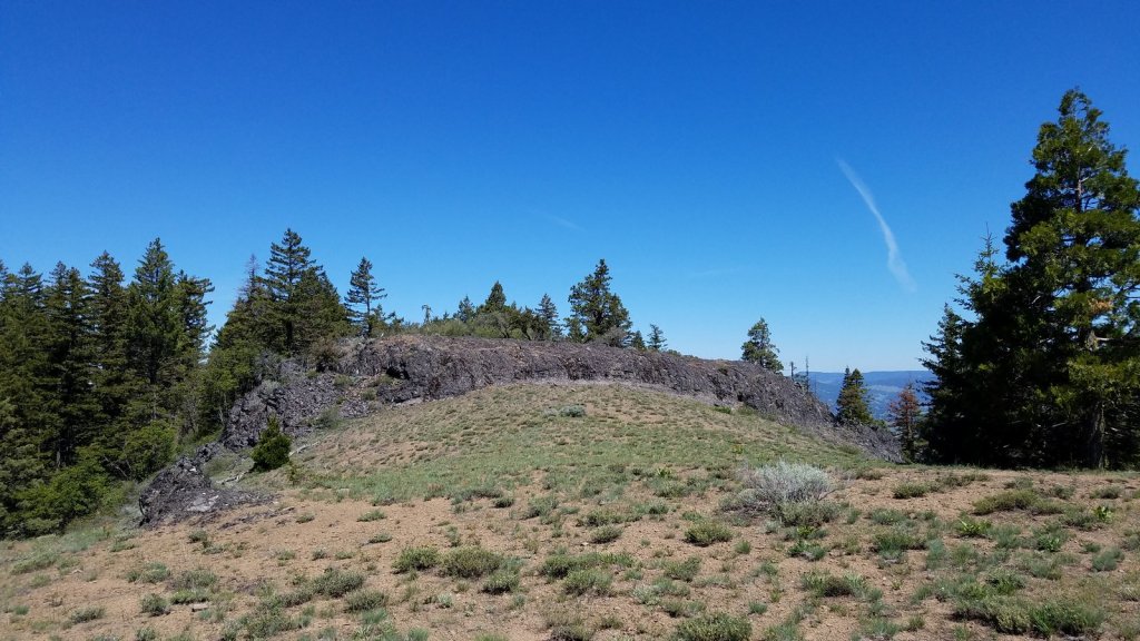
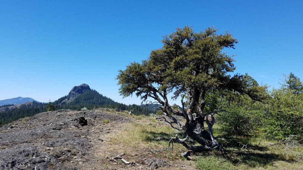
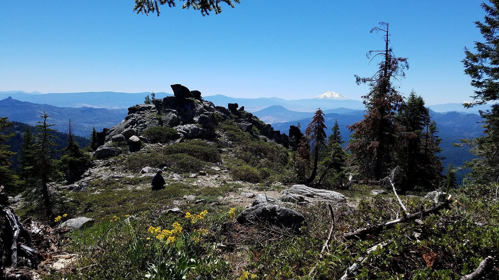
We began on the Pacific Crest Trail, heading west from the Grouse Gap trailhead through meadows and woods to the rocky opening, near the big switchback on the gap’s west wall, where we knew we could see the lake if it was there. It wasn’t, but we decided to go down to look at the lake bed anyway. From the dry lake, we worked our way cross-country to the real goal of the day – a large rock outcrop on the west ridge of the gap we’d been to once before. The combination of rock scrambling, flowers, dramatic dropoffs, and huge views dominated by the double white cone of Mt Shasta make it one of my favorite spots in the Siskiyou range.

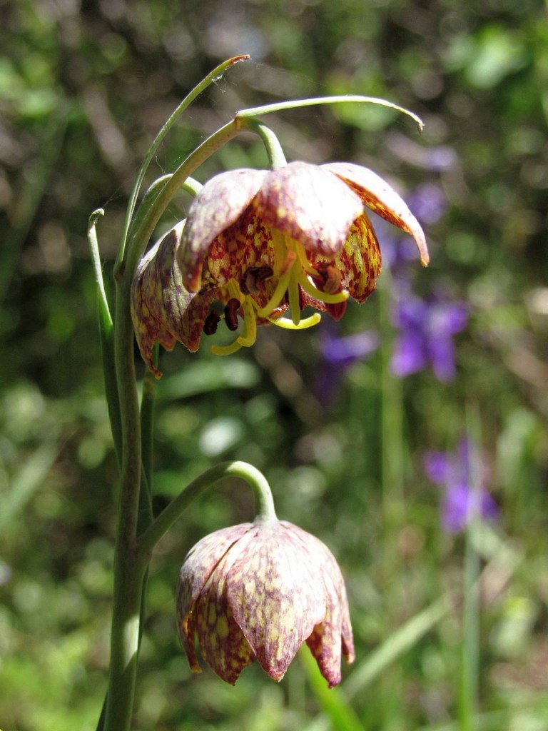
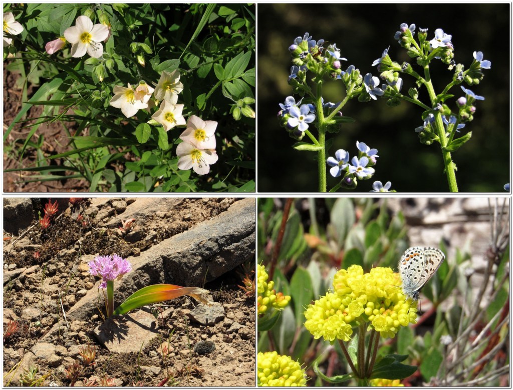
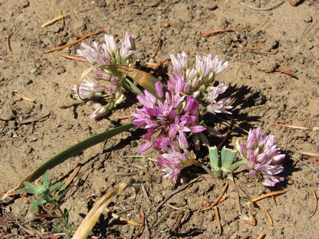
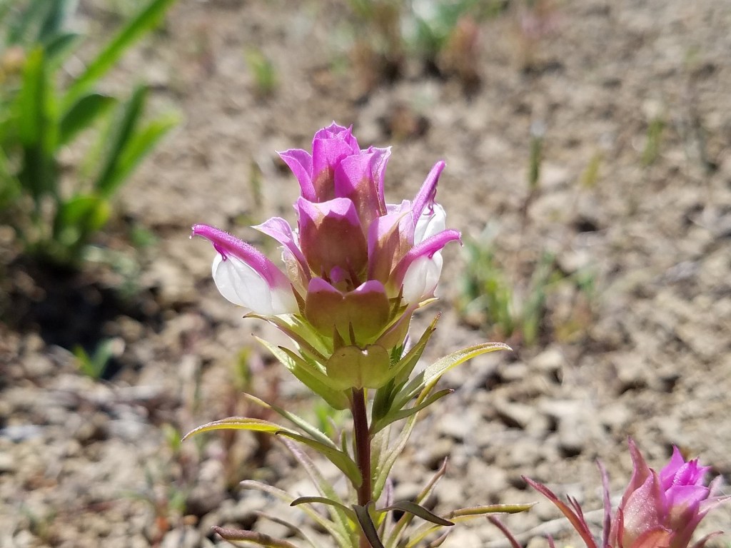
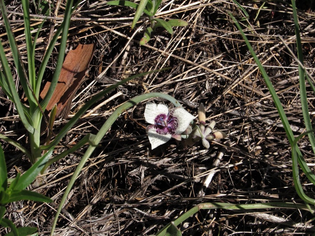
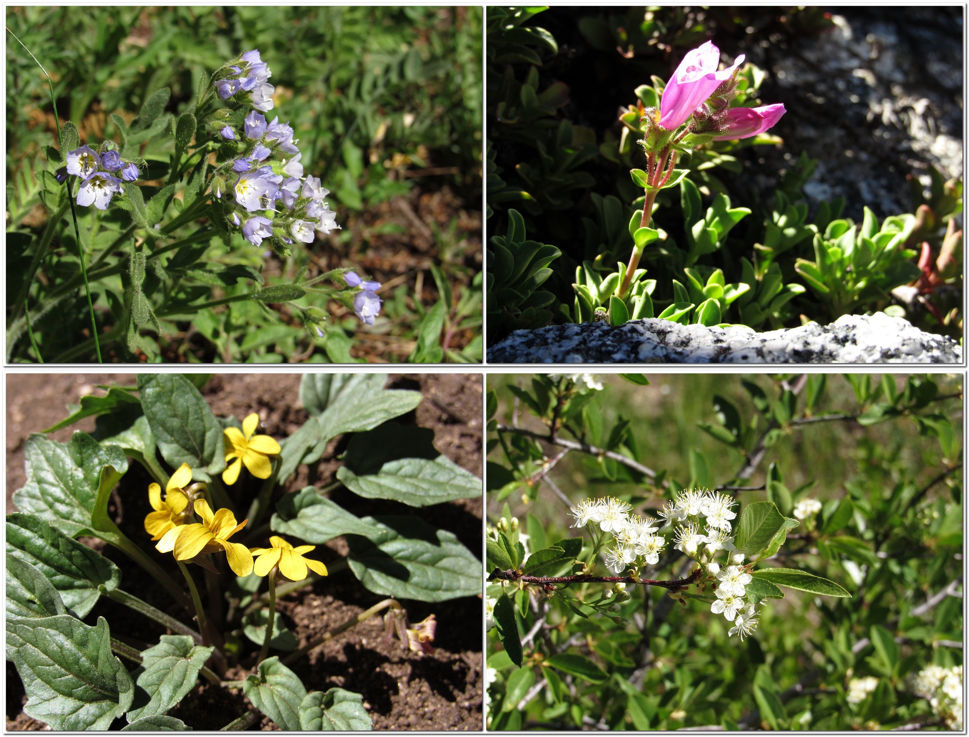
Flower photos and granola bars dominated the next hour.

The outcrop, with Melody seated at its base.
Clockwise from upper left: showy polemonium, cliff penstemon, bitter cherry, Nuttall’s violet.

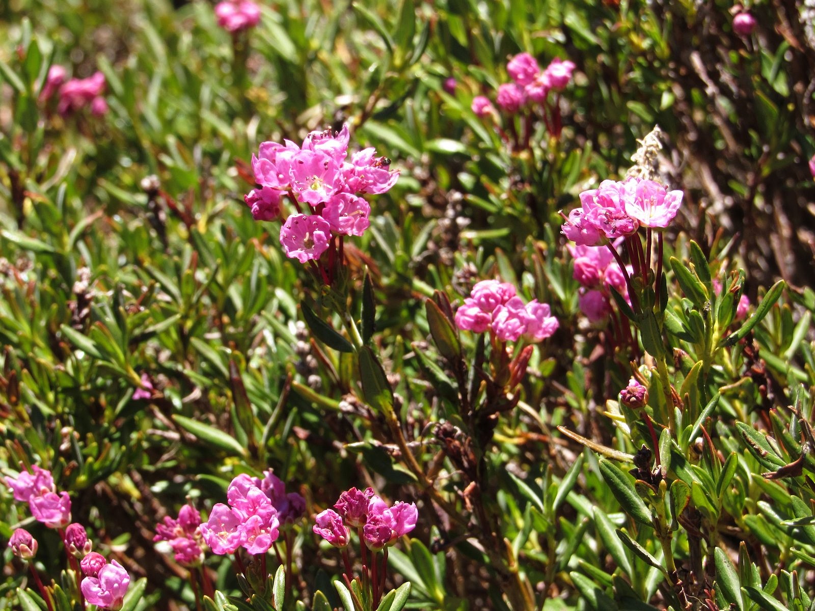
We kept to the ridge on the way back, climbing up and over the unnamed rock knob at its crest and coming down to the high saddle that’s converged on by both the PCT and Road 20 to cross the ridge – the trail and the road are perhaps fifteen feet apart at that point, so you have a choice. We chose to walk the road for a bit. There’s a spring full of buttercups, on a steep, open hillside of small streams lined with kalmia, in the bend where the side ridge we’d been on joins the main east/west backbone of the range, and we often use that hillside to drop from the road to the trail, some distance below. A deep draught of the good juice of the Earth from the spring, a visit to the kalmia – the blooms were fading but still lovely – and we were soon back to the car, ready to head down the mountain and rejoin the rest of the human race.

Kalmia

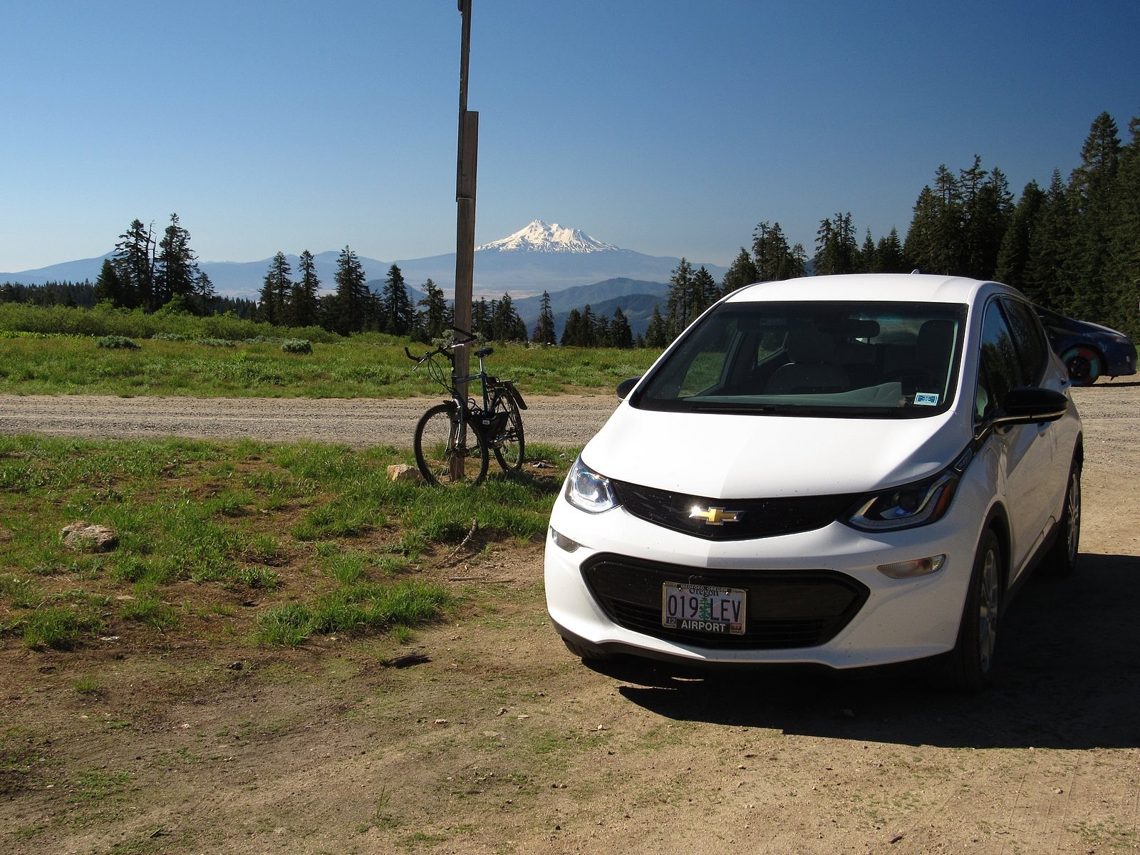
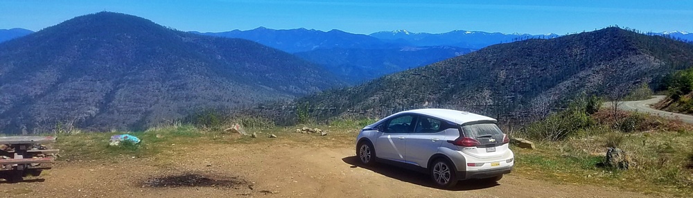
This is an electric-car blog, so I’ll put in a word here about the great advantage of an electric car over an ICE – internal combustion engine car – for mountain driving. It is 36 miles from our home to the Grouse Gap trailhead, with a 5600-foot elevation gain, most of it in the 20 miles between the Highway 66 freeway interchange in Ashland and the trailhead. Climbing those 5600 feet requires extra energy, in either an electric car or an ICE. What’s different about electric drive is that, on the descent, you gain a fair amount of that extra energy back. An ICE will just burn more gasoline – if only enough to keep the engine turning over and available.

The screen that reports a running total of the number of kilowatt-hours drained from the Bolt’s battery pack since its last complete charge holds the key figure, here. That screen read 16.1 kwh at the trailhead. It read 13.2 kwh at the Highway 66 interchange, meaning that almost three of those depleted kwh had been put back in – the car had only borrowed them. By the time we pulled into our garage, sixteen miles further along, we had used up those three regenerated kwh plus one more – the screen reading was 17.2. We’d used a net of just over one kwh to travel 36 miles. That’s the equivalent, roughly, of 750 mpg in an ICE, on cheaper fuel. Add the Bolt’s rough-road cred – full torque available at all speeds; clutchless application of that torque (allowing finer control for dealing with potholes, puddles, and rocks); and seven inches of ground clearance (two inches more than a typical sedan, and only a little over an inch and a half less than a Subaru Outback), and I can’t for the life of me figure out why anyone would want to drive anything else.

The Bolt at the Grouse Gap trailhead, with Mt Shasta in the background. Lead photo: Mt Shasta over meadow larkspur in Grouse Gap.

Reelfoot’s Lair

Hiking Grizzly Peak in the Cascade-Siskiyou National Monument

It isn’t really Reelfoot’s lair. Old Reelfoot, the last known grizzly bear in Oregon, was shot in 1890 near Pilot Rock, sixteen miles south of here in a different part of the Cascade-Siskiyou National Monument. It was another grizzly, unnamed in the accounts, who mauled a hunter on this mountain in the late 1850s and gave it the name Grizzly Peak. But the story has been attached to the wrong mountain for so long that it still seems appropriate to honor Old Reelfoot with the name of this account. After all, Grizzlies have a huge home range. It’s probable that he visited Grizzly at least once in a while.

He wouldn’t have traveled most of the way in an electric car, however.

We hiked the Grizzly Peak trail most recently on June 13, 2019. We made a full day of it, traveling first 12 miles north of Medford to Eagle Point for breakfast at the Barbed Wire Grill, then east up the Brownsville Road and Highway 140 40 miles to the Great Meadow near Lake of the Woods, where I had heard that a major camas bloom was happening. It was. Most of the west end of the immense meadow was covered with the purple flowers of Great Camas, Camassia leichtlinii. Thousands of Camassia leichtlinii. They made a spectacular show in the early morning light, under the high peaks of the Mountain Lakes Wilderness, and I was immensely grateful to Kimberly Hill, whose pictures of the meadow on the Oregon Wildflower Facebook page the day before had alerted me to their presence.

Then it was on to Grizzly down Dead Indian Memorial Road, named to honor three Native Americans whose bodies, dead from unknown causes, were found along its course in the mid-1850s (the settlers honestly thought they were being respectful). We stopped briefly by Lake of the Woods, where I walked the trail out along Rainbow Bay for some photographs of Mt McLoughlin across the water; then we didn’t stop again until we reached the Grizzly Peak trailhead, coming in by way of the upper end of Shale City Road, through an area we have long known as “Elderberry Heaven” for the great number of elderberry bushes that grow there beneath a glorious view of McLoughlin’s snowy cone. The road to the trailhead was in better shape than I’ve seen it for years; it didn’t even begin to challenge the Bolt’s considerable abilities as a backroads vehicle.

Checker lily

The hike itself took most of the rest of the day. The Grizzly Peak trail is a six-mile loop with a 750-foot elevation gain, most of it in the first mile, and as we age into our late 70s it is beginning to be a challenge. But it is worth it for the wildflower show. The trail begins in a verdant conifer forest, a northern-coast-range type forest of tall trees and rich green undergrowth, inexplicably transported to a mountain in the southern Oregon Cascades: then it traverses a loop around the edges of a high plateau covered with a graceful mix of forest and meadow. We took the loop counter-clockwise this time. Views opened out toward Medford and Roxy Ann, looking tiny and lost in an immensity of space. The scar of the 2002 Antelope burn held even more views, across green slanting meadows laced with wildflowers beneath the black snags of the burned trees, a sign that the forest is recovering well. The best view was saved for the far end of the loop. We climbed a steep hillside to the west summit, through paintbrush and balsamroot and fields of rosy plectritis, to cliffs that look out over hundreds of square miles of landscape. The view stretched from Mt Shasta in the south past Pilot Rock and the high peaks of the Siskiyous to the Rogue-Umpqua Divide in the north. A fine place to munch granola bars and contemplate how very, very small you actually are. And maybe wonder how Old Reelfoot might have felt, sitting in this very spot, 130 years ago.

Clockwise from upper left: royal polemonium, Jessica’s stickseed, sulfur flower (with passenger), and Siskiyou onion.

Statistics: we covered about 120 miles on sun-generated electrons, using roughly 27 kwh of the 60 we had available. That works out to about 4.4 miles per kwh – good enough to take us another 145 miles, had we wanted to do that. The car’s EPA-rated range is 238 miles. On this trip, we were actually getting around 265. A small difference, but I’ll take it.

Dutchman’s Peak from Grizzly Peak. Rosy plectritis in the foreground.

Porcupine Mountain

A little-known destination in a little-known National Monument in Oregon.

Pilot Rock

This time, the tires held up.

Not that they weren’t challenged. The road to the Pilot Rock trailhead, the closest access to the single most spectacular scenic feature of the Cascade-Siskiyou National Monument, is vile. Two miles of rocks, ruts, and really robust potholes. But then the CSNM, as it is known locally, wasn’t established to protect scenery or hiking trails. In keeping with the actual reasons behind the passage of the Antiquities Act, back in the Theodore Roosevelt administration, the Monument encompasses an area of outstanding historical or scientific interest – in this case, botany. There are two parallel mountain chains in the Pacific West, stretching most of the way from Mexico to Canada without a break: the coast ranges along the ocean – which climb as high as 9,000 feet in northern California – and the much younger Cascade-Sierra chain, which forms the eastern side of the great western valleys, including California’s Central Valley, Oregon’s Rogue and Willamette Valleys, and Washington’s Puget Trough. There is a great knot of mountains in southern Oregon and northern California that connects the two mountain systems, but the connections are mostly low, rarely exceeding 2000 feet. Only in one spot does the east/west connection between the coast ranges and the Cascade/Siskiyou system actually reach mountain proportions: a long, high ridge that mostly parallels the Oregon-California border. The highest pass on Interstate 5, Oregon’s 4400-foot high Siskiyou Summit, goes over the lowest point on that ridge. That ridge forms a bridge for species from the coast ranges and the Cascade/Siskiyou system to meet and merge, and it is that ridge, and its adjacent areas to the east, that the CSNM protects.

Along the Pacific Crest Trail in the Cascade-Siskiyou National Monument.

And the whole thing is just 30 miles south of our house.

So it’s not surprising that a couple of wildflower enthusiasts like Melody and me would end up there on a sunny Tuesday in early June. Our plan was to start at the Pilot Rock trailhead and hike in to Porcupine Mountain, a favorite destination of ours, roughly a mile south and two miles to the east. The plan worked. After breakfast in a favorite restaurant of ours, Ashland’s Breadboard, we headed up the mountain and, despite a seemingly interminable time on the Pilot Rock Road, were on the trail by about 8:40. The pictures below will show you what we found.

The Bolt at the Pilot Rock trailhead. We were grateful for the relatively high clearance of the car (7″) and the ability of electrical drive to precisely control the application of power to the drive wheels while crawling at very low speeds over a road that really needs to be improved if the public is ever expected to find the Cascade-Siskiyou National Monument.

Mount Eddy, a 9000-foot peak in the Klamath Mountain system, viewed from the Pacific Crest Trail at a saddle just east of Pilot Rock.

Siskiyou onion, one of the many endemics (plants limited to a specific area) found in the Siskiyou Mountains, that leaks over into a small area of the Cascades along the bridge provided by the Cascade-Siskiyou National Monument.

Copland’s owl clover, bridging the other way – from the Cascades to the Siskiyous.

Elegant cat’s-ear lily, rare anywhere: it differs from the much more common Tolmie’s cat’s-ear by having pointed petal tips without hairs.

The summit of Porcupine Mountain is guarded by this 15-foot wall of basalt stretching all the way across the summit ridge. Easy enough to climb, but intriguing geologically.

Pilot Rock from Porcupine Mountain’s summit. That’s a mountain mahogany tree on the right.

About that supposed bugaboo of electric cars, range anxiety, by the way: we pulled into the garage at the end of this trip having used under 14 kwh of the 60 we had available. Just thought I should keep mentioning this….