Oregon is under shelter-in-place orders in an attempt to control COVID-19, but – although most activities have been curtailed – hiking is specifically allowed as long as social distancing is maintained. So Melody and I have been drawing on our large repertory of little-known Southern Oregon trails. One of these is the Taylor Creek trail in the foothills of the Siskiyou Mountains west of Grants Pass. There are no great scenic panoramas here, but the trail has just about everything else: waterfalls, wildflowers, rock outcrops, and several different forest types, through a wide range of lush to dry. And although cars have occasionally passed us when we have been parked beside the road on each of our several trips up there, we have yet to encounter anyone else on the trail itself.
To get to Taylor Creek, you leave the freeway at the small town of Merlin and head west along the Galice Road, the popular highway to the Grave Creek trailhead and boat launch at the eastern end of the Rogue River Canyon. Immediately after you pass Morrison’s Lodge – roughly 12 miles in – you’ll see a road on the left, with a brown sign on the right pointing to “Briggs Valley.” That’s the Taylor Creek Road; Briggs Valley is beyond, over Lone Tree Pass at the creek’s head.
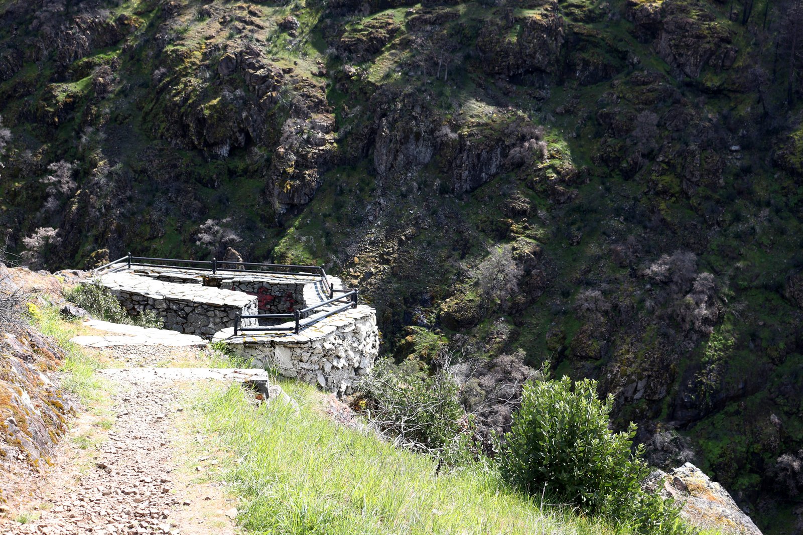
The road is paved, but it’s only about a lane and a half wide, so oncoming traffic must be passed with care. It climbs quickly up the mountainside, with glimpses across Taylor Creek’s valley to the tall waterfall on Schoolmarm Creek (no place to park for a photograph, dammit). In a little over two miles, you’ll see a small parking lot on the left. Pull in. A short trail here leads to the Taylor Gorge Overlook, a stone-and-concrete platform perched on the lip of the narrow, deep gorge through which Taylor Creek leaves its valley. It’s wild, and rugged, and the only certifiably spectacular scenery you’ll see on this trip. Enjoy.
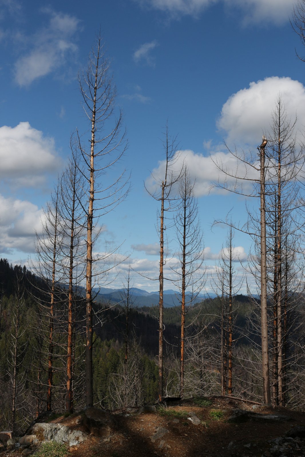
Beyond the overlook, the road levels out, winding along the side of the valley high above the creek. Trees line your course; rock outcrops hold wildflowers. Taylor Creek’s forest was burned over in the 2018 Klondike Fire – second largest in Oregon history – but the burn was spotty, and most of the overstory here in the lower end of the valley remains intact. After roughly half a mile, a sign points to the Taylor Creek Trailhead, on the left. We choose to pass this one; it’s a long, steep, mostly boring way down to the creek. In another quarter-mile, an unmarked parking area provides a second trail access point, through an abandoned homestead meadow called English Flat. We think of stopping here – we once had a gorgeous (though chilly!) morning in a hoarfrost fog in that meadow – but another vehicle is already present, so we pass that, too. Social distancing. The best, we know, is yet to come.
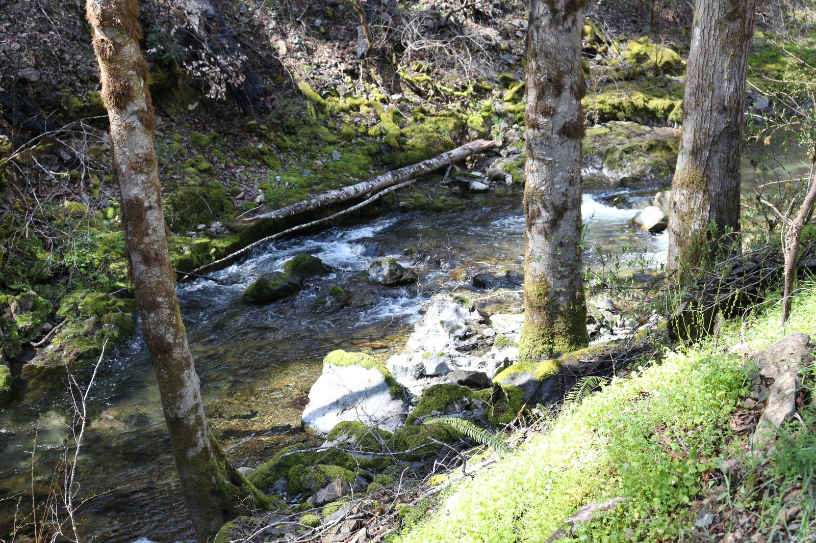
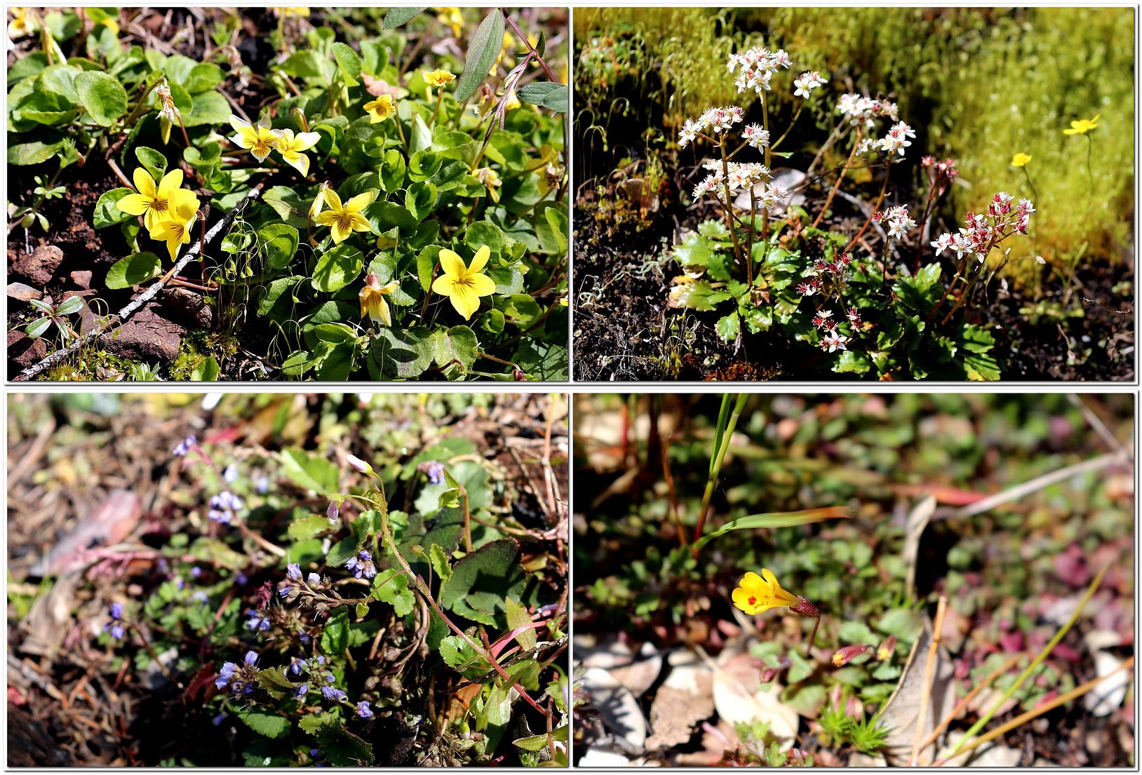
A bit beyond English Flat the road and the creek finally converge, and the quiet, intimate beauty of this out-of-the-way valley begins to show itself. The broad, limpid creek – one of the few places I know of where that overworked word actually fits – alternates between tumbling over rocks and flowing gently among alders. A small side-stream waterfall tumbles down a roadside cliff. A riot of spring gold (Crocidium multicaule, a small member of the sunflower family) spills over just about everything.
After a mile or so of this, Burned Timber Creek enters through a narrow gorge on the far bank; and shortly after that a gravel side road branches left, crossing the main creek on a narrow concrete bridge. The Taylor Creek Trail intersects that road a few feet beyond the bridge. We park in the large parking area at the main-road end of the bridge and gear up for a walk. We cross the bridge and, knowing what will be in store, head north.
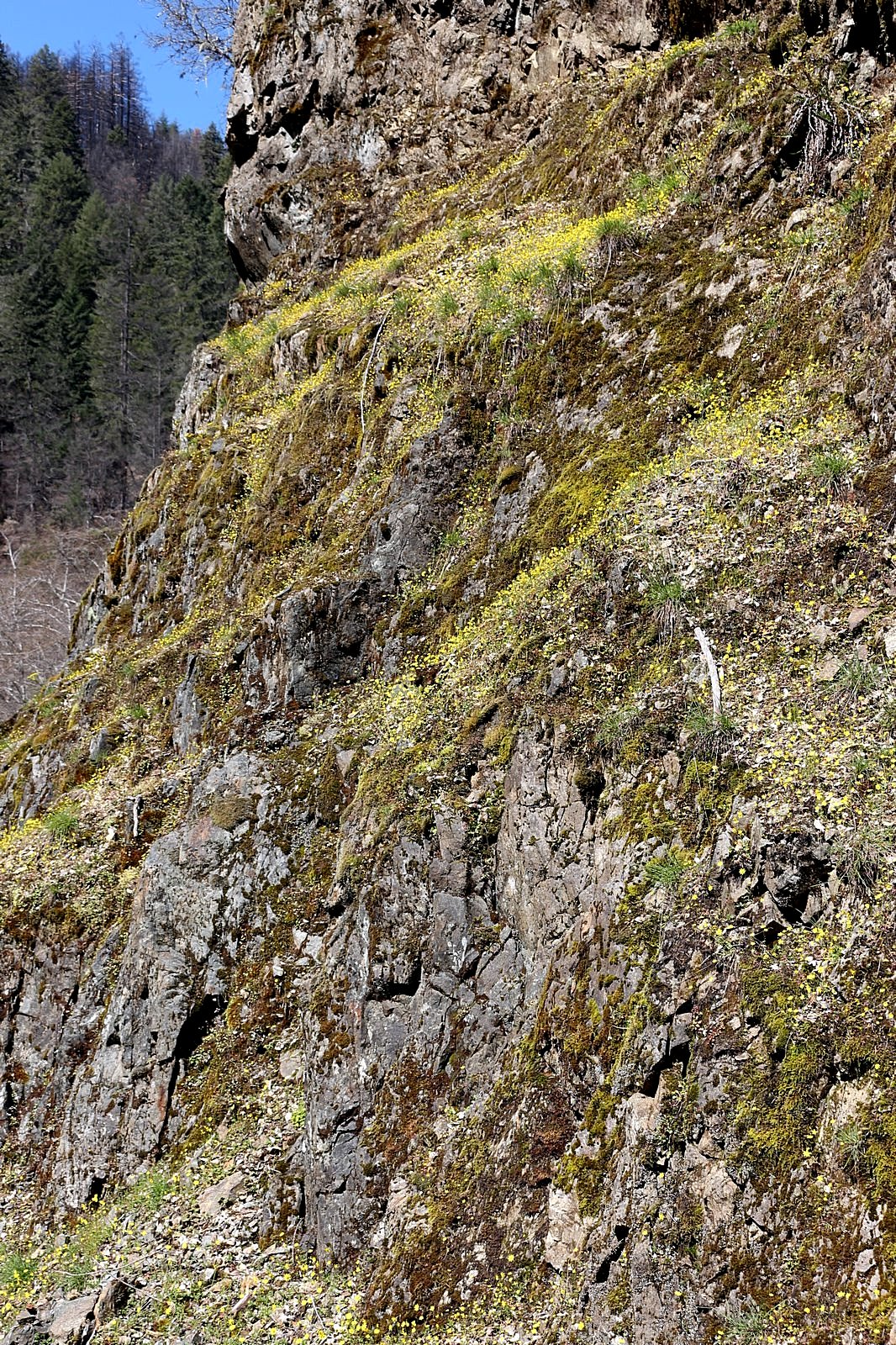
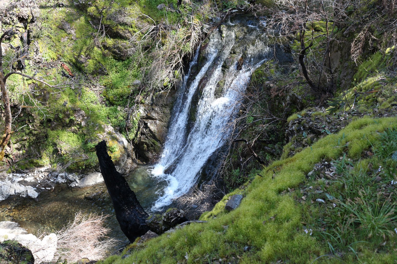
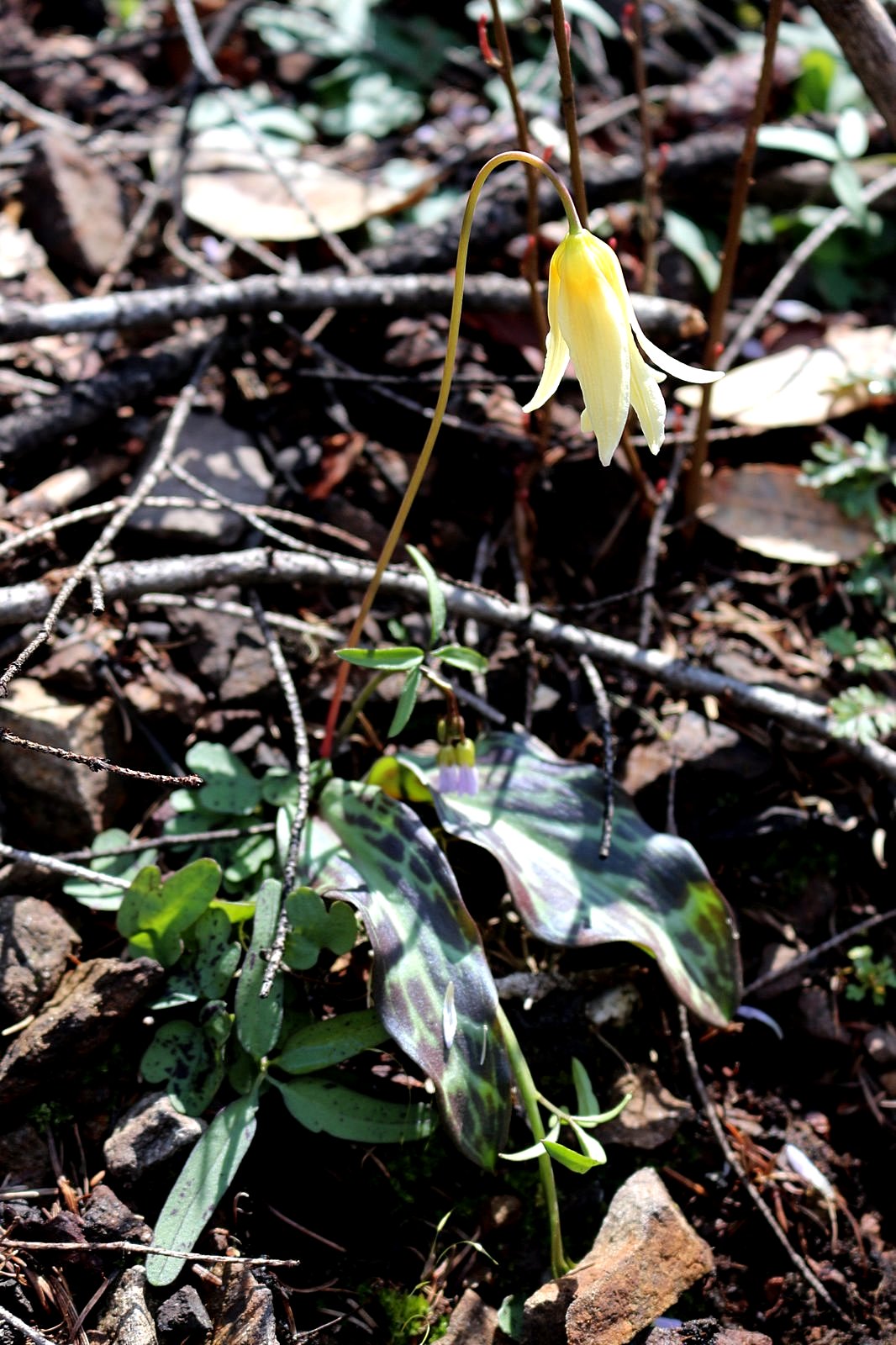
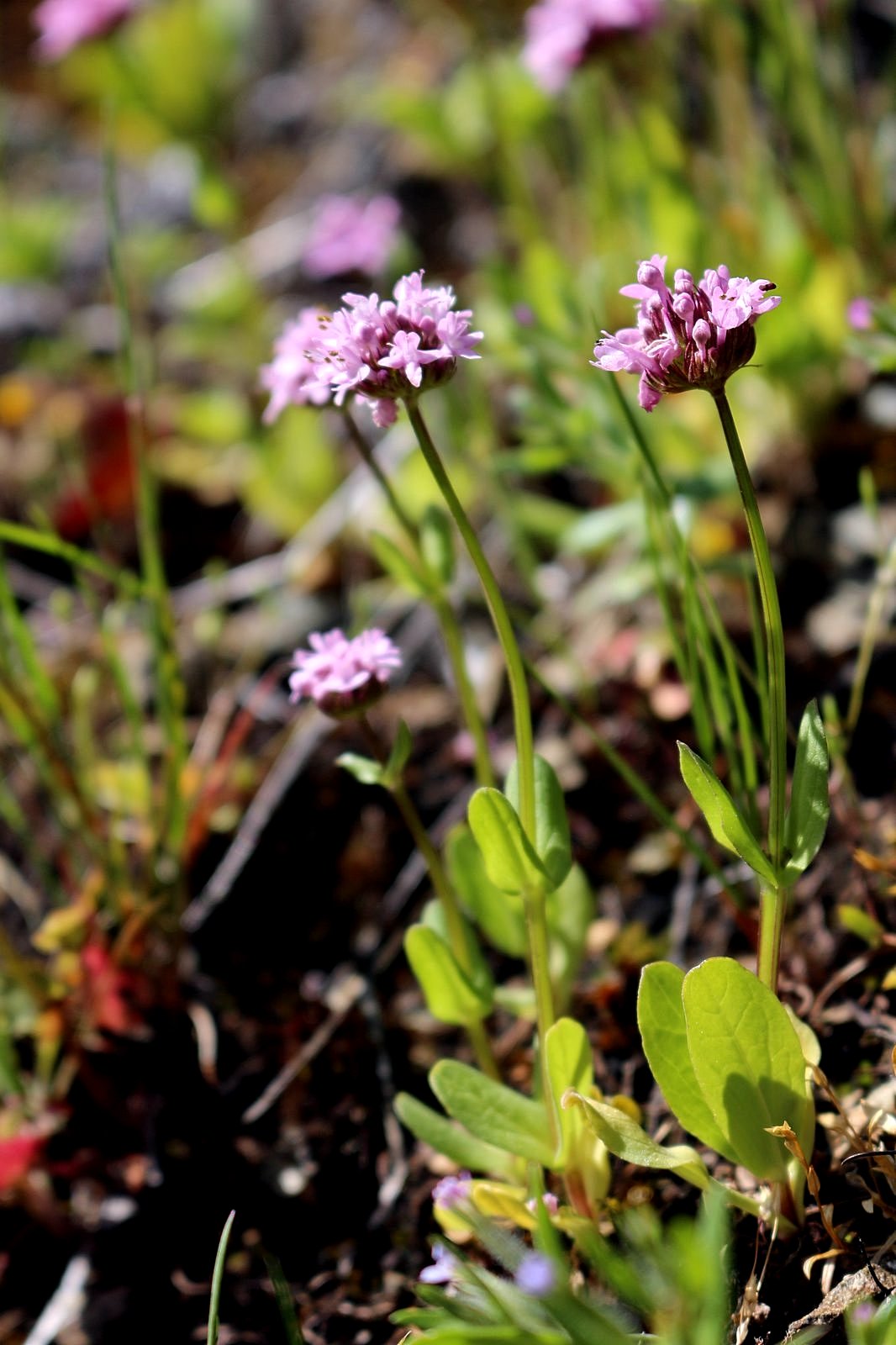
The trail climbs gently up a hillside through a small patch of burned-over timber. Yellow violets and blue-purple snow queens sprawl beside our path, mixed with a few cream-colored Oregon fawn lilies. We round the end of a ridge and come, as we knew we would, into a tiny paradise. The trail skirts the rim of a small bowl; at the head of the bowl, Burned Timber Creek laces gracefully down a 30-foot cliff. To the left, beyond a bit of woods, the ridge we have just crossed ends in a long, gently sloping rock outcrop. The rock is bright yellow with spring gold.
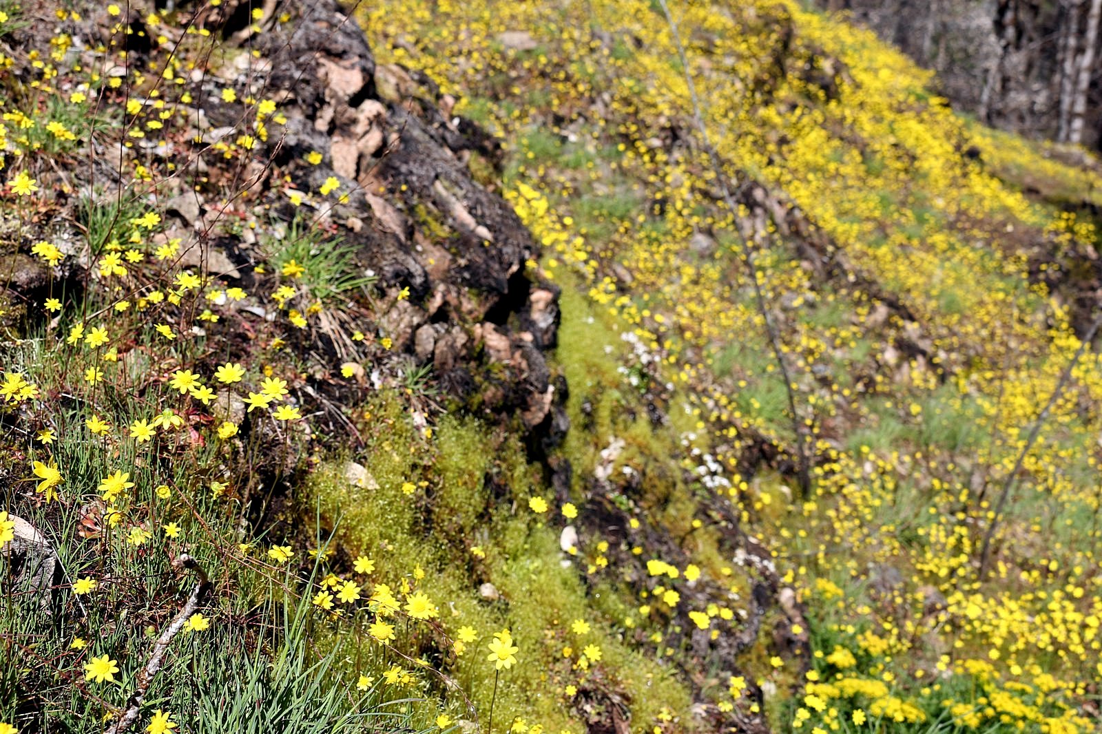
We take a faint way trail out to the rock outcrop and spend the next thirty minutes among the flowers.
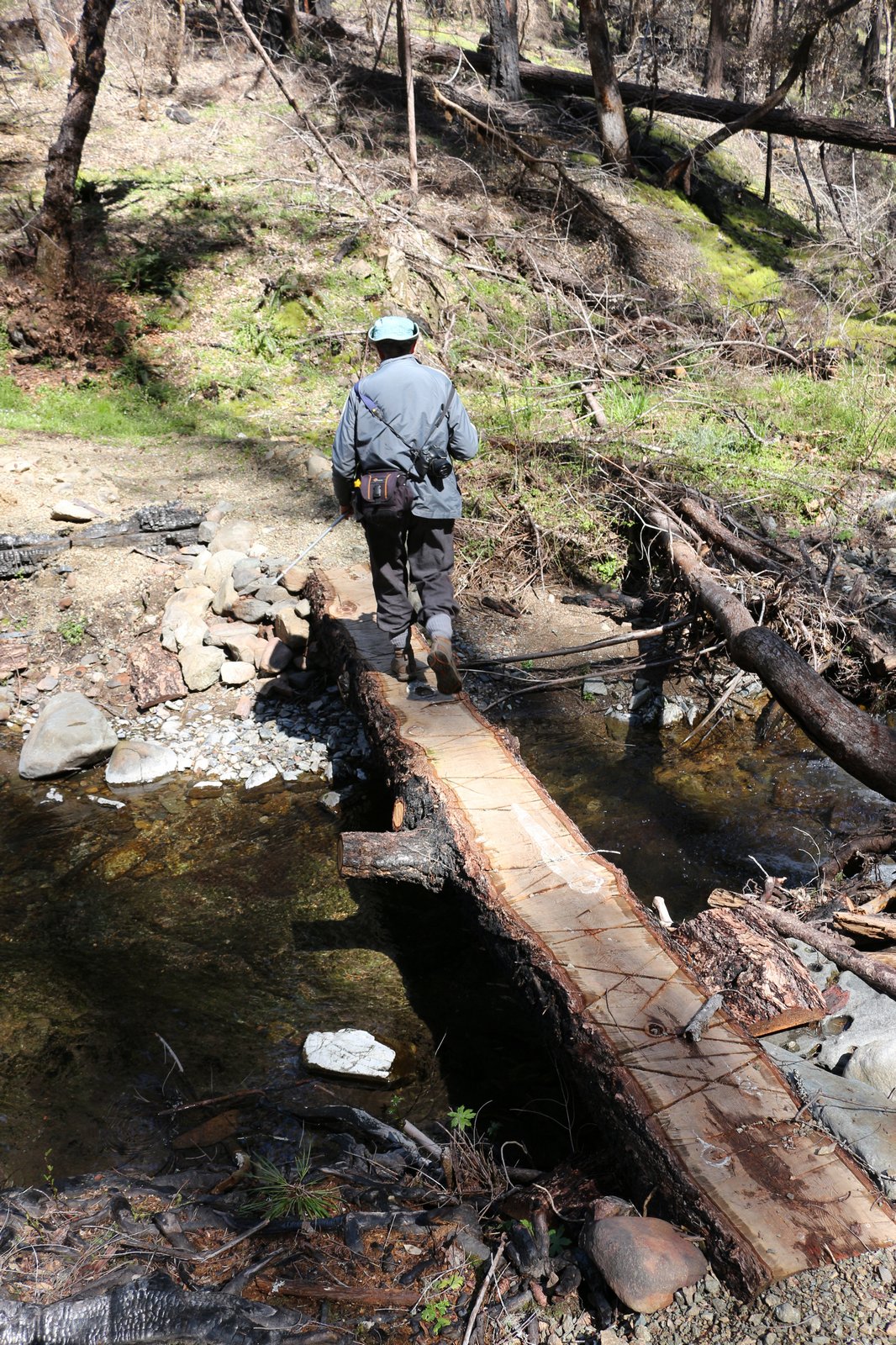
The rest of the day was anticlimatic, so I’ll keep this brief. Back on the trail, we crossed Burned Timber Creek a few dozen feet above the falls on a makeshift log bridge placed by the trail crews who cleaned up after the Klondike Fire and contoured up the steep hillside beyond. A mile or so from the trailhead, an unmarked but well-built trail forked off to the right: we followed it to the Burned Timber Creek Road and strolled down that to the point where we had begun, a couple of hours before. Back in the car, we drove south to Lone Tree Pass, stopping briefly at a small gorge near the mouth of Minnow Creek and again at a massive display of Oregon fawn lilies near the China Creek trailhead. The road to the pass narrowed for the last mile after leaving the creek, winding through the charred remains of one of the hottest burns of the fire; the pass provided views of green mountains through burned timber.
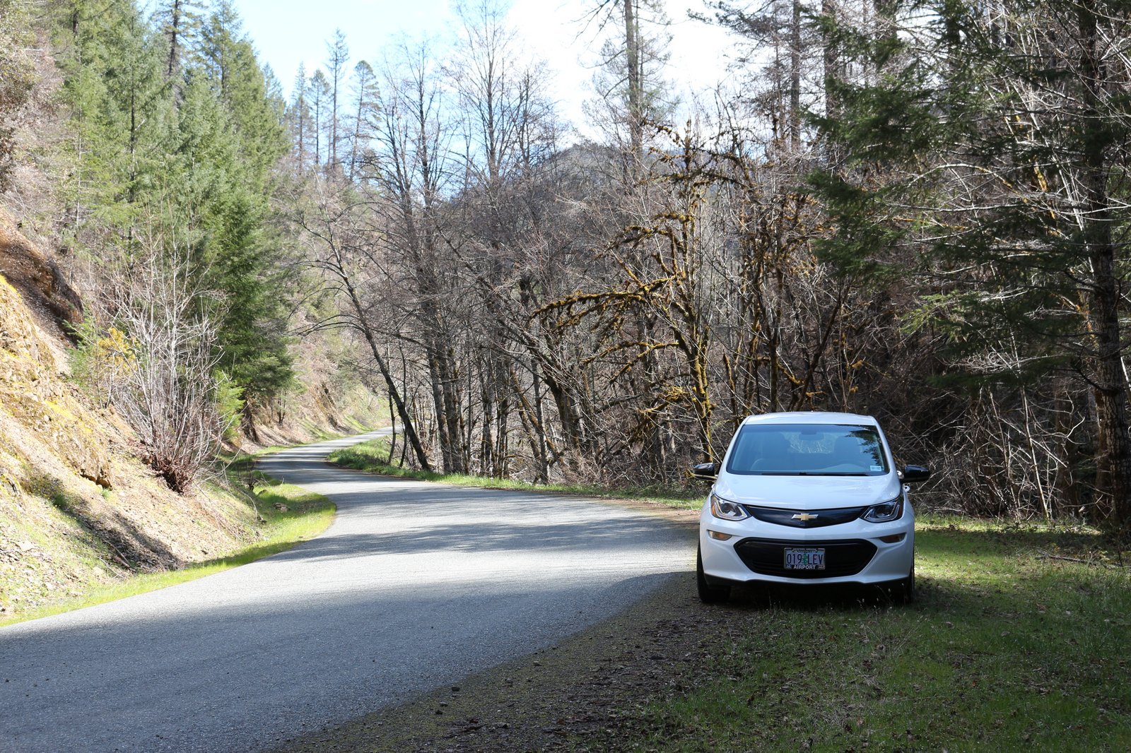
We stopped once on the way out, at a trailhead near China Creek, to check the status of a footbridge built there just two years before the fire (it had survived) and headed for home, pulling into the driveway shortly after 5:00 pm with half of the Bolt’s battery still unused. We could have done it again, but although the car had plenty of energy, the two humans in it were happily tuckered out. Another time.