Down the River

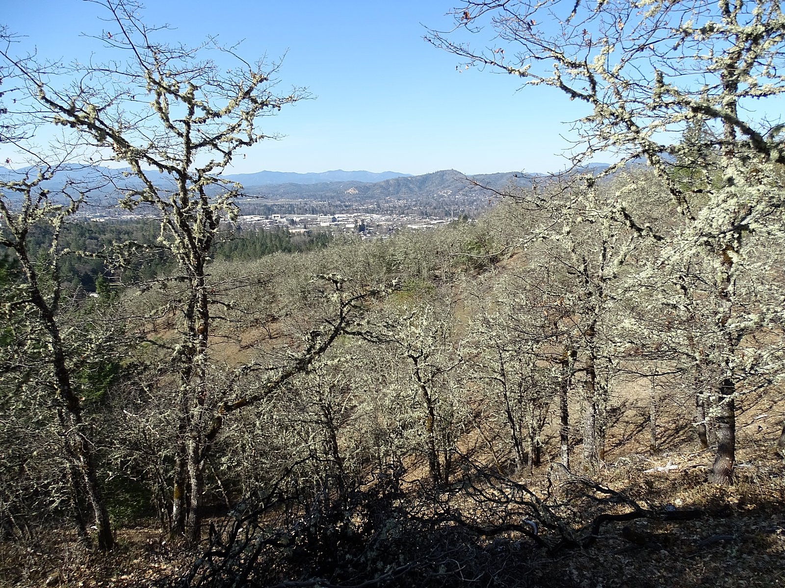
It is just over 50 easy miles, as the crow flies, from Grants Pass, Oregon, to the Pacific Ocean. If the crow has to travel by land, it’s a different story. Between Grants Pass and the ocean lie the Siskiyou Mountains, a confused jumble of ancient peaks and ridges rising to a height of as much as 5000 feet above sea level. The Siskiyous are made of some of the oldest, toughest rock in western North America. Through them, the Rogue River has managed to slice a deep sliver of a canyon, forming the only water-level connection between the populous Rogue Valley, where we live, and the coast.

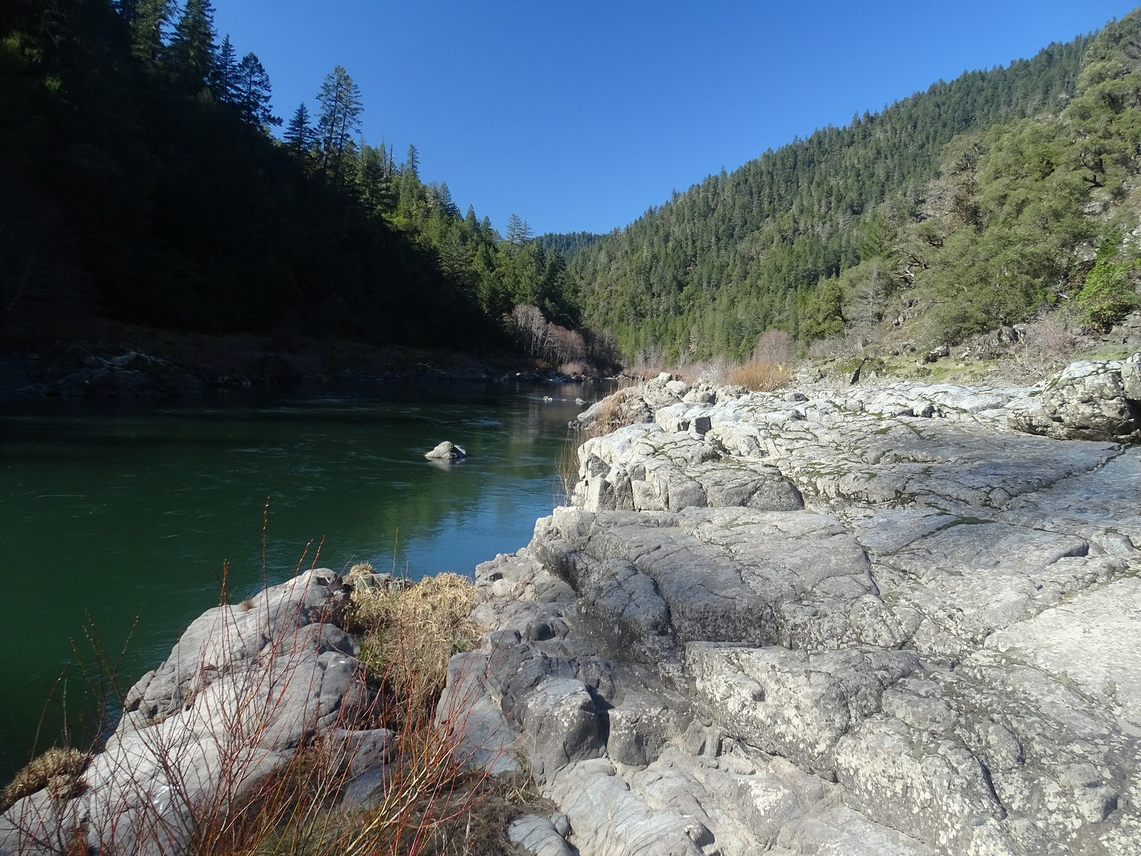
19th-century railroad builders attempted to develop the canyon as a transportation route. They got in only as far as the mouth of Grave Creek, about 30 river miles below Grants Pass. Here the northbound river – already deep in the earth – makes an abrupt 90 degree turn to the west and enters a narrow slot canyon with near-vertical walls rising several hundred feet above the water before giving way to timbered slopes, only slightly less steep, that shoot a good 3000 feet higher. The railroad builders looked at that and recoiled. So did the road builders that followed them. Not so much as a path penetrated the canyon any further until 1907, when a pack trail was hacked out to serve the small mining community of Marial, tucked onto a tiny flat fifteen miles further downriver. The trail took advantage of a natural ledge on the south bank for a mile and a half, then crossed a sturdy bridge to the north bank. The river ate the bridge in 1927, ending that experiment after just two decades. No further attempts at a route through the canyon would be made until 1961, when the current recreation trail was built.

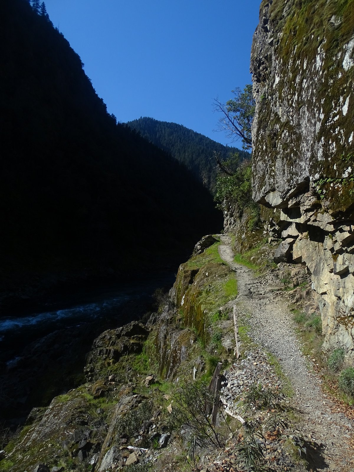
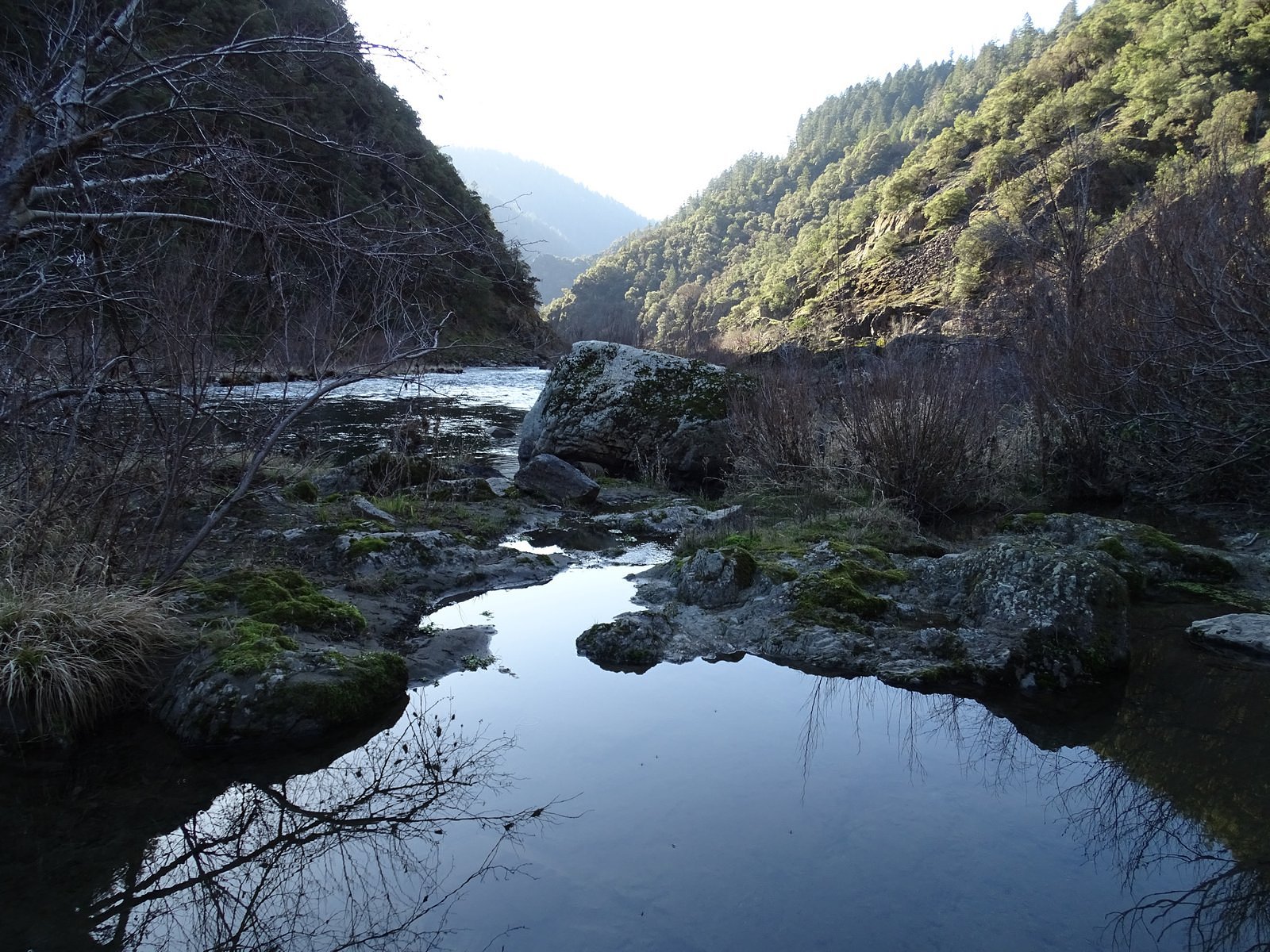
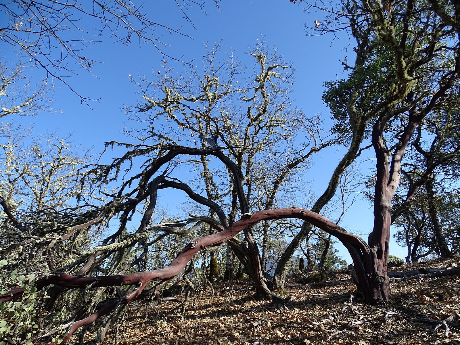
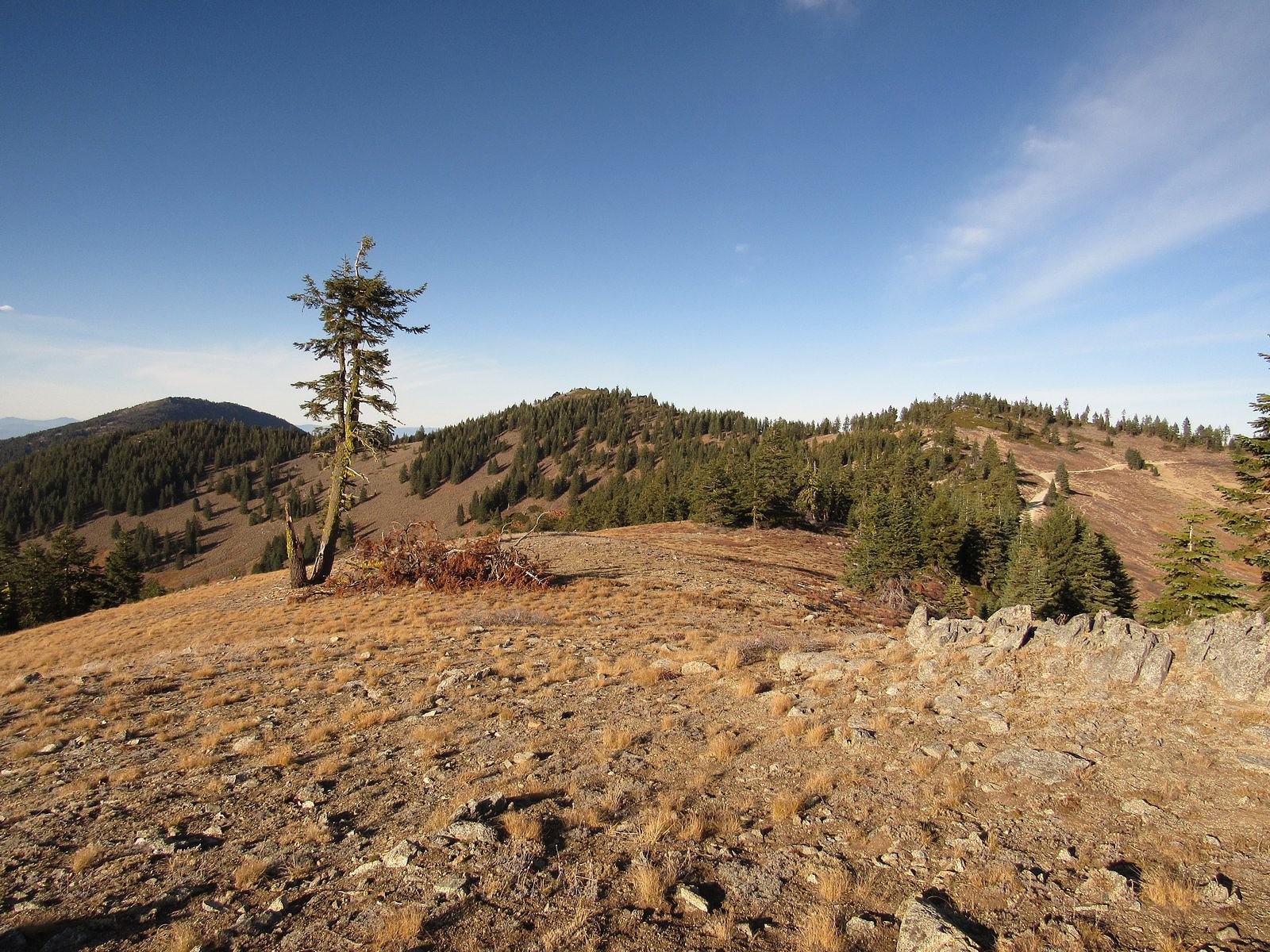
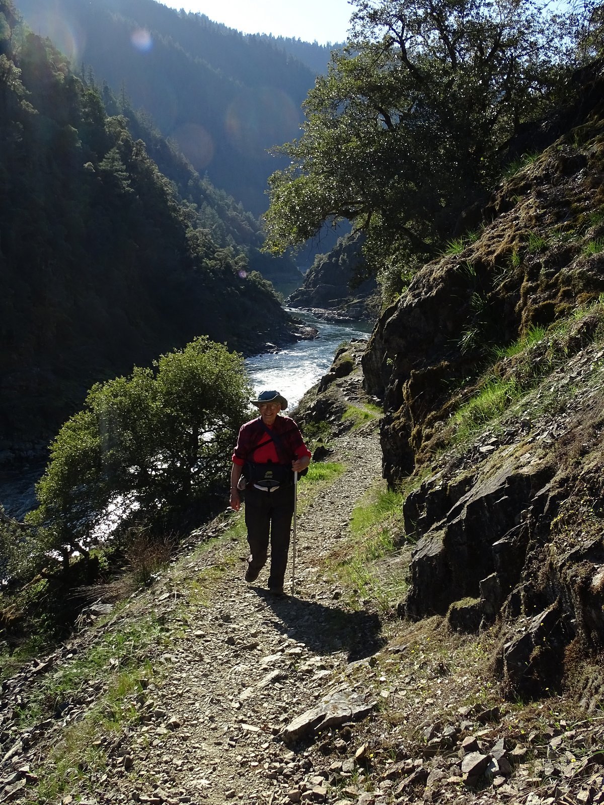
The Rogue River trail wisely dispenses with river crossings, remaining on the north bank from Grave Creek to Marial and all of the rest of the 40 miles through the canyon to Agness, where the road struggling upriver from the coast is forced to a stop. For much of its first several miles below Grave Creek, the trail occupies a tiny vertigo-inducing ledge thirty inches to four feet wide, 60 to 200 feet above the river. Side streams tumble down at intervals. The roar of rapids is almost constant. And there are flowers.

Spring gold (Crocidium multicaule)

Heat reflected off the canyon walls starts bringing them out as early as mid-February. For many years, now, the Rogue River trail below Grave Creek has been one of our favorite early-season hikes.

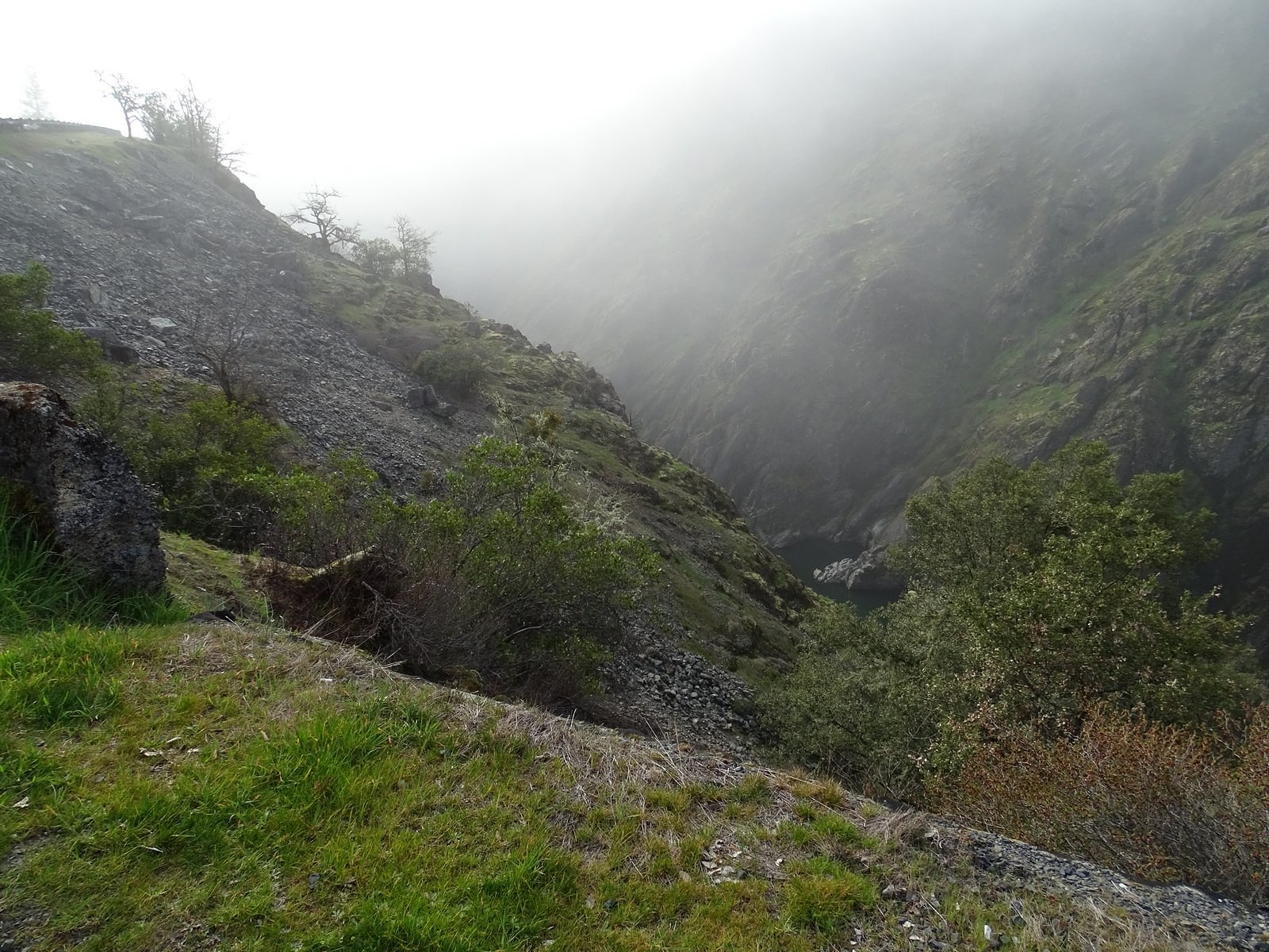
The most recent of those hikes took place last Thursday, February 27. The air was barely above freezing when we left the house around 7:00 AM, but the sun was shining and the temperature was predicted to get into the high 60s later in the day. We made a leisurely stop for breakfast at Patti’s Kitchen in Gold Hill. Mists from the river drifted in and out across the road and made Hellgate, where the river first enters the mountains, look like a scene out of Lord of the Rings.

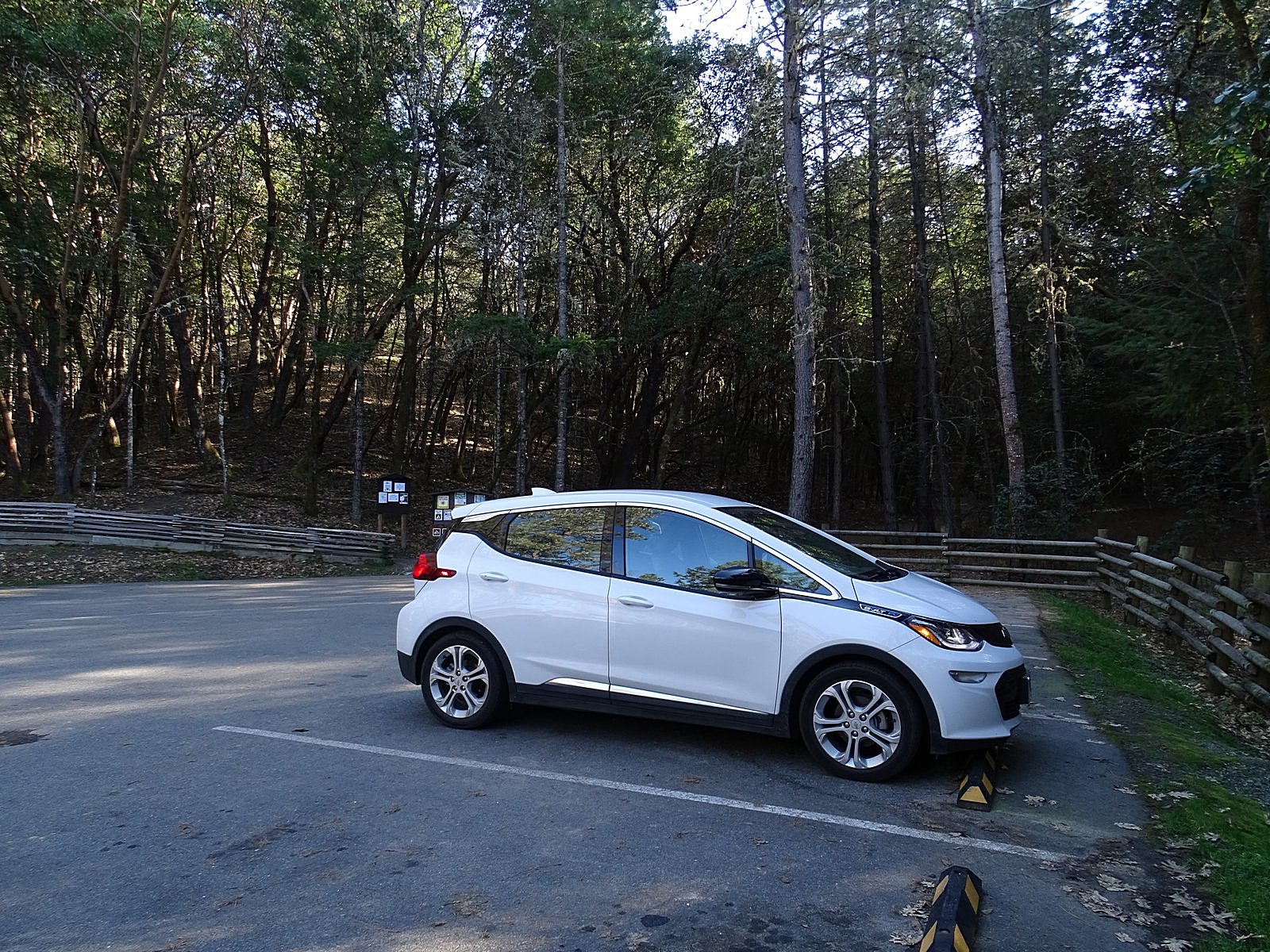
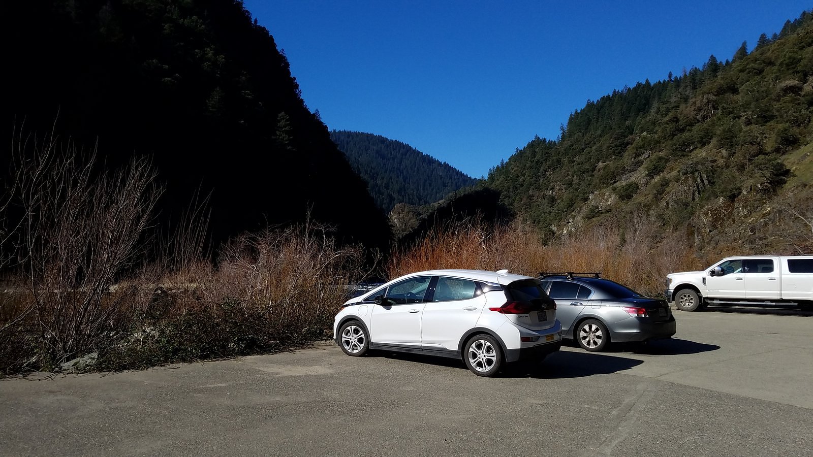
The last wisps were evaporating as we parked the car at the Grave Creek trailhead, and it was already too warm for heavy clothing. We picked up the cameras and started down the trail.

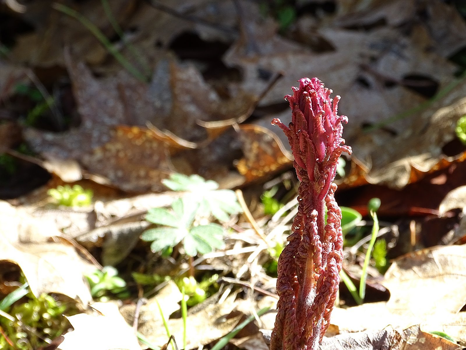
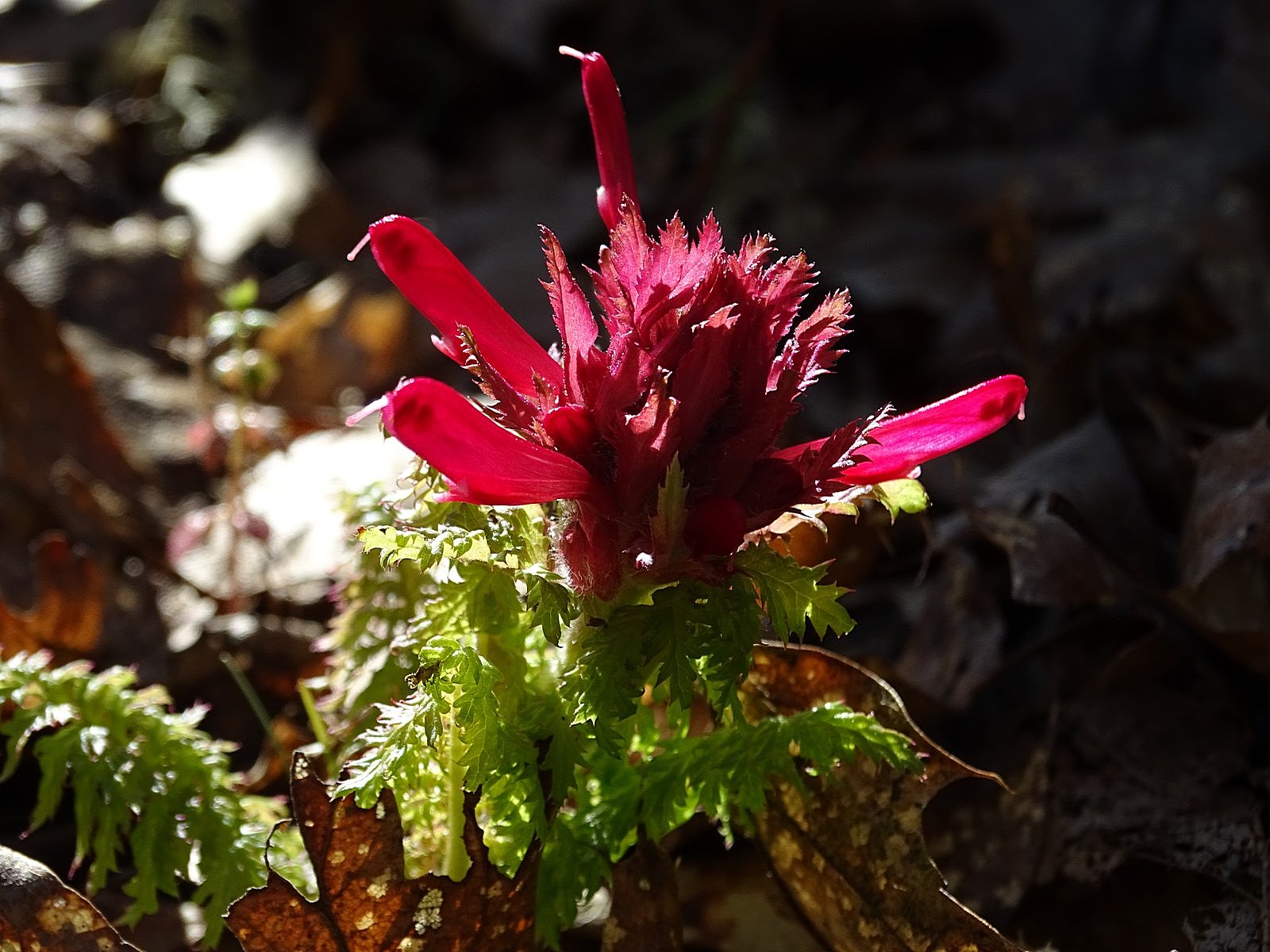
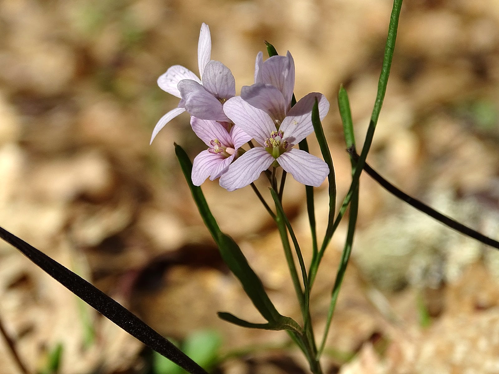
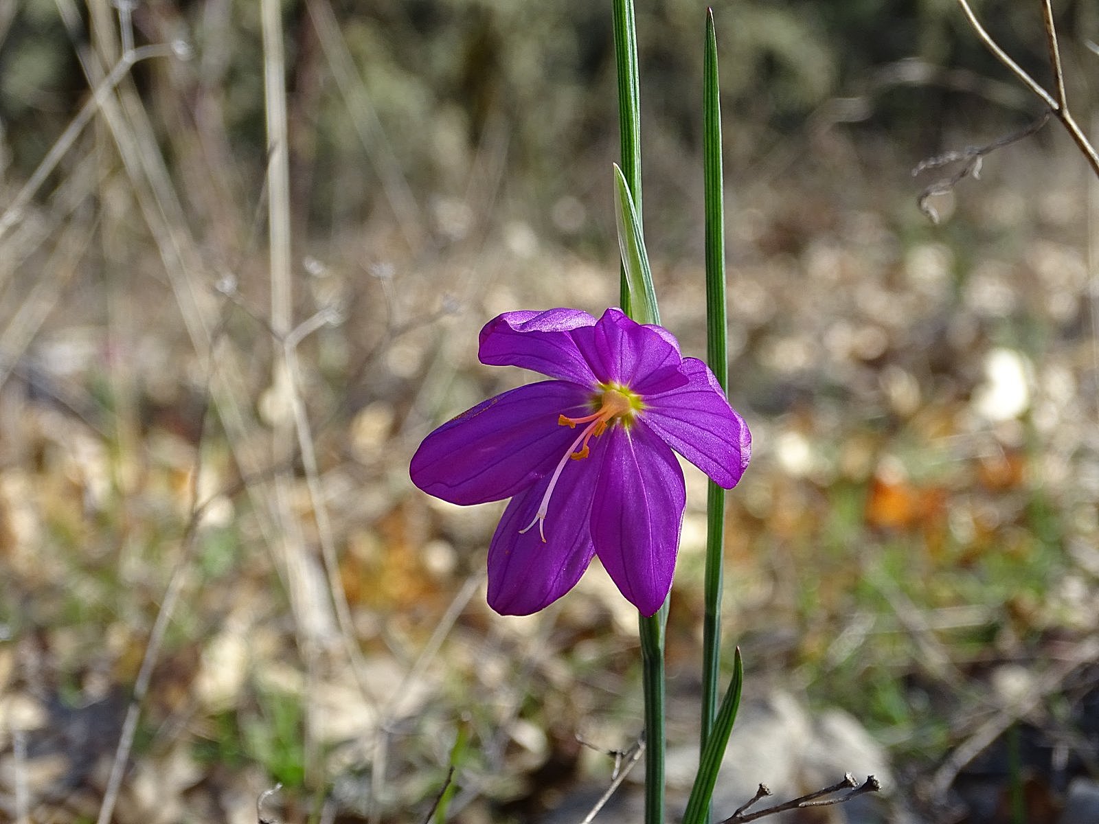
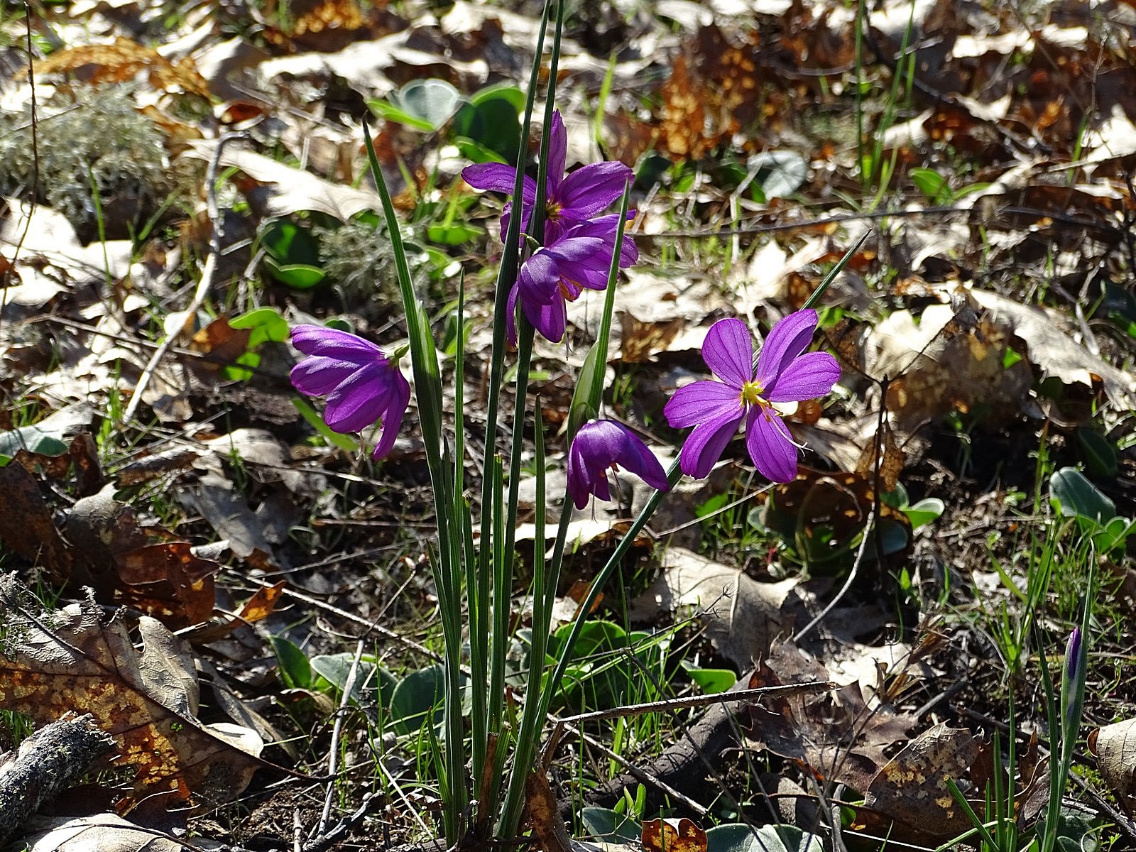
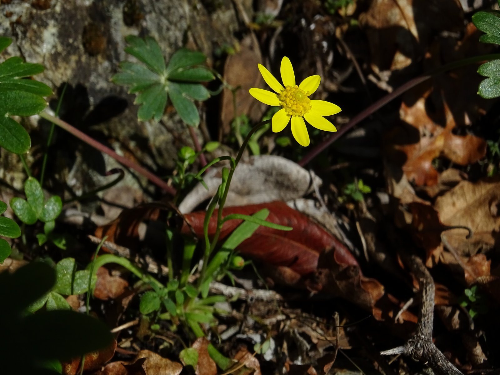
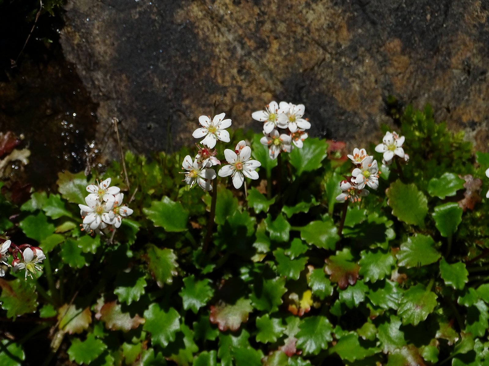
The flowers began almost at once: yellow lomatium and spring gold, pink milkmaids and sea blush, and white saxifrage.

Clockwise from top: lomatium; sea blush; milkmaids; Howell’s saxifrage.

Lots of white saxifrage.

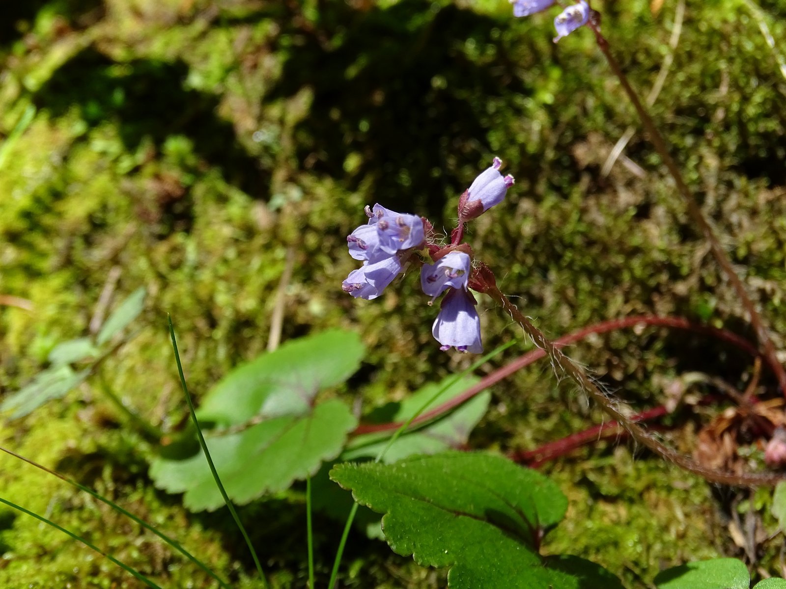
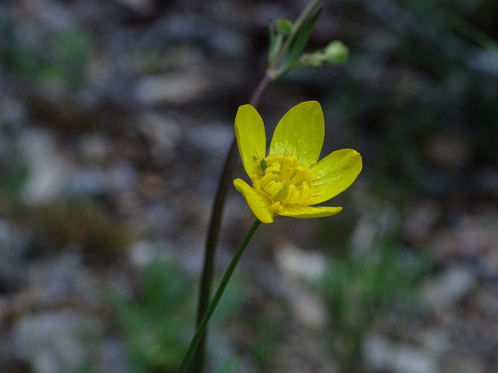
At China Gulch, two miles in, a pair of snow queens and a few buttercups.

Snow queen (Synthyris reniformis)
Western buttercup (Ranunculus occidentalis)

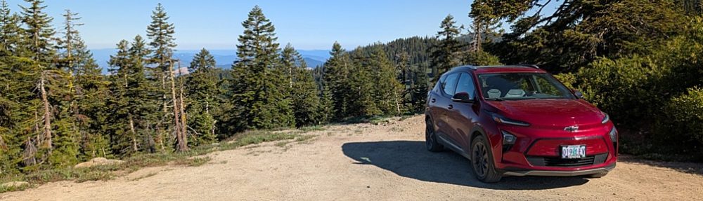
Our plan had been to hike to Whiskey Creek, a bit over three miles downriver from the trailhead, but – delayed by the flowers – we gave up the effort with about a quarter of a mile left to go. A half-hour of basking on a large flat rock by the river gave us the energy to get back to the trailhead; the Bolt took us the rest of the way home.

Flat rock beside the river near the mouth of Whiskey Creek
Almost back to the trailhead.
The Bolt, parked as far down the canyon as roads can get you.

For those keeping track, we left home with a 95% charge and got back from our 120-mile round-trip drive with almost half of that remaining. The range indicator as we pulled into the garage read 105 miles. I’d tell you how this trip affected my range anxiety, but I’ve almost forgotten what that actually feels like.

Early Flowers at Cathedral Hills

Wildflower season has finally arrived in southern Oregon. Two weeks ago, we took the Tunnel Ridge trail in the Siskiyou foothills south of Jacksonville – an excellent early-season wildflower hike, most years – and saw nary a flower. This week, though, in the Cathedral Hills just outside Grants Pass, the story was different. There was a scattering of milkmaids (Cardamine californica) along the two trails we took. There was a concentration of grass widows (Olsynium douglasii) along one ridge. And Indian warriors (Pedicularis densiflora) were popping out of the ground everywhere.

Indian warrior (Pedicularis densiflora) in early shoot stage

The weather was still cool early this week, with nighttime temperatures dropping into the 20s, so we didn’t leave Medford until after lunch. Reveling in the sunshine, we avoided the freeway, staying on back roads for all of the 45-minute drive to Grants Pass. We entered Cathedral Hills through the Sky Crest trailhead, the northernmost of the area’s several trailheads, and my personal favorite. The parking lot was nearly full, but I was able to find a spot for the Bolt. We climbed into the woods via the Sky Crest trail, then turned east onto the Sky Crest Loop. (You approach the trailhead along Sky Crest Drive. Someone in Grants Pass really likes that name.) The Indian warriors showed up almost immediately, in large bunches but mostly immature; they are semiparasitic on the roots of members of the heath family, including madrones and manzanitas, which are common in the open mixed oak/madrone woodland that covers the Cathedral Hills.

Indian warrior in nearly full bloom
Milkmaids (Cardamine californica)
Madrone (foreground) and California black oak.

Completing an amble along the Sky Crest loop, we crossed the Timber Riders trail and picked up the Madrone Trail (aren’t there madrones everywhere here?) a few feet further along. The trail climbed gently from this junction to a ridge with big views of Grants Pass through open oak woodland; plenty of Indian warriors; and a lovely collection of grass widows, which hadn’t shown themselves at all on the Sky Crest loop.

Grass widow (Olsynium douglasii).
Grants Pass from the Madrone trail.

We wandered slowly along the ridge, savoring the views and shooting photos of the flowers. All too soon (though it was approaching 4:00 PM) the trail dropped off the ridge through a series of switchbacks, back to the Timber Riders trail and a short hike to the parking lot, which was now almost competely empty. Overall distance, between 2-1/2 and 3 miles. Overall time, about three hours. Overall experience, beyond measure. It stayed with us all the way home.

Farewell to the High Country

November on McDonald Peak

McDonald Peak from the knoll.

Snow has not yet come to the high country of the Siskiyous. This is worrisome for the winter we are about to have, but it is also an opportunity. On November 6 we took advantage of that opportunity, with a ramble along the Split Rock Trail from Road 20 to the summit of McDonald Peak.

The Bolt at the Split Rock trailhead.


The Split Rock Trail begins at a tiny parking area just west of the ridge that forms the west wall of Grouse Gap, the large basin west of Mt Ashland. It ends at the summit of Wagner Butte, five miles to the north along the same ridge. A “use trail” for many years, maintained by hikers’ feet, it has recently been adopted into the Rogue River-Siskiou National Forest trail system, and now rates a trailhead sign and occasional maintenance. McDonald Peak is roughly a mile in. It is 7226 feet high, but that is less impressive than it may sound; the trail goes almost directly over its summit, and the entire route from trailhead to summit stays above 7000 feet.

I suffer from Reynaud’s Syndrome, which cuts off the circulation to the tips of my fingers if I get too cold, so we didn’t leave the house until after noon. The drive up was uneventful (although I do wish Road 20 would get some proper maintenance for what are developing into some pretty bad potholes), and we were on the trail by 1:30. There was haze in the valleys, but we were above most of that, and the views were glorious, stretching from Mt Shasta to the Crater Lake rim and almost everything in between. A flock of bluebirds swirled past as we climbed the south slope of the small knob we call “Little McDonald Peak” near the trailhead: they flew in 15s and 20s, fifteen or twenty feet in the air and then fifteen or twenty seconds on a convenient rock or red-fir limb. Near the same spot we found a few sulphur flowers still partially in bloom.

Western bluebird.
Sulphur flower

The actual summit of McDonald Peak is a rock outcrop about fifteen feet high, which the Split Rock Trail bypasses on the west side. It’s an easy scramble, so of course we summited. This was the site of the “geezer climb” my old friend and former climbing companion Cliff Olin and I made together in August 2017, roughly 50 years after our last previous climb together (and a lot easier than that one was!). Being there brought back pleasant memories of that trip.

The summit of McDonald Peak.
One lone phlox in bloom just below the summit.

Right: Cliff Olin and me summiting two different mountains. The top photo was taken on Sacajawea Peak in the Wallowa Mountains in 1966; the bottom photo is from our “geezer climb” in 2017.
Looking west from the summit.
Above and below: two views of McDonald Peak from the Split Rock trail.

It was still early when we got back to the car, so we added the half-mile round trip to the top of the gentle, nameless knoll west of McDonald Peak along the main crest of the Siskiyous. The electric propulsion system of the Bolt performed its magic on the way home, actually adding fuel to the battery instead of using it up as we came down the Mt Ashland Ski Road and the stretch of I-5 between Siskiyou Summit and Ashland, so we reached our garage with about the same charge showing on the range indicator as it had shown at the trailhead (just try to do that in a gas-powered vehicle). What I hope is the first of our winter storms is expected to come through at the end of this week, so this was probably our farewell trip to the high country for 2019.

Mt Shasta from the knoll.