A little-known destination in a little-known National Monument in Oregon.

This time, the tires held up.
Not that they weren’t challenged. The road to the Pilot Rock trailhead, the closest access to the single most spectacular scenic feature of the Cascade-Siskiyou National Monument, is vile. Two miles of rocks, ruts, and really robust potholes. But then the CSNM, as it is known locally, wasn’t established to protect scenery or hiking trails. In keeping with the actual reasons behind the passage of the Antiquities Act, back in the Theodore Roosevelt administration, the Monument encompasses an area of outstanding historical or scientific interest – in this case, botany. There are two parallel mountain chains in the Pacific West, stretching most of the way from Mexico to Canada without a break: the coast ranges along the ocean – which climb as high as 9,000 feet in northern California – and the much younger Cascade-Sierra chain, which forms the eastern side of the great western valleys, including California’s Central Valley, Oregon’s Rogue and Willamette Valleys, and Washington’s Puget Trough. There is a great knot of mountains in southern Oregon and northern California that connects the two mountain systems, but the connections are mostly low, rarely exceeding 2000 feet. Only in one spot does the east/west connection between the coast ranges and the Cascade/Siskiyou system actually reach mountain proportions: a long, high ridge that mostly parallels the Oregon-California border. The highest pass on Interstate 5, Oregon’s 4400-foot high Siskiyou Summit, goes over the lowest point on that ridge. That ridge forms a bridge for species from the coast ranges and the Cascade/Siskiyou system to meet and merge, and it is that ridge, and its adjacent areas to the east, that the CSNM protects.
And the whole thing is just 30 miles south of our house.
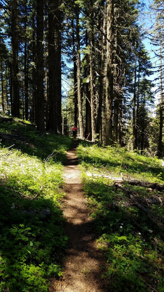
So it’s not surprising that a couple of wildflower enthusiasts like Melody and me would end up there on a sunny Tuesday in early June. Our plan was to start at the Pilot Rock trailhead and hike in to Porcupine Mountain, a favorite destination of ours, roughly a mile south and two miles to the east. The plan worked. After breakfast in a favorite restaurant of ours, Ashland’s Breadboard, we headed up the mountain and, despite a seemingly interminable time on the Pilot Rock Road, were on the trail by about 8:40. The pictures below will show you what we found.

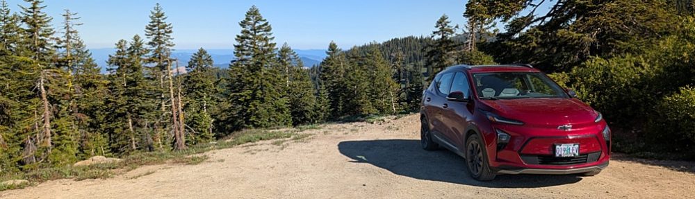
The Bolt at the Pilot Rock trailhead. We were grateful for the relatively high clearance of the car (7″) and the ability of electrical drive to precisely control the application of power to the drive wheels while crawling at very low speeds over a road that really needs to be improved if the public is ever expected to find the Cascade-Siskiyou National Monument.
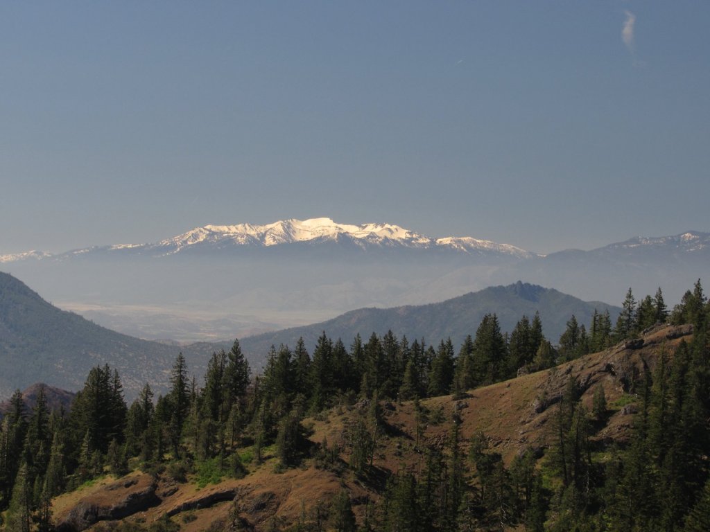
Mount Eddy, a 9000-foot peak in the Klamath Mountain system, viewed from the Pacific Crest Trail at a saddle just east of Pilot Rock.
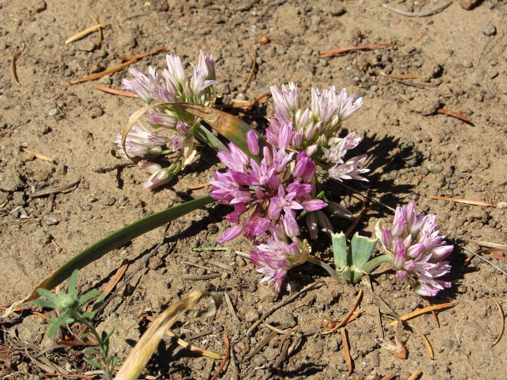
Siskiyou onion, one of the many endemics (plants limited to a specific area) found in the Siskiyou Mountains, that leaks over into a small area of the Cascades along the bridge provided by the Cascade-Siskiyou National Monument.
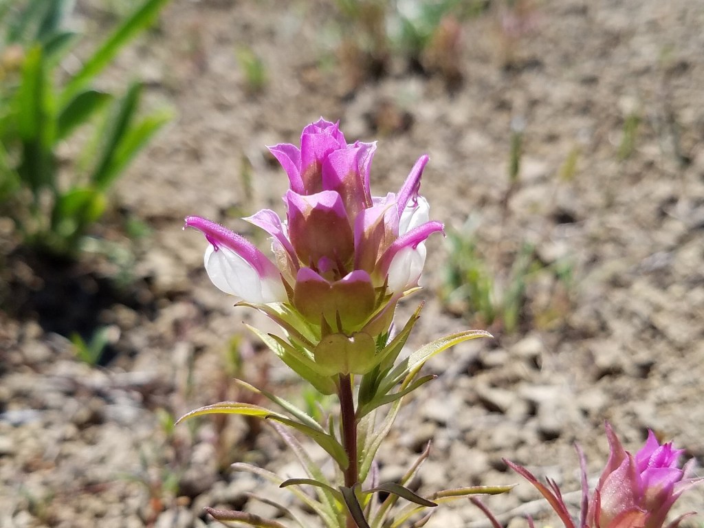
Copland’s owl clover, bridging the other way – from the Cascades to the Siskiyous.
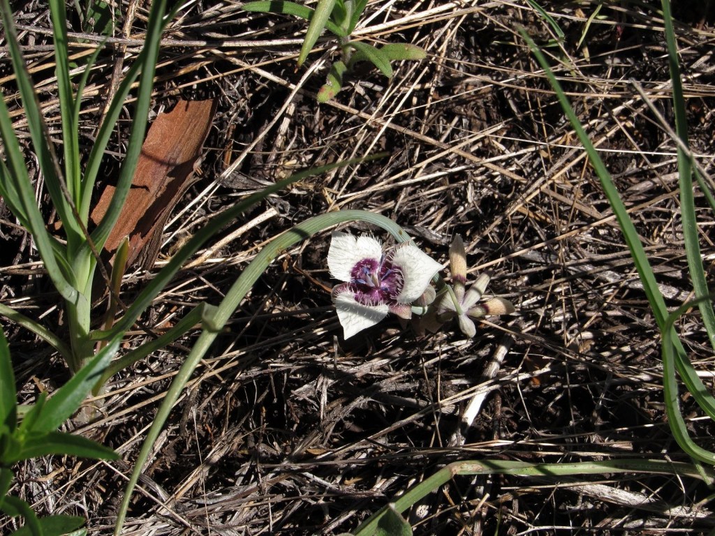
Elegant cat’s-ear lily, rare anywhere: it differs from the much more common Tolmie’s cat’s-ear by having pointed petal tips without hairs.
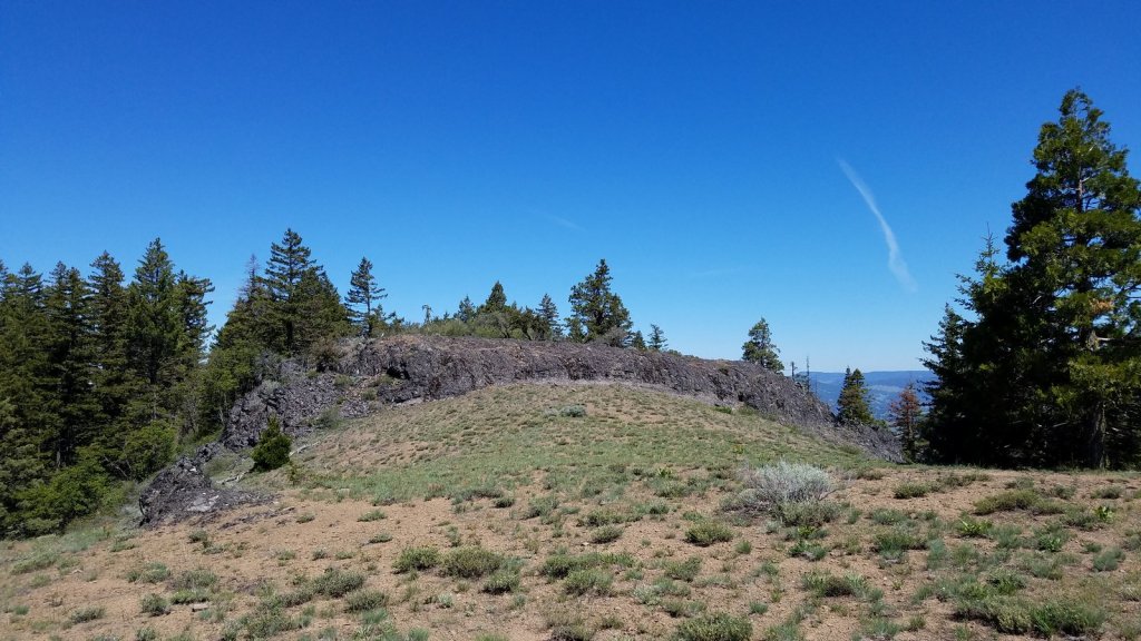
The summit of Porcupine Mountain is guarded by this 15-foot wall of basalt stretching all the way across the summit ridge. Easy enough to climb, but intriguing geologically.
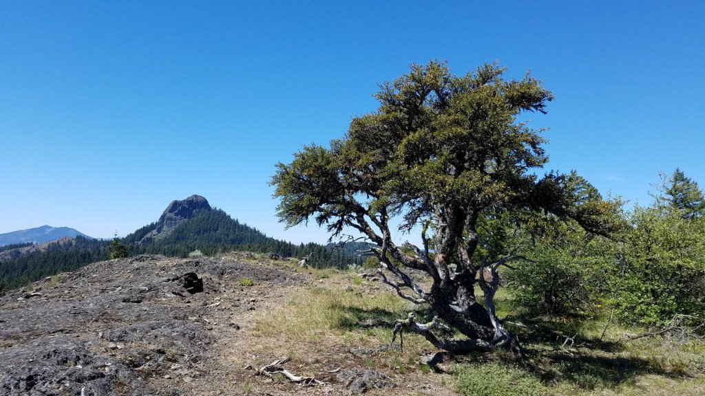
Pilot Rock from Porcupine Mountain’s summit. That’s a mountain mahogany tree on the right.
About that supposed bugaboo of electric cars, range anxiety, by the way: we pulled into the garage at the end of this trip having used under 14 kwh of the 60 we had available. Just thought I should keep mentioning this….
