Peak Bloom

Every sport has its own Grail moment – its own ideal, defining event, which players strive toward and spectators applaud. For golfers, it’s a hole-in-one; for baseball players, a triple play; for basketball players, a three-point shot that hits nothing but net. For surfers, it’s the perfect wave.

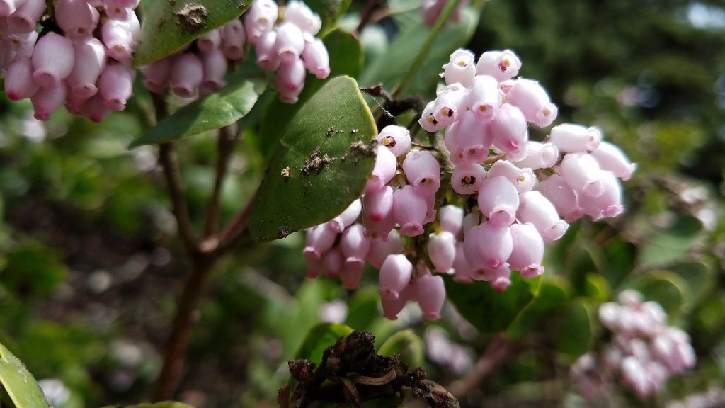
For wildflower addicts, it’s peak bloom.

Wiggins’s tiger lily and tower delphinium at a spring in Grouse Gap.

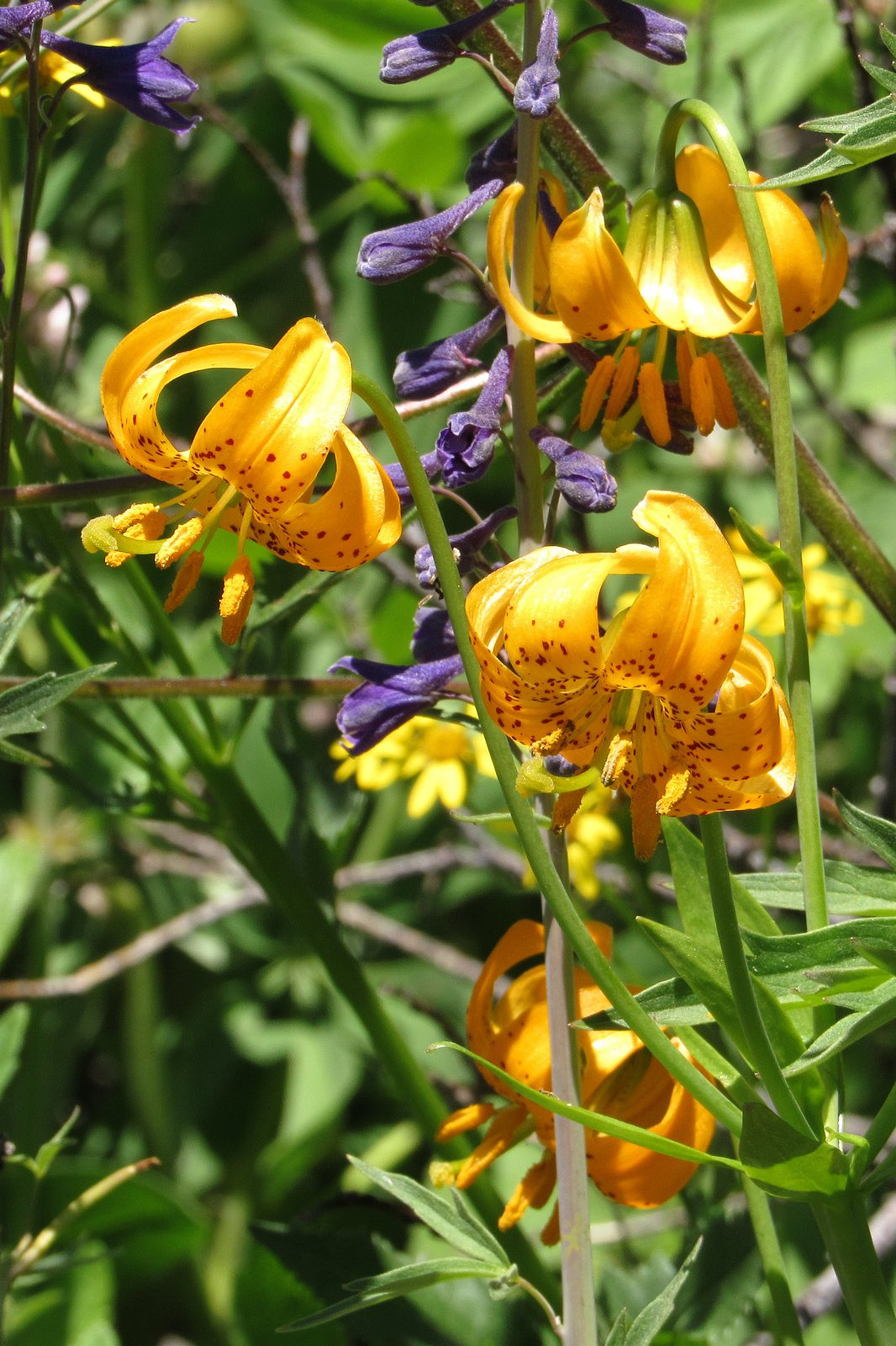
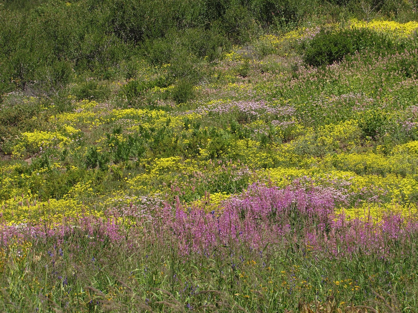
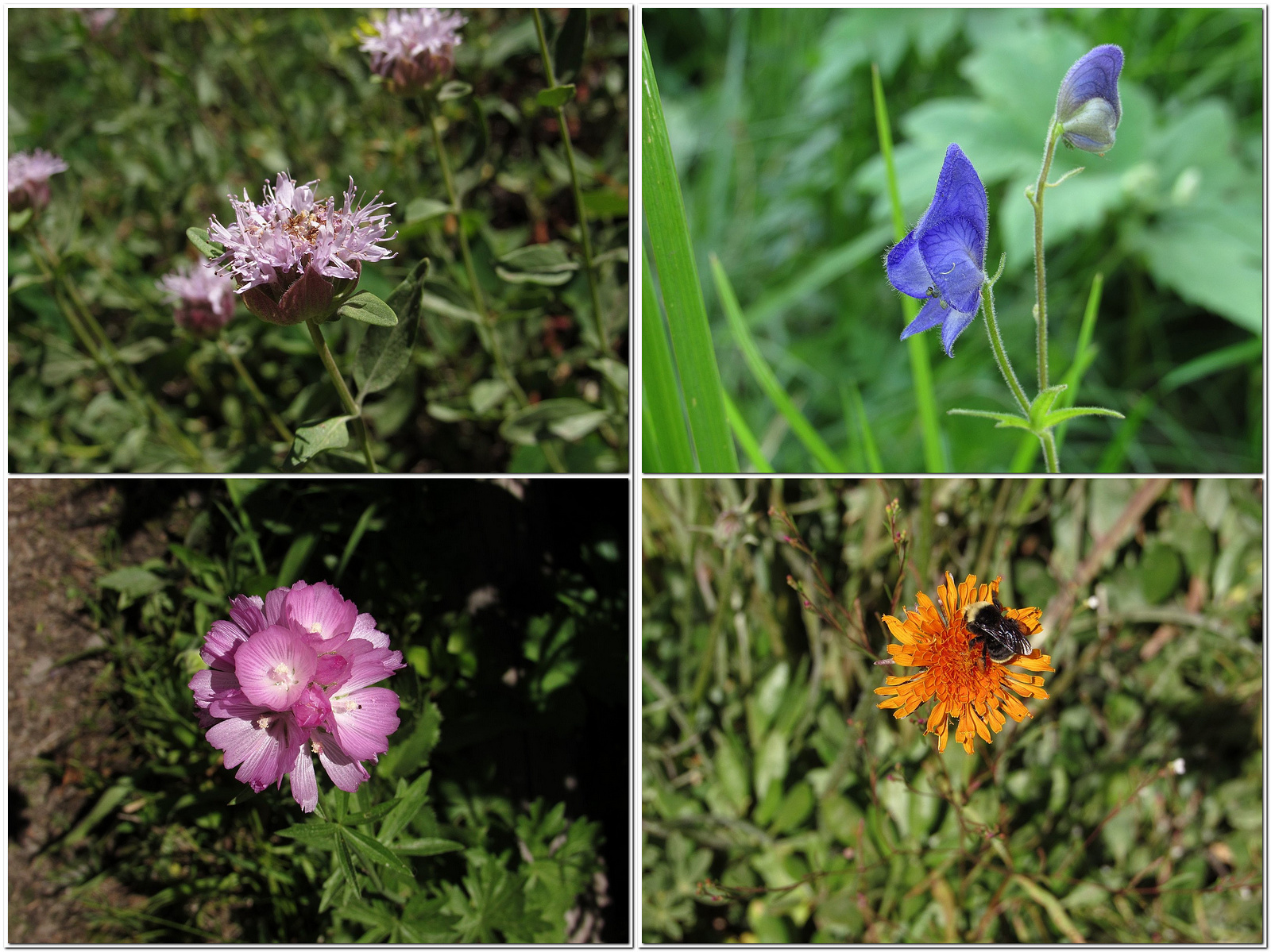
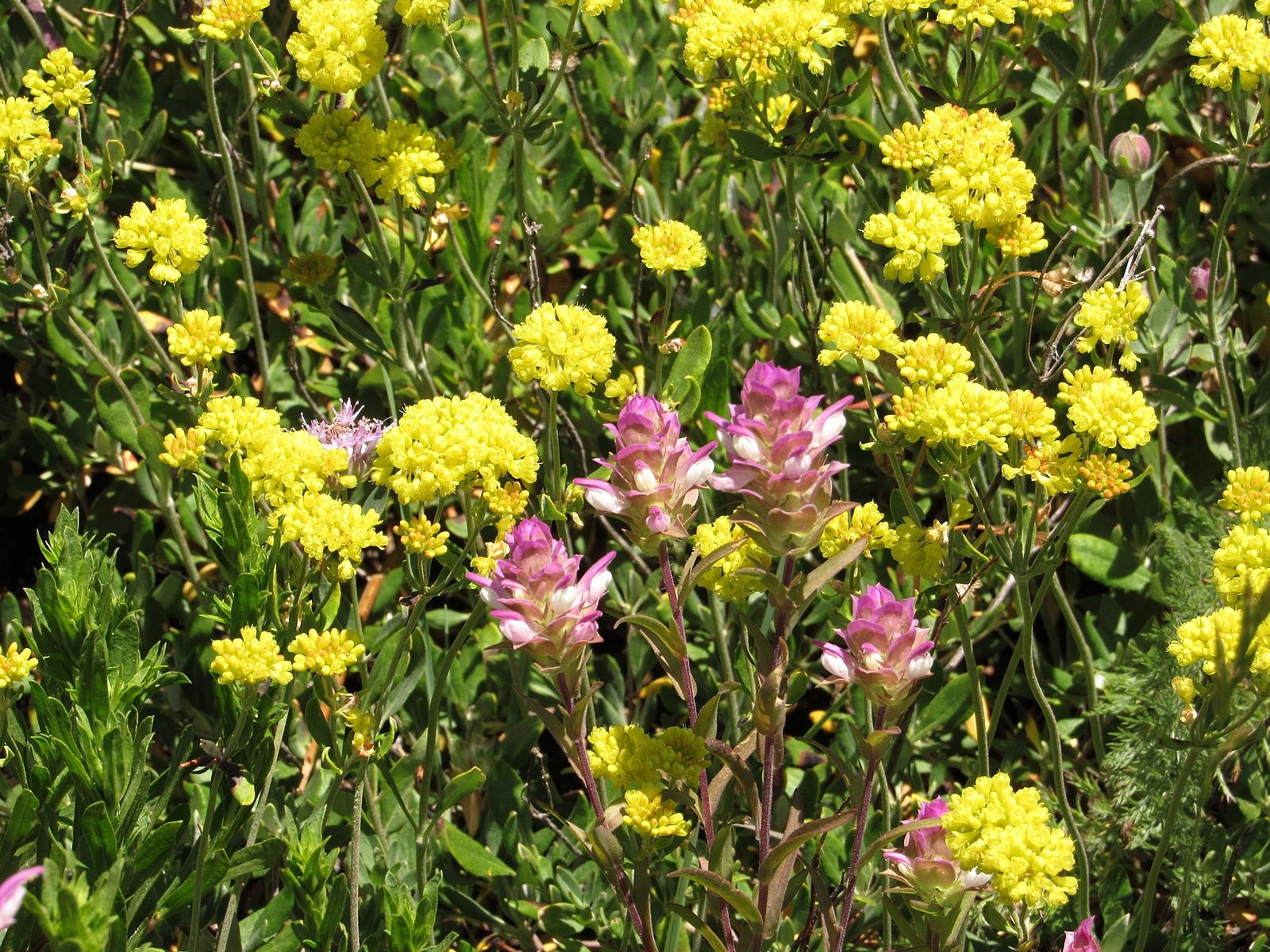
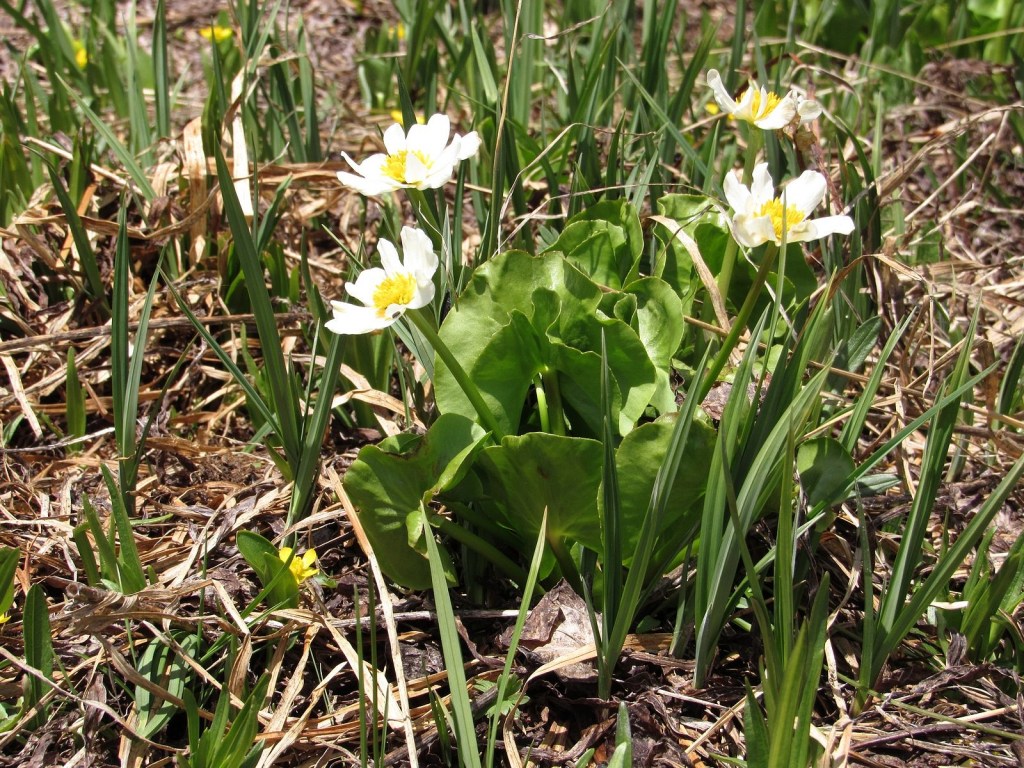
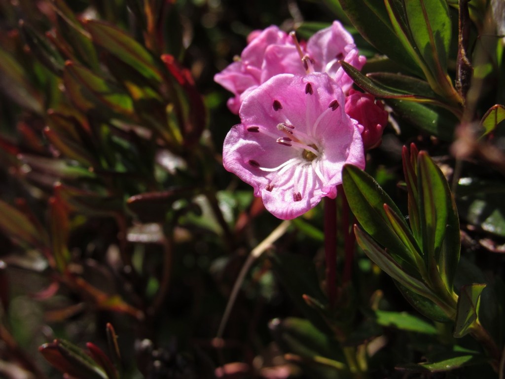
“Peak bloom” is technically defined simply as the time when the most flowers are blooming, but that stark sentence doesn’t begin to capture the term’s nuances. It is different for every place; for a given place, it is different for every habitat; for a given habitat, it is different for every year. A wet year will delay it; a dry year will bring it on early. A rainstorm at the wrong time may defeat it completely. The conditions that trigger blooming can vary dramatically from species to species, so the actual mix of flowers present at peak bloom for a given locality is almost always different each year. Depending on that mix of species, the display may be soft and muted, or it may be a riotous extravaganza of color and form. Or anything in between.

All this is by way of explaining why, only two weeks after our most recent previous trip to Mt Ashland, we were back again last Thursday. The push came from our longtime friend and fellow wildflower fanatic Diane Meyer, via a post on Facebook. Diane had just come back from the mountain with a camera full of pictures. “If you plan to visit Mt Ashland,” she wrote, “go NOW.”

We went. It didn’t hurt that we could do it as a half-day trip, which allowed us to get to the weekly Medford farmers’ market in the morning.

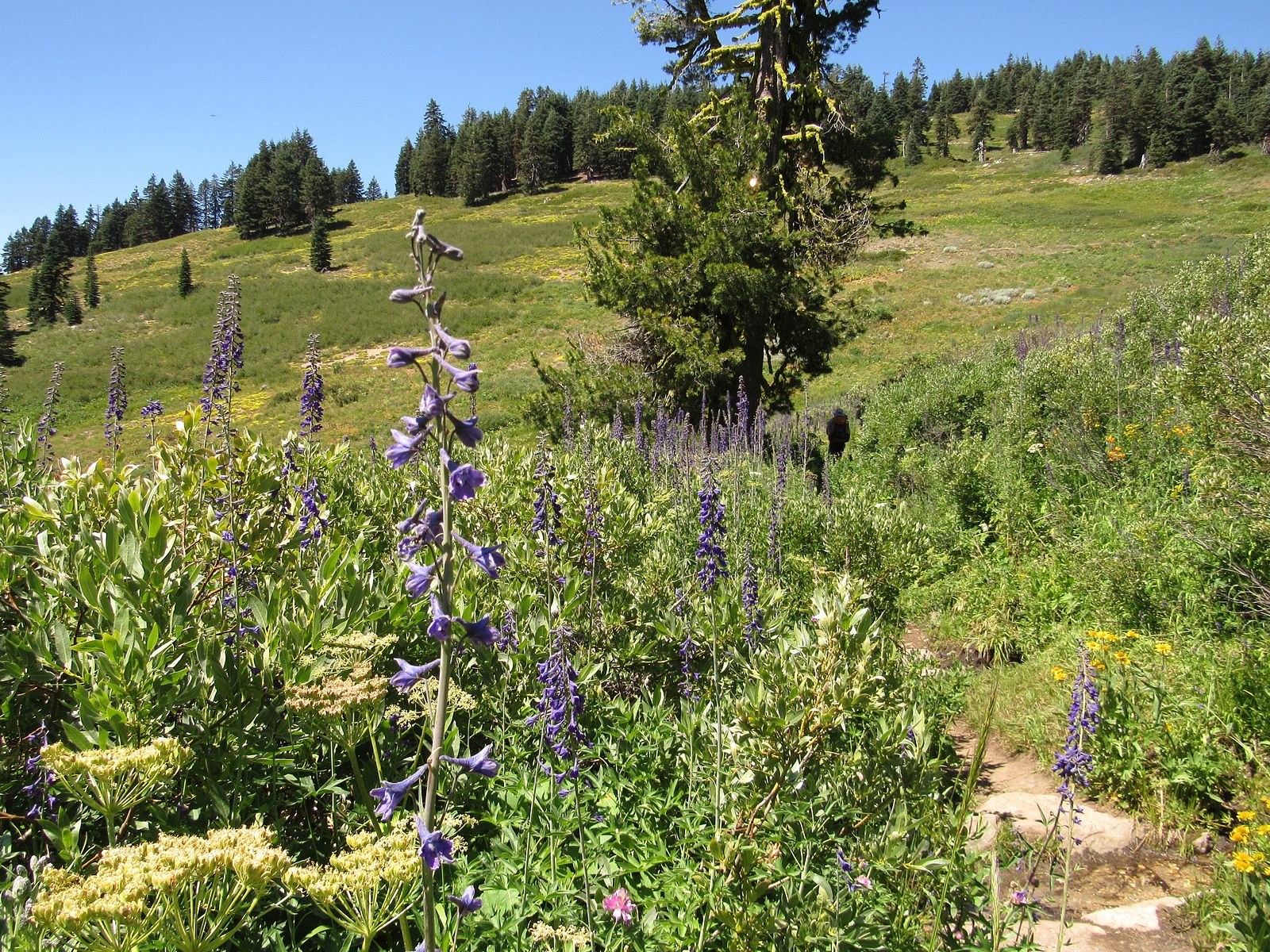
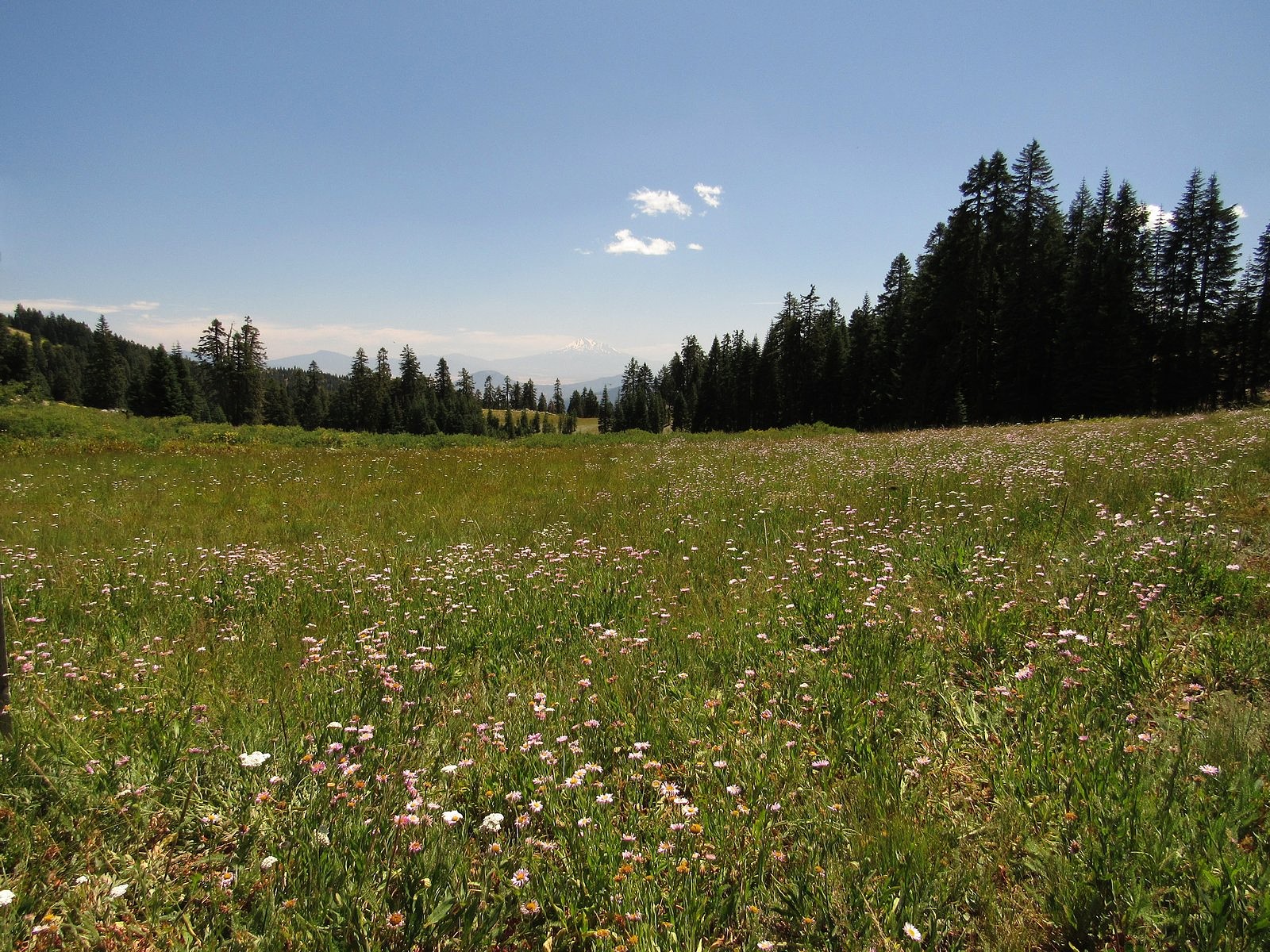
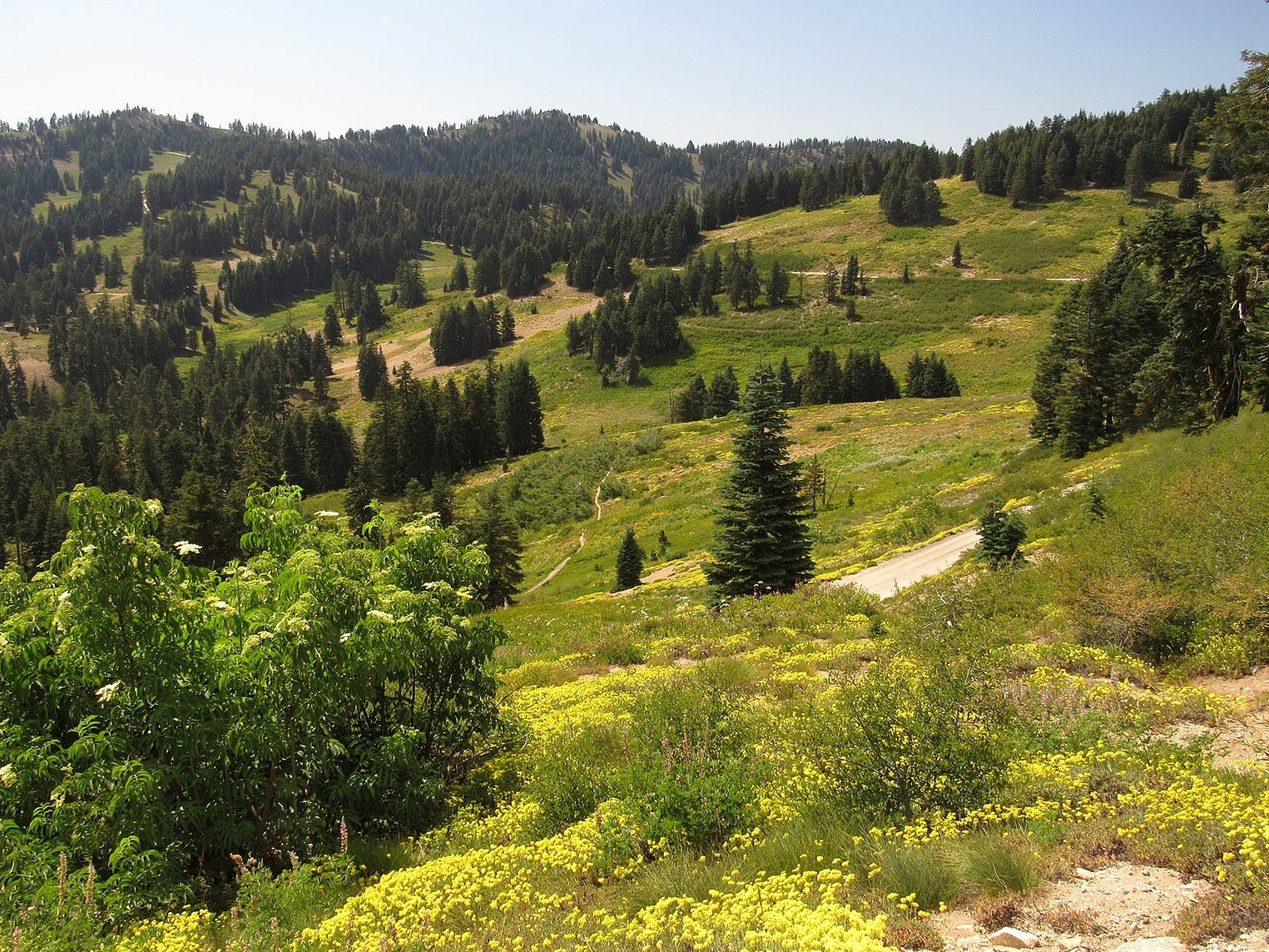
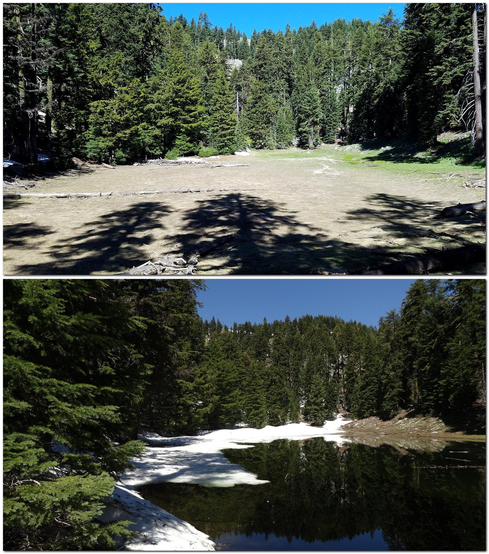
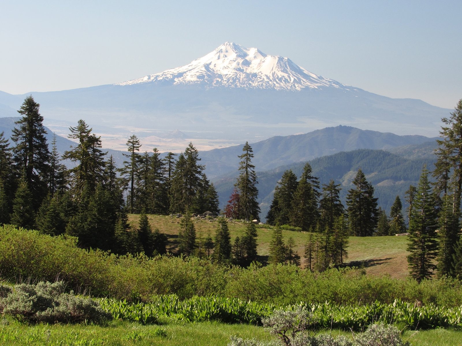
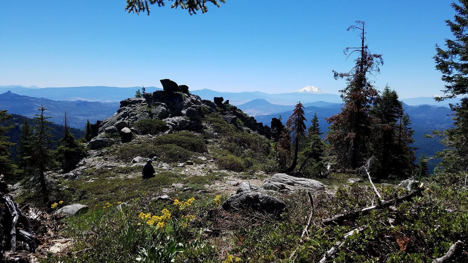
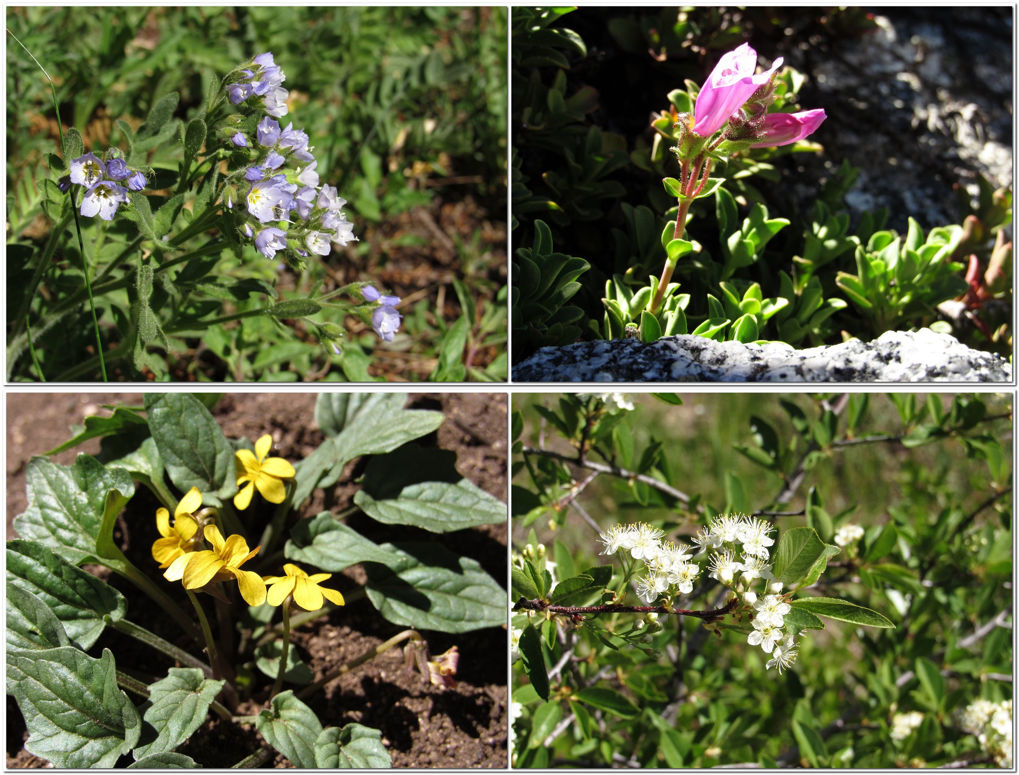
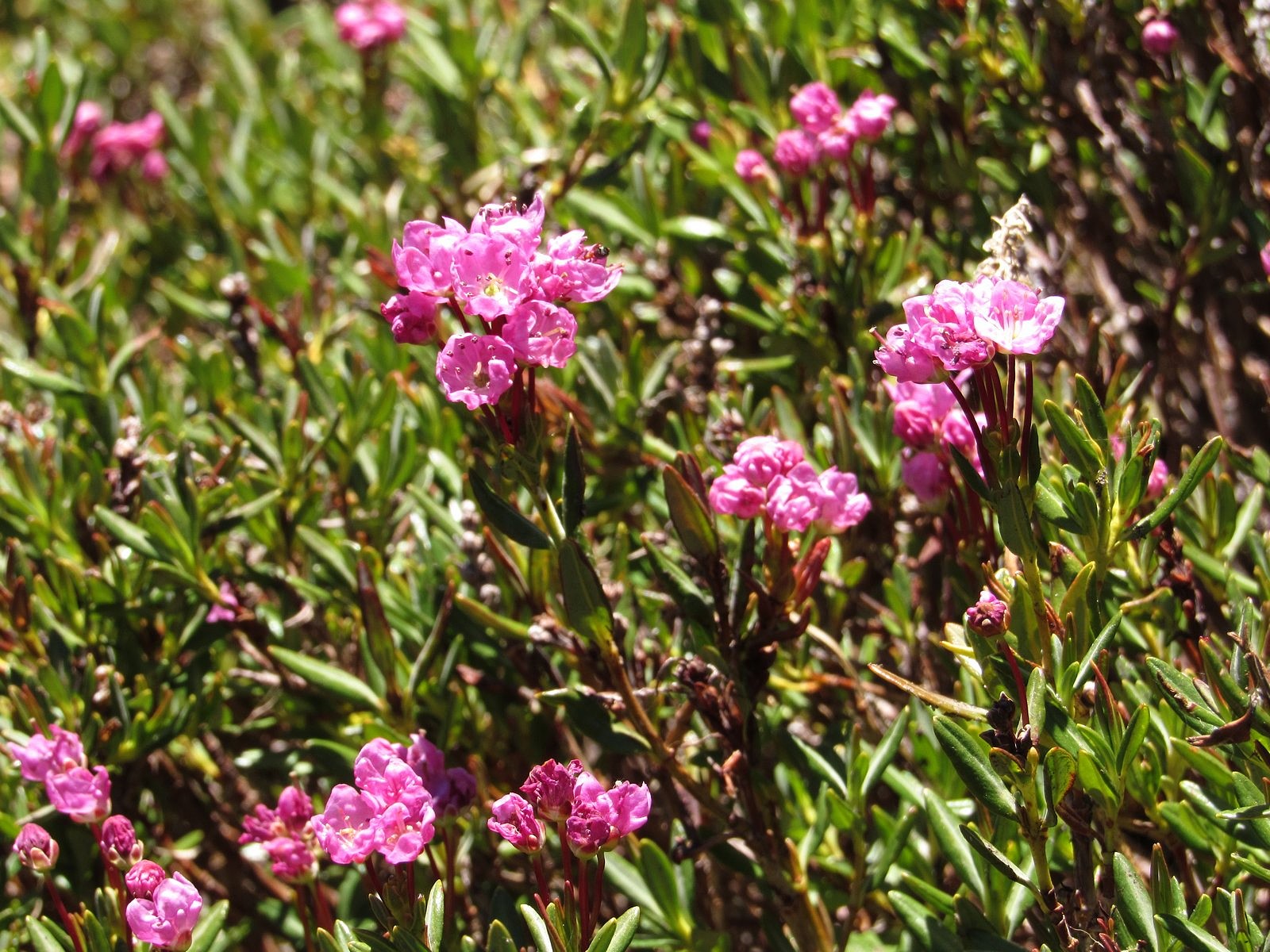
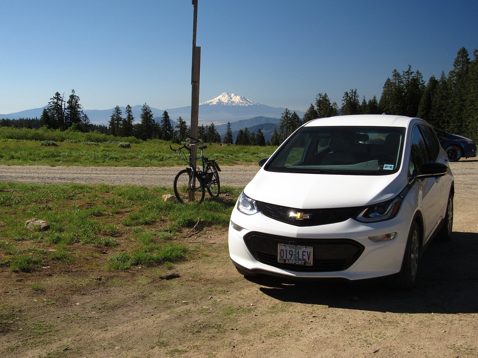
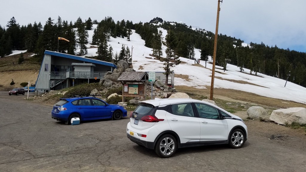
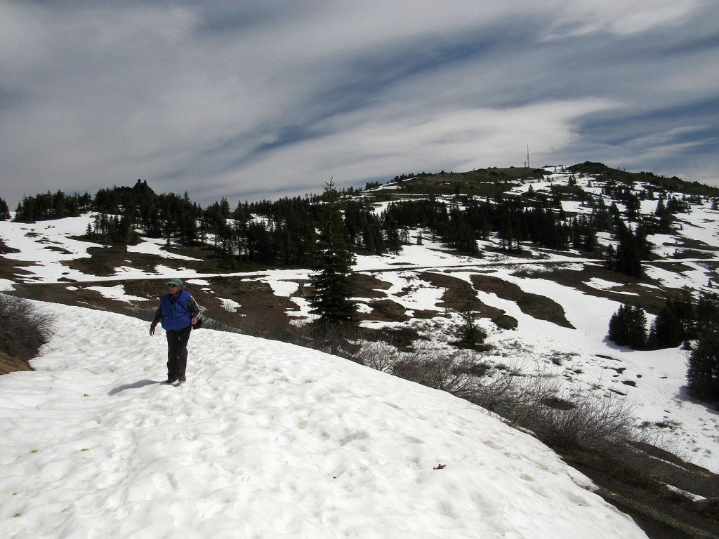
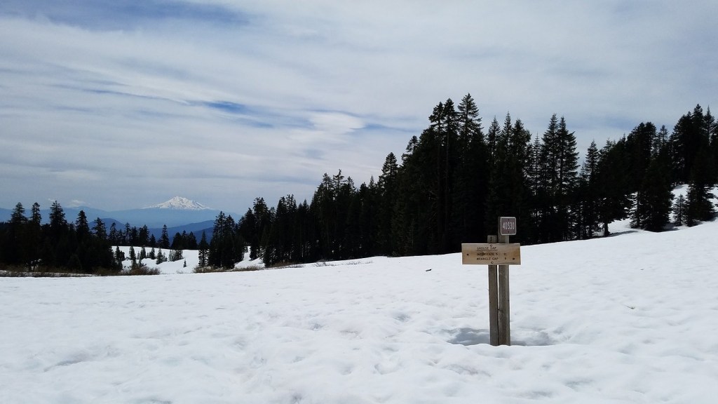
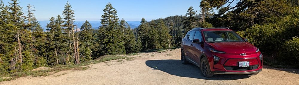
There is not much to say about the actual hike. We left Medford under a heavy overcast that was expected to get heavier, so it was a surprise to find the mountain basking beneath blue skies decorated by little puffy clouds. We parked the Bolt at the Mt Ashland Campground, dropped down the hill to the Pacific Crest Trail, and followed it around to the trailhead just off Road 20 in Grouse Gap; from there we climbed cross-country to the long, rocky ridge that juts west from Mt Ashland at the Rabbit Ears – picked up the mountain-bike trail along that ridge – took the trail back to the Mt Ashland summit road – and walked the road back to the car. Total distance was a bit over three miles, not much by our standards. The flowers on the ridge were disappointingly far past peak (remember what I said about different habitats?). The flowers in the Grouse Gap meadow system were….well, prepare yourself, and then check out the pictures.

Along the Pacific Crest Trail in Grouse Gap.
Along Road 20 near its junction with the Mt Ashland summit road.
Tower delphinium along the Pacific Crest Trail in the Grouse Gap meadows.
Mt Shasta across a field of Alice’s fleabane in Grouse Gap.
Clockwise from upper left: coyote mint, monkshood, orange agoseris, Oregon checker mallow.
Sulphur flower and Siskiyou owls’ clover.
The Grouse Gap meadow system, from the Mt Ashland summit road. Sulphur flower overrunning just about everything in sight.

The Lake on Mt Ashland

If you know where to look, there is a small lake on southern Oregon’s Mt Ashland.

Top: the lakebed this year. Bottom: the lake full of water on July 4, 2011. The two pictures were taken from about the same place.

Let me qualify that. It’s not actually a lake, it’s more like a large vernal pool. And it isn’t directly on Mt Ashland, it’s on the west wall of Grouse Gap, the big meadow-filled basin that lies just west of Mt Ashland. Mt Ashland forms Grouse Gap’s east wall. But if you get to the right place at just the right time – most of the way, but not all of the way, through the snowmelt season – there is, in fact, a lake there.

Wednesday of this week wasn’t the right time. We were too late: the lake had come and gone, which is the way we commonly find it. We’ve been able to get there when the lake was full only once. But it’s always fun trying.

Yesterday’s hike started early, with breakfast at The Breadboard in Ashland shortly after 7:00 AM, followed by a drive up I-5 and the Mt Ashland Ski Road to Forest Road 20, which heads west from the ski area along the crest of the Siskious, a high landscape of rocky peaks, lingering snow, and wildflower meadows – but very few lakes – to Dutchman’s Peak. By 10:00, following a couple of stops and some really slow driving along heavily-potholed Road 20, we were ready to walk.

Mt Shasta from Grouse Gap.

We began on the Pacific Crest Trail, heading west from the Grouse Gap trailhead through meadows and woods to the rocky opening, near the big switchback on the gap’s west wall, where we knew we could see the lake if it was there. It wasn’t, but we decided to go down to look at the lake bed anyway. From the dry lake, we worked our way cross-country to the real goal of the day – a large rock outcrop on the west ridge of the gap we’d been to once before. The combination of rock scrambling, flowers, dramatic dropoffs, and huge views dominated by the double white cone of Mt Shasta make it one of my favorite spots in the Siskiyou range.

Flower photos and granola bars dominated the next hour.

The outcrop, with Melody seated at its base.
Clockwise from upper left: showy polemonium, cliff penstemon, bitter cherry, Nuttall’s violet.

We kept to the ridge on the way back, climbing up and over the unnamed rock knob at its crest and coming down to the high saddle that’s converged on by both the PCT and Road 20 to cross the ridge – the trail and the road are perhaps fifteen feet apart at that point, so you have a choice. We chose to walk the road for a bit. There’s a spring full of buttercups, on a steep, open hillside of small streams lined with kalmia, in the bend where the side ridge we’d been on joins the main east/west backbone of the range, and we often use that hillside to drop from the road to the trail, some distance below. A deep draught of the good juice of the Earth from the spring, a visit to the kalmia – the blooms were fading but still lovely – and we were soon back to the car, ready to head down the mountain and rejoin the rest of the human race.

Kalmia

This is an electric-car blog, so I’ll put in a word here about the great advantage of an electric car over an ICE – internal combustion engine car – for mountain driving. It is 36 miles from our home to the Grouse Gap trailhead, with a 5600-foot elevation gain, most of it in the 20 miles between the Highway 66 freeway interchange in Ashland and the trailhead. Climbing those 5600 feet requires extra energy, in either an electric car or an ICE. What’s different about electric drive is that, on the descent, you gain a fair amount of that extra energy back. An ICE will just burn more gasoline – if only enough to keep the engine turning over and available.

The screen that reports a running total of the number of kilowatt-hours drained from the Bolt’s battery pack since its last complete charge holds the key figure, here. That screen read 16.1 kwh at the trailhead. It read 13.2 kwh at the Highway 66 interchange, meaning that almost three of those depleted kwh had been put back in – the car had only borrowed them. By the time we pulled into our garage, sixteen miles further along, we had used up those three regenerated kwh plus one more – the screen reading was 17.2. We’d used a net of just over one kwh to travel 36 miles. That’s the equivalent, roughly, of 750 mpg in an ICE, on cheaper fuel. Add the Bolt’s rough-road cred – full torque available at all speeds; clutchless application of that torque (allowing finer control for dealing with potholes, puddles, and rocks); and seven inches of ground clearance (two inches more than a typical sedan, and only a little over an inch and a half less than a Subaru Outback), and I can’t for the life of me figure out why anyone would want to drive anything else.

The Bolt at the Grouse Gap trailhead, with Mt Shasta in the background. Lead photo: Mt Shasta over meadow larkspur in Grouse Gap.

Mount Ashland in mid-May, 2019: a few flowers, and a whole lot of snow!

The Bolt in the parking lot for the Mt Ashland ski lodge – not the place we left it during the hike.

Melody and I spent most of yesterday on Mt Ashland, checking out current snow and wildflower conditions. We found a lot of the former and not very many of the latter; here are a few of the more than 100 pictures I shot.

The walk

The gate was closed on Road 20 at the west end of the Mt Ashland Ski Area, so we parked a couple of hundred feet east of it, in a spot I judged would have shade when we got back to the car, and walked the road toward Grouse Gap. The road was plowed to the branch that goes to the summit of the mountain, and then up that branch; that’s for the people who service the equipment on top of the mountain, including a TV broadcast antenna and a weather radar dome as well as the upper terminals of a couple of ski lifts. At the junction, we chose to stay on Road 20. After the plowed part, the road was three to six feet deep in snow. Some of the time there were bare patches along the edges, and we could walk in those; at other times, there was no choice but the top of the snow, which luckily was fairly firm. Grouse Gap itself was covered with snow to a depth of about two feet. Weather was cloudy and cold when we started walking around 10:30, but had mostly cleared by the time we got back to the car five hours later, having walked a total of about 5 miles. The Bolt was in the ONLY small bit of shade in the very large parking lot, and yes, I felt smug.

Grouse Gap. Mt Shasta in the distance.

The flowers

Walking in, the only things we saw in bloom were manzanita bushes, but I did spot some color in a large bare area up a south-facing slope above the road near the big bend in the road beneath the rock formation known as the Rabbit Ears, so we climbed the slope to investigate on the way back. The “color” was a large patch of mixed buttercups and marsh marigolds. They were accompanied by a few miniature white lomatiums, and not much else – except a tiny patch of kalmia, with two fully-developed blooms. We hadn’t seen kalmia on that part of the mountain before, so finding it was the highlight of the day.

Kalmia microphylla, western bog laurel.

The car

The Bolt, of course, behaved splendidly. Interesting point: it’s 35 miles from our house to the ski area parking lot, during which one climbs a bit over a vertical mile. The gauge that measures the car’s electrical use read 15.6 kilowatt-hours (kwh) when I turned off the power in the parking lot. It read 15.7 kwh when I turned off power at home, at the end of the trip. The power generated by the drop in elevation had almost matched the power used by the 35 miles of distance, and we had used just a net 0.1 kwh on the return trip. The estimated remaining range had actually increased by 47 miles, from 150 in the parking lot to 197 at home. Try to do THAT in a gasoline-powered car.