The Odd Day

It started as a simple trip to a good wildflower hike we know of along the lower Rogue River. It ended somewhere else entirely, and even the somewhere-else required a somewhere-else to make it succeed properly. But the day ended well, and I have the pictures to prove it. Keep reading.

The whole thing was a result of COVID-19, really. This would normally be the time of year for the Table Rocks, southern Oregon’s premiere spring wildflower hike: but the BLM and The Nature Conservancy, which jointly manage the two big mesas, have closed the trails to enforce social distancing during the ongoing pandemic – and even if they hadn’t, at our age (both of us are 77), we’d avoid the place right now like the pl … no, because of the plague. So we are constantly looking for trails that no one else is likely to be hiking. One of these, I thought, just might be the Umpqua Joe Trail, which starts across the road from Josephine County’s Indian Mary Park, just beyond Hellgate on the Rogue River, and climbs to wildflowers and views. We’d driven past the trailhead three times this spring and had not seen any cars there. It seemed – innocently, I now know – like a good choice.

Umpqua Joe is a short trail – about a mile and a half, one way – and it was 32°F outside the house when we woke up, so we waited until about 11:30 AM to leave the house. The hour’s drive to the trailhead was uneventful – right up to the time we pulled into the parking lot and saw the sign announcing that the trail was closed for repairs due to the damage caused by the Klondike Fire in 2018. No wonder we hadn’t seen any cars parked there.

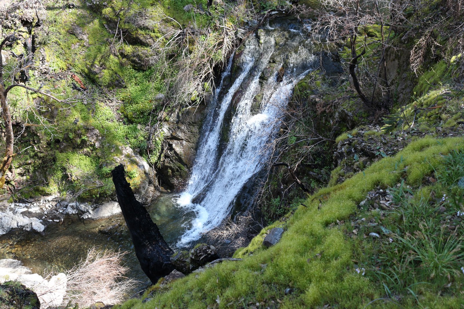
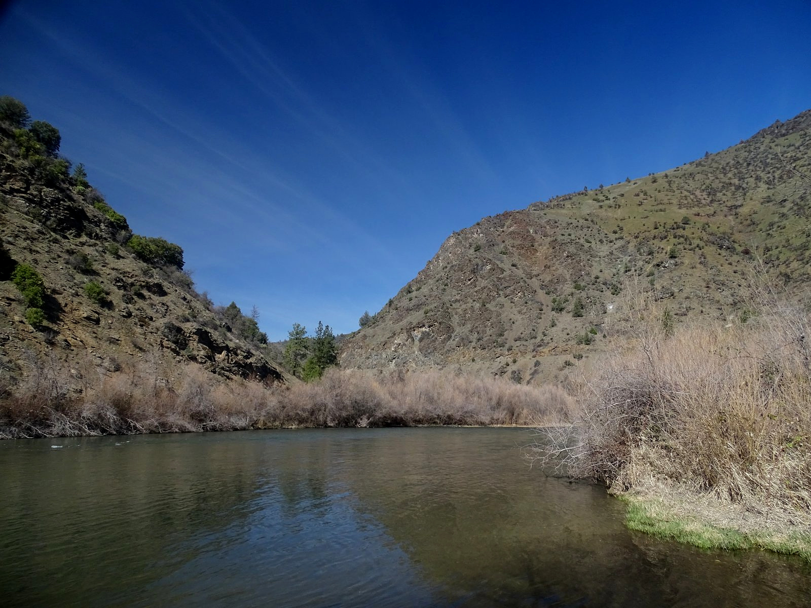
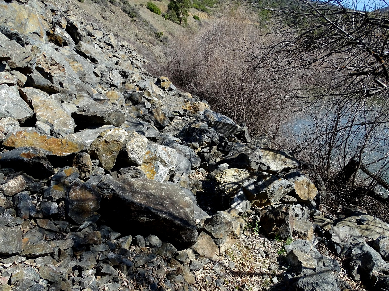
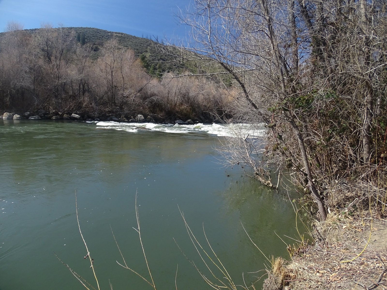
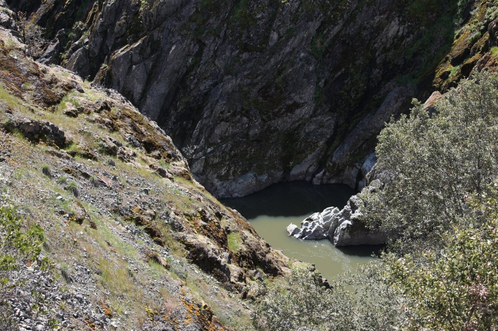
Well, never mind: I’d planned an alternative, just in case. Right across the river from Indian Mary there is a large rock-and-scree bluff, and the bluff has a trail up it. No cars parked there, either. But when we crossed the bridge and took the gravel side road to the bottom of the bluff, we were met by a wire fence and another “closed trail” sign, this one evidently because the trail – constructed only by feet and bicycle tires, even though it has a nice trailhead kiosk – was now considered too hazardous to use. There are a couple of paths to the river there, also, but there were already people down them; we could see their car in the trees further down the road. Sigh.

Back up-river a short way, to the old side road that can be walked to the river just below Hellgate. There were people down that road, too.

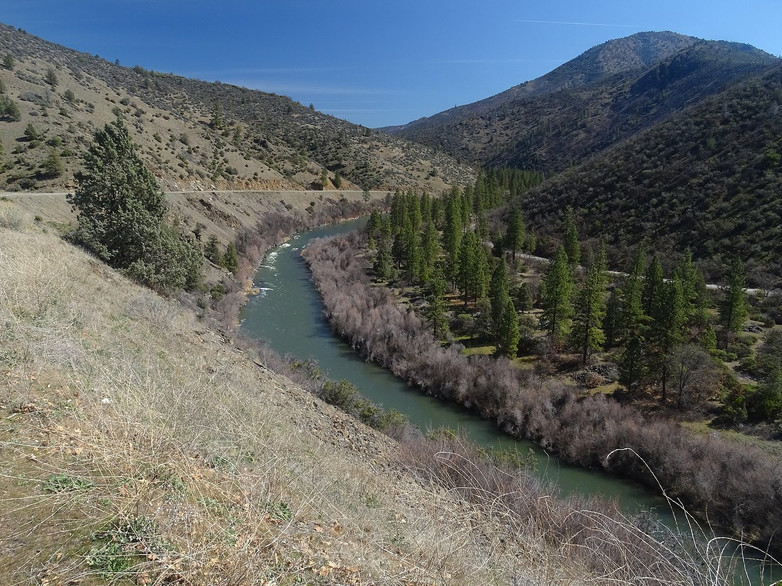
At least the Hellgate Overlook parking lot was empty. We parked there and walked the gravel path along the roadway. It runs about a quarter of a mile and offers some nice views of the gorge and a few flowers, but with traffic whizzing by just a few feet away, it wasn’t exactly what we were looking for. However, I’d also prepared a third alternative. Sexton Mountain, north of Grants Pass, is well-known to travelers on Interstate 5 – the freeway runs over its western shoulder, through a deep road cut, and there are signs beside the road identifying the road cut as “Sexton Mt. Pass.” What is not so well known is that there is also a road over the EAST shoulder of Sexton Mountain.

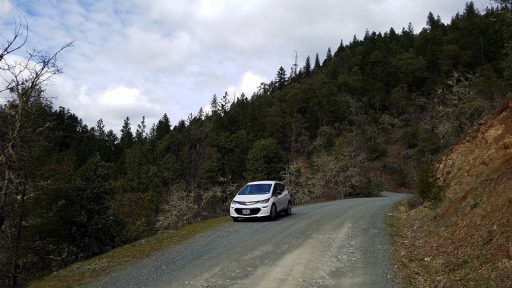
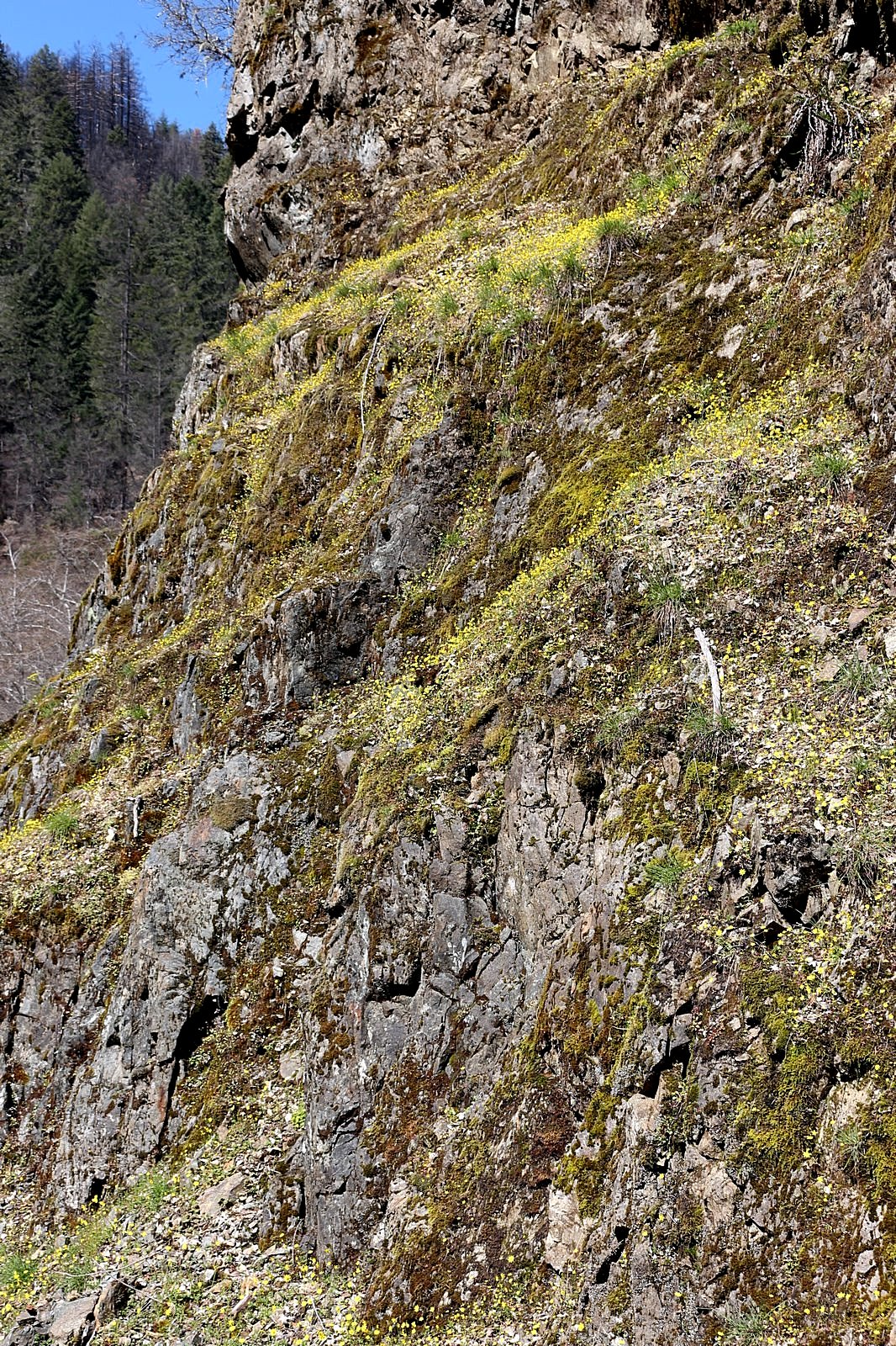
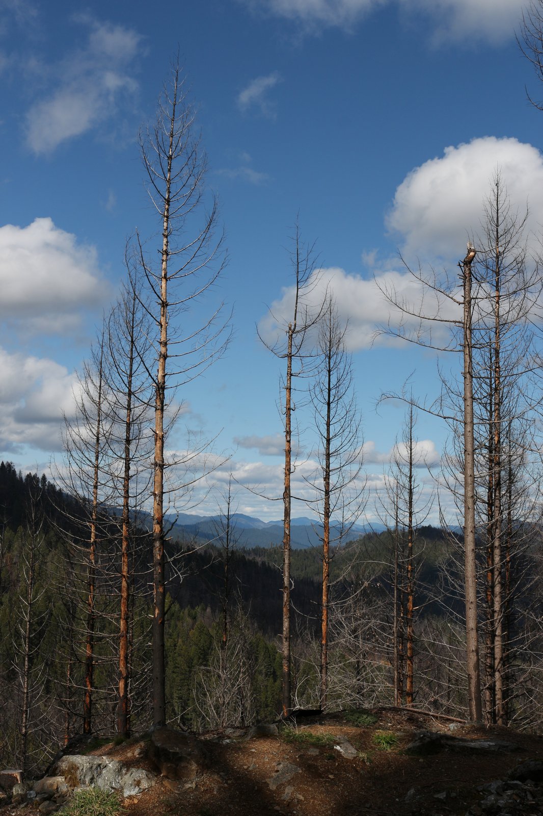
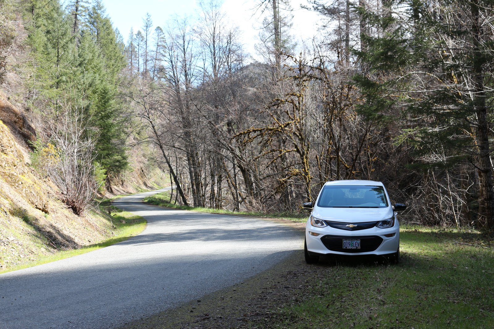
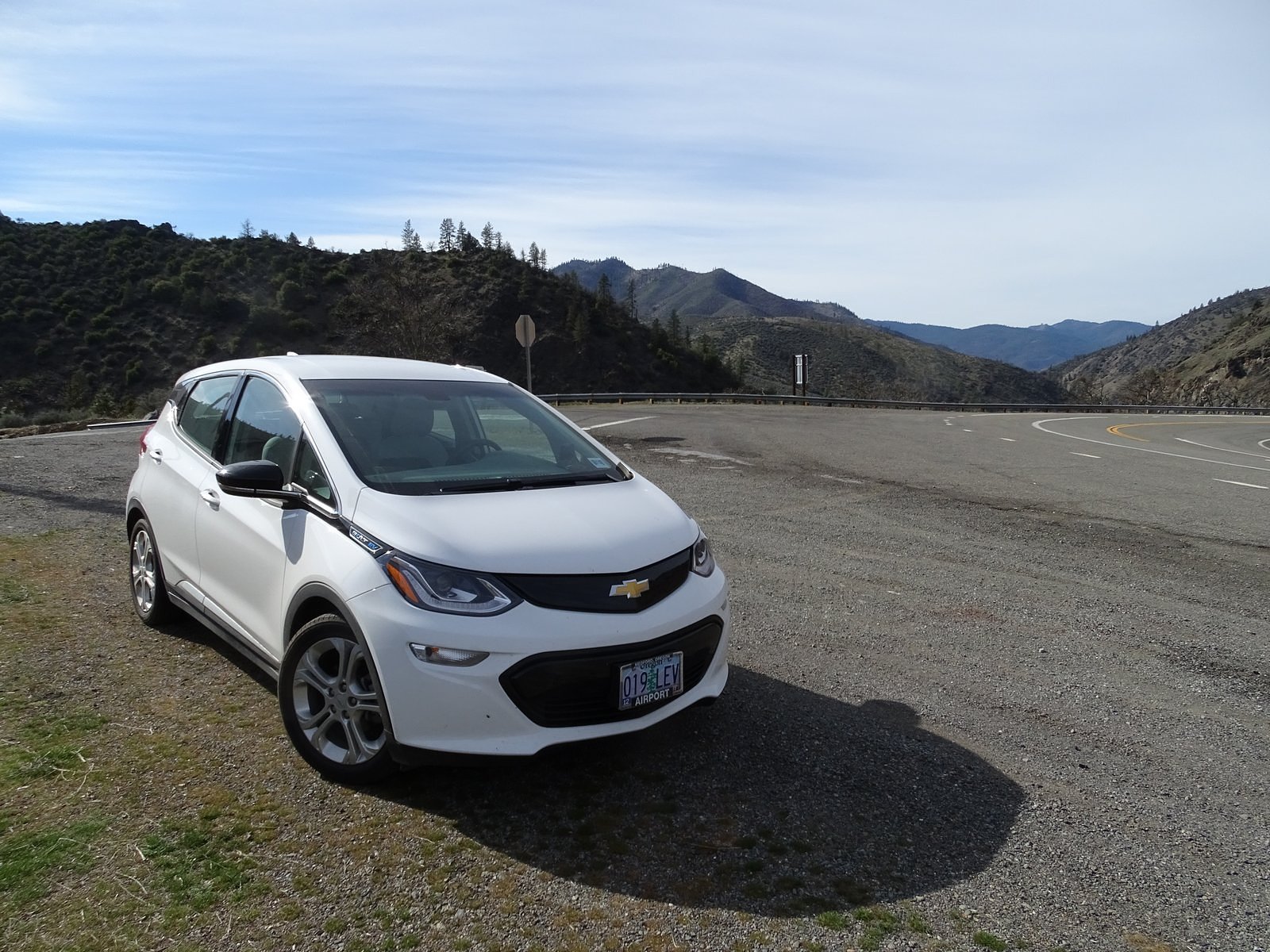
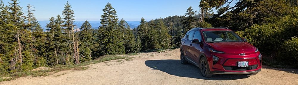
It is a narrow gravel road badly in need of repair, it leaves from a paved Josephine County back road called “Jumpoff Joe” that is itself very little traveled. It probably sees only a few cars each week – if that. Off that road, right at the pass over the shoulder, there is an even smaller road, an old BLM logging road, gated and going back to earth. We’d walked that old road before, and we knew it to be a great spot for spring wildflowers. So I pointed the Bolt’s nose in that direction.

Henderson’s fawn lily

The quickest way from Hellgate to Hugo – where the Jumpoff Joe Road leaves the freeway – is via the Pleasant Valley Road from Merlin. Unfortunately, I hadn’t researched that, so we took what was labeled the “Hugo Road” instead. I have to say it was a pleasant drive, over a well-maintained, paved, two-lane road through a sunny, woodsy valley, but it takes you quite a ways north before curving around and bringing you back to the freeway. Another oddity. The Jumpoff Joe Road is similarly pleasant, but the Jack Creek Road – which is the one which leads to the back side of Sexton Mountain – is poorly marked, and we had driven about a mile past it before my wife convinced me that I’d missed the junction and I turned us around. The Jack Creek Road is gravel, and steep, and erosion is taking its toll: in several places I had to creep the Bolt over, around, or through dips and potholes and the occasional partial gully. This, of course, is one of the things that keeps the area we were headed for isolated, and I was congratulating myself and announcing loudly to Melody that we should definitely be alone up here when we pulled up to the saddle and spotted a parked SUV. Damn.

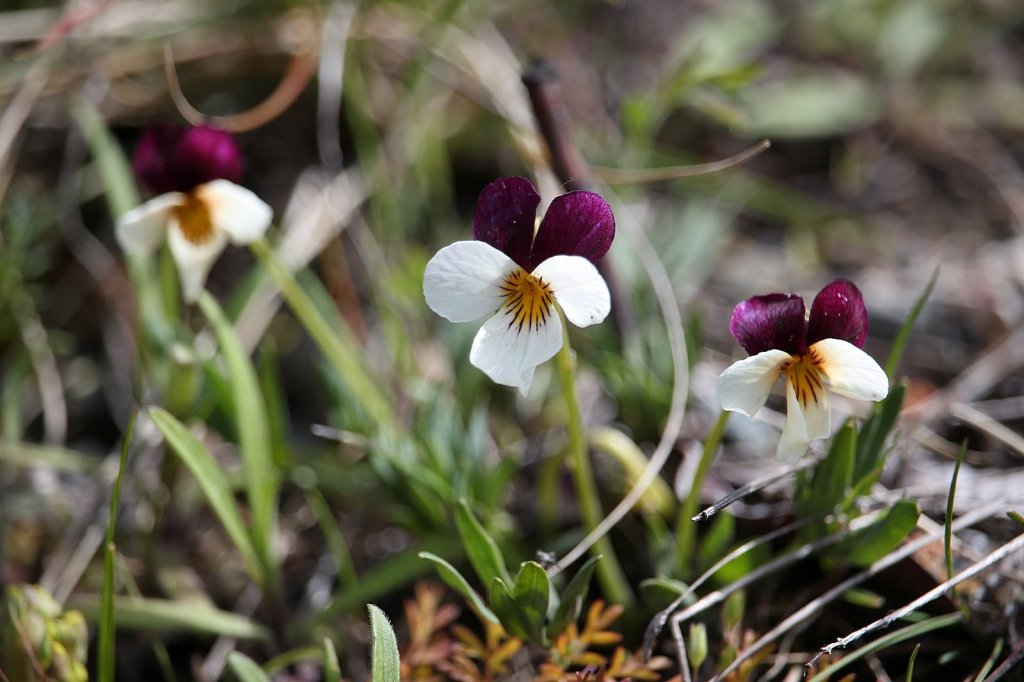
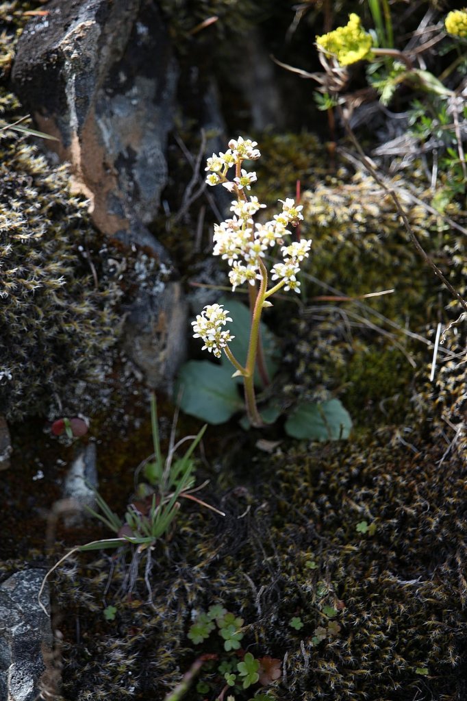
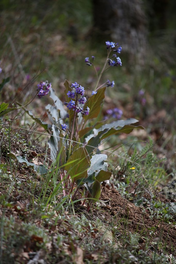
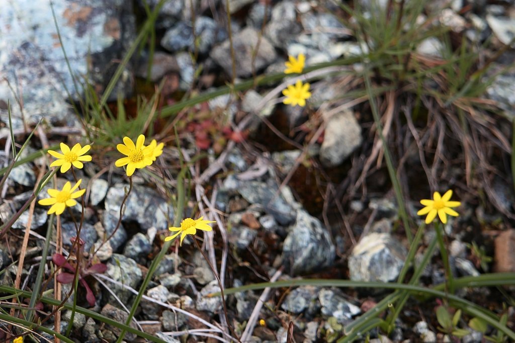
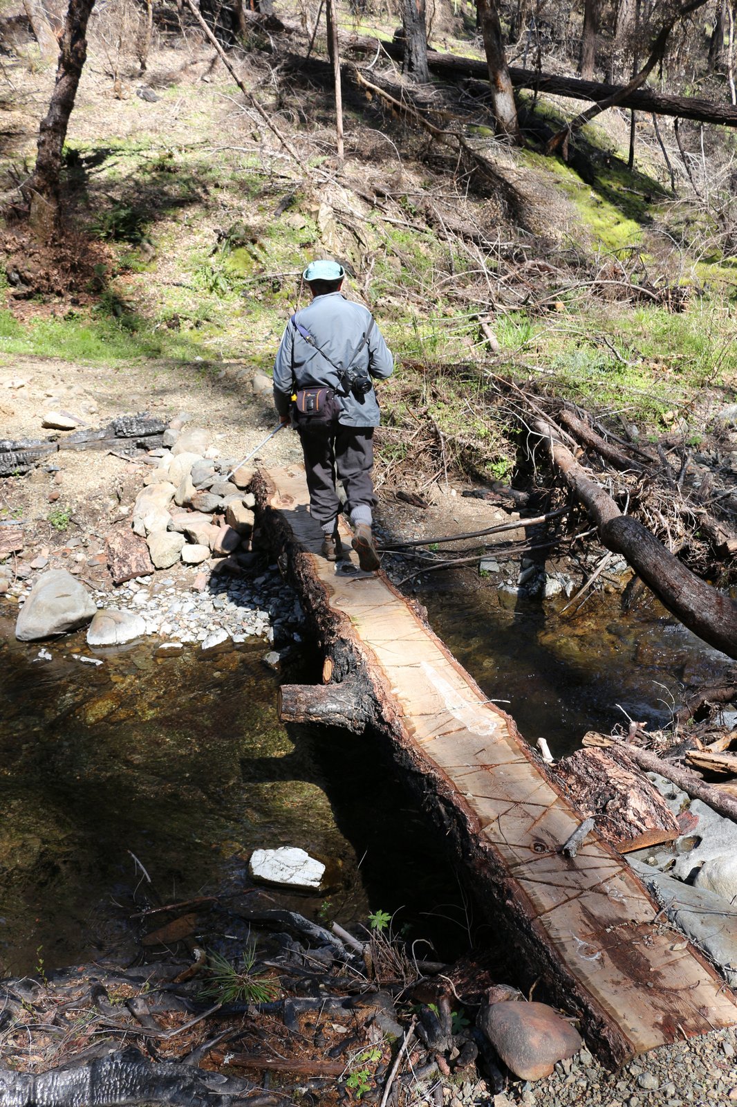
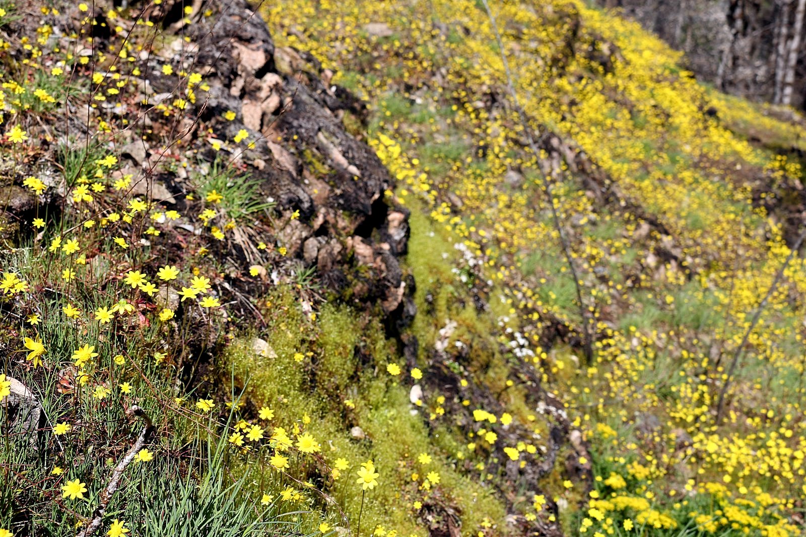
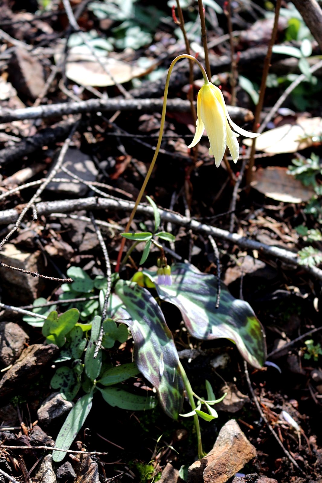
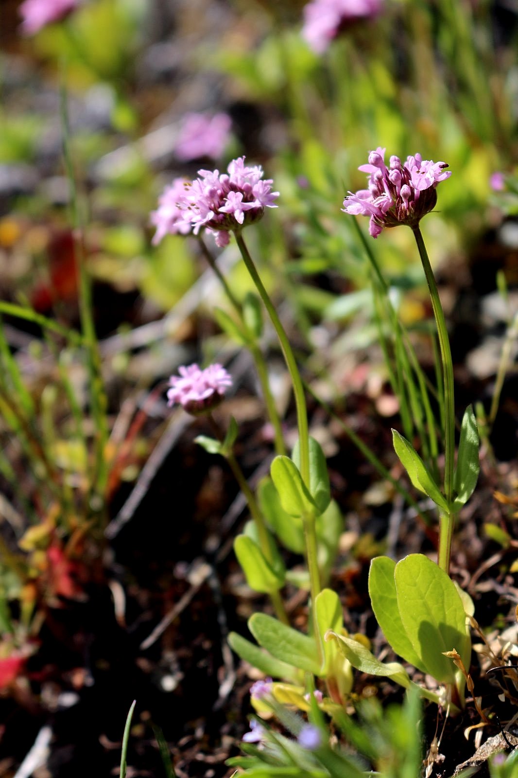
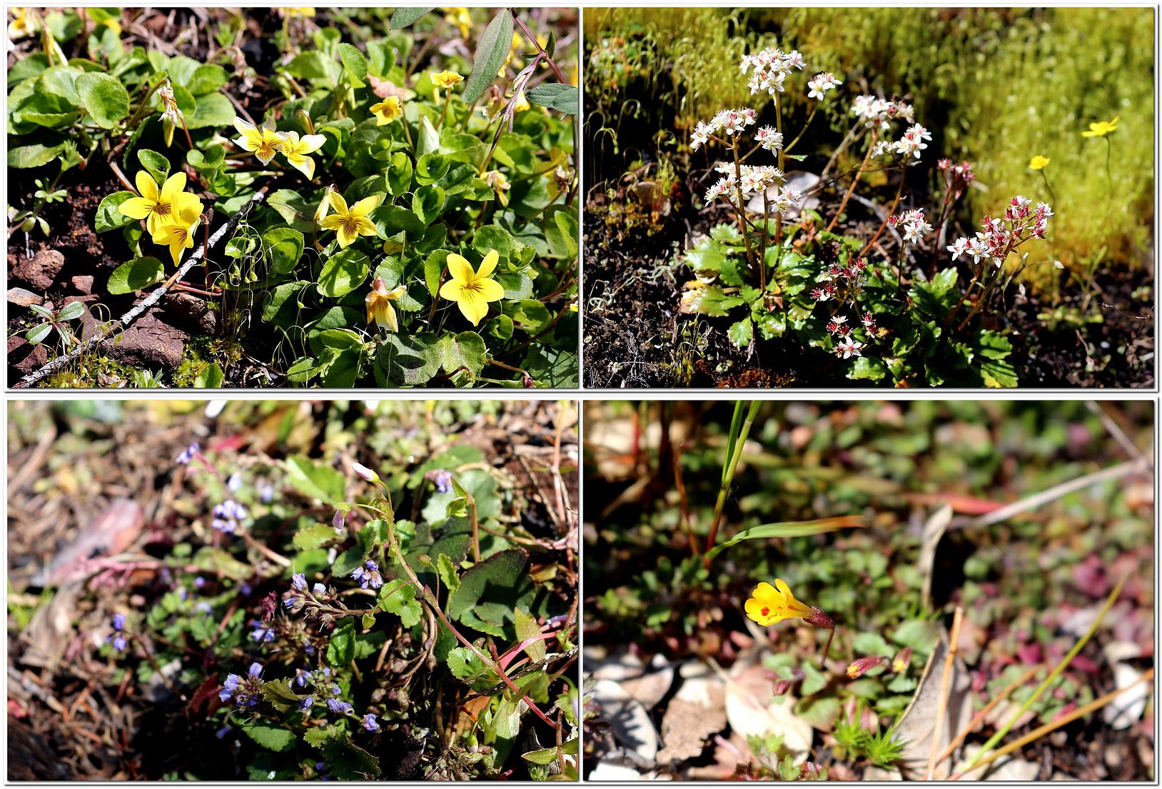
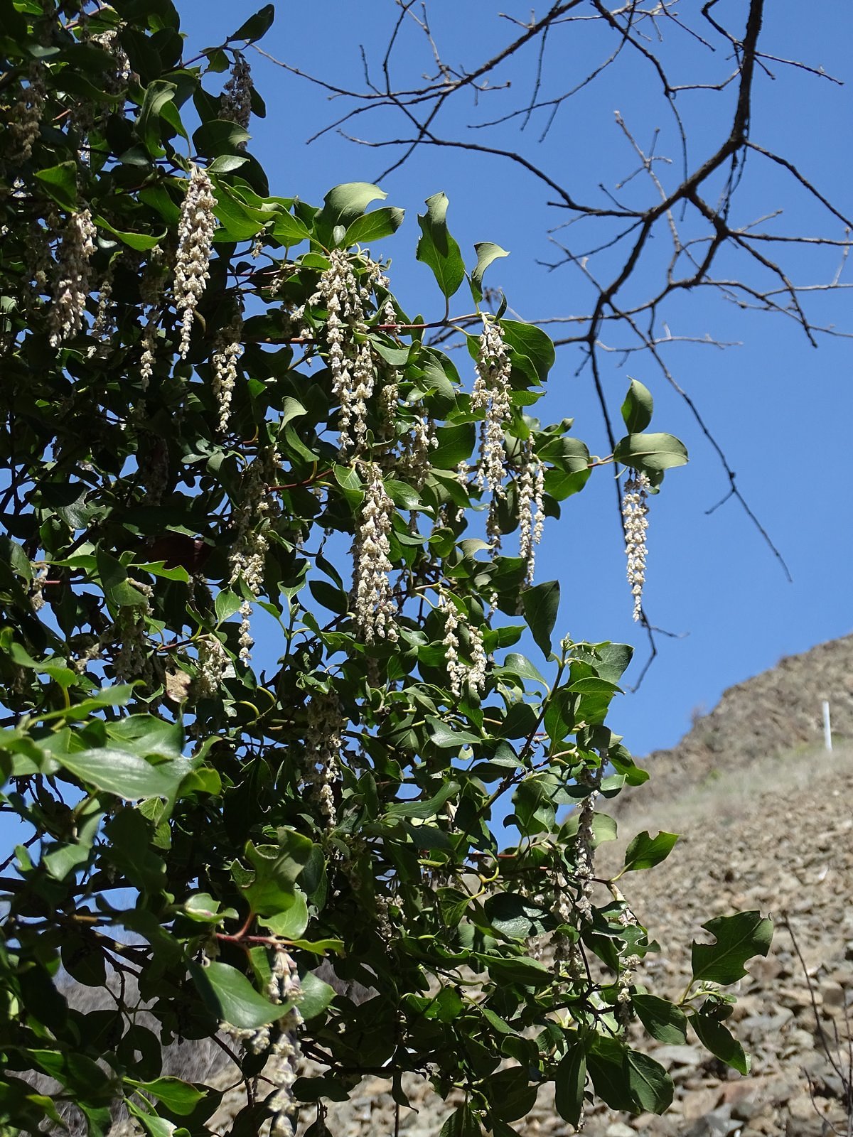
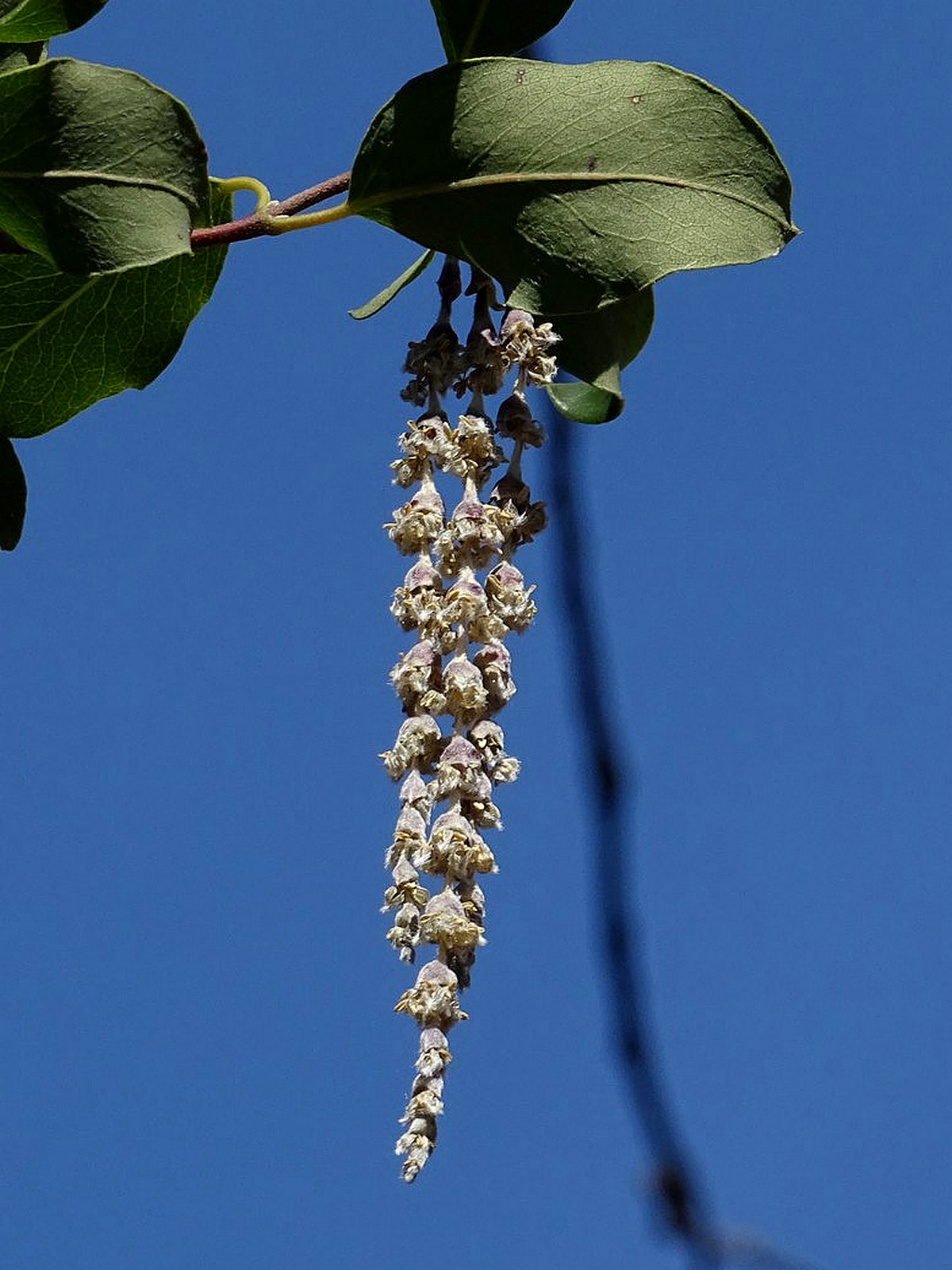
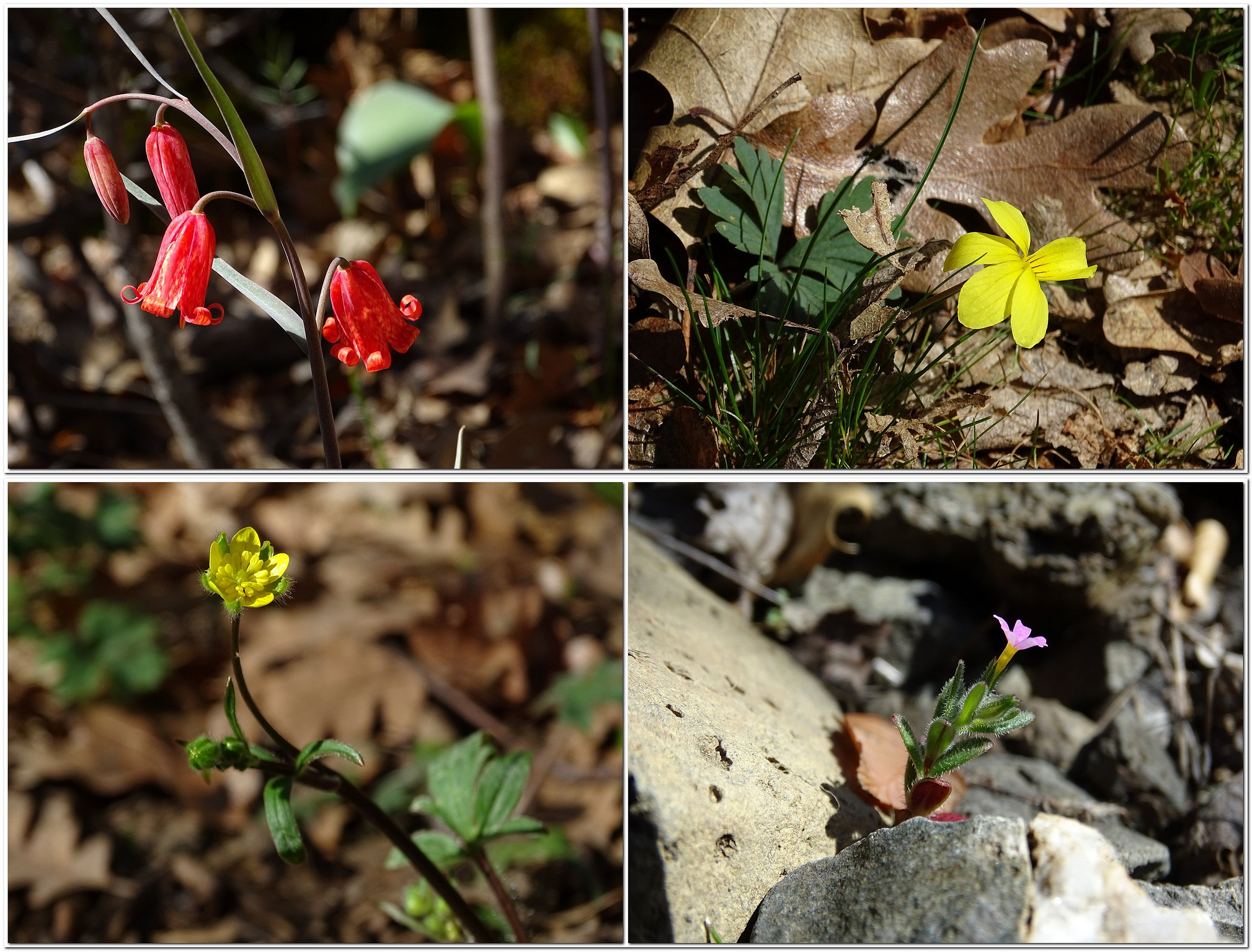
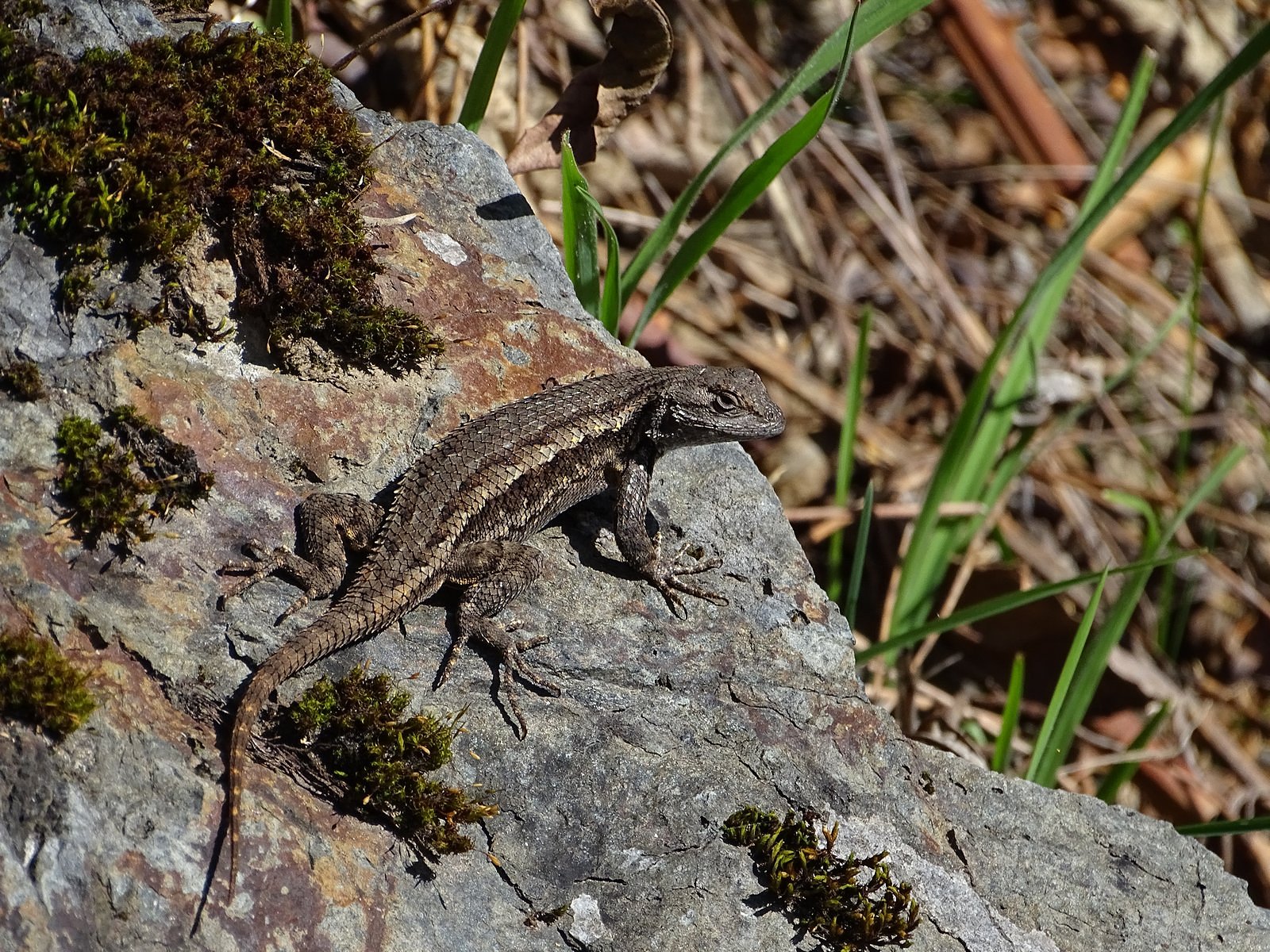
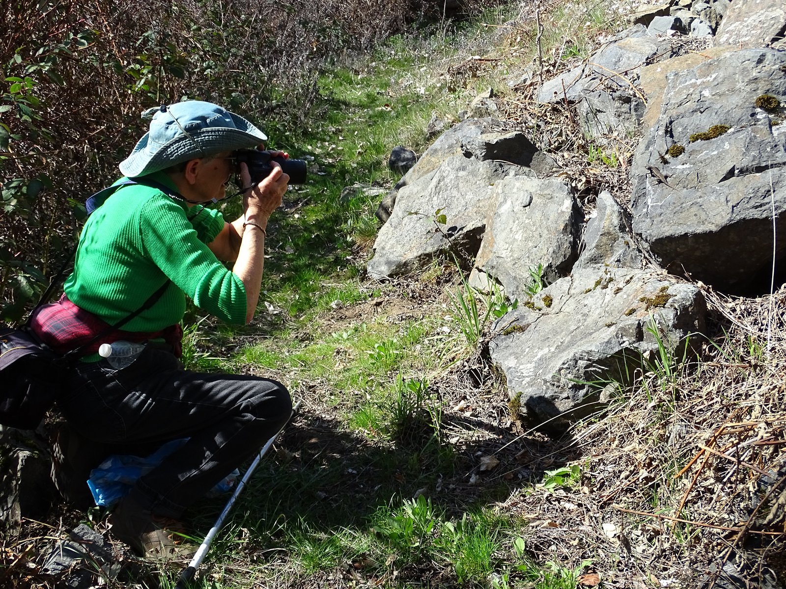
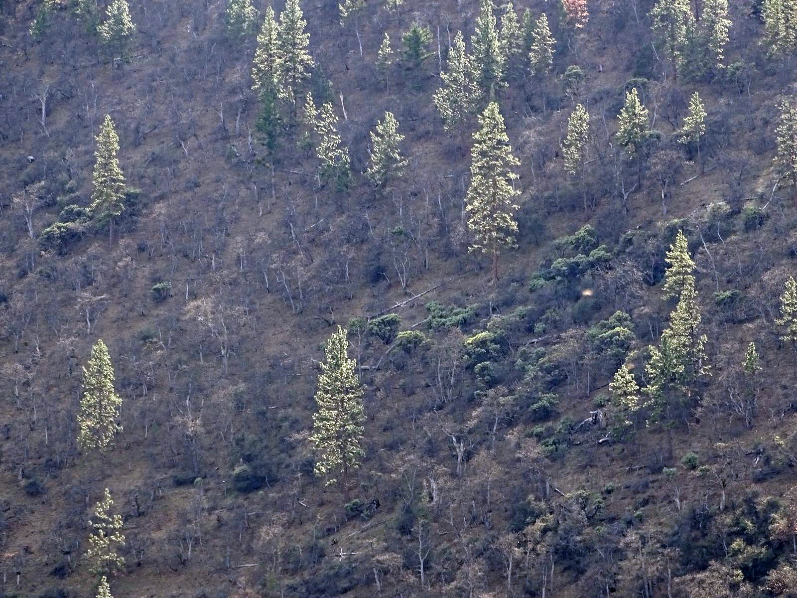
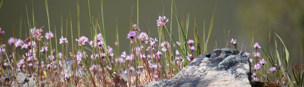
Fortunately, the gated logging road – which I was pretty sure the people in the SUV had taken – wasn’t our only choice. The Jack Creek Road continues north (as the Shanks Creek Road) all the way back to the freeway; there is a BLM road that heads east from the saddle, through private property; and a high-voltage powerline also passes through, with a corresponding cleared area and service track. After an abortive start walking up the east road – during which we encountered very few flowers or views, but plenty of “no trespassing” signs (and also the signs’ owner, in a large black SUV: he was pleasant enough to us, at proper social distance, since we were on the road and not on his land directly) – we opted for the powerline. The service road was rough, with rocky ruts and occasional large spring-filled puddles, but it kept a gentle slope for the first third of a mile or so before plunging straight down the mountainside. That was the point at which we turned around. There was a great deal of trash littering the beginning of the service road, but it thinned out after 100 yards or so. And there were flowers. Lots and lots of flowers. I had a new telephoto lens to try out. Enjoy the pictures.

Henderson’s shooting star
Hall’s violet
Western buttercup
Saxifrage
Hound’s tongue
Spring Gold
King Mountain from Sexton Mountain (telephoto)

Fire, Falls, and Flowers: the Taylor Creek Trail

Oregon is under shelter-in-place orders in an attempt to control COVID-19, but – although most activities have been curtailed – hiking is specifically allowed as long as social distancing is maintained. So Melody and I have been drawing on our large repertory of little-known Southern Oregon trails. One of these is the Taylor Creek trail in the foothills of the Siskiyou Mountains west of Grants Pass. There are no great scenic panoramas here, but the trail has just about everything else: waterfalls, wildflowers, rock outcrops, and several different forest types, through a wide range of lush to dry. And although cars have occasionally passed us when we have been parked beside the road on each of our several trips up there, we have yet to encounter anyone else on the trail itself.

To get to Taylor Creek, you leave the freeway at the small town of Merlin and head west along the Galice Road, the popular highway to the Grave Creek trailhead and boat launch at the eastern end of the Rogue River Canyon. Immediately after you pass Morrison’s Lodge – roughly 12 miles in – you’ll see a road on the left, with a brown sign on the right pointing to “Briggs Valley.” That’s the Taylor Creek Road; Briggs Valley is beyond, over Lone Tree Pass at the creek’s head.

The road is paved, but it’s only about a lane and a half wide, so oncoming traffic must be passed with care. It climbs quickly up the mountainside, with glimpses across Taylor Creek’s valley to the tall waterfall on Schoolmarm Creek (no place to park for a photograph, dammit). In a little over two miles, you’ll see a small parking lot on the left. Pull in. A short trail here leads to the Taylor Gorge Overlook, a stone-and-concrete platform perched on the lip of the narrow, deep gorge through which Taylor Creek leaves its valley. It’s wild, and rugged, and the only certifiably spectacular scenery you’ll see on this trip. Enjoy.

Beyond the overlook, the road levels out, winding along the side of the valley high above the creek. Trees line your course; rock outcrops hold wildflowers. Taylor Creek’s forest was burned over in the 2018 Klondike Fire – second largest in Oregon history – but the burn was spotty, and most of the overstory here in the lower end of the valley remains intact. After roughly half a mile, a sign points to the Taylor Creek Trailhead, on the left. We choose to pass this one; it’s a long, steep, mostly boring way down to the creek. In another quarter-mile, an unmarked parking area provides a second trail access point, through an abandoned homestead meadow called English Flat. We think of stopping here – we once had a gorgeous (though chilly!) morning in a hoarfrost fog in that meadow – but another vehicle is already present, so we pass that, too. Social distancing. The best, we know, is yet to come.

A bit beyond English Flat the road and the creek finally converge, and the quiet, intimate beauty of this out-of-the-way valley begins to show itself. The broad, limpid creek – one of the few places I know of where that overworked word actually fits – alternates between tumbling over rocks and flowing gently among alders. A small side-stream waterfall tumbles down a roadside cliff. A riot of spring gold (Crocidium multicaule, a small member of the sunflower family) spills over just about everything.

After a mile or so of this, Burned Timber Creek enters through a narrow gorge on the far bank; and shortly after that a gravel side road branches left, crossing the main creek on a narrow concrete bridge. The Taylor Creek Trail intersects that road a few feet beyond the bridge. We park in the large parking area at the main-road end of the bridge and gear up for a walk. We cross the bridge and, knowing what will be in store, head north.

The trail climbs gently up a hillside through a small patch of burned-over timber. Yellow violets and blue-purple snow queens sprawl beside our path, mixed with a few cream-colored Oregon fawn lilies. We round the end of a ridge and come, as we knew we would, into a tiny paradise. The trail skirts the rim of a small bowl; at the head of the bowl, Burned Timber Creek laces gracefully down a 30-foot cliff. To the left, beyond a bit of woods, the ridge we have just crossed ends in a long, gently sloping rock outcrop. The rock is bright yellow with spring gold.

We take a faint way trail out to the rock outcrop and spend the next thirty minutes among the flowers.

Oregon fawn lily
Sea blush
Clockwise from upper left: round-leaf violet, Howell’s saxifrage, chickweed monkeyflower, snow queen.

The rest of the day was anticlimatic, so I’ll keep this brief. Back on the trail, we crossed Burned Timber Creek a few dozen feet above the falls on a makeshift log bridge placed by the trail crews who cleaned up after the Klondike Fire and contoured up the steep hillside beyond. A mile or so from the trailhead, an unmarked but well-built trail forked off to the right: we followed it to the Burned Timber Creek Road and strolled down that to the point where we had begun, a couple of hours before. Back in the car, we drove south to Lone Tree Pass, stopping briefly at a small gorge near the mouth of Minnow Creek and again at a massive display of Oregon fawn lilies near the China Creek trailhead. The road to the pass narrowed for the last mile after leaving the creek, winding through the charred remains of one of the hottest burns of the fire; the pass provided views of green mountains through burned timber.

We stopped once on the way out, at a trailhead near China Creek, to check the status of a footbridge built there just two years before the fire (it had survived) and headed for home, pulling into the driveway shortly after 5:00 pm with half of the Bolt’s battery still unused. We could have done it again, but although the car had plenty of energy, the two humans in it were happily tuckered out. Another time.

Tree of Heaven

If you’ve traveled from California to Oregon on Interstate 5, you’ve seen the Klamath River. The freeway crosses it at the Collier Rest Area, a few miles south of the border. It is a big, muscular river there, narrow but deep, flowing rapidly past the lawns and tables of the rest area, clearly intent on getting somewhere else as fast as possible. Leave the freeway, head west along the river on California 96, and you almost immediately enter the Klamath Mountains. The riverbed’s gradient increases: rapids appear, contrasting with the steep, nearly treeless canyon slopes on either side. This beast of a river has already cut all the way through the Cascade/Sierra Mountain chain – the only river south of Canada to do so, save the Columbia – and now it’s chewing through the Klamaths. Nothing is going to stand in its way between here and the Pacific Ocean.

Looking upstream (east) from the parking area at the top of the entrance road to the campground.

Seven miles in, the highway briefly leaves the river to climb over the neck of a tall horseshoe parapet, and in this unlikely spot, 250 feet above the water, you come across a sign to a boat ramp. A narrow, paved side road plunges over the edge. Down that road, a steep third of a mile below you, is the Tree of Heaven Campground.

Tree of Heaven campground. This USFS recreation site is named for a grove of “trees of heaven” (Ailanthus altissima) planted on this flat by miners in the 19th century.
Looking downstream from the boat ramp. This is not a small river.
The River Trail, looking upstream from about its halfway point.

Melody and I were there most recently on the afternoon of March 11, 2020. We went in search of flowers (in the spring, we are always in search of flowers). The campground was closed for the season, so we parked near the gate and walked down the entrance road. The campground, on a flat perhaps ten feet above the river, was lovely and green and entirely deserted except for us. Exploring upriver along a designated nature trail gave us very little in the way of either flowers or views, but downstream we found signs pointing to a “River Trail,” and that was a different story. The River Trail is hacked out of the north wall of the canyon for roughly a mile, from the campground to Masonic Bar Rapid – the first whitewater downstream from the boat launch at Tree of Heaven. And there we found the flowers.

Clockwise from upper left: violet (probably Howell’s violet); hairy bittercress; red henbit; and clasping henbit. The bittercress and the two henbits are non-native plants. The violet is probably native.
Silk tassel bush.


Silk tassel bush, Garrya elliptica, grows naturally only along the Pacific Coast of North America – the Tree of Heaven campground is about as far inland as it gets. The picture at left is a closeup of one of the tassels.

Masonic Bar rapids, from above.

The trail crosses a little flat beside the rapid, where a white oak woodland has found a tentative foothold. Here we found red bells, Fritillaria recurva – common in the Rogue Valley, but I’ve never seen it on the Klamath before.

Clockwise from upper left: red bells (Fritillaria recurva); Shelton’s violet; slender phlox; and western buttercup.
White oaks arching over the trail.

Beavers have been at work in the woodland.

Beaver marks on a white oak trunk.

We spotted this little guy on the way back. I think he’s a western fence lizard. He held still long enough for both of us to photograph him.

The slant of the late-afternoon light almost matched the slant of the hill as we walked back up the entrance road, lighting up the trees on the opposite side of the canyon while leaving the slope behind them in the dark. A lovely end to a lovely day.

Back at the car, ready to go home. Since this is really an electric-car blog, I’ll use this picture to remind you that we make all of these trips on electricity alone. This particular 100-mile round trip left us with 130 miles left on the range indicator when we got home – not exactly straining the Bolt’s batteries.