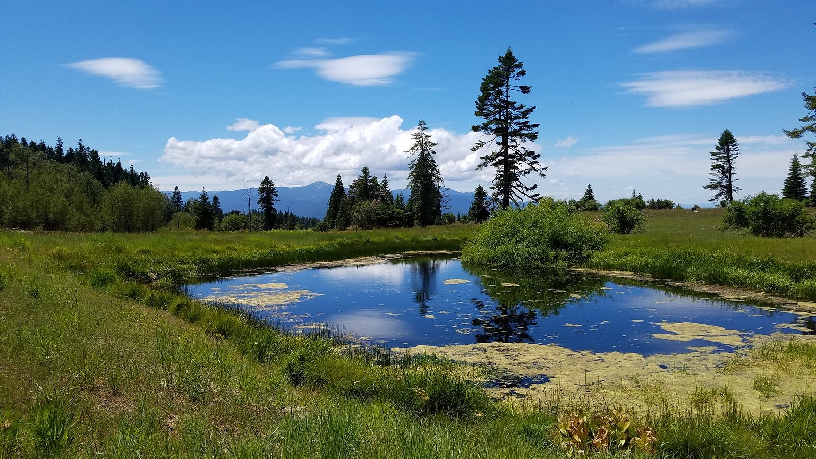
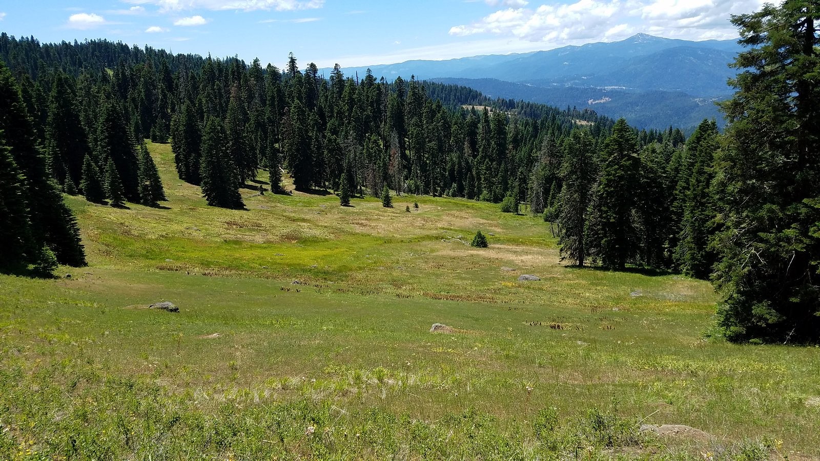
I promised a post on the hike I didn’t get around to blogging before we left town for a week, so here it is. It was a relatively short, relatively level walk on a stretch of the Pacific Crest Trail that traverses the northeastern slope of Soda Mountain near Ashland, Oregon. This section of the PCT is not known for its scenery – through-hikers usually just trudge through without stopping – but its mix of meadow and forest, with occasional views out to Ashland and the rest of the distant Bear Creek Valley, has a quiet charm about it. Streamlets abound in the meadows in early summer, and the mid-season flower displays can be spectacular, especially on one particular rocky knoll about a third of a mile in. It’s a great introduction to hiking in the the Cascade-Siskiyou National Monument for first-time visitors, and a relaxing afternoon stroll for old-timers like us who had just recently made the much stiffer climb up Grayback Mountain.
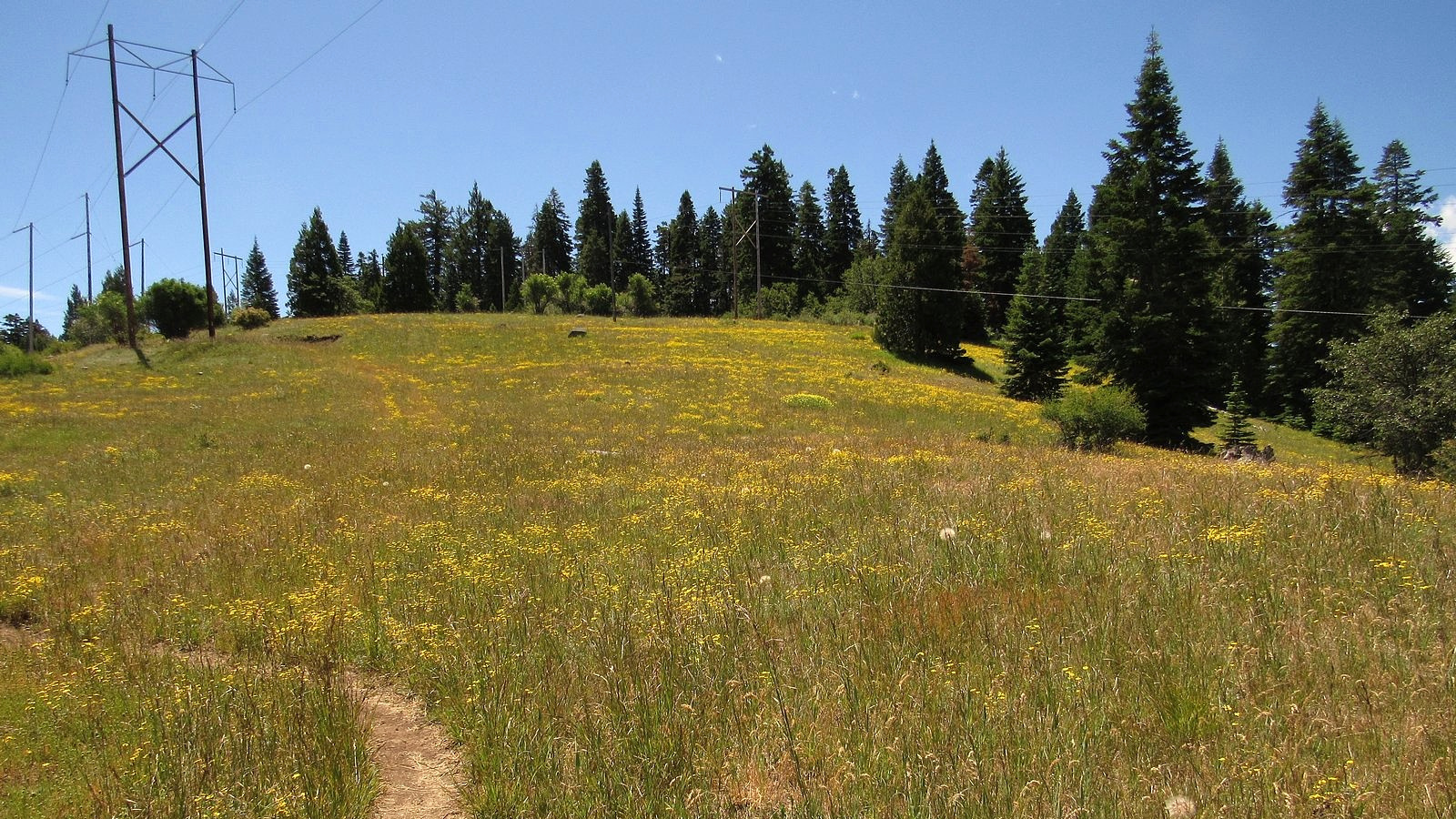
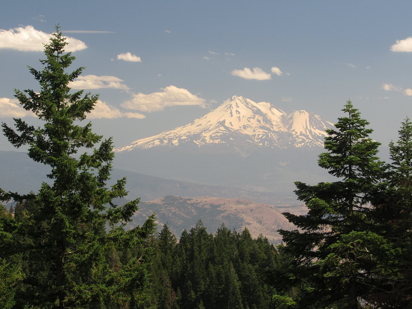
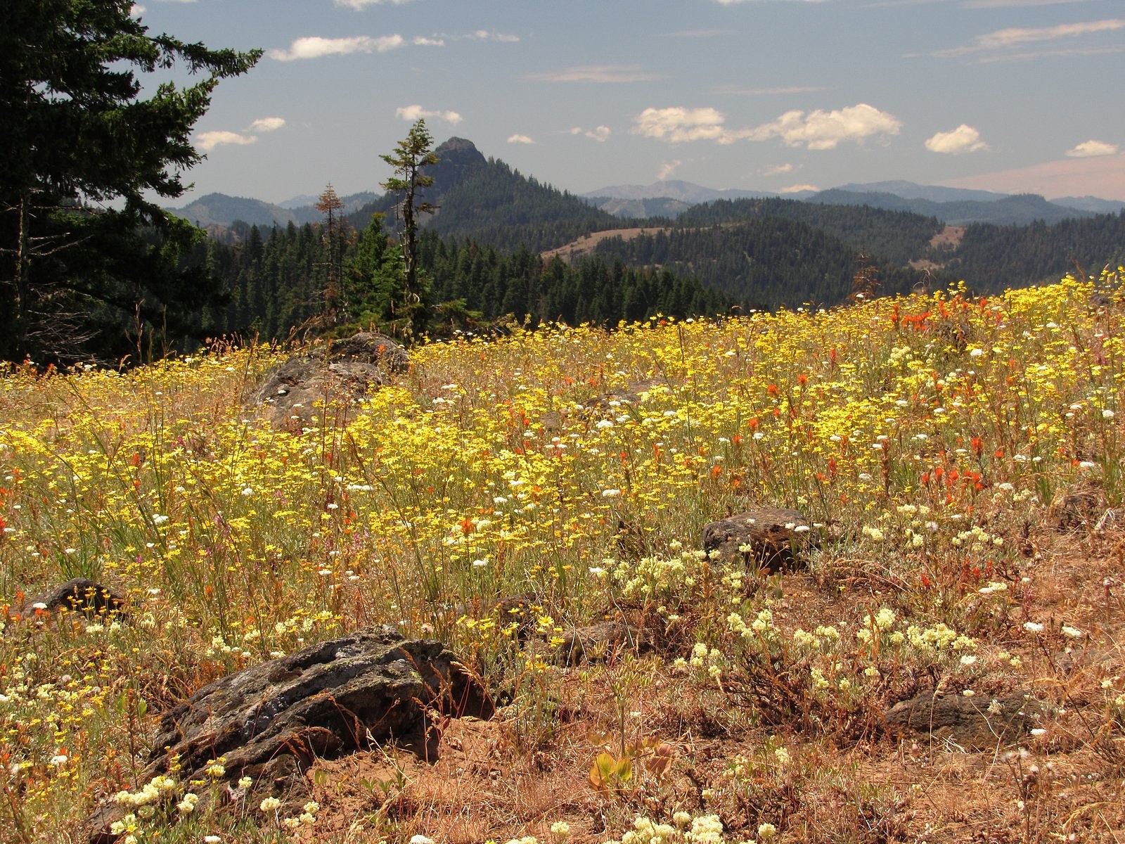
We parked the Bolt around 1:00 PM at the Hobart Bluff trailhead on the Soda Mountain Road, off Oregon Highway 66 at the Greensprings Summit, and headed south. The trailhead meadow was a yellow carpet of woolly sunflower under power lines; the knoll was spectacular, with woolly sunflower, paintbrush, buckwheat, and many other flowers covering nearly every square inch of ground beneath big views down the valley. After that, the flower displays were quieter but still lovely: hyacinths, columbine, honeysuckles, and many other plants in the woods; yampah and owls clover in the dry meadows; monkeyflowers and heals-all near the one small pond the trail passes in this stretch. We turned around at the saddle under Little Pilot Peak, a little less than three miles in, where there is a nice view south to Mt Shasta.
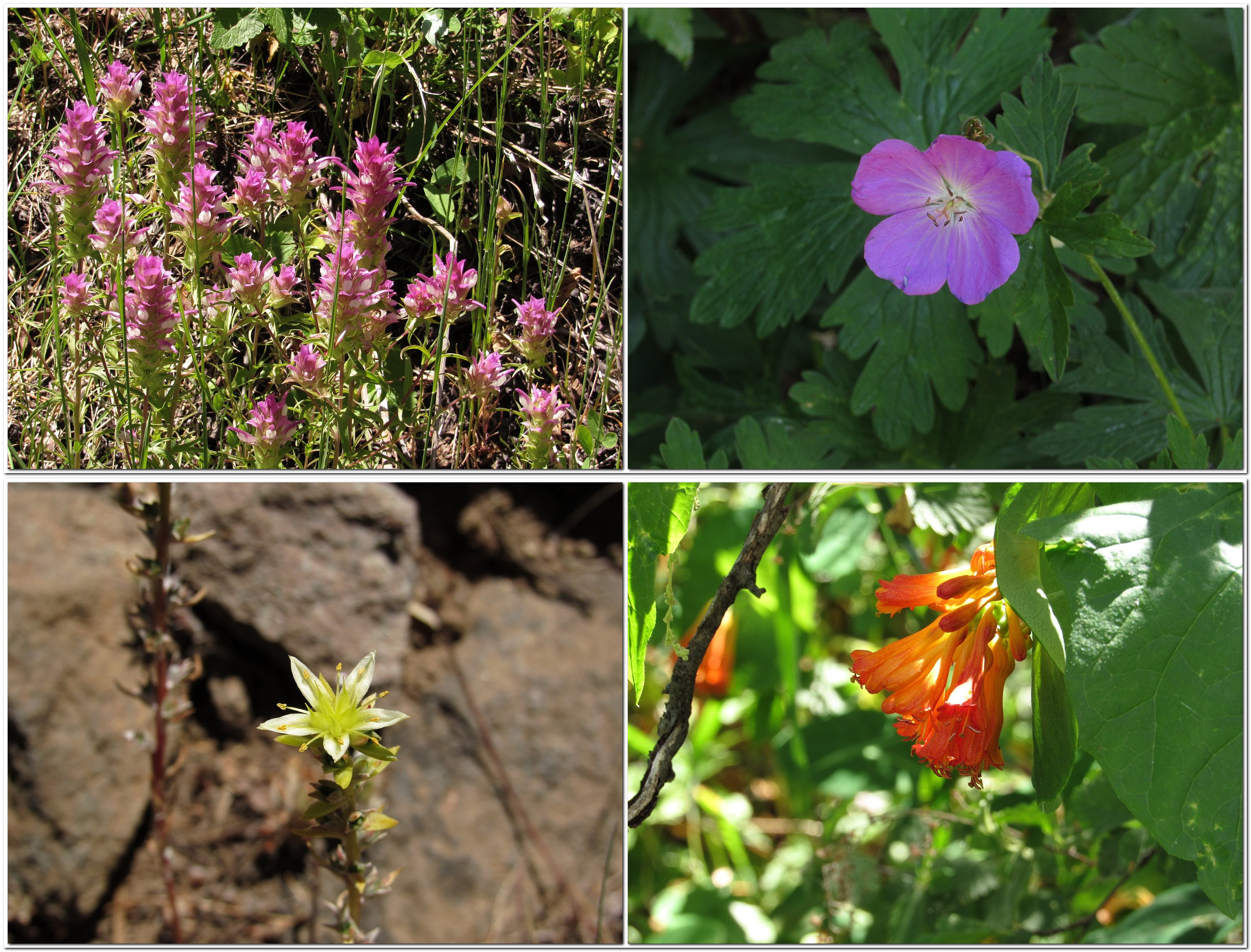
Clockwise from upper left: owl’s clover, Oregon geranium, honeysuckle, stonecrop.
It was 5:00 when we reached the car, so we headed for the Greensprings Inn, a small, old mountain restaurant and lodge a few miles east of the Greensprings Summit that has long been known among locals for the quality of its food. There is not much more to say. Enjoy the pictures.
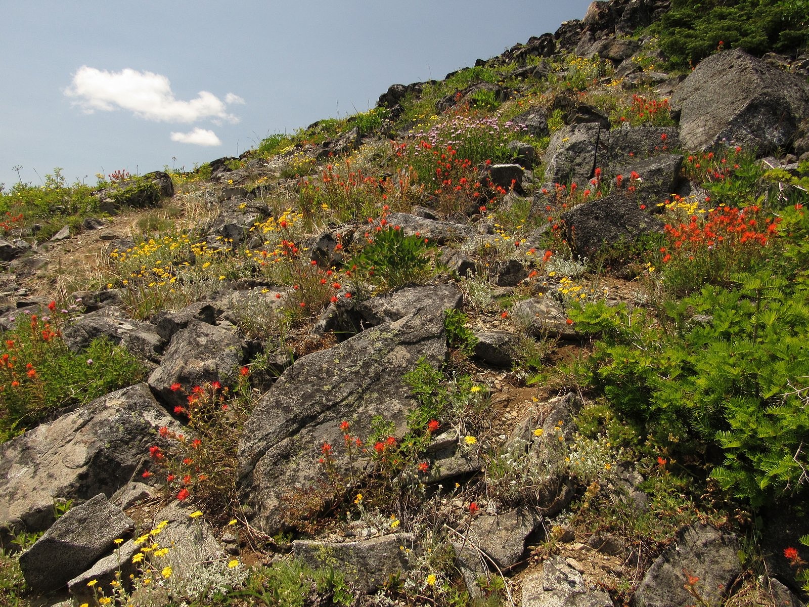
Pilot Rock from the knoll. The predominant flowers are woolly sunflower, paintbrush, and buckwheat.
What it’s really like to take an electric car on a road trip.
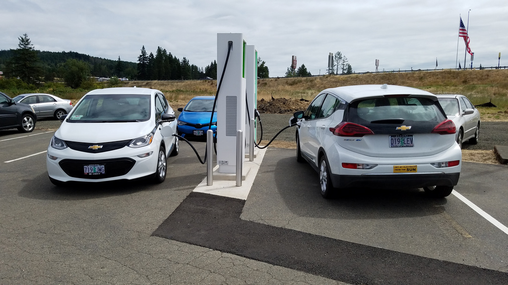
At the charger in Sutherlin – not the first time we’ve shared a set of charging stations with another white Bolt. Ours is the one on the right, with its back to the camera.
I’m one trip behind on hike reports, but I thought I should do this first. We’ve just returned from a week in McMinnville, Oregon – a small town near Portland, 250 miles from our home in Medford. That is a “maybe” distance for an electric car: maybe we could make it all the way if we start with a full battery, but maybe not. So prudence dictated a refueling stop each way, as well as at the destination. And because the process of refueling an electric car on the road is broadly misunderstood, it seems useful to try to clear up some misconceptions by describing exactly how it worked on this particular trip.
One caveat: it is still necessary to plan carefully. This has nothing to do with the actual recharging process, and everything to do with the state of the charging network. There are gas stations just about everywhere, but charging stations are still few and far between. I dream of the day when there are charging stations on every corner and it’s the drivers of gasoline vehicles who have to plan, but we have to deal with reality. I had to choose in advance where to stop along the way, and I made reservations far ahead in the single reasonably-priced motel in McMinnville that has a charger in its parking lot.
Once that part is out of the way, though, the rest is easy. It is actually simpler to charge an electric car’s battery than it is to fill a gas tank, and it takes less time out of your trip. Let me repeat that: it is actually simpler to charge an electric car’s battery than it is to fill a gas tank, and it takes less time out of your trip. The horror stories you hear about how dreadfully long it takes to charge are probably true for the people who experience them, but they result from failure to understand that charging a battery is not like filling a fuel tank. It’s a different process, and requires a different way of thinking.
With a gasoline car, the usual procedure is to run the car until the tank is nearly empty, then pull into a gas station and fill all the way up. While it’s filling, you stay with the car. If the gas station is also a convenience store, you may run in to buy a bag of potato chips or a cup of coffee to go; otherwise, you just wait for the ten or fifteen minutes it takes the tank to fill. With an electric car, that model simply doesn’t work. You’re rarely going to fill the battery all the way up – that’s not even a good idea (doing it regularly can shorten the battery’s life). And you don’t need to stay with the car. While the charger is doing its thing, you can be off doing something else. Here’s how that works – actual experience, on our trip that ended yesterday.
PLANNING: I started by trying to find out whether we would be able to charge the car in McMinnville. The best tool for this is the Plugshare website (plugshare.com), a crowdsourced site that attempts to map and describe every public charger in the country. We would be spending the first two nights in a motel before moving to a dorm on the Linfield College campus, so I looked for motels with “destination chargers” – level 2 (220-240 volt) chargers located at places where you expect to stay a long time, such as overnight. McMinnville’s Best Western had such a charger. I called to see if we could reserve it; the answer was “no”, but the woman I spoke with said it was rarely used. That seemed satisfactory. I booked a room.
Next, I visited A Better Route Planner (abetterrouteplanner.com), a routing site designed specifically to help electric-car drivers find the most efficient routes for long-distance travel. It suggested a charging stop in Sutherlin, a small town just north of Roseburg, to boost the battery up to 71%. That, it said, would be enough to reach McMinnville with about twenty miles to spare. Estimated time on the charger would be 13 minutes. I checked out the Sutherlin charger on Plugshare and found it had a 10-star rating (out of 10) and four charging stations, which meant we could probably count on getting the charge started immediately. It was also next to a Dairy Queen and near a Starbucks. I penciled it in. Planning was complete.
THE TRIP NORTH: The night before our departure, I reset the top charge on the Bolt from 95%, where we usually keep it, to 100%. That would be insurance against broken or full chargers. As I backed the fully-packed and fully-charged car out of the garage the next morning, I noticed that the range indicator said we had 307 miles, which would get us to McMinnville with more than 50 miles to spare. That, of course, was based on running around Medford, rather than dashing a couple of hundred miles at freeway speeds with the air conditioner on. We decided to stop at Sutherlin anyway.
The drive went smoothly. At Sutherlin I plugged in, inserted my credit card, and had electricity flowing into the car in about a minute and a half. We had nearly 60% of the battery left, so we decided 10 minutes of charge would probably do. We slipped into the Starbucks, and those 10 minutes stretched to nearly half an hour, giving the car an 83% charge. I unplugged – about a 30-second procedure – and we headed for McMinnville, taking the shorter but slower Territorial Highway instead of the freeway route that A Better Route Planner had suggested. That got us to the McMinnville Best Western with 100 miles of range left. The charger’s parking slot was empty and the charger was a SemaConnect, for which we carry a charge card. Plugging in and starting the juice flowing took all of about 45 seconds. We would wake up the next morning with a full battery. It would take about 5 seconds to unplug.
THE TRIP SOUTH: We didn’t use the car much for the five and a half days we spent in McMinnville, so we didn’t bother charging again. Pulling out of town in the early afternoon, I noticed that we had a 95% charge – plenty to get back to Sutherlin, where we stopped and plugged in again. The charger told us it could get the car back up to an 80% charge in 40 minutes. It was just before 5:00 PM, so we went to the Dairy Queen and grabbed a meal. We finished eating with about ten minutes left of the estimated 40. The battery was up to 74% – more than enough to get to Medford – so I stopped the charge and unplugged. We changed drivers and Melody drove us the 110 miles home, at freeway speeds, with the A/C on and the outside temperature hovering above 90°F. We pulled into the driveway with 77 miles of range left.
ANALYSIS: Adding up the various plugging and unplugging times, you’ll find that we spent under five minutes charging the car. The car actually charged much longer than that, of course, but it’s really our time that counts, and while the car was charging, our time was spent doing things we would have done anyway. I wanted to stop for coffee, anyway; we would have slept in the motel all night, anyway; we would have made a dinner stop someplace on the way home, anyway. By combining those stops with charging, we had actually saved time over what it would have taken us to fill a gas tank twice. Or even once.
So that’s what it’s really like to make a 500-mile round trip in an electric car – a car that is as capable as any vehicle I’ve ever driven, and more fun than most. And it’s probably worth adding that the Bolt’s small appearance is deceptive. We got all we needed for a week – including our clothes and toiletries, a guitar, a laptop, a box of papers for the conference we were attending, and the car’s wall charger (just in case) – into the covered space behind the back seat, and we carted three extra people around McMinnville for part of the time we were there. Aside from the planning time needed, there was literally no downside to taking the Bolt instead of taking a gasoline-powered car. Ignore the naysayers. Welcome to the real future of driving.
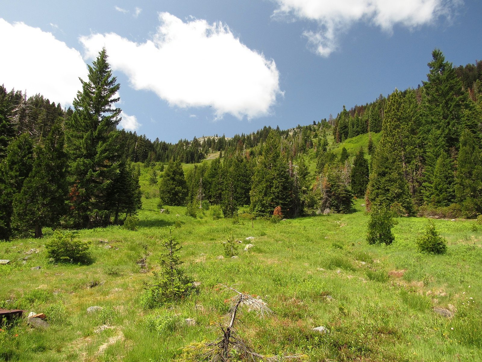
If I had to describe the O’Brien Creek trail in one word, it would be “brutal”. The trail, built long ago to supply a herders’ cabin in a large subalpine meadow in the Siskiyou Mountains, heads uphill abruptly from the trailhead and climbs 2000 thigh-challenging feet in two miles, all of it through dense, dark, mostly dry conifer forest. Not my normal idea of a good time. But it is also the best way to reach Grayback Mountain, and Grayback is definitely worth reaching. Grayback is the highest peak in Oregon’s Josephine County, and one of only a few Siskiyou summits to top 7,000 feet. The meadow spoken of a few minutes ago, Grayback Meadow, spreads up the bottom of a shallow bowl on the mountain’s steep east slope for nearly 1000 vertical feet – acres and acres of grass and little springs and wildflowers, edged by trees and capped by a lovely line of granite cliffs below the summit ridge. And from the summit, it is said, on a clear day you can see the ocean.
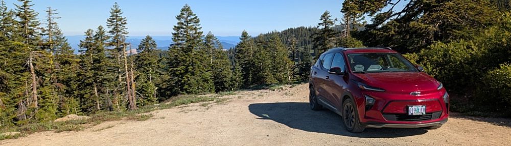
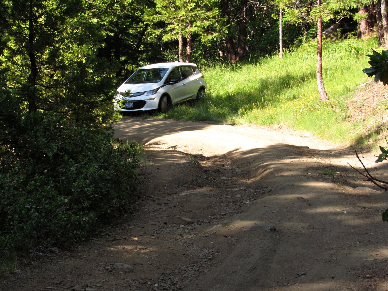
All of which is why Melody and I found ourselves in the Bolt last Friday morning, creeping up a road specified for high-clearance 4wd vehicles only, headed for the O’Brien Creek trailhead and that damned mountainside fall-line of a trail.
We didn’t quite get there – not in the car, anyway. Roughly half a mile before the road’s end, a fallen madrone had sprawled into the roadway. There was space to go around, but that space was occupied by a deep, rocky pothole followed immediately by a large rock. I had managed to work my way around all potholes and rocks until then, but I’d had the full width of the road to maneuver. This one looked impossible. So I backed the Bolt into a convenient flat area on a switchback 100 feet or so back down the road, locked it up, and we began walking. In fifteen minutes, we were on the trail.
The way up that steep, essentially switch-back-less two miles seemed very long. But there were woodland flowers to contemplate (wildflower photography is a great excuse to take rest stops), and there was a small side stream with a lovely little waterfall on it to cross, and eventually we broke out into the little clearing where O’Brien Creek itself tumbles across the trail. At that point the worst was over. It’s a half-mile from the creek crossing on a nearly level trail, past a small snow-survey cabin, to the site where the old Krause herders’ cabin stood at the foot of Grayback Meadow. The cabin burned down over a decade ago, but its stove is still there. So is its view.
Grayback Meadow.
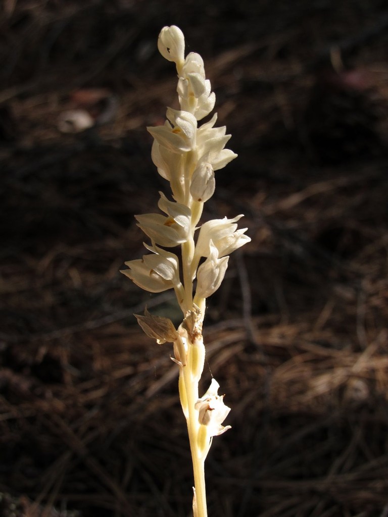
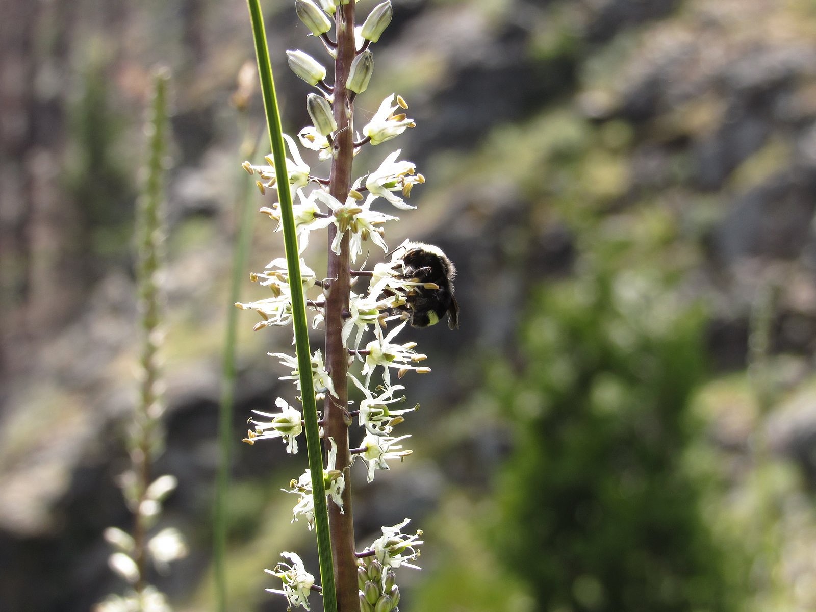
White rushlily, Hastingsia alba. Not in the guidebooks.
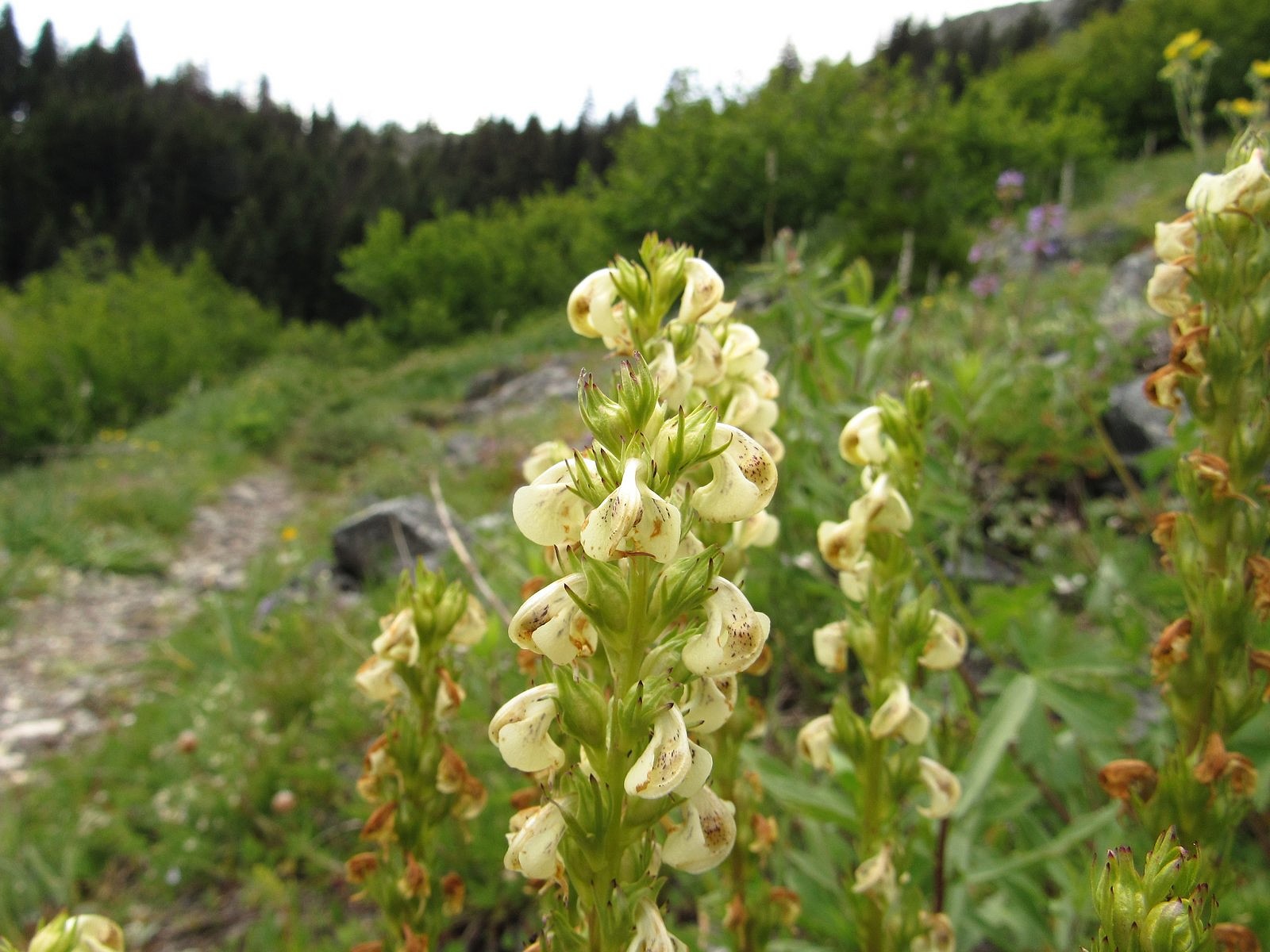
We moved slowly up the meadow, savoring. The slope was even steeper than the trail had been, but here there was sunshine, and the cliff far above us (but growing nearer), and views out that grew longer and vaster as we climbed. And nearly every square inch under our feet was covered with flowers. The Siskiyou Mountains are part of the larger Klamath Mountain system, which is mostly made of ultramafic rock – peridotite, serpentine, and their relatives – and ultramafic soils grow unusual plants. Grayback is actually made of granite, but it has its share. One flower, in fact – prolific here – is rare enough that it doesn’t appear in either of the standard wildflower guidebooks I use (see the accompanying photo). Others are Klamath Mountains endemics that would probably be happier on serpentine, but will also grow on granite. Add to those the standard mountain-meadow flowers you find everywhere in the west, and you begin to get the idea.
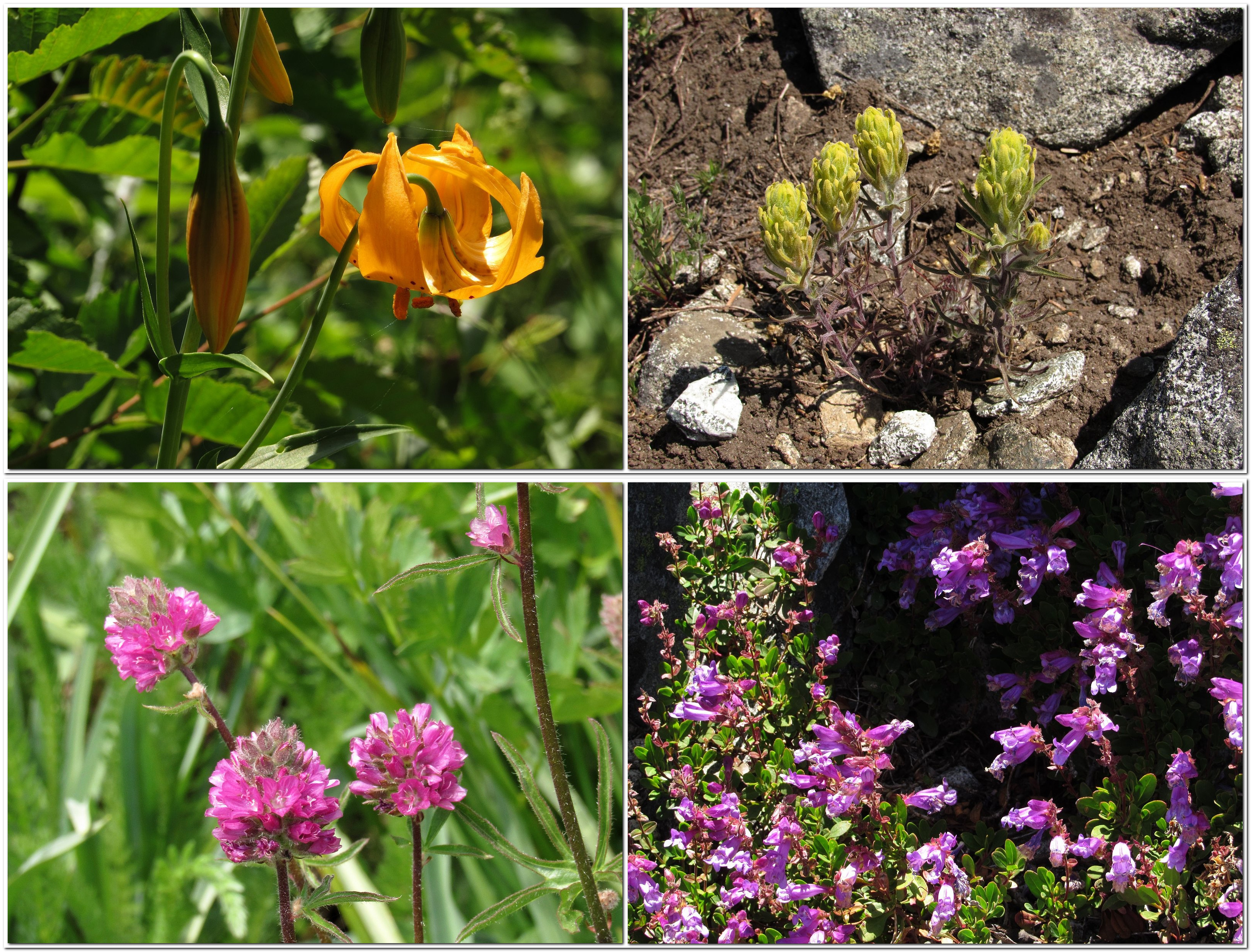
Clockwise from upper left: tiger lily, cobwebby paintbrush, Davidson’s penstemon, Oregon checker mallow.Coiled lousewort along the Boundary Trail.Paintbrush and woolly sunflower on the summit ridge.
An hour later and two-thirds of the way up the meadow we hit the Boundary Trail, so named because it runs along the western and southern boundaries of the Rogue River National Forest, beginning at Windy Gap – a little over a mile north of where we hit it – and ending many miles away at Lily Pad Lake, near the eastern end of the Red Buttes Wilderness. We took the Boundary Trail south for a mostly level half mile to the mountain’s south ridge, left it, and started boulder-hopping up the ridge. An hour of that, and we were on top. On top of the world.
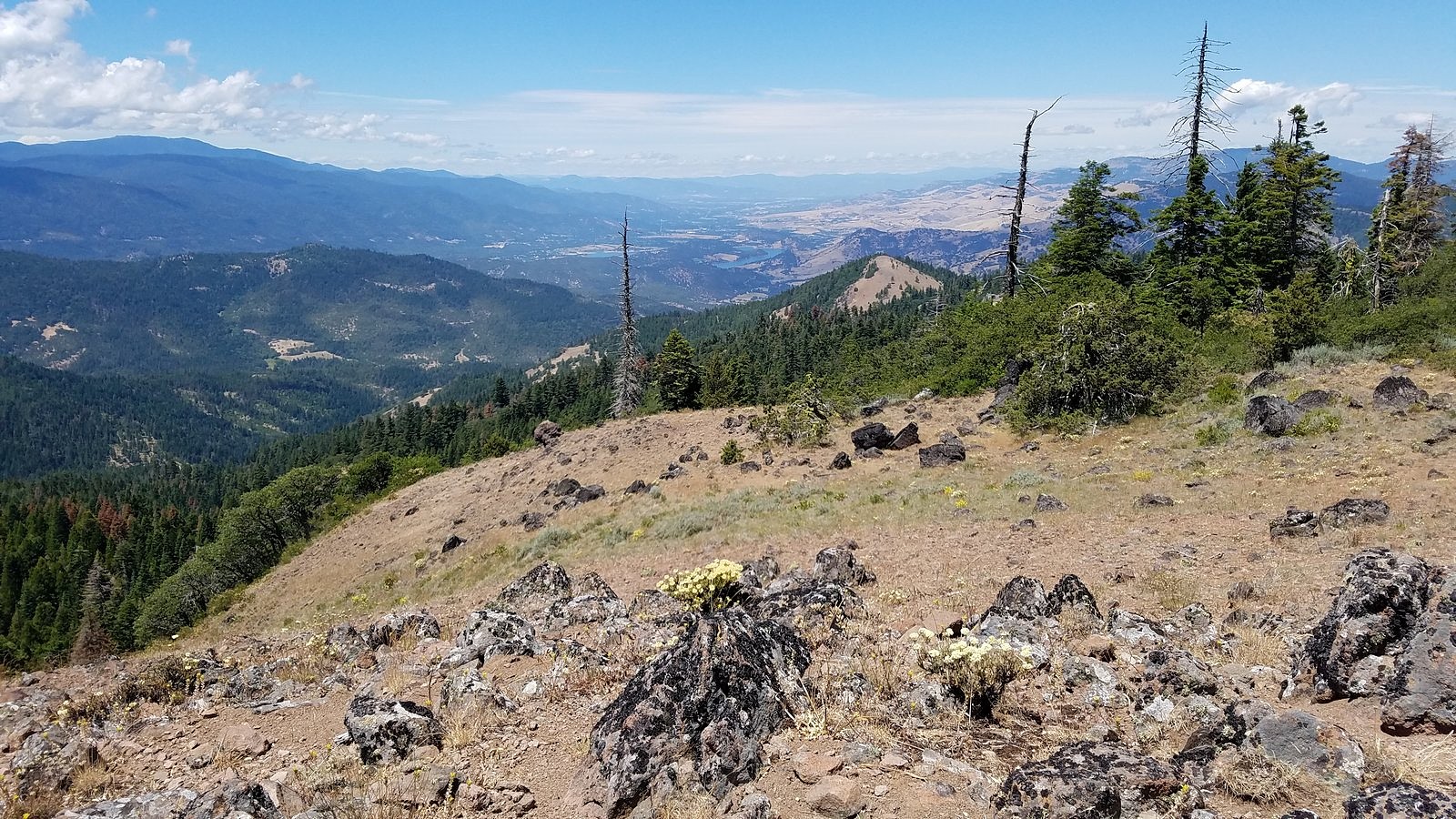
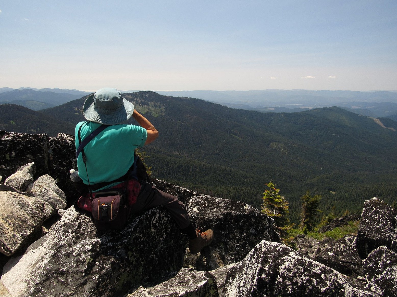
I’m sorry to say that we couldn’t see the ocean. The air was too hazy to make it out, although the pictures I took do show, on close examination, a level line separating two slightly different shades of blue that I wistfully hope is the ocean horizon. We were able to make out a white line of what were clearly coast-hugging clouds far off to the southwest, and we had to make do with that. That, and the rest of the tremendous, hundreds-of-square-miles view in every conceivable direction.
We were on top for roughly 20 minutes. Then we picked our way down the north ridge, found Windy Gap and the start of the Boundary Trail, and headed for the car. We were home and comforting two anxious cats by a little after 7:00 pm. The Bolt’s GOM said that we could still go 200 miles, if we wanted to.