Hershberger

Fleabanes (pink) and asters (violet) beside Road 530 on Hershberger Mountain.

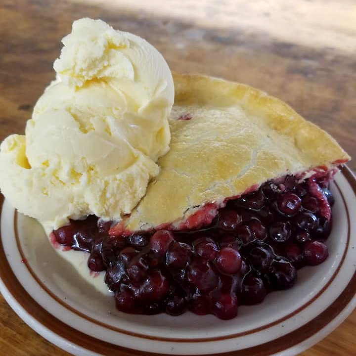
The real attraction was Beckie’s huckleberry pie, but we needed an excuse. I thought of Hershberger Mountain.

Hershberger sits on the divide between the Rogue and Umpqua Rivers, high in the southern Oregon Cascades and just a dozen miles or so from the border of Crater Lake National Park. It is remote – getting there involves nearly an hour’s drive on winding Forest Service gravel roads after you leave the highway – so it gets only a few visitors each year. Those who go are drawn primarily by the flowers. Hershberger is one of the premiere wildflower sites in Oregon, with floral meadows that are often compared to Mt Rainier’s Paradise Park. Peak bloom is always well past by early September, but I thought there might be a few stragglers still around. And the turnoff onto those winding gravel roads from Highway 230 is only a few miles past the Union Creek Resort. Which includes Beckie’s Cafe.

Beckie’s is a treasure. Nestled in towering firs a couple of hundred yards from the rushing Rogue, the small, rustic, immaculately kept cafe is little changed since Ed Becklehymer opened it in 1926 to serve early motorists traveling to Crater Lake. The building has earned a spot on the National Register of Historic Places; the pies have earned rave reviews since Becklehymer’s wife began baking them right after the place opened. Among those pies, the huckleberry pie is way out in first place. Made from huckleberries picked by restaurant employees and others in the mountains surrounding the resort, it is served only from Labor Day weekend until the berries run out. Last year, that was just two weeks, and we didn’t manage to get up there before they were gone. This year, I was determined not to do that again. Labor Day weekend itself? No – that would be uncool. We would go the day after.
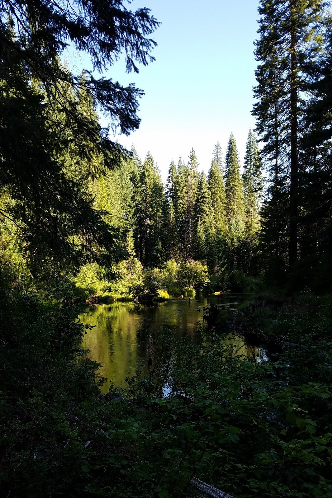
Morning light on the Rogue River beside the Hershberger Mountain road.

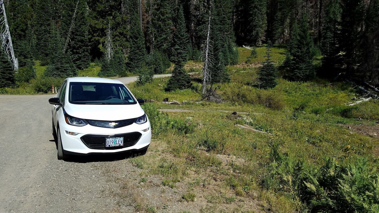
As we backed out of the driveway, I noted that the Bolt’s range indicator was estimating 347 miles. Comforting, even though I knew the real world wouldn’t give us that much. We turned onto the Hershberger Mountain Road around 9:20 AM, and after a brief stop along the Rogue near the road’s beginning and a somewhat longer stop at the base of the twin volcanic plugs known as the Rabbit Ears, we reached the turnoff to Road 530 – the spur off Road 6515 that leads to the Hershberger lookout – at 10:30. I turned onto 530, and immediately wished I hadn’t. We had been warned by the ranger at Prospect that this already-terrible road had been made much worse by the Pup Fire, a wildfire that had burned through the area in 2017, but I had hoped that, with the backwoods-driving skills I’ve honed over 60 years, I could ease the Bolt up it anyway. Within 150 feet, I knew that wasn’t going to happen. We would have needed at least a foot of ground clearance to make it across the ditches and exposed boulders in the roadbed; the Bolt has seven inches. Carefully – torturously – I backed out again. Even with the support of the backup camera, it took about ten minutes to cover those 150 feet backwards. I parked on the shoulder of 6515, on the edge of a lovely green meadow, and we started walking.
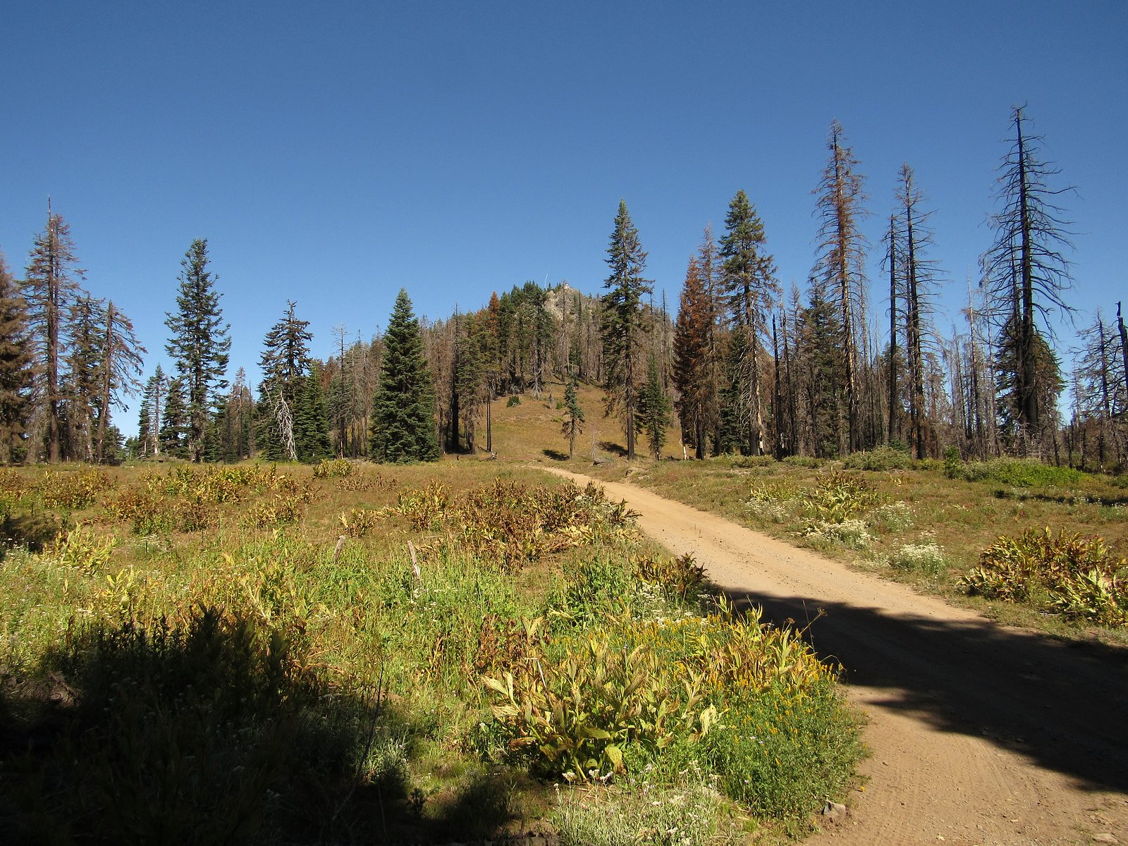
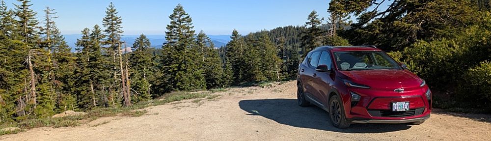
Hershberger Mountain from Road 530. The photo at the head of this post is a telephoto of the lookout, taken from this same place.

The Prospect ranger had told us that the walk along the road to the Ackerman Divide trailhead, which we intended to use, would be about a mile. It was a very long mile – nearly two miles, it turned out, when we checked the distance later at home. The Pup Fire had turned the forest around the mountain and its meadows into a mosaic of burned and green trees. The flowers, as expected, were mostly past, but there were remnants here and there of the glory that must have been present a month ago, including one very special find: Mazama collomia, a rare endemic that is found only in Crater Lake National Park and just a few other places within a 30-mile radius of the lake.
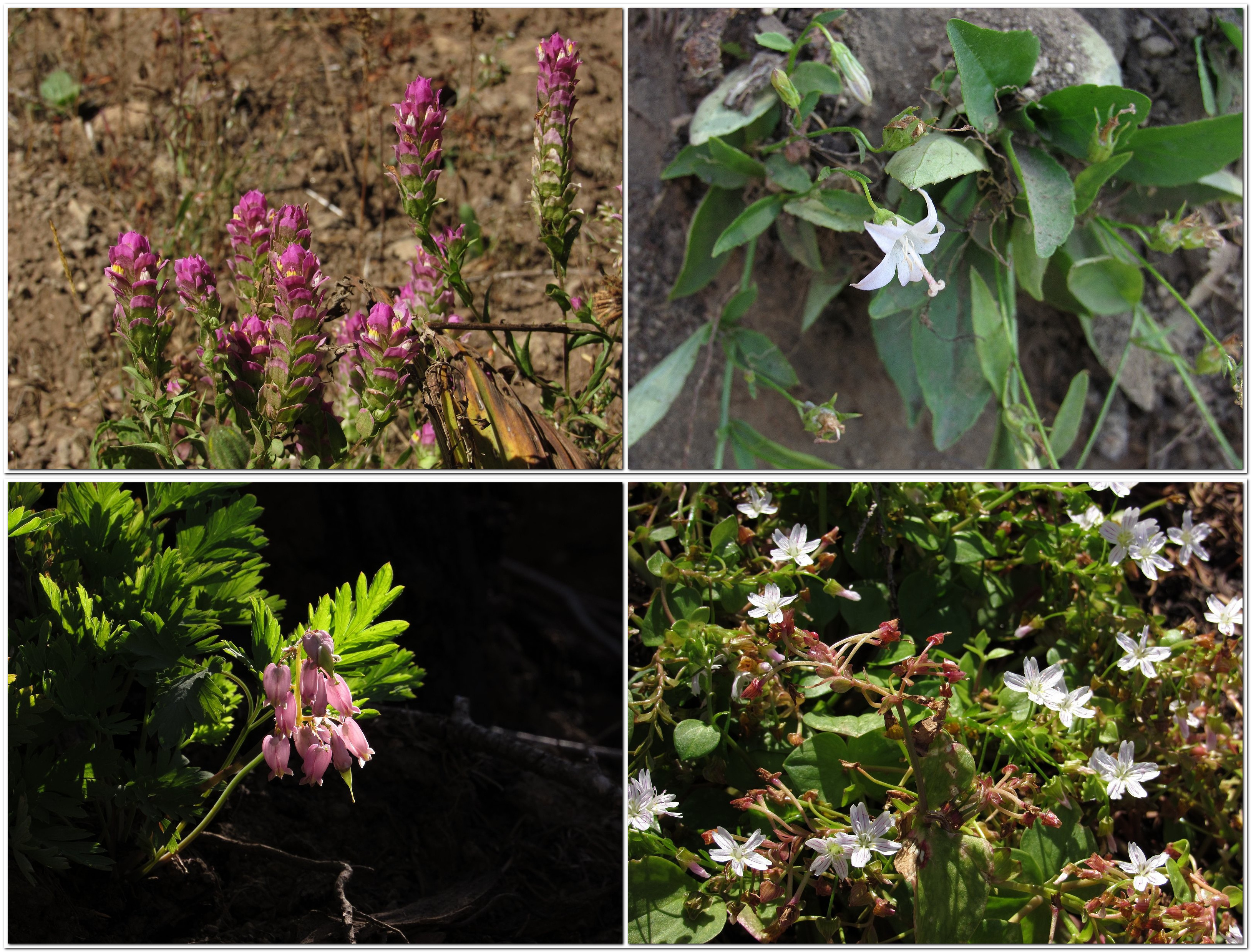
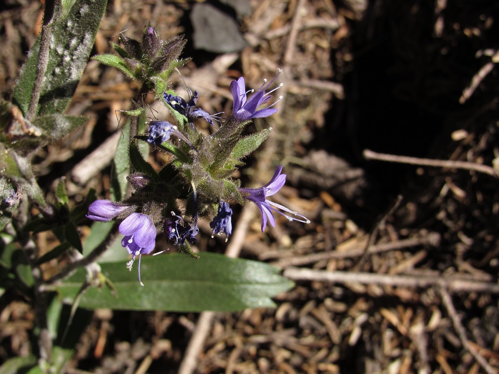
Clockwise from top left: mountain owls clover, Scouler’s bluebell (yes, it’s supposed to be white), bleeding heart, Siberian candy flower.
Mazama collomia, aka Crater Lake collomia, Collomia mazama – found only within 30 miles of Crater Lake.

We reached the trailhead around noon. Two trails begin here: the Ackerman Divide Trail, which drops steeply into a meadow called Pup Prairie, and the Rogue-Umpqua Divide Trail, which stays more or less level for two miles before plunging into a cirque named, aptly, Hole-In-The-Ground. We had been planning Pup Prairie, but in our already-tired condition, more or less level won out. We took the Rogue-Umpqua Trail through the burned-over woods for a mile and a half, far enough to get a good view of the impressively rugged hulk of Highrock Mountain. A quick scramble to a ridgetop meadow – which yielded no views – and we headed for Beckie’s. We arrived home several hours later, with 141 new miles on the odometer and just under half the battery still available.
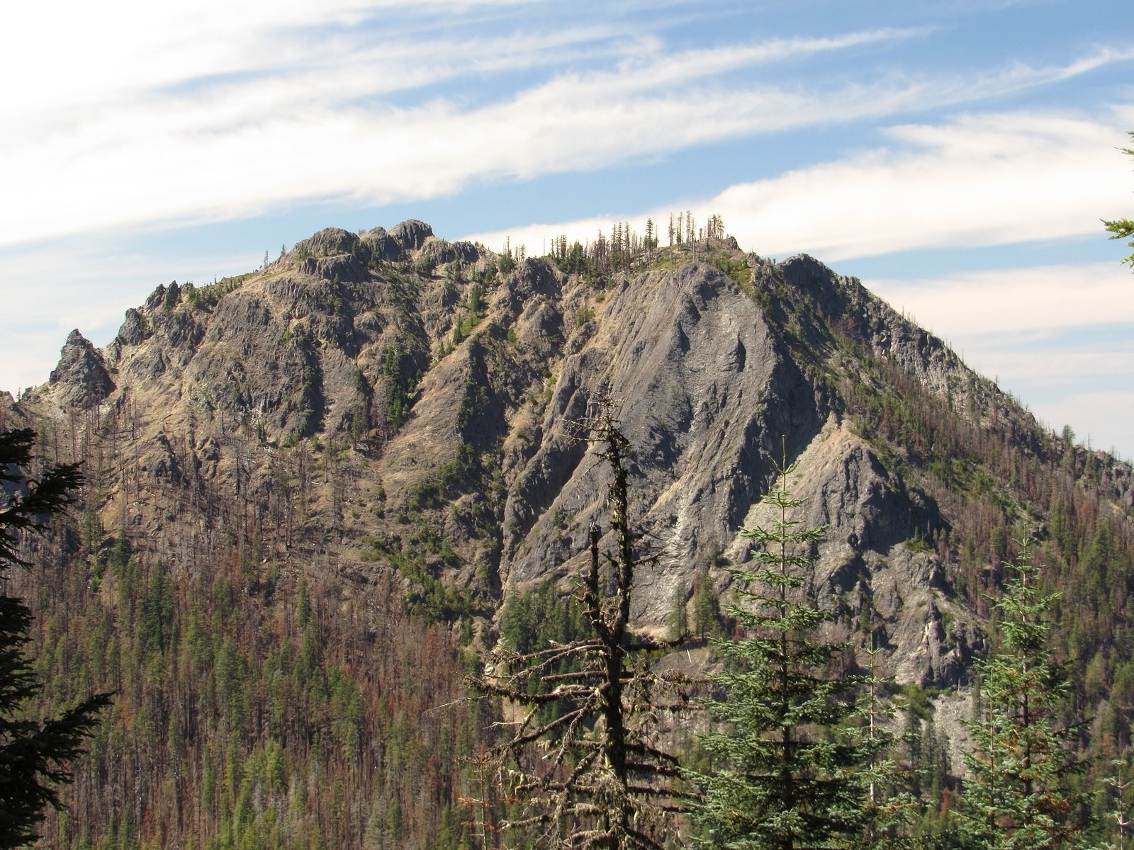
Highrock Mountain
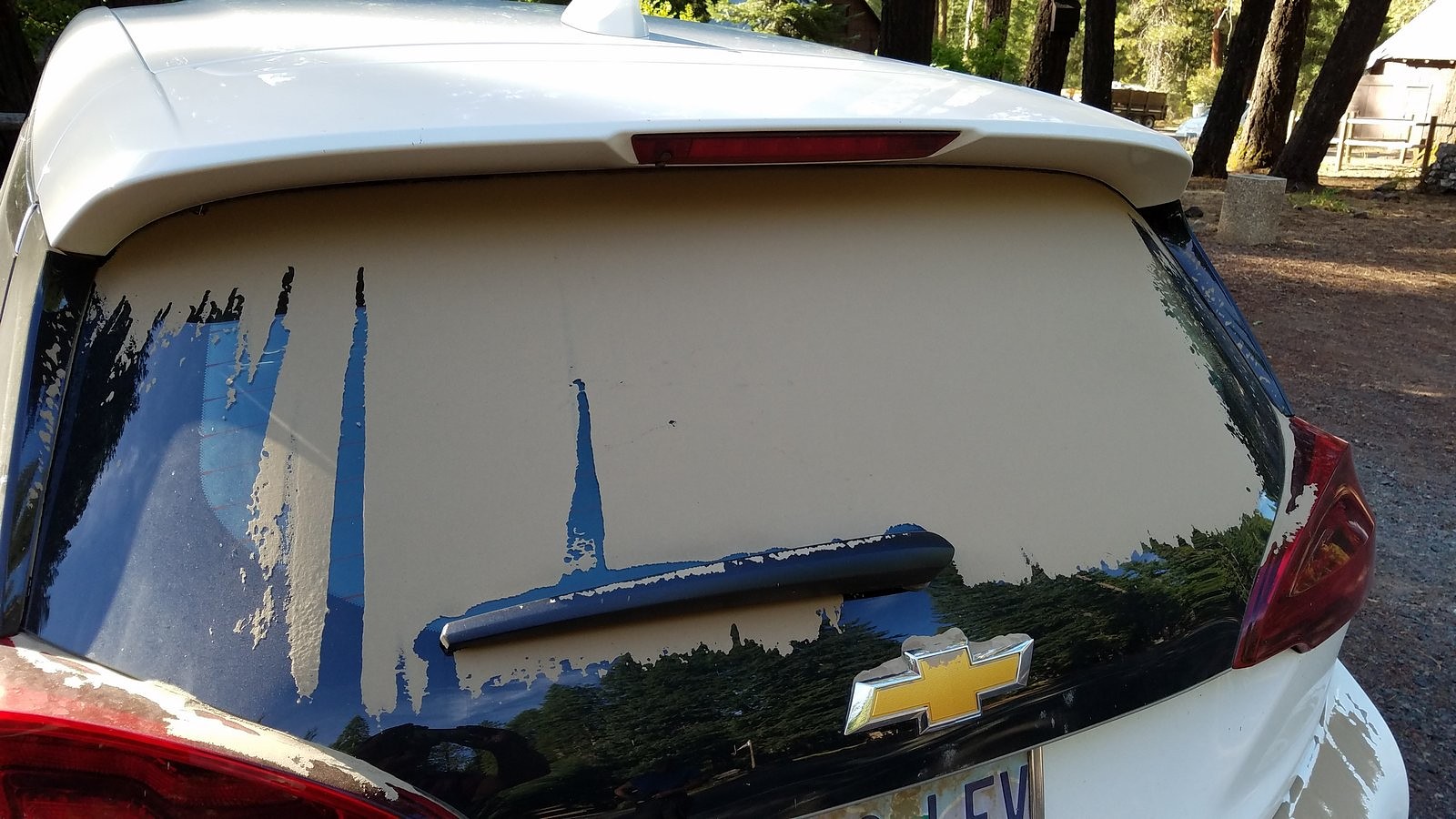
The Bolt’s back window became opaque with dust. This photo was taken at Beckie’s before we brushed it off.

And oh, yes, the huckleberry pie was delicious. So delicious that it disappeared before I thought to photograph it: I had to borrow this picture from Beckie’s Facebook page to show it to you.
Earth Juice

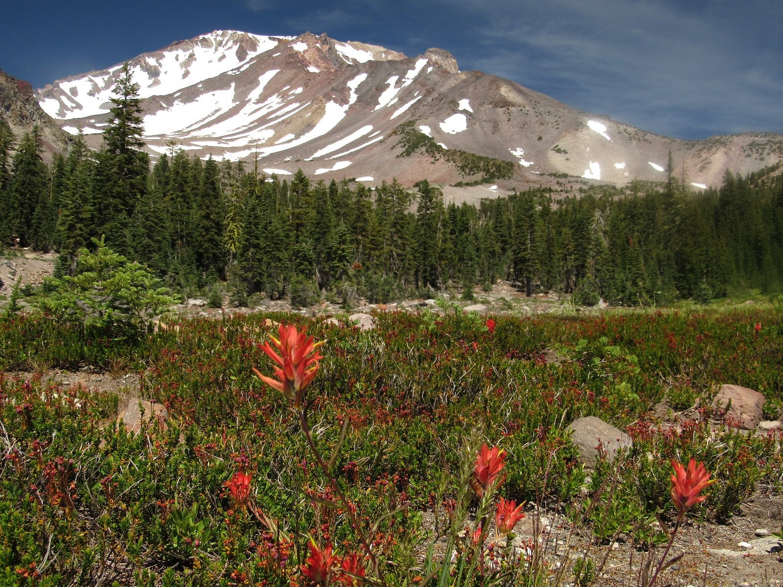
Lonely as God, and white as a winter moon, Mount Shasta starts up sudden and solitary from the heart of the great black forests of Northern California.
– Joaquin Miller

Mount Shasta rises in solitary grandeur from the edge of a comparatively low and lightly sculptured lava plain near the northern extermity of the Sierra, and maintains a far more impressive and commanding individuality than any other mountain within the limits of California. Go where you may, within a radius of fifty to one hundred miles or more, there stands before you the colossal cone of Shasta, clad in ice and snow, the one grand, unmistakable landmark – the pole-star of the landscape.
– John Muir

It hasta be Shasta.
– 1950s advertising slogan

Mt Shasta from Lower Panther Meadow

Mount Shasta is unique. Statistics tell only part of the story. You can read, for instance, that Shasta is the fifth-highest mountain in California by height above sea level: that doesn’t tell you that all of the four higher ones – and the next 20 lower ones – are clustered together more than 300 miles to the south, in the Sierra. Shasta is just the second-highest mountain in the Cascade Range: but the only higher one is Mt Rainier, two states away, and all Cascade peaks within 200 miles of Shasta – all peaks, actually, of any kind – are at least 4,000 feet lower. Using a different measure of altitude, prominence – meaning a mountain’s height above its base – Shasta comes in second in California to Mt Whitney. But Whitney’s great prominence exists only on its east side; Shasta’s exists pretty much all the way around the mountain. It dominates the scenery from every possible angle. The tallest peak in the 10,000-square-mile Klamath Mountain System, Mt Eddy, is a respectable 9,037 feet high, with a prominence of more than 5,000 feet. But it has the misfortune of sitting directly across the pass at the head of the Sacramento Valley from Shasta, so it rarely receives more than a second glance from the stream of tourists flowing between the two mountains along Interstate 5, their eyes all fixed irrevocably on the white monster to the east.

With Don Judd on the summit of Shasta, September 9, 1971. That’s me on the right.

Back in the reckless days of my youth, I attempted Shasta twice. The first time, climbing with my brother Jack and two friends while I was still in college, I didn’t get quite all the way to the top: we gave up at the edge of the summit plateau, slightly over 14,000 feet high but still an eighth of a mile or so from the mountain’s final pinnacle. The second time, though, climbing with just one friend a few years later, I made it all the way. We weren’t exactly alone, either time. Shasta, known among climbers as the “Friendly Giant”, is among the most-climbed 14,000-footers on the planet. It is also a mecca for new-age spiritualists, who crawl all over it every summer. And it has some very lovely wildflower meadows, which is what draw me to it these days. The meadows are very high. Late in the season, when everything else is beginning to dry up, Shasta is just coming alive.

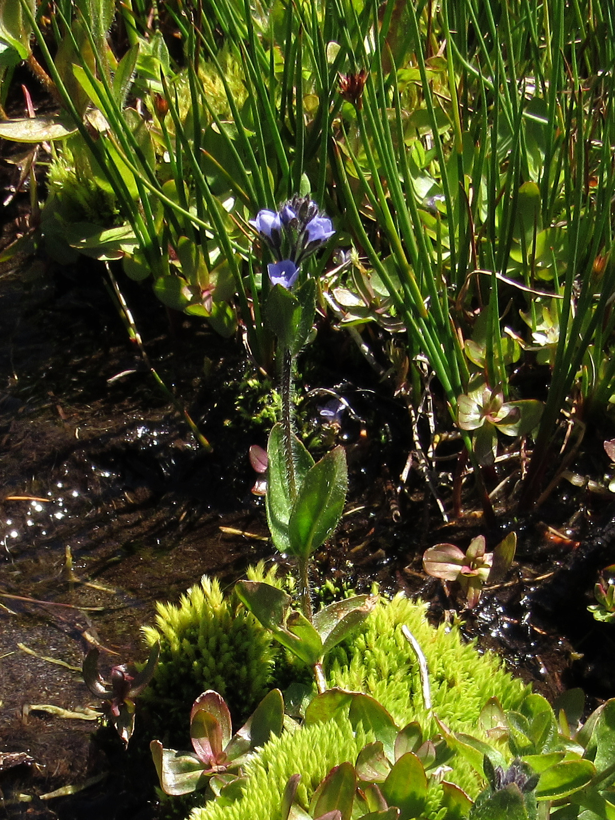
Alpine speedwell in Lower Panther Meadow

A paved two-lane road, the Everett Memorial Highway, reaches to almost 8,000 feet on the mountain’s south side. A mile before road’s end, at 7,500 feet, is the trailhead for the one-mile loop trail through Panther Meadows, one of Shasta’s two premiere meadow systems. At the very end of the road, almost at timberline, are two more trailheads. One trail rambles east around the mountain for two miles to South Gate Meadows, Shasta’s other premiere meadow system; the other climbs upward along what was once the maintenance road for the Mt Shasta Ski Bowl’s chair lifts. The Ski Bowl was destroyed by an avalance in 1978, and has since been moved to a safer spot a bit further down and several miles further east. The Old Ski Bowl Trail, as it is officially known, is still there. It’s a mile and a half long, and reaches an altitude of 9,400 feet. This was our primary goal. On the way up, we would also stop for a quick look at Panther Meadows.

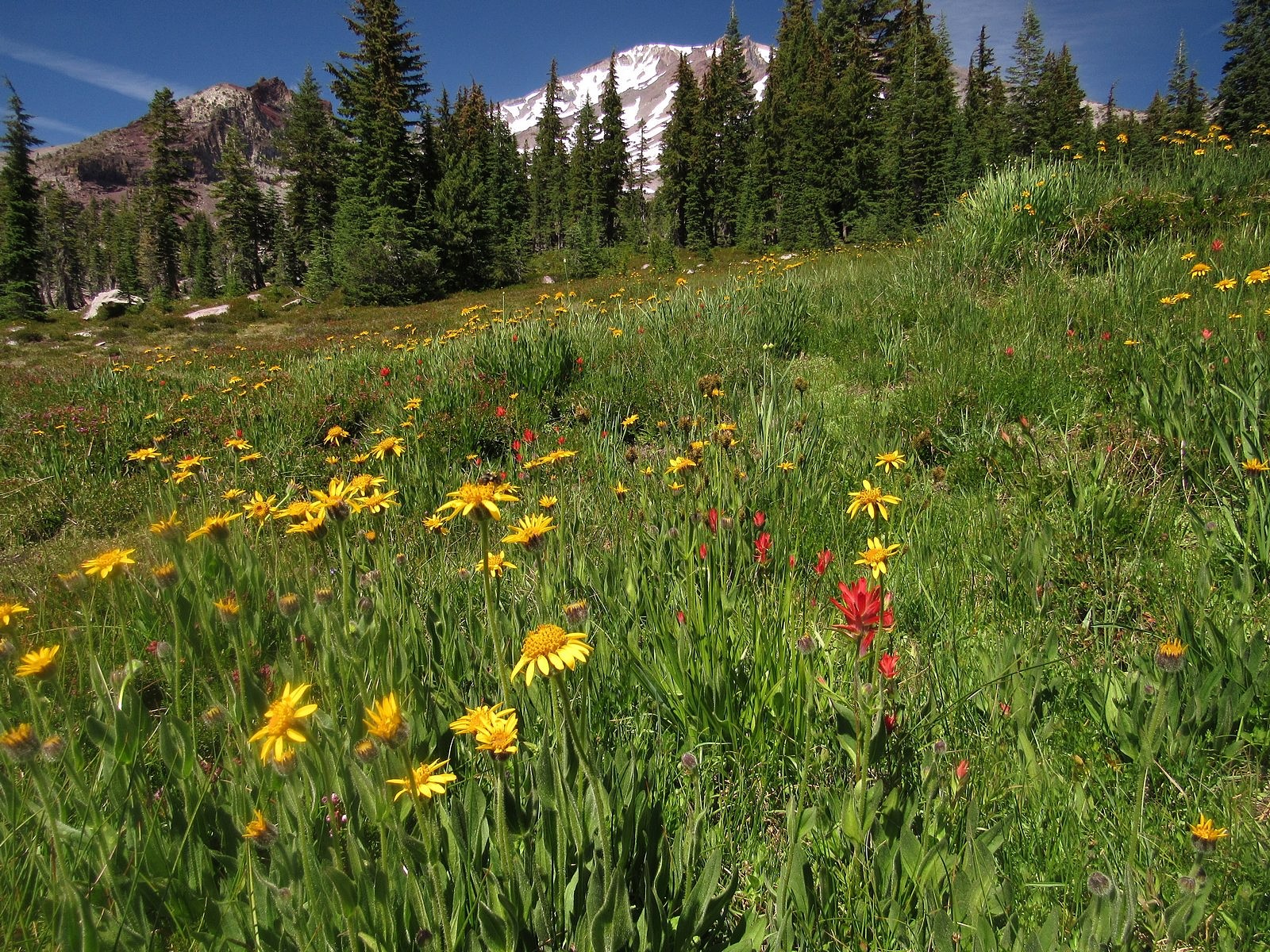
Thursday was our only available day for hiking, and we needed to get to the weekly Medford farmers’ market that same day, so we got a late start, leaving for Shasta around 9:30 AM with the Bolt’s range already down six miles due to the drive to and from the market. That, lunch, and a fifteen-minute construction delay on a back road that was theoretically supposed to save us some range meant that we didn’t reach the Panther Meadows trailhead until noon. Surprisingly, given the beauty of the day and the popularity of the mountain, we found the parking lot only 3/4 full. The meadows were gorgeous, full of red paintbrush and yellow arnica, with the white and brown bulk of the snow-streaked mountain looming over them like a protective spirit. A scatter of smaller flowers and a dance of mountain water – Panther Creek runs down the center of the meadows – made joyous companions on our walk, stretching it somewhat longer than originally intended.

Arnica and paintbrush in Upper Panther Meadow.
Flowers in the Panther Meadows. Clockwise from top left: tinker’s penny, alpine willowherb, three-leaved lewisia, cobwebby paintbrush (with bumblebee).

We were back in the car by a little after two, driving on up the highway to the big parking lot at its end. Before turning off the motor, I made a mental note of the range and battery indicators. 98 miles left on the GOM – 34 kwhs of juice used up, four kwhs past the midpoint of the 60-kwh battery. We were 101 miles from home and had 26 kwhs left to get there. Hmmmm. Since we would also be dropping more than 6,000 feet, I wasn’t really worried; but I do have to admit to a certain curiosity about how it was all going to work out.

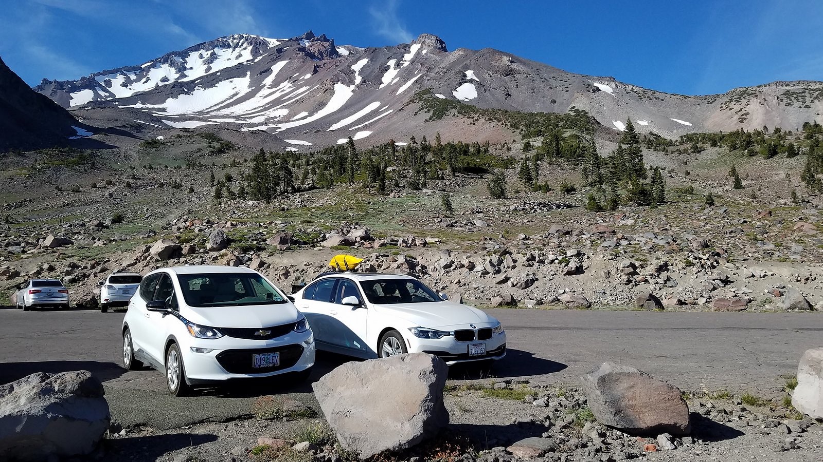
The Bolt keeping company with a BMW in the Old Ski Bowl parking lot.

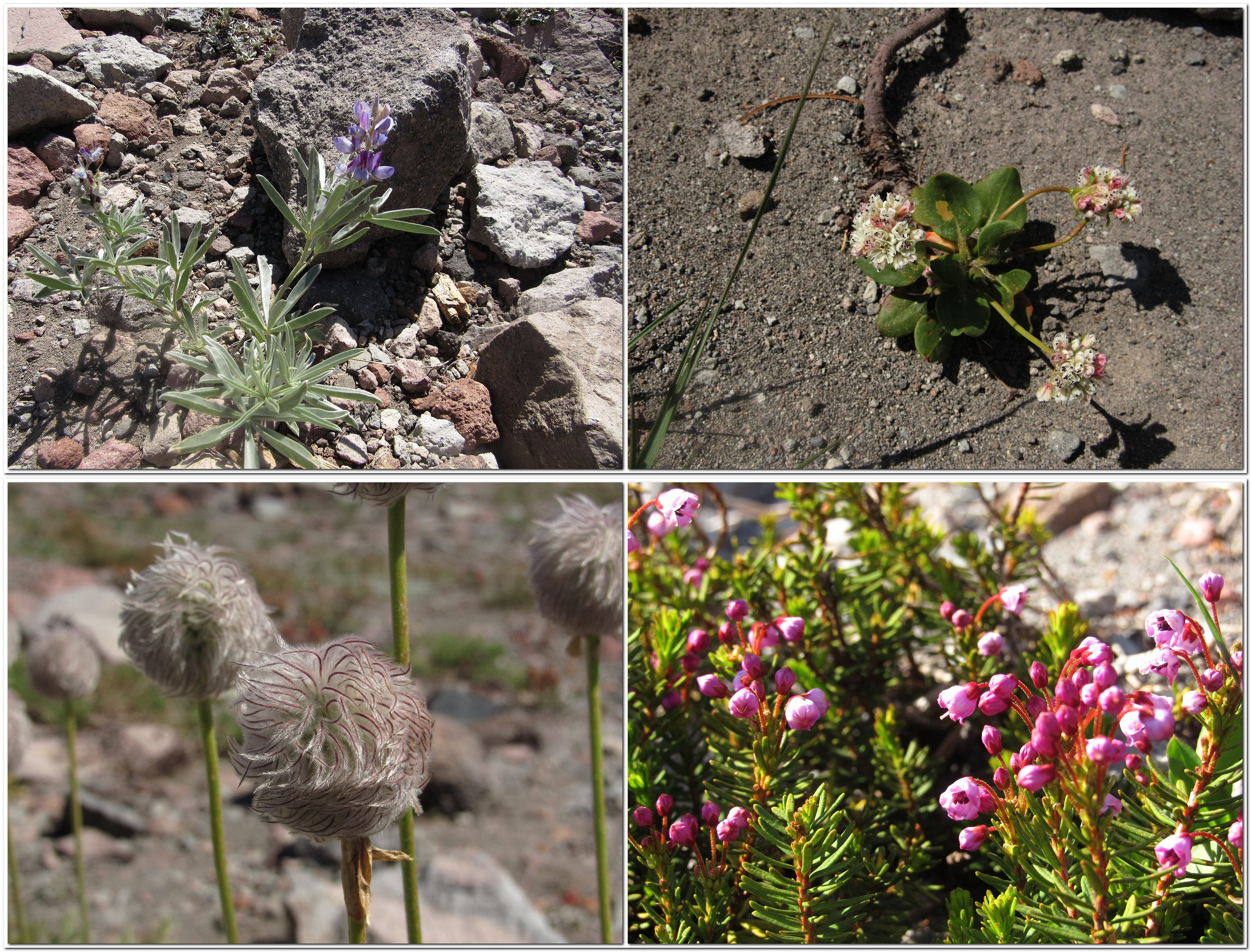
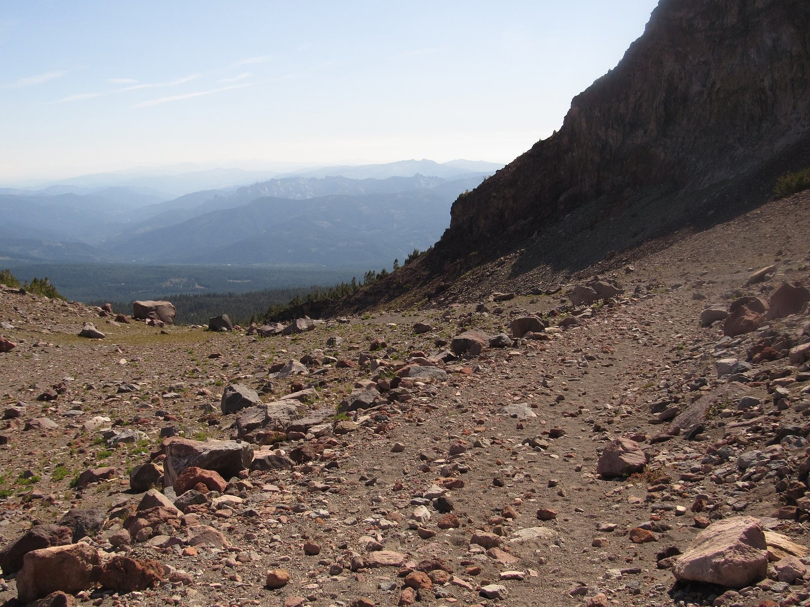
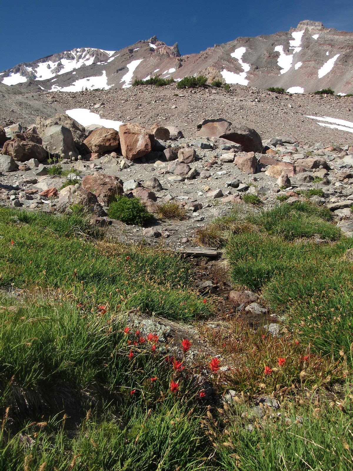
We were on the Old Ski Bowl trail for most of the rest of the afternoon. All of that trail lies essentially above timberline. The only trees are in widely scattered, tight little groves, and they grow increasingly smaller and scarcer as you ascend; by the time we reached our turnaround point, the only “trees” left had been beaten down to knee-high krummholz by the altitude and the weather. You walk on loose volcanic rock up there, with occasional patches of sand. Surprisingly, perhaps, there are quite a few flowers; but they are almost all different species from the ones down in the meadows. Coyote mint, and pussy’s paws, and a species of lupine I couldn’t quite identify. Several buckwheats, including the malodorous and well-named “dirty socks”. Large numbers of tall western pasqueflowers, past bloom and showing off the tousled, hairy-looking round seedheads that give them their other common name – “old man of the mountains”.

Flowers along the Old Ski Bowl trail. Clockwise from upper left: lupine, dirty socks, heather, western pasqueflower.

At 9200 feet, the trail disappeared beneath a steep snowbank. Ten years ago – probably even five years ago – that wouldn’t have stopped us; but at 77 and almost-77, we have grown more cautious. It was already after 4:00. Conveniently, the back end of the loop started just a few feet back from the snowbank. We turned onto it and started down.

Starting the descent, along the base of Green Butte (R)
A mini-meadow at 9000 feet on Mt Shasta.

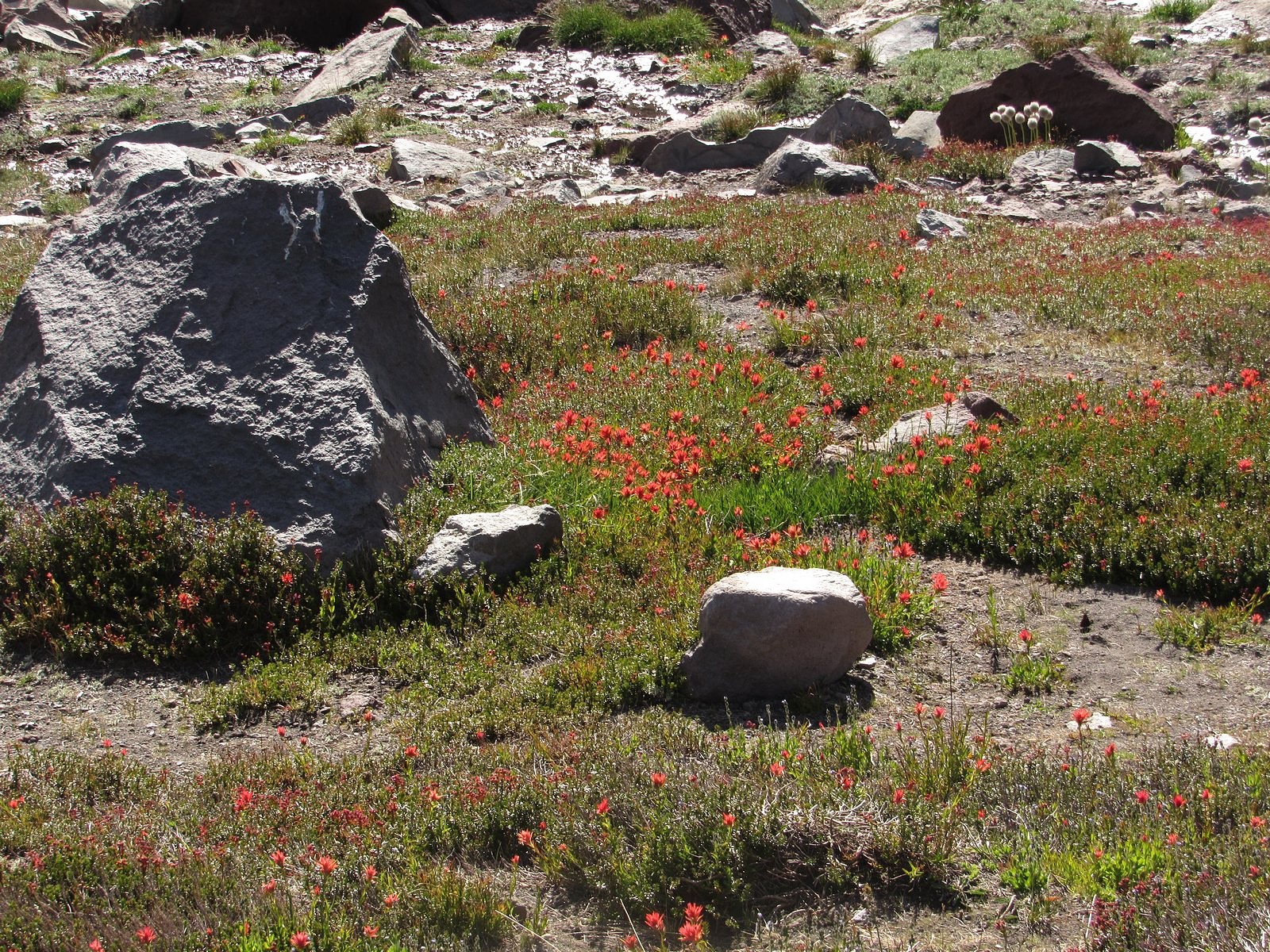
A few hundred yards below the junction, the mountain worked a bit of magic: we came over a small lip and there, just below the edge, was a small circle of springs and a streamlet, just a few inches wide, flowing from them down the steep mountainside. The springs and the streamlet supported a tiny meadow, and the meadow was full of meadow flowers – paintbrush mostly, though there was also heather and monkey flower and a smattering of others. That high, and that close to its underground source, the water seemed certain to be potable. I pulled the 110-year-old collapsible aluminum drinking cup that once belonged to my grandfather from my waist pack and stuck it beneath a tiny four-inch “waterfall” a few feet below one of the springs. Our family name for this is “earth juice”. It was transparent, and ice-cold, and tastier than plain water anywhere has any right to be.

We were back at the car by a little after 5:00. I left the central dashboard screen on its kilowatt-hour display so we could watch regeneration feed the battery during our descent: it had climbed three kwhs by the time we reached Mt Shasta City, 12 miles and 5,000 feet down, and the GOM now read 134 miles. We would get home. A quick supper at a fast-food place and we hit the freeway, watching the sun drop toward and eventually behind the Klamath Mountains. It was almost exactly 8:00 when we pulled into the driveway. The Bolt’s gauges showed 16 kwhs in the battery and 48 miles of range left. The two humans in the Bolt were bone-tired, exalted, and in full agreement with all three of the quotes at the head of this post. I dropped off to sleep that night thinking about earth juice.

Paintbrush at the bottom of the mini-meadow, where the streamlet from the spring trickles to an end.

The Trail Less Traveled

Upper Ruffey Lake, near Etna, California

Coyote mint with butterflies, on the Ruffey Lakes trail.

Two roads diverged in a wood, and I—
I took the one less traveled by,
And that has made all the difference.

Robert Frost’s advice about roads often applies to trails, too. It certainly applies to the trail to Upper Ruffey Lake, a side path off the Pacific Crest Trail just north of the Russian Peaks Wilderness in California’s Klamath Mountains.

I’ve known about the Ruffey Lakes for a while. I’ve even seen the sign on the PCT pointing to them – Melody and I walked right past it several years ago on our way to goggle over the spectacular granite scenery surrounding Smith Lake, two miles further down the trail. They’ve just never seemed much of a draw. The guidebooks haven’t been encouraging. Jeffrey Shaffer, in his guide to the PCT in Northern California, dismisses Upper Ruffey Lake as a “small cow-inhabited basin”; William L. Sullivan, in “100 Hikes in Southern Oregon” – a lot of which are actually in northern California – mentions it only in passing, as a “woodsy” lake which makes “an acceptable day-hike goal” if you run out of steam before reaching Paynes Lake, the destination he is actually describing. Few other guides, either in print or on line, even bother to mention the Ruffeys. People rarely seem to plan to go there.

Nor did we, at least in the beginning. The original idea was to try to catch a glimpse of Wicks Lake, a tiny, remote pond in a steep little cirque cut into a granite cliff high on a nameless peak above the tiny, remote town of Etna, California. No trail reaches Wicks Lake; no trail even goes within sight of it. The PCT runs along the other side of the mountain. Cliffs above and below the lake make getting to it a formidable task. I doubt that it gets three visitors in a decade. I didn’t expect to be among them, but I did want to see it. The best chance seemed to be to take the PCT south from the Etna Summit trailhead, veer off on the Ruffey Lakes trail for 300 yards or so to the saddle where the trail crosses the ridge above the upper lake, and follow that rugged ridge a mile or so north to the third of its three summits, where we could peer over the edge of the cliff and – hopefully – see Wicks Lake. Upper Ruffey Lake would be, to borrow Sullivan’s words, an “acceptable day-hike goal” if the Wicks Lake plan petered out.

That was the plan. By the time we left the house last Wednesday, though, it had morphed into something a little different. I’d been a bit under the weather all week – not enough to keep me from hiking, but enough so that choosing to bushwack a mile along a steep up-and-down ridge seemed, at best, questionable judgement. So the goal now became Upper Ruffey Lake. That way, we would at least get someplace. If I had enough energy left, we would tackle the traverse to the view of Wicks Lake on our way out.

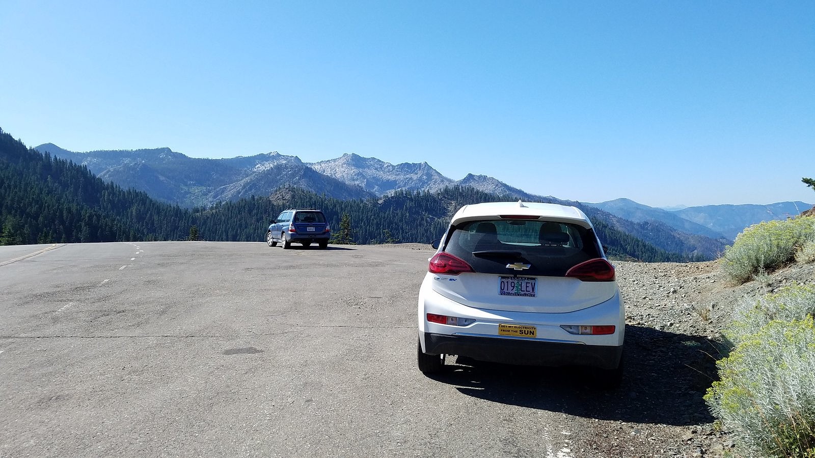
The Bolt at Etna Summit. Taylor Lake massif in the background.

It’s a bit over 90 miles from our home in Medford to Etna Summit – about half on the freeway (over two passes), another third on a two-lane rural road (over another pass), and the rest up a winding, narrow mountain road (to the top of a 4th pass, this one 6000 feet high). I didn’t expect that to strain the Bolt’s range, but it would be interesting to see how well it did. The drive went smoothly, after a leisurely breakfast at Ashland’s Breadboard; I checked the dashboard display just before turning off the motor at the trailhead and found we had used 28 kwh of electricity to get there. That left us 32 kwh to get home. More than enough – especially since home was 4500 feet closer to sea level than our current location. We locked the car and set off up the trail.

The first quarter mile of the PCT south of Etna Summit is out in the open, with spectacular views across the upper Salmon River canyon to the rugged granite massif that holds Taylor, Hogan, and Big Blue Lakes. After that, though, you enter the forest, and the views disappear. The way is relentlessly uphill. Every few minutes, we met PCT through-hikers coming down. We spoke briefly to a young man from Germany who was looking for a ride into Etna (a regular reprovisioning stop for hikers doing the whole trail). I told him that if he was still waiting at the trailhead when we came out four or five hours later, he would have his ride.

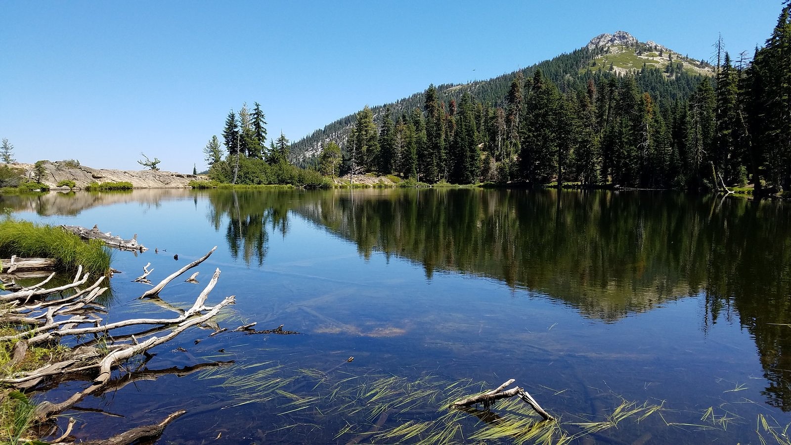
At around 11:30, we turned onto the Ruffey Lakes trail. A couple of hundred yards and less than 100 feet of elevation gain later, we broke out of the woods at the saddle above the upper lake. I’m not sure what I expected to see, but what did meet our eyes was certainly far more than just “acceptable”:

Etna Mountain and Upper Ruffey Lake from the top of the connecting trail to the lake, with Mt Shasta peeking around Etna’s right-hand ridge.

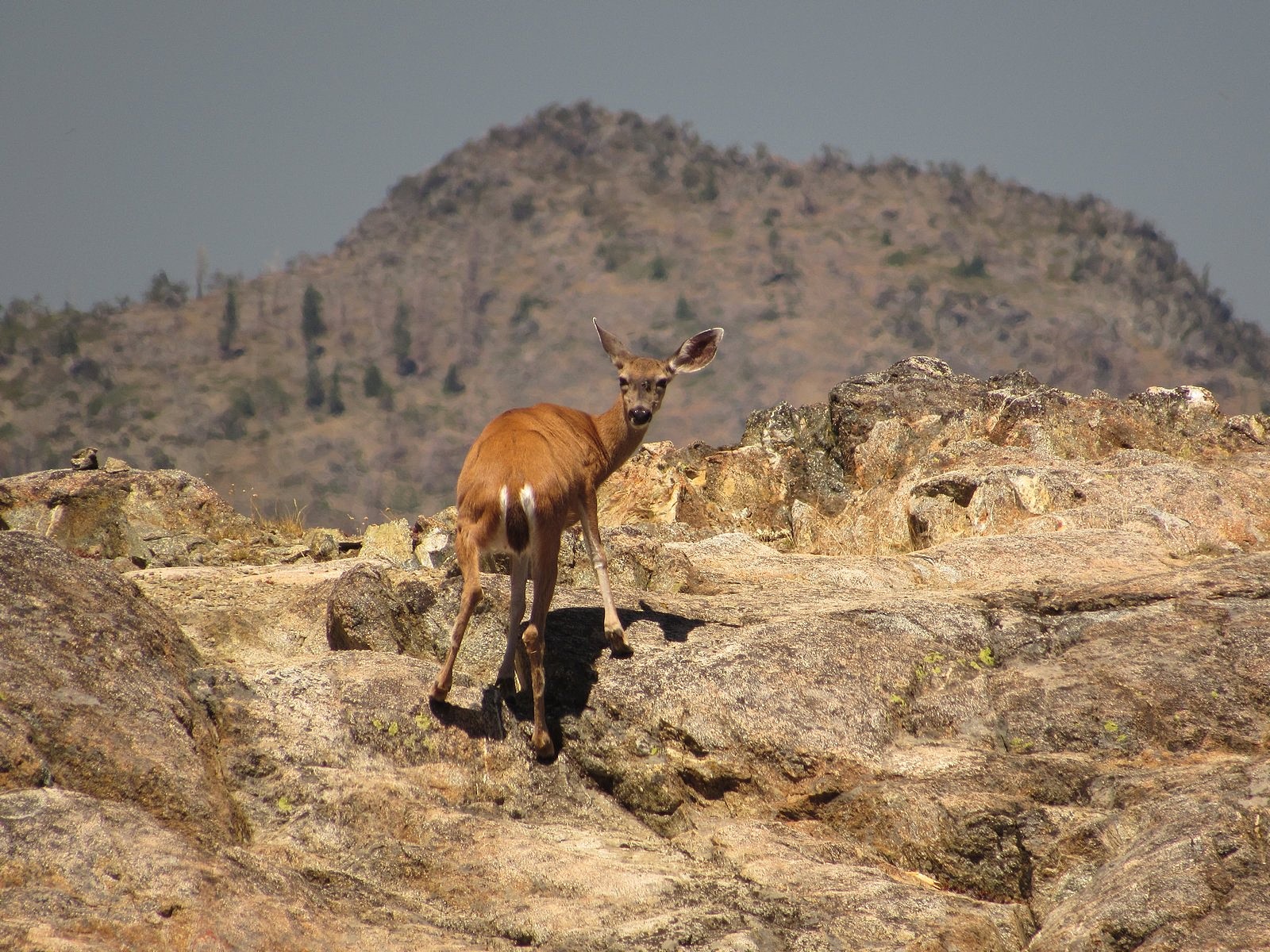
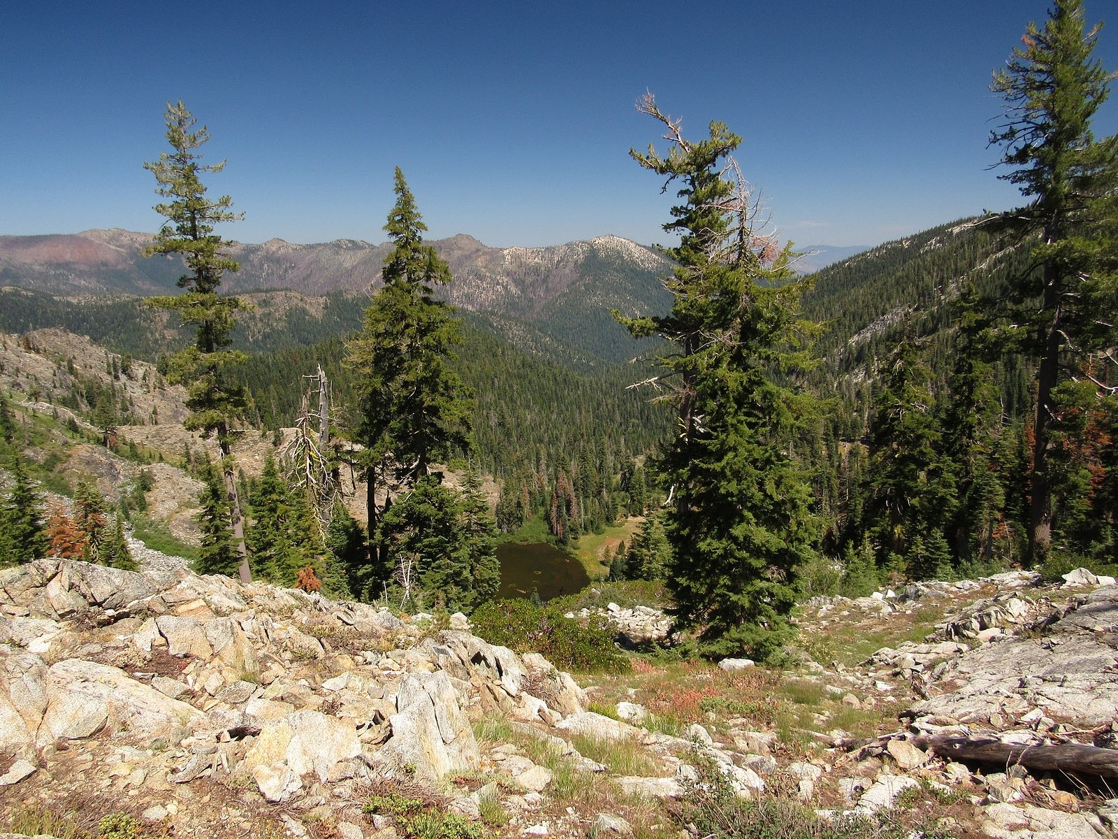
We descended, through flowers and open woods, to the lakeshore. The white double pyramid of Etna Mountain loomed over us. We circled the lake slowly, clockwise, beginning along the polished granite rim. That rim is perhaps 20 feet wide, and is bounded on the side away from the lake by a precipitous 600-foot drop to Lower Ruffey Lake, tucked so tightly against the bottom of the cliff that it was difficult to get a view of it. Back into the woods at the far end of the rim, with views across the lake to the sharp sawtooth knobs of the ridge we had crossed from the PCT. A deer stepped daintily out of the woods onto the rim, checked us out across the water, decided we were safe, and began to graze on something invisible growing from the granite.

Deer on the rim (telephoto from the far side of the lake).

On around to a spring near the spot where we had first reached the shore. The spring’s small stream seeped into the lake through bright yellow monkey flowers and blue monkshoods. A reluctant departure from the shore, then; a slow climb out of the basin to the ridge again, through masses of coyote mint fluttering with butterflies. Since leaving the PCT more than two hours before, we had not seen a single other human being.

Etna Mountain and Upper Ruffey Lake.
Lower Ruffey Lake from the rim of Upper Ruffey Lake.
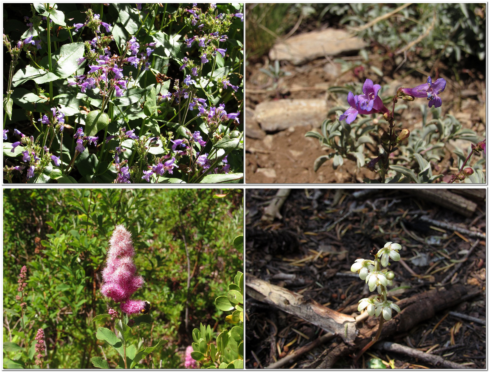
Clockwise from upper left: woodland penstemon, azure penstemon, little Prince’s pine, Douglas spirea.
Upper Ruffey Lake from the ridge north of the connecting trail’s saddle.

On the ridge we diverted, as planned, toward the unnamed summit that would give us a view of Wicks Lake; but it was a halfhearted diversion, and we gave it up after just a short distance and returned to the trail. Back on the PCT, we began once more to encounter through-hikers every few minutes. Hiker Grand Central. Most were traveling north, so they would come up behind us, pass us – sometimes with a greeting, mostly not – and stride rapidly on down the trail. It seemed a grim way to hike. Not for the first time, I wondered what they were seeing at that pace.

We reached the car around 4:30. The German hiker wasn’t waiting for a ride, but another hiker was. He turned out to be from Cleveland. He had never ridden in an electric car, and asked intelligent questions on the way down the hill. We dropped him at Etna’s small supermarket and headed for home. Rolled into the garage with 30% of the battery left, 77 miles showing on the GOM, and a new determination not to ignore “the trail less traveled by”.

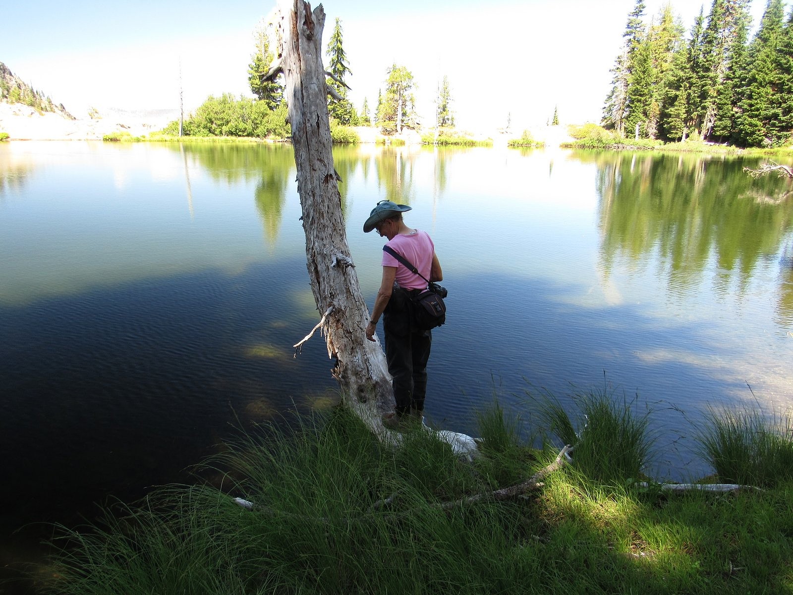
Melody on the south shore of Upper Ruffey Lake.