Earth Juice

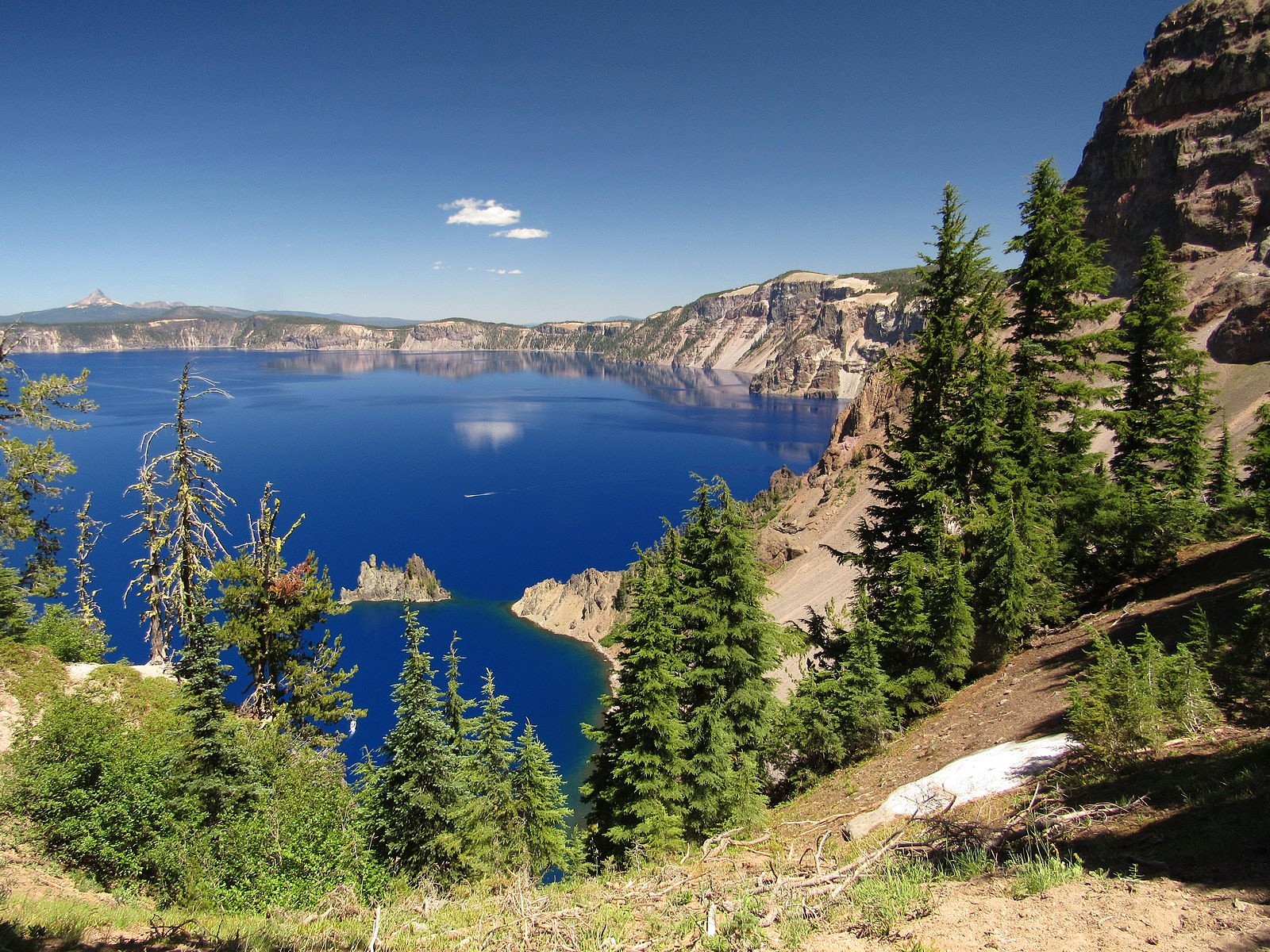
Lonely as God, and white as a winter moon, Mount Shasta starts up sudden and solitary from the heart of the great black forests of Northern California.
– Joaquin Miller

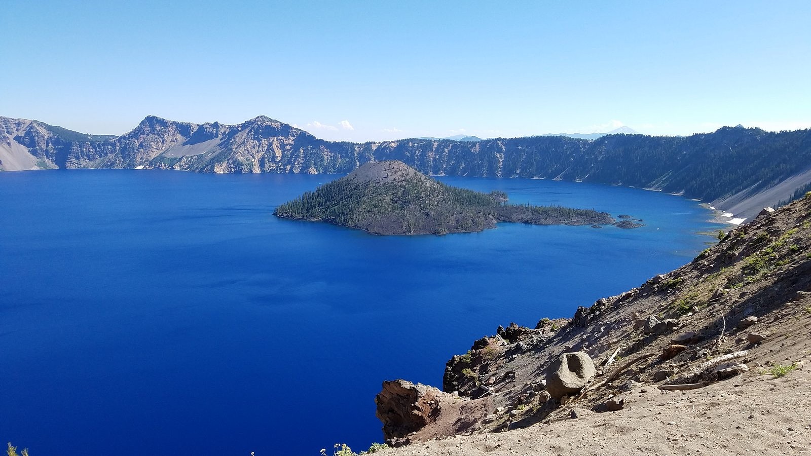
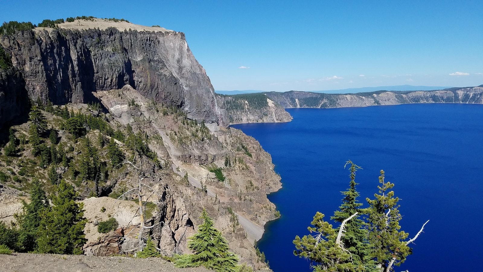
Mount Shasta rises in solitary grandeur from the edge of a comparatively low and lightly sculptured lava plain near the northern extermity of the Sierra, and maintains a far more impressive and commanding individuality than any other mountain within the limits of California. Go where you may, within a radius of fifty to one hundred miles or more, there stands before you the colossal cone of Shasta, clad in ice and snow, the one grand, unmistakable landmark – the pole-star of the landscape.
– John Muir

It hasta be Shasta.
– 1950s advertising slogan

Mt Shasta from Lower Panther Meadow

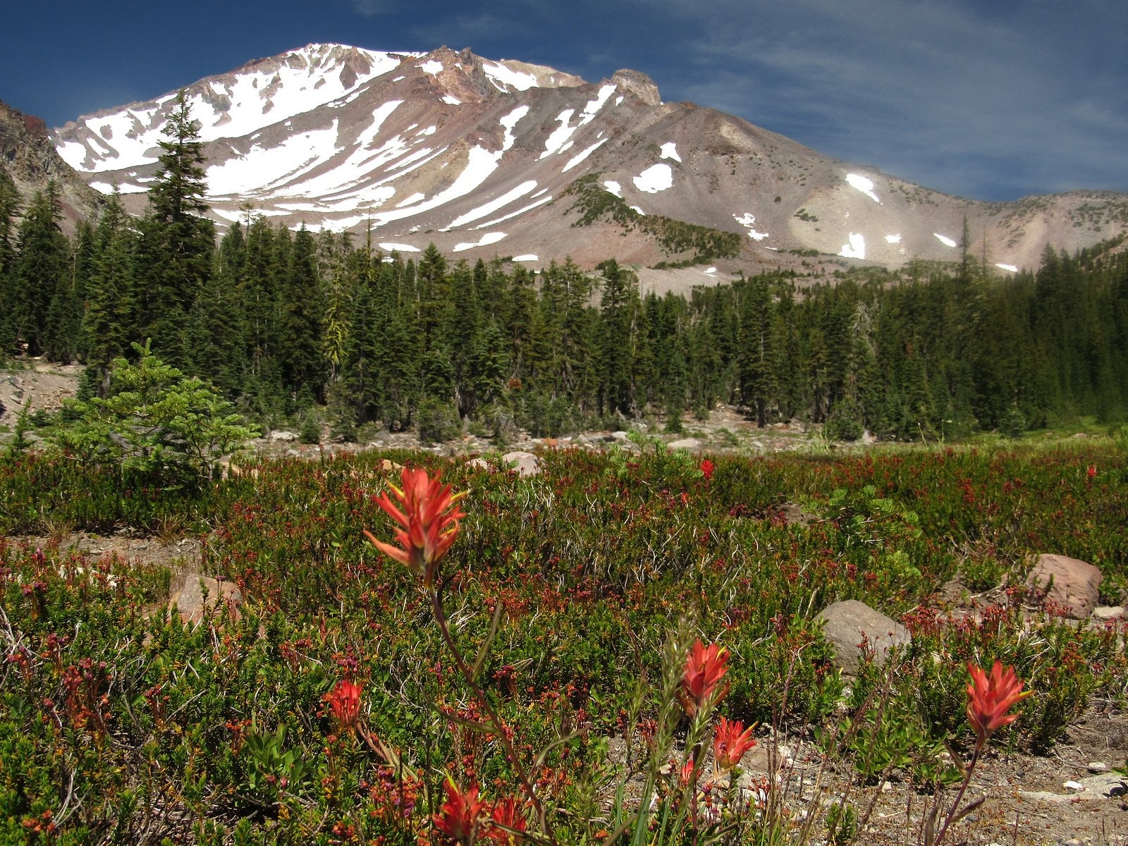
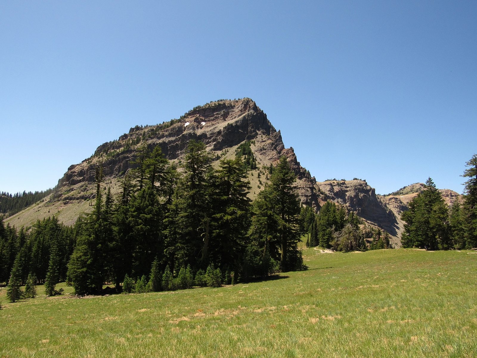
Mount Shasta is unique. Statistics tell only part of the story. You can read, for instance, that Shasta is the fifth-highest mountain in California by height above sea level: that doesn’t tell you that all of the four higher ones – and the next 20 lower ones – are clustered together more than 300 miles to the south, in the Sierra. Shasta is just the second-highest mountain in the Cascade Range: but the only higher one is Mt Rainier, two states away, and all Cascade peaks within 200 miles of Shasta – all peaks, actually, of any kind – are at least 4,000 feet lower. Using a different measure of altitude, prominence – meaning a mountain’s height above its base – Shasta comes in second in California to Mt Whitney. But Whitney’s great prominence exists only on its east side; Shasta’s exists pretty much all the way around the mountain. It dominates the scenery from every possible angle. The tallest peak in the 10,000-square-mile Klamath Mountain System, Mt Eddy, is a respectable 9,037 feet high, with a prominence of more than 5,000 feet. But it has the misfortune of sitting directly across the pass at the head of the Sacramento Valley from Shasta, so it rarely receives more than a second glance from the stream of tourists flowing between the two mountains along Interstate 5, their eyes all fixed irrevocably on the white monster to the east.

With Don Judd on the summit of Shasta, September 9, 1971. That’s me on the right.

Back in the reckless days of my youth, I attempted Shasta twice. The first time, climbing with my brother Jack and two friends while I was still in college, I didn’t get quite all the way to the top: we gave up at the edge of the summit plateau, slightly over 14,000 feet high but still an eighth of a mile or so from the mountain’s final pinnacle. The second time, though, climbing with just one friend a few years later, I made it all the way. We weren’t exactly alone, either time. Shasta, known among climbers as the “Friendly Giant”, is among the most-climbed 14,000-footers on the planet. It is also a mecca for new-age spiritualists, who crawl all over it every summer. And it has some very lovely wildflower meadows, which is what draw me to it these days. The meadows are very high. Late in the season, when everything else is beginning to dry up, Shasta is just coming alive.

Alpine speedwell in Lower Panther Meadow

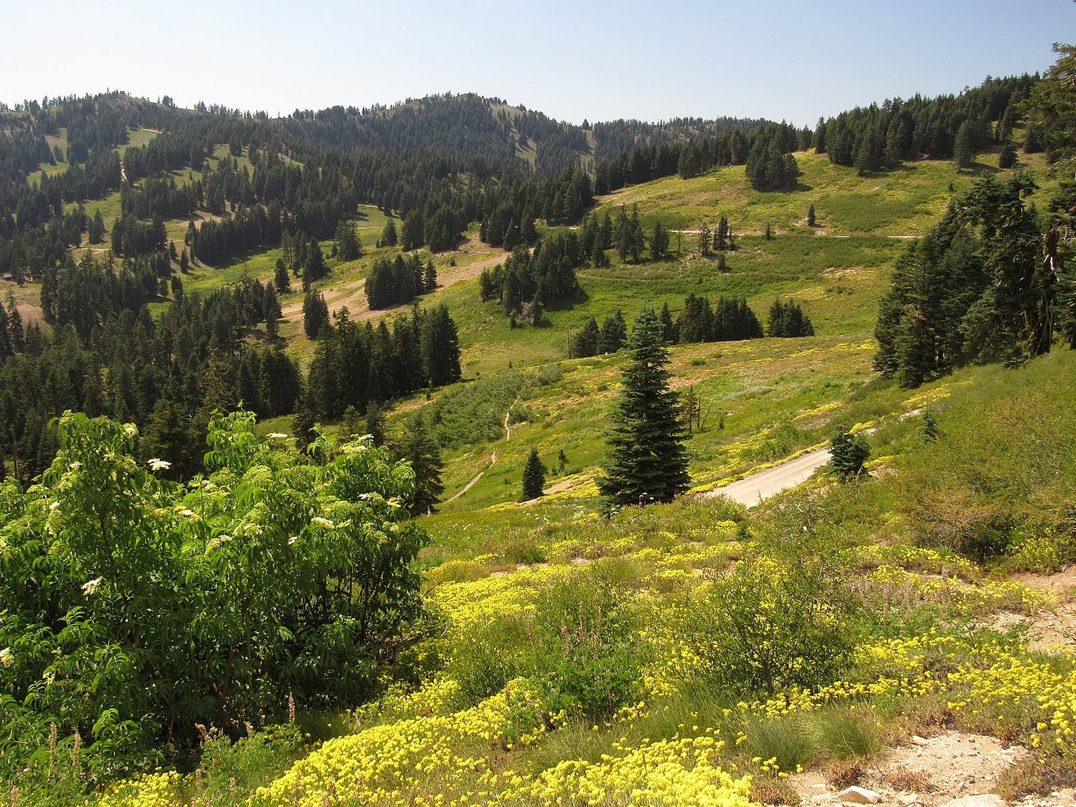
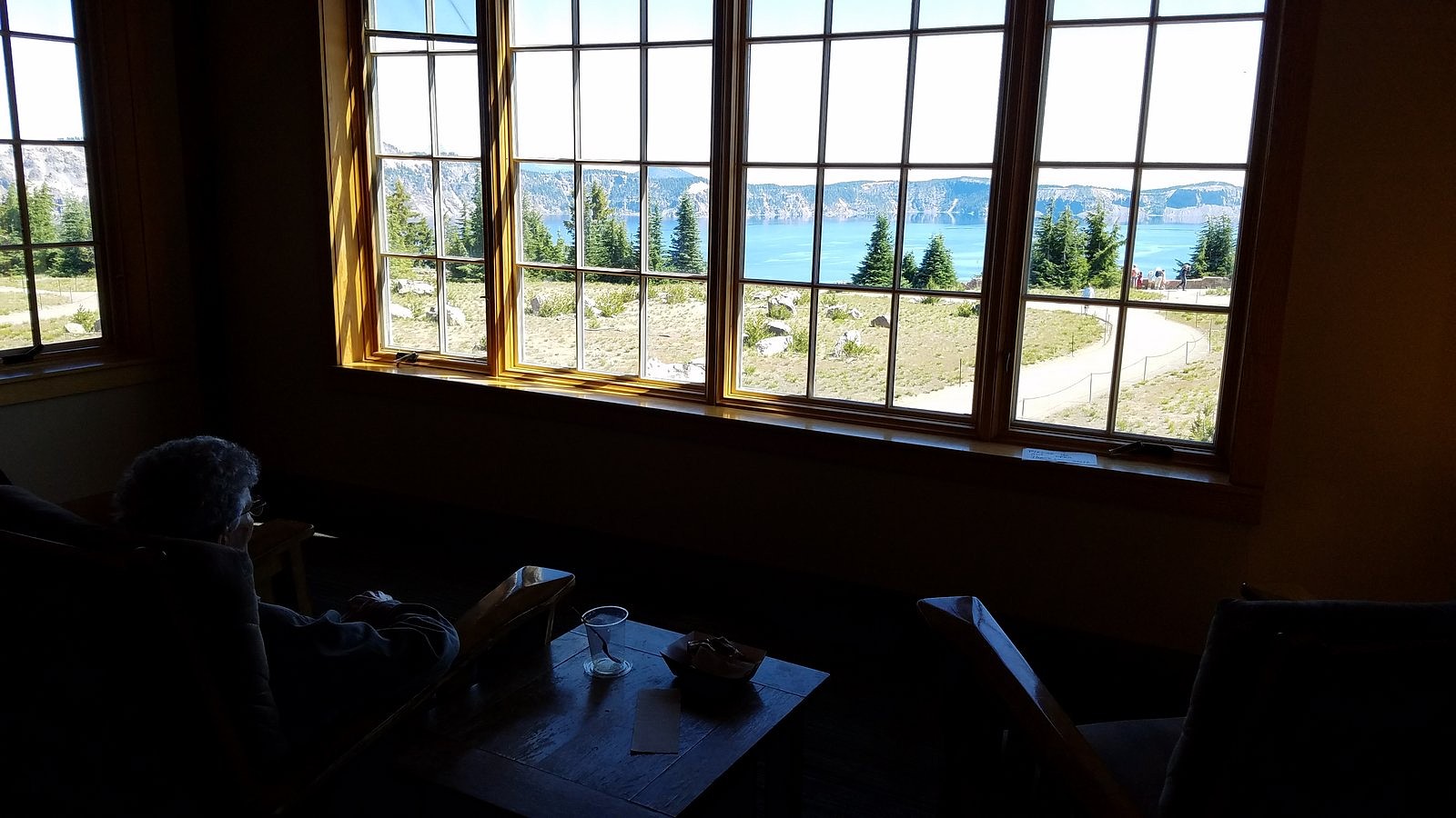
A paved two-lane road, the Everett Memorial Highway, reaches to almost 8,000 feet on the mountain’s south side. A mile before road’s end, at 7,500 feet, is the trailhead for the one-mile loop trail through Panther Meadows, one of Shasta’s two premiere meadow systems. At the very end of the road, almost at timberline, are two more trailheads. One trail rambles east around the mountain for two miles to South Gate Meadows, Shasta’s other premiere meadow system; the other climbs upward along what was once the maintenance road for the Mt Shasta Ski Bowl’s chair lifts. The Ski Bowl was destroyed by an avalance in 1978, and has since been moved to a safer spot a bit further down and several miles further east. The Old Ski Bowl Trail, as it is officially known, is still there. It’s a mile and a half long, and reaches an altitude of 9,400 feet. This was our primary goal. On the way up, we would also stop for a quick look at Panther Meadows.

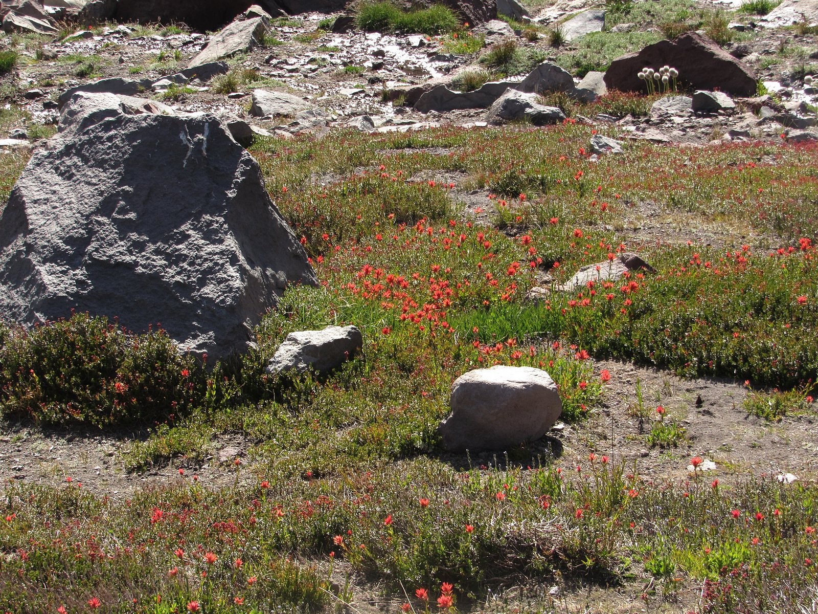
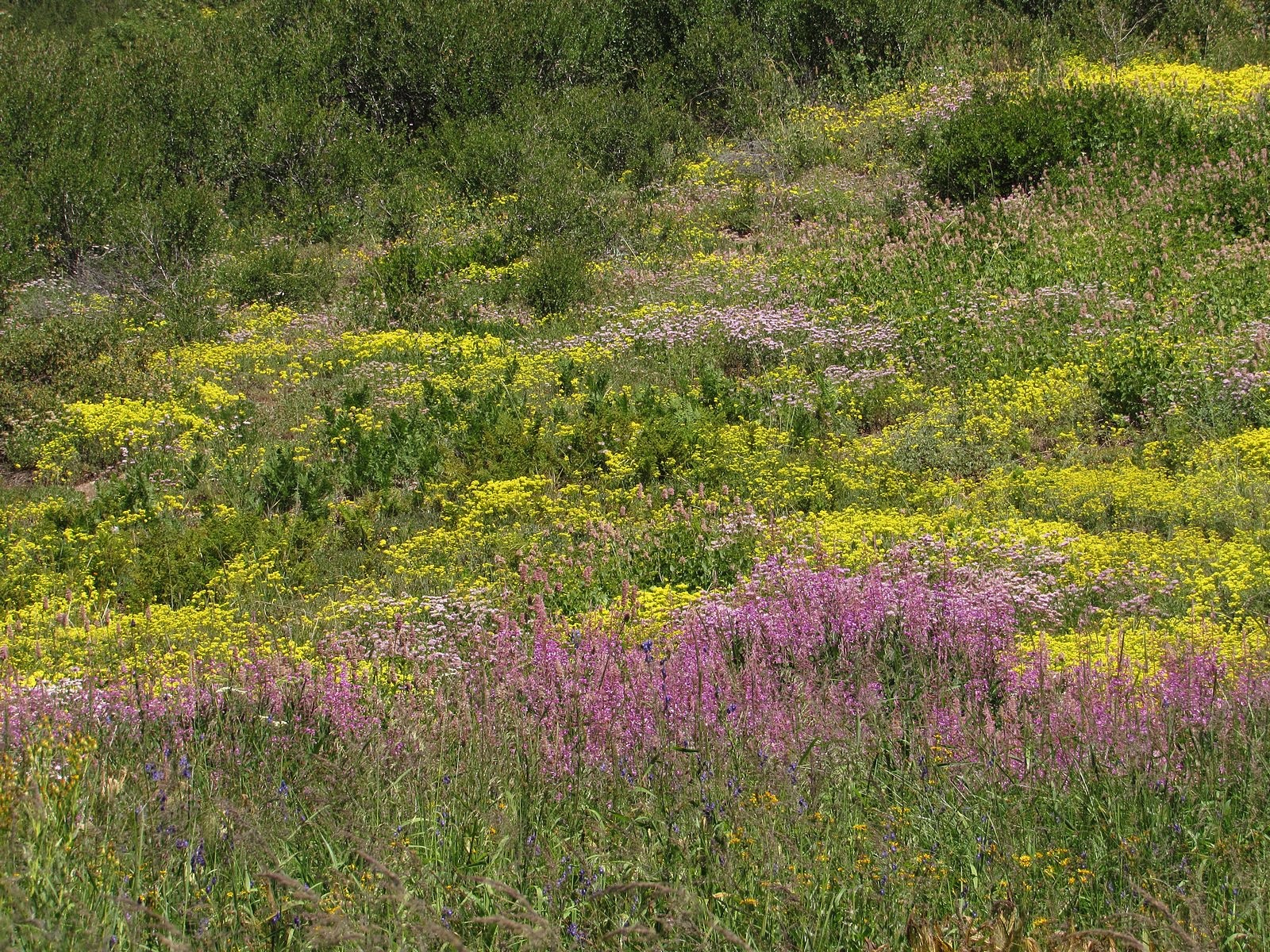
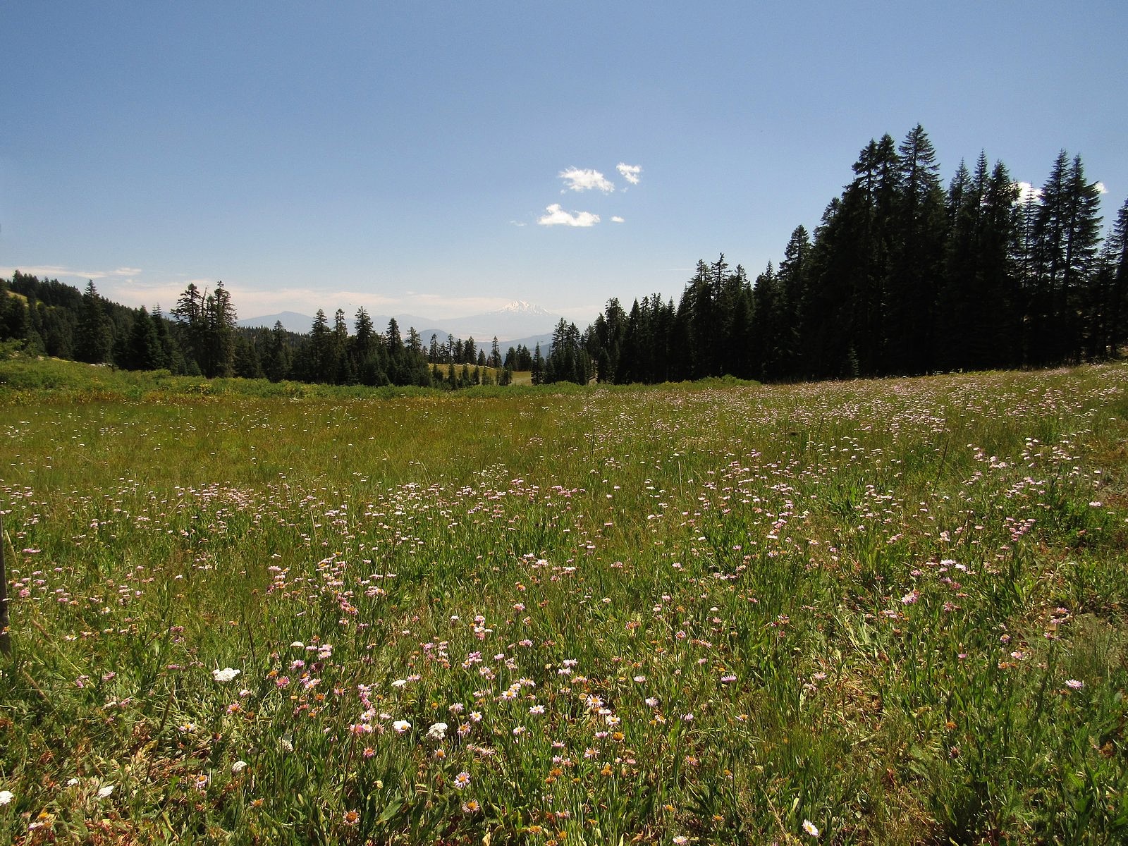
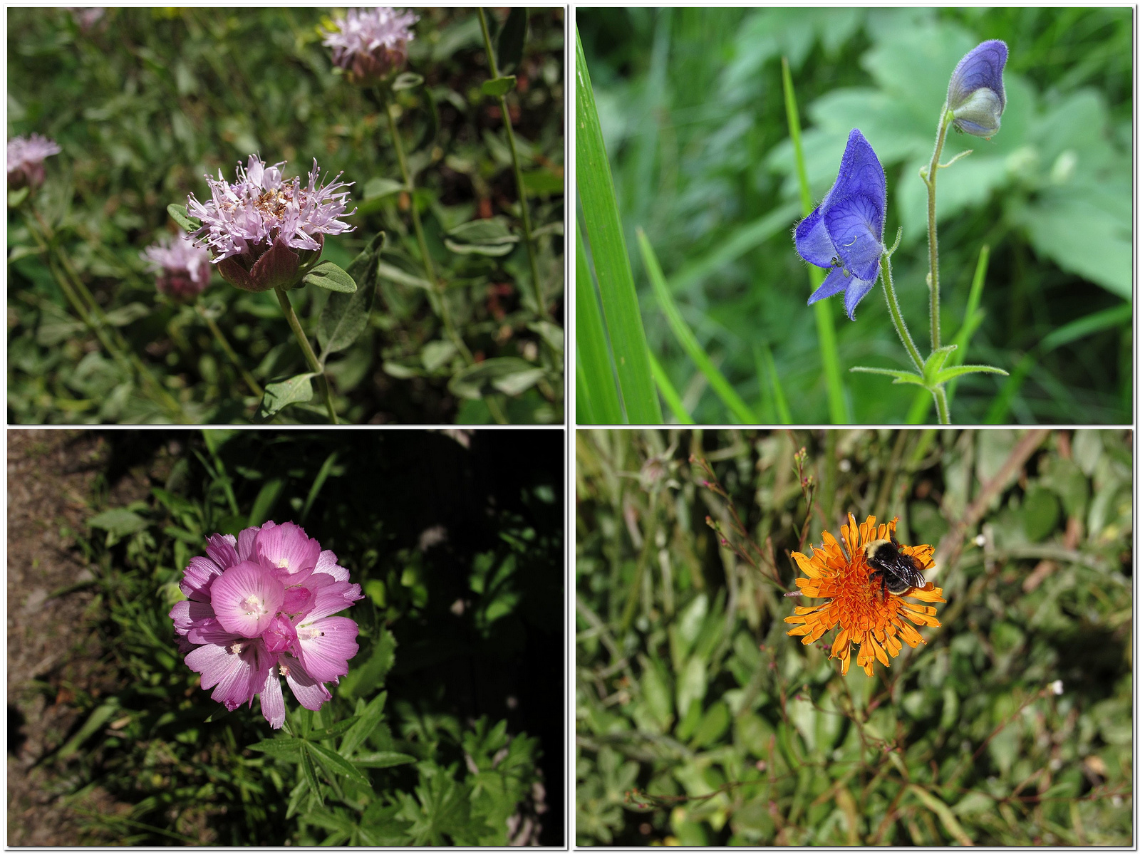
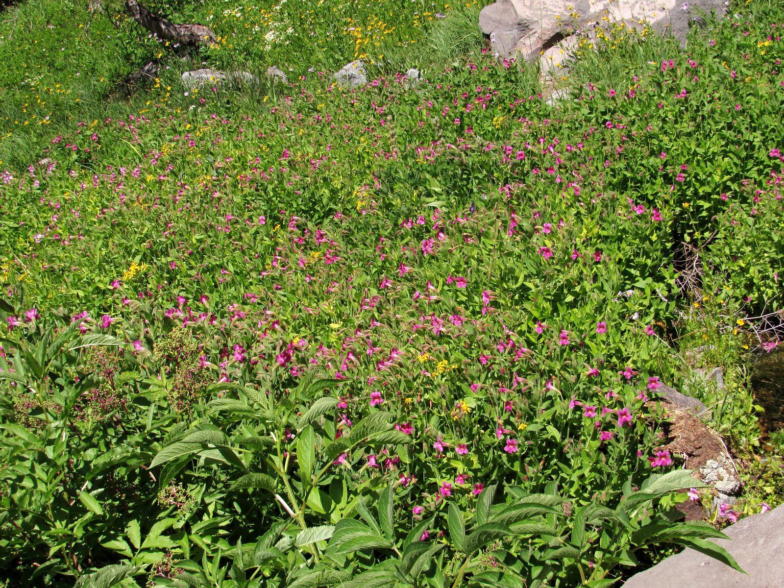
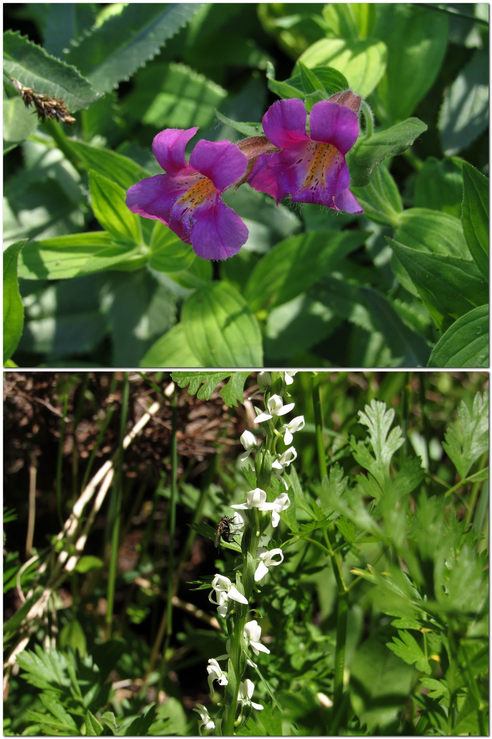
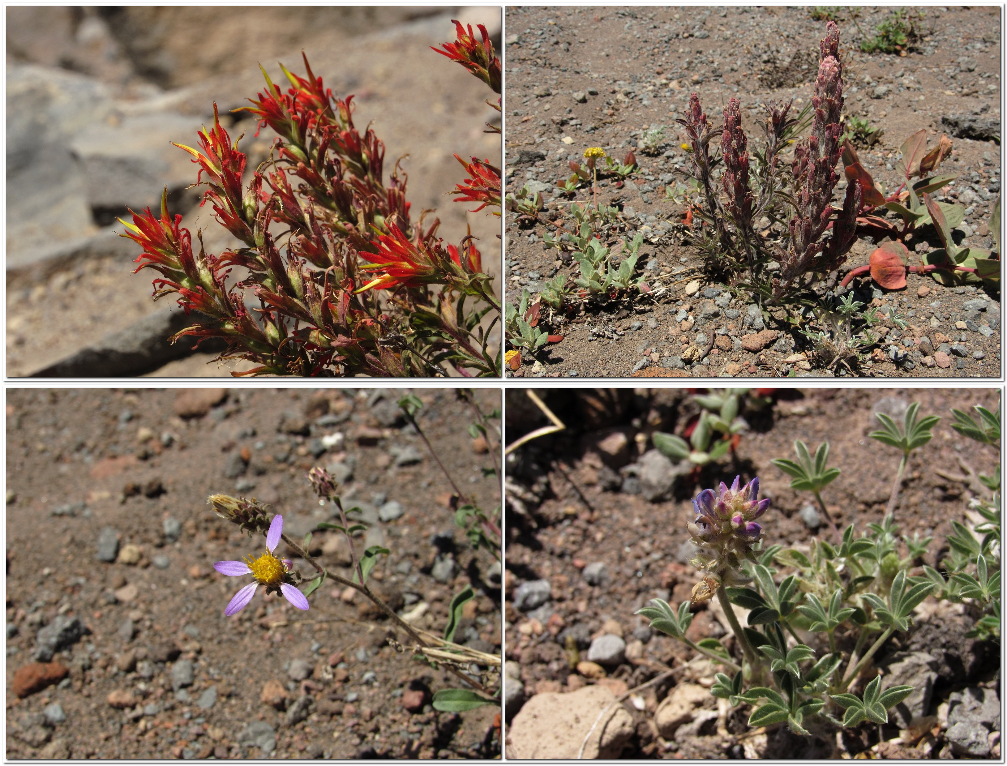
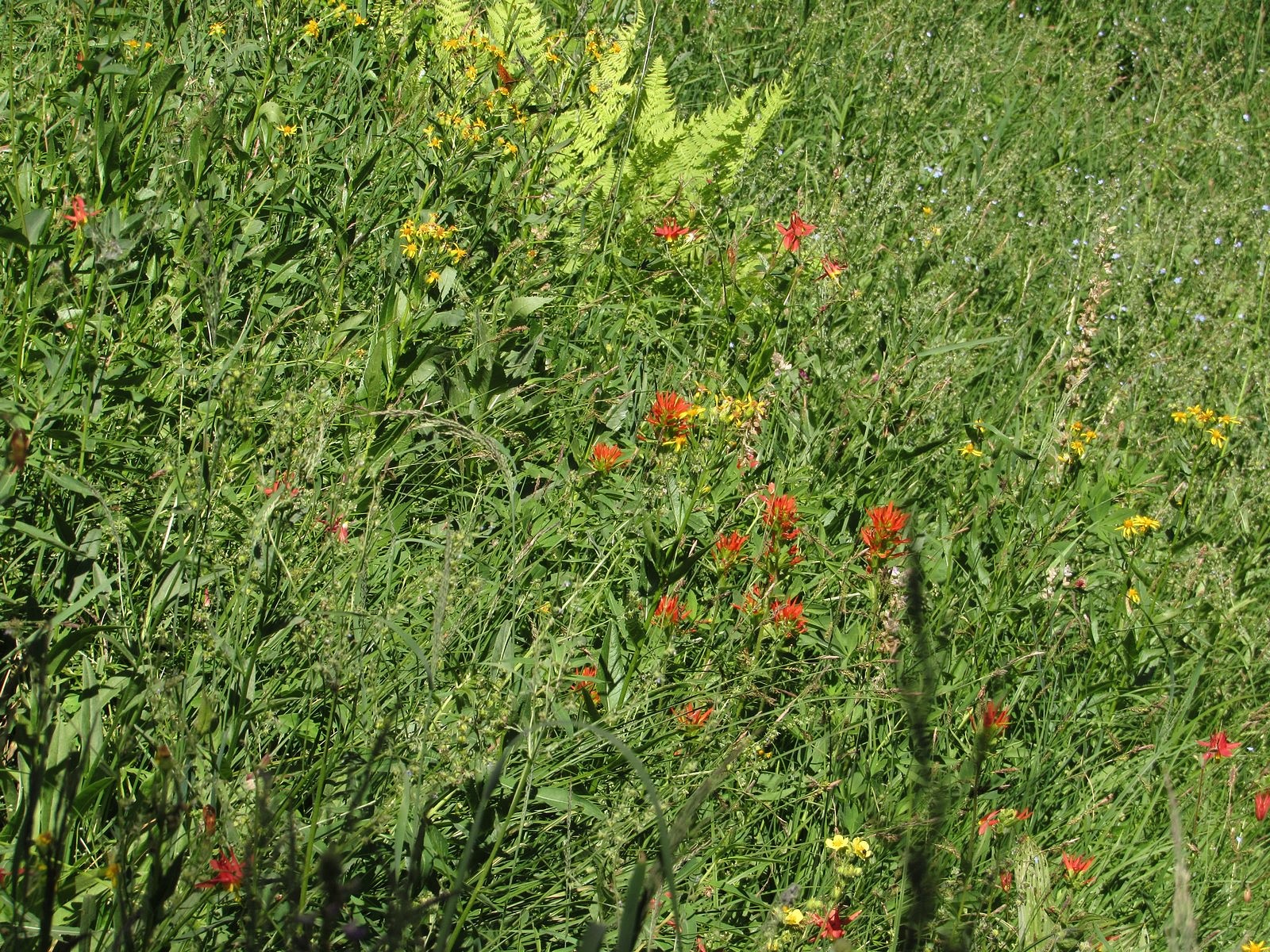
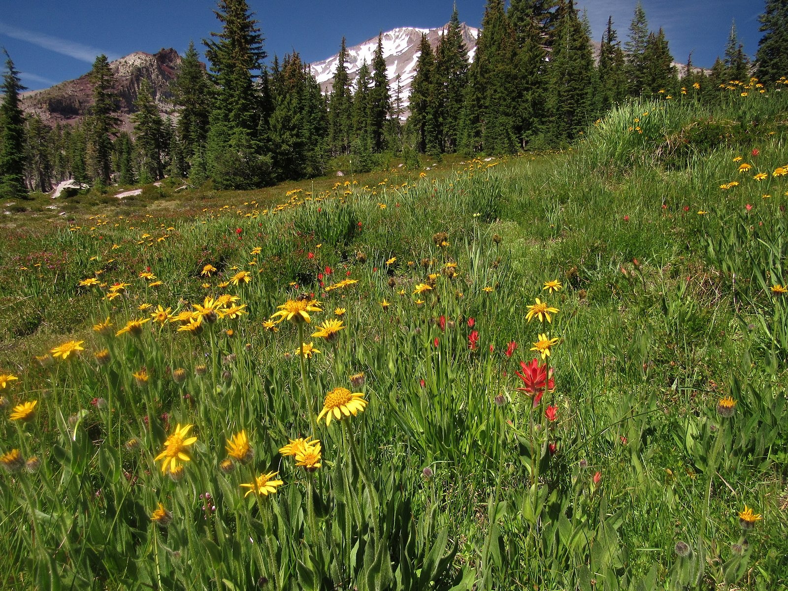
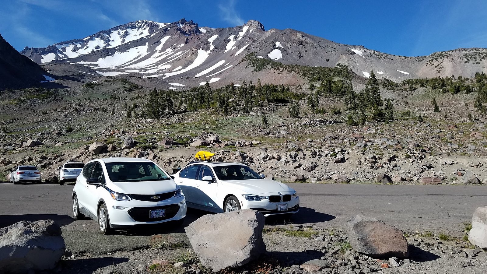
Thursday was our only available day for hiking, and we needed to get to the weekly Medford farmers’ market that same day, so we got a late start, leaving for Shasta around 9:30 AM with the Bolt’s range already down six miles due to the drive to and from the market. That, lunch, and a fifteen-minute construction delay on a back road that was theoretically supposed to save us some range meant that we didn’t reach the Panther Meadows trailhead until noon. Surprisingly, given the beauty of the day and the popularity of the mountain, we found the parking lot only 3/4 full. The meadows were gorgeous, full of red paintbrush and yellow arnica, with the white and brown bulk of the snow-streaked mountain looming over them like a protective spirit. A scatter of smaller flowers and a dance of mountain water – Panther Creek runs down the center of the meadows – made joyous companions on our walk, stretching it somewhat longer than originally intended.

Arnica and paintbrush in Upper Panther Meadow.
Flowers in the Panther Meadows. Clockwise from top left: tinker’s penny, alpine willowherb, three-leaved lewisia, cobwebby paintbrush (with bumblebee).

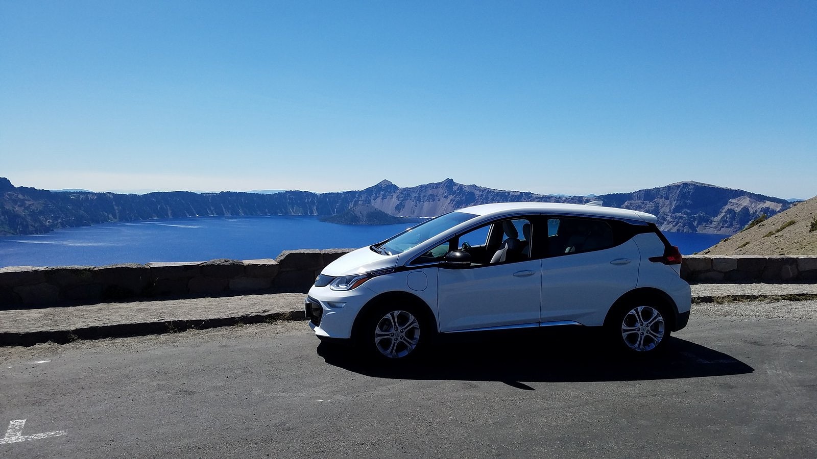
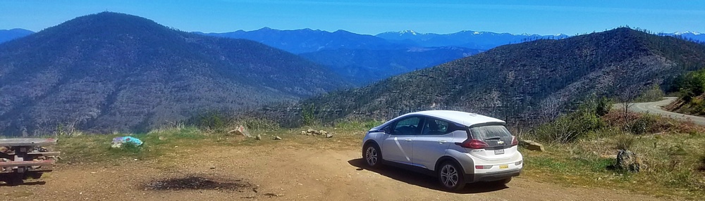
We were back in the car by a little after two, driving on up the highway to the big parking lot at its end. Before turning off the motor, I made a mental note of the range and battery indicators. 98 miles left on the GOM – 34 kwhs of juice used up, four kwhs past the midpoint of the 60-kwh battery. We were 101 miles from home and had 26 kwhs left to get there. Hmmmm. Since we would also be dropping more than 6,000 feet, I wasn’t really worried; but I do have to admit to a certain curiosity about how it was all going to work out.

The Bolt keeping company with a BMW in the Old Ski Bowl parking lot.

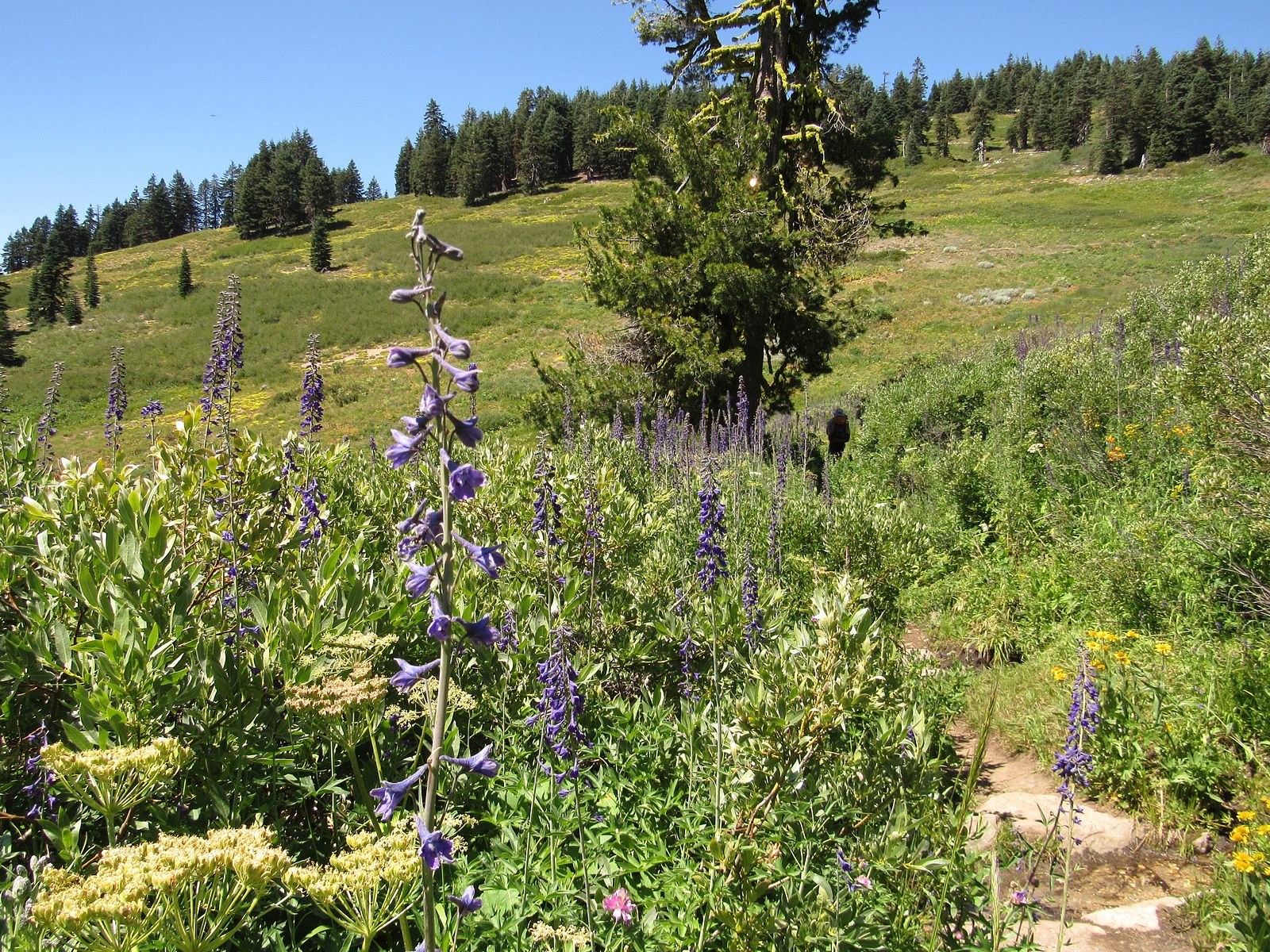
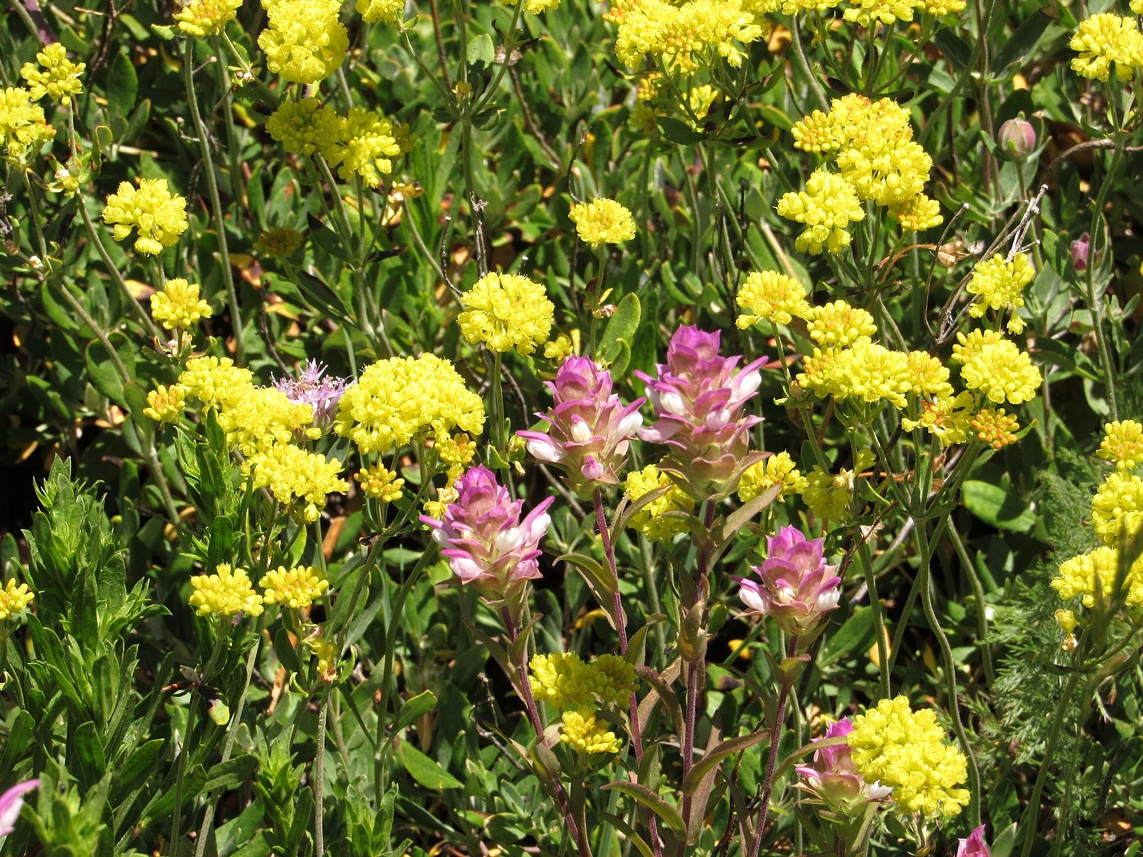
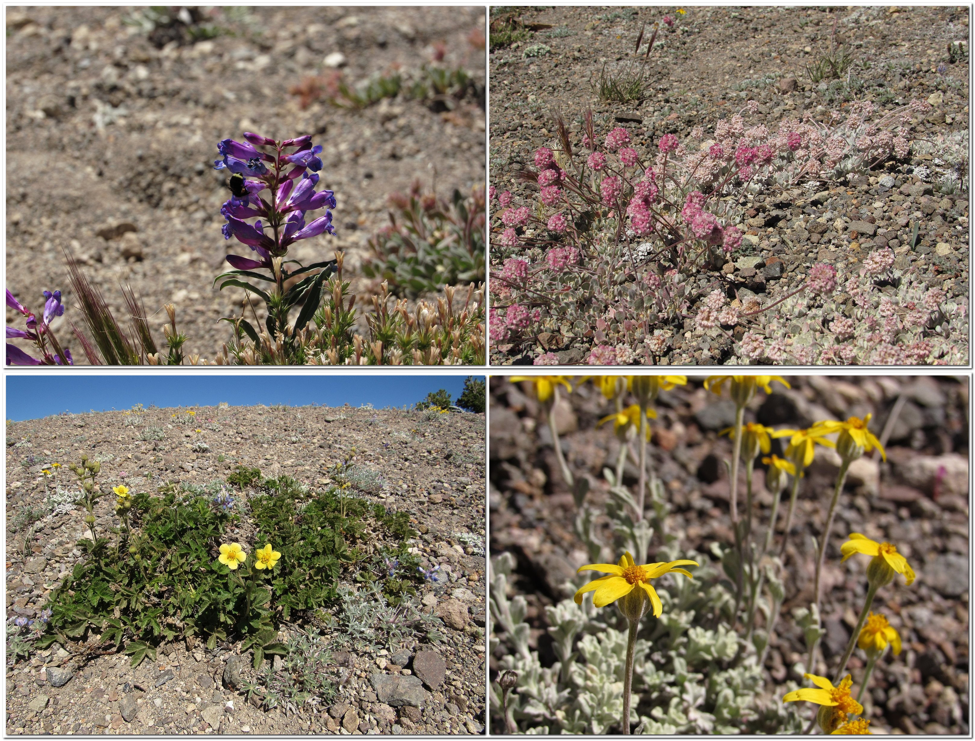
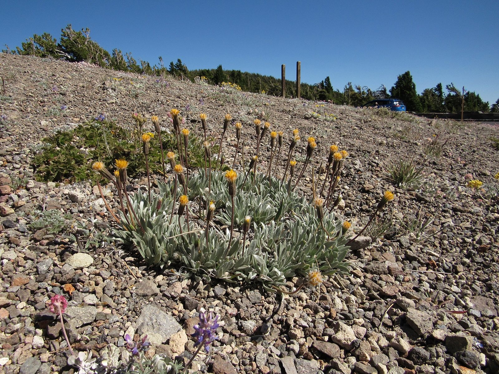
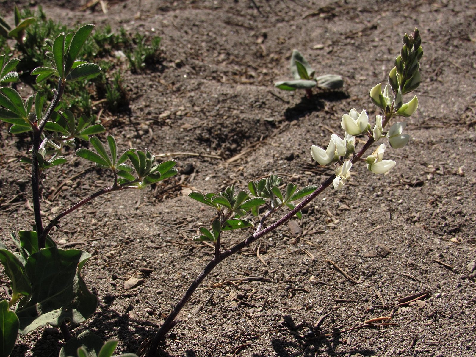
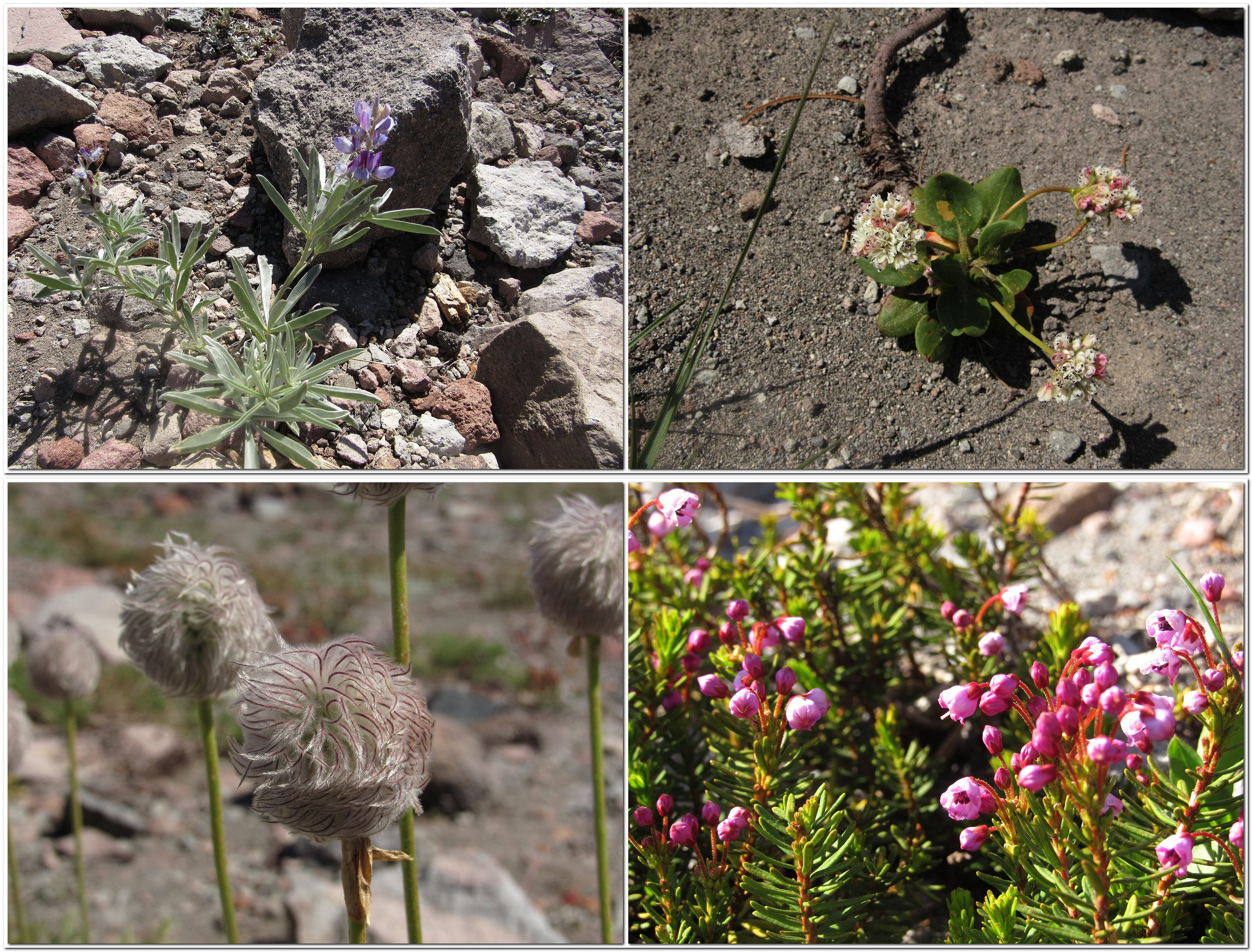
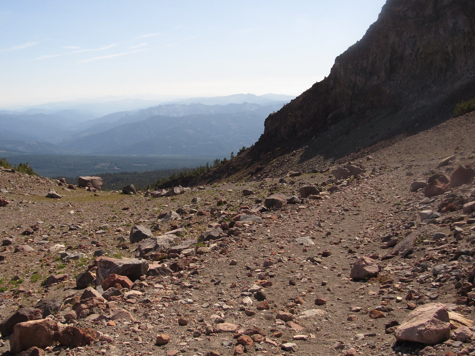
We were on the Old Ski Bowl trail for most of the rest of the afternoon. All of that trail lies essentially above timberline. The only trees are in widely scattered, tight little groves, and they grow increasingly smaller and scarcer as you ascend; by the time we reached our turnaround point, the only “trees” left had been beaten down to knee-high krummholz by the altitude and the weather. You walk on loose volcanic rock up there, with occasional patches of sand. Surprisingly, perhaps, there are quite a few flowers; but they are almost all different species from the ones down in the meadows. Coyote mint, and pussy’s paws, and a species of lupine I couldn’t quite identify. Several buckwheats, including the malodorous and well-named “dirty socks”. Large numbers of tall western pasqueflowers, past bloom and showing off the tousled, hairy-looking round seedheads that give them their other common name – “old man of the mountains”.

Flowers along the Old Ski Bowl trail. Clockwise from upper left: lupine, dirty socks, heather, western pasqueflower.

At 9200 feet, the trail disappeared beneath a steep snowbank. Ten years ago – probably even five years ago – that wouldn’t have stopped us; but at 77 and almost-77, we have grown more cautious. It was already after 4:00. Conveniently, the back end of the loop started just a few feet back from the snowbank. We turned onto it and started down.

Starting the descent, along the base of Green Butte (R)
A mini-meadow at 9000 feet on Mt Shasta.

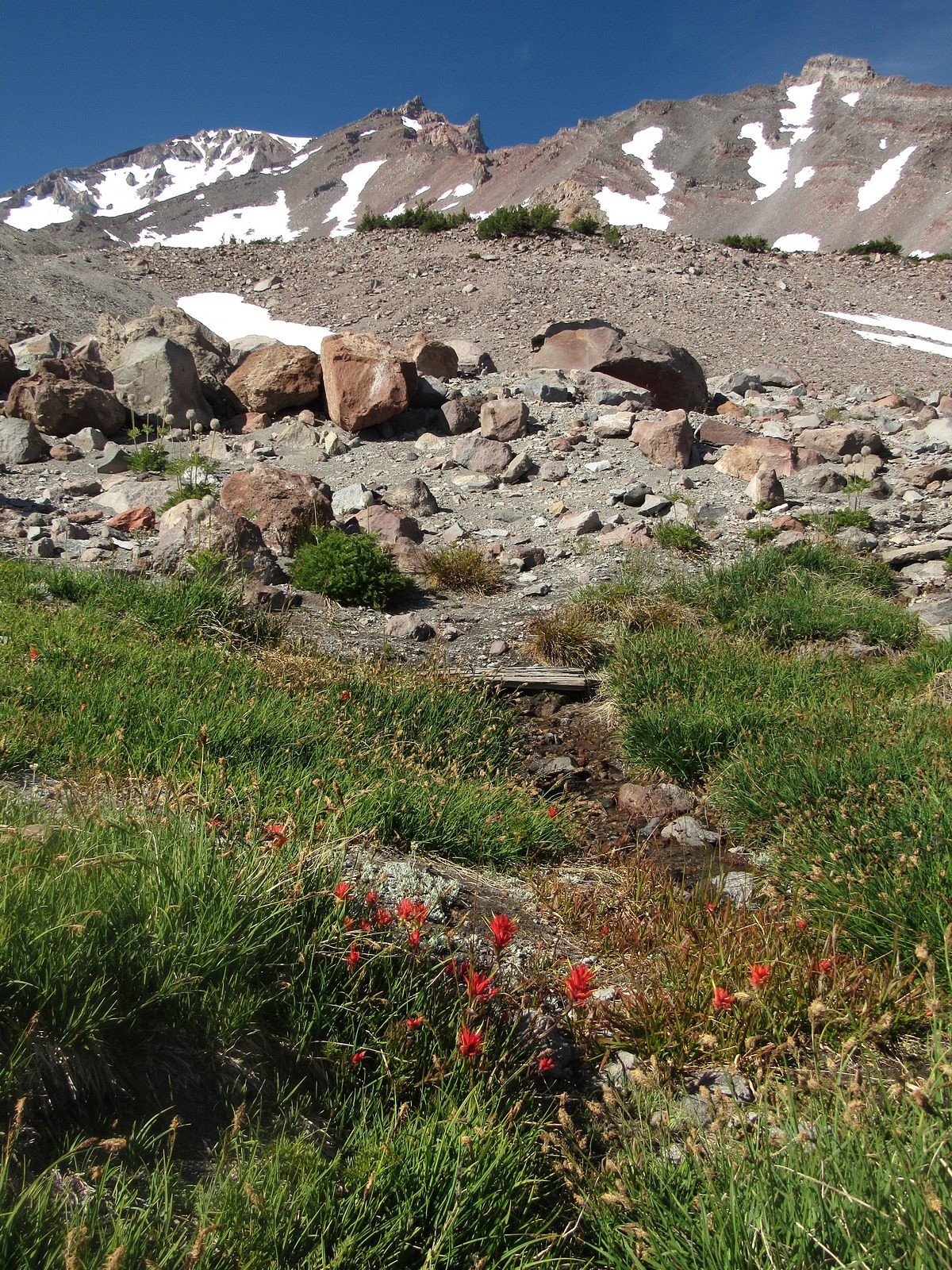
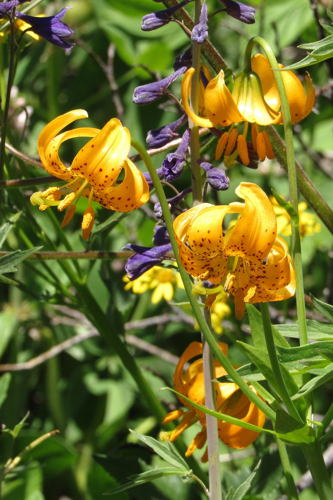
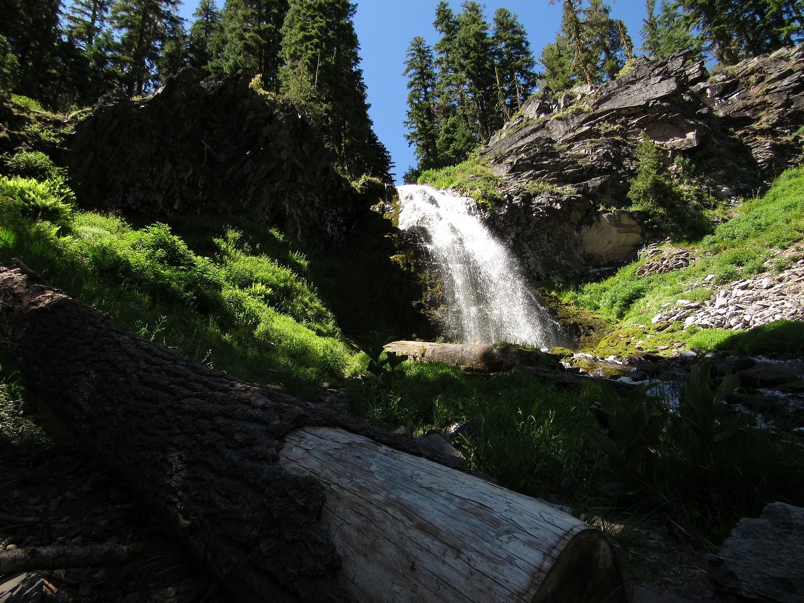
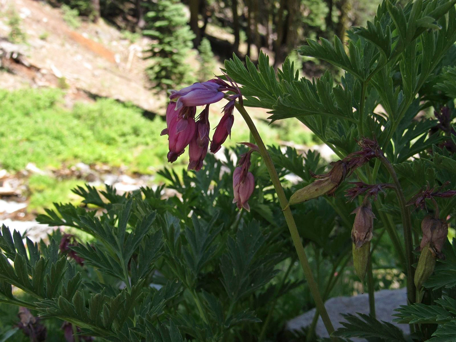
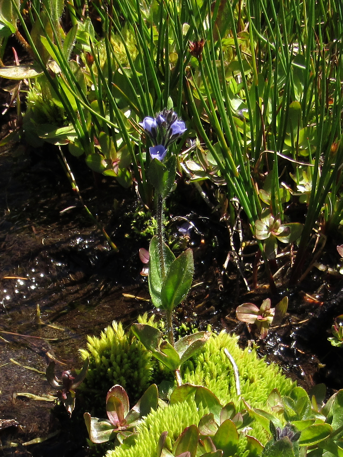
A few hundred yards below the junction, the mountain worked a bit of magic: we came over a small lip and there, just below the edge, was a small circle of springs and a streamlet, just a few inches wide, flowing from them down the steep mountainside. The springs and the streamlet supported a tiny meadow, and the meadow was full of meadow flowers – paintbrush mostly, though there was also heather and monkey flower and a smattering of others. That high, and that close to its underground source, the water seemed certain to be potable. I pulled the 110-year-old collapsible aluminum drinking cup that once belonged to my grandfather from my waist pack and stuck it beneath a tiny four-inch “waterfall” a few feet below one of the springs. Our family name for this is “earth juice”. It was transparent, and ice-cold, and tastier than plain water anywhere has any right to be.

We were back at the car by a little after 5:00. I left the central dashboard screen on its kilowatt-hour display so we could watch regeneration feed the battery during our descent: it had climbed three kwhs by the time we reached Mt Shasta City, 12 miles and 5,000 feet down, and the GOM now read 134 miles. We would get home. A quick supper at a fast-food place and we hit the freeway, watching the sun drop toward and eventually behind the Klamath Mountains. It was almost exactly 8:00 when we pulled into the driveway. The Bolt’s gauges showed 16 kwhs in the battery and 48 miles of range left. The two humans in the Bolt were bone-tired, exalted, and in full agreement with all three of the quotes at the head of this post. I dropped off to sleep that night thinking about earth juice.

Paintbrush at the bottom of the mini-meadow, where the streamlet from the spring trickles to an end.

Peak Bloom

Every sport has its own Grail moment – its own ideal, defining event, which players strive toward and spectators applaud. For golfers, it’s a hole-in-one; for baseball players, a triple play; for basketball players, a three-point shot that hits nothing but net. For surfers, it’s the perfect wave.

For wildflower addicts, it’s peak bloom.

Wiggins’s tiger lily and tower delphinium at a spring in Grouse Gap.

“Peak bloom” is technically defined simply as the time when the most flowers are blooming, but that stark sentence doesn’t begin to capture the term’s nuances. It is different for every place; for a given place, it is different for every habitat; for a given habitat, it is different for every year. A wet year will delay it; a dry year will bring it on early. A rainstorm at the wrong time may defeat it completely. The conditions that trigger blooming can vary dramatically from species to species, so the actual mix of flowers present at peak bloom for a given locality is almost always different each year. Depending on that mix of species, the display may be soft and muted, or it may be a riotous extravaganza of color and form. Or anything in between.

All this is by way of explaining why, only two weeks after our most recent previous trip to Mt Ashland, we were back again last Thursday. The push came from our longtime friend and fellow wildflower fanatic Diane Meyer, via a post on Facebook. Diane had just come back from the mountain with a camera full of pictures. “If you plan to visit Mt Ashland,” she wrote, “go NOW.”

We went. It didn’t hurt that we could do it as a half-day trip, which allowed us to get to the weekly Medford farmers’ market in the morning.

There is not much to say about the actual hike. We left Medford under a heavy overcast that was expected to get heavier, so it was a surprise to find the mountain basking beneath blue skies decorated by little puffy clouds. We parked the Bolt at the Mt Ashland Campground, dropped down the hill to the Pacific Crest Trail, and followed it around to the trailhead just off Road 20 in Grouse Gap; from there we climbed cross-country to the long, rocky ridge that juts west from Mt Ashland at the Rabbit Ears – picked up the mountain-bike trail along that ridge – took the trail back to the Mt Ashland summit road – and walked the road back to the car. Total distance was a bit over three miles, not much by our standards. The flowers on the ridge were disappointingly far past peak (remember what I said about different habitats?). The flowers in the Grouse Gap meadow system were….well, prepare yourself, and then check out the pictures.

Along the Pacific Crest Trail in Grouse Gap.
Along Road 20 near its junction with the Mt Ashland summit road.
Tower delphinium along the Pacific Crest Trail in the Grouse Gap meadows.
Mt Shasta across a field of Alice’s fleabane in Grouse Gap.
Clockwise from upper left: coyote mint, monkshood, orange agoseris, Oregon checker mallow.
Sulphur flower and Siskiyou owls’ clover.
The Grouse Gap meadow system, from the Mt Ashland summit road. Sulphur flower overrunning just about everything in sight.

Deep Blue Lake

Wizard Island from the overlook at the junction of Rim Drive and the North Entrance Road.

ON July 31 – the day before I was due to turn 77 – Melody and I spent a full-day touring Crater Lake National Park. We’re lucky to live less than 80 miles from this spectacular park, whose creation year (1902) puts it among the oldest national parks in the world, and we’ve been going there several times each year since 1970. We haven’t tired of it yet. I don’t think we ever will.

This particular trip was primarily planned because smoke from the Milepost 97 fire near Canyonville, Oregon had made the air unhealthy in many of the places we usually go, but had largely bypassed Crater Lake. But I’ve also been wondering, ever since we got the Bolt, how it would fare on a full Crater Lake day. We’d taken it to the Rim Village overlook and back (see https://drivingonsunlight.net/2019/05/06/the-story-so-far/), but the park includes much more than Rim Village. There is a road – Rim Drive – all the way around the rim of the caldera that holds the lake, with side roads to several other points of interest, including one of the highest spots reachable by car in the entire state of Oregon. Since buying the Bolt in December, I’ve preached that an EV is perfectly adequate for all uses anyone would normally put a car to. Taking Rim Drive its entire length, plus as many of the side roads as we could fit into one day, would add many extra miles over our previous visit; but for outdoor enthusiasts such as us, it would certainly qualify as “normal use”. How would the Bolt’s battery hold up?

So let’s deal with that question, first. We left home with less than a full battery – we usually charge to 95% instead of 100% (there are reasons), and I forgot to make my usual adjustment for longer trips. I drove the 72 highway miles between Medford and Crater Lake as I have always driven them, a few miles over the 55 mph speed limit, with bursts up to 75 and a bit over for passing out-of-state tourists gawking at the big trees. We covered almost every road in the park (we left out only the road from Rim Drive to the north entrance, and the last few miles of the road to the Pinnacles, neither of which we had time for) – a total distance of 195 miles. We got home with 30% of the battery remaining, and 103 miles left on the range indicator. If you have had any doubts about an electric car substituting perfectly for a gasoline car in all normal circumstances, please lay them aside.

Wall-to-wall flowers in the Castle Crest Wildflower Garden


Otherwise, the trip was a mixed bag. We got to Mazama Village, where we had planned to have brunch, just as the breakfast line was closing. (We were standing by the counter preparing to order when they suddenly announced that breakfast was over and took all the food away. We were the only ones waiting.) The small collapsible tripod I was carrying to try out for flower photos kept pinching me, leaving me with a blood blister on one hand and a cut thumb on the other. I left my camera bag behind at one stop (the camera wasn’t in it, so I lost only my spare camera battery and cleaning cloth, but still…). But the scenery and the flowers overwhelmed all of that. Looked back on, it was a simply glorious ten hours. Enjoy the pictures. You can follow the course of our day in the captions.

Melody enjoying the view of the lake from the upper floor of the snack bar/gift shop in Rim Village. We put together a brunch from the snack bar and ate it here, looking out over the lake.
We took Rim Drive counter-clockwise, which put us at the Castle Crest Wildflower Garden first. This is not a tended garden, just a trail past a set of springs emerging from the base of Castle Crest. The upper picture is Lewis’s monkey flower; the lower is a white bog orchid. See also the picture inset into the last paragraph of the text.
Vidae Falls – our next stop.
The short trail to Sun Notch is probably my favorite in the park, and leads to a wonderful view of the lake. This is Applegate Peak from the Sun Notch meadow. The rim is marked by the line of trees at right.
The lake from Sun Notch, with the Phantom Ship front and center. You can see why the first Europeans to stumble upon the place, in 1853, named it Deep Blue Lake.
Where the Rim Drive crosses Dutton Ridge a mile or so beyond the Sun Notch parking area, it reaches its highest point (though not the highest point reached by road – keep reading). The flowers here are characteristic of alpine and subalpine areas. Clockwise from upper left: Applegate’s paintbrush, pumice paintbrush, dwarf mountain lupine, Cascade aster. Pumice paintbrush is found only high on volcanic peaks in the Cascade range.
Plaikni Falls is the destination of a relatively new trail off the side road to the Pinnacles, east of the lake. The flowers here are similar to those found at Castle Crest.
The red flowers here are of two different and unrelated species, western columbine and scarlet paintbrush. The yellow is arrow-leaf groundsel; the blue (upper right corner) is Jessica’s stickseed.
Bleeding heart at Plaikni Falls.
The highest point reachable by road in the park is the Cloudcap Overlook, at the end of a side road from the northeastern section of the Rim Road. Elevation here is 7960 feet. Naturally, I had to get a shot of the Bolt in the parking lot. For an unencumbered look at the view, see the photo at the head of this post.
Flowers at Cloudcap are decidedly alpine. Clockwise from upper left: royal penstemon, cushion buckwheat, woolly senicio, and Ashland cinquefoil, .
Silver raillardella is rare in Oregon; it’s found primarily in the high mountains of California and western Nevada. This one was growing by the Cloudcap parking lot.
Our last extensive stop was at the Merriam Point overlook, at the junction of the North Entrance Road and Rim Drive. It features a stunning view of Llao Rock.
One last flower shot: Anderson’s lupine in its white phase, photographed at Merriam Point.