Deep Blue Lake

Wizard Island from the overlook at the junction of Rim Drive and the North Entrance Road.

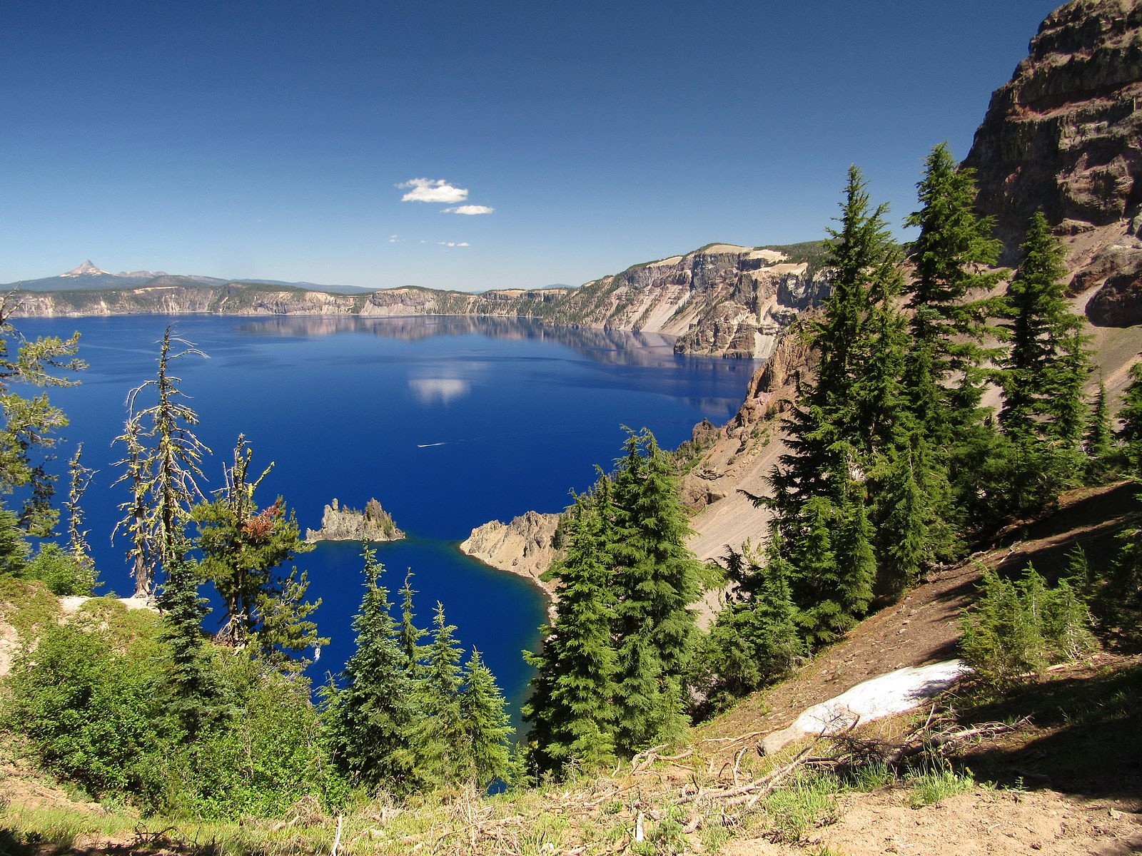
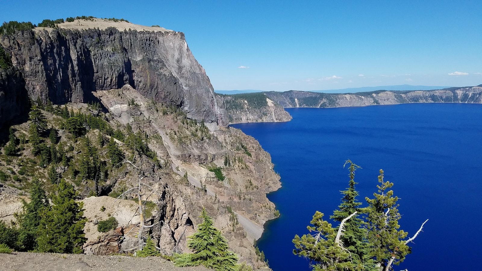
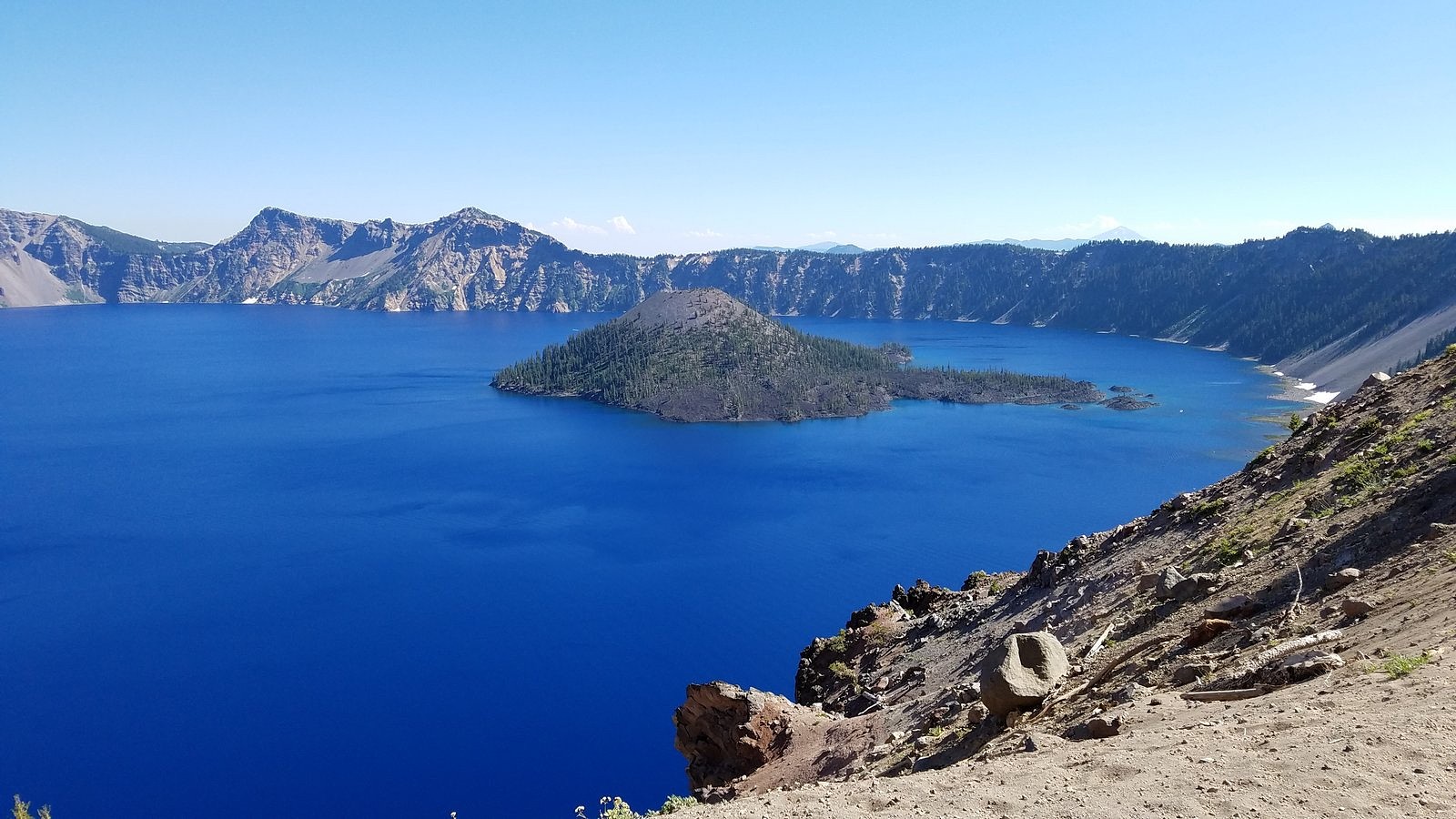
ON July 31 – the day before I was due to turn 77 – Melody and I spent a full-day touring Crater Lake National Park. We’re lucky to live less than 80 miles from this spectacular park, whose creation year (1902) puts it among the oldest national parks in the world, and we’ve been going there several times each year since 1970. We haven’t tired of it yet. I don’t think we ever will.

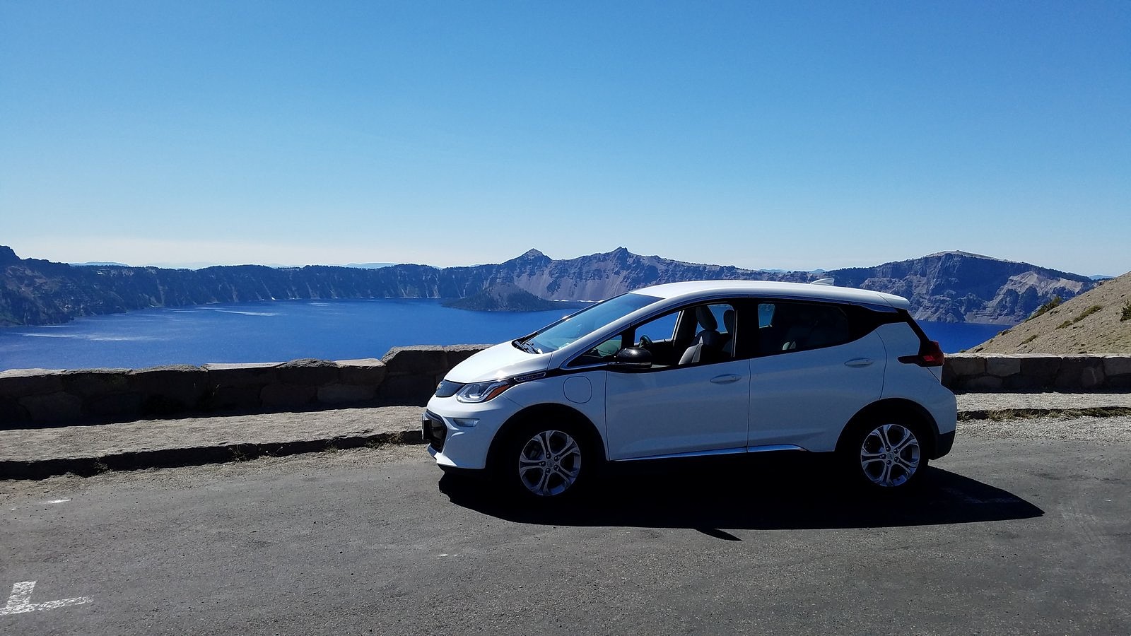
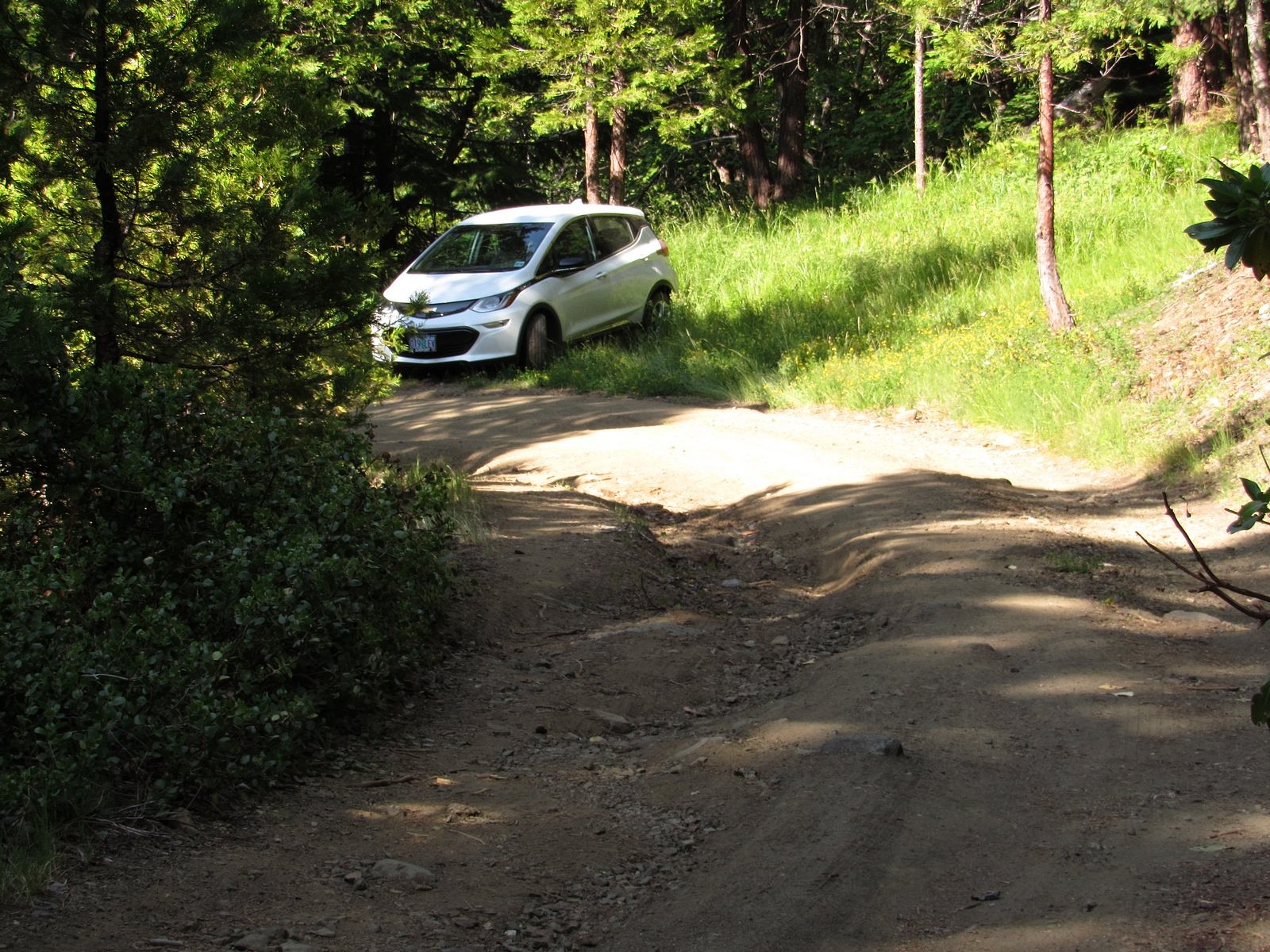
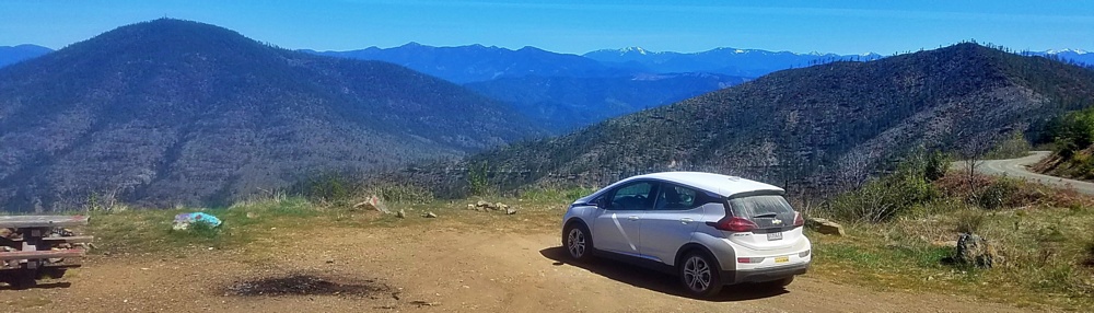
This particular trip was primarily planned because smoke from the Milepost 97 fire near Canyonville, Oregon had made the air unhealthy in many of the places we usually go, but had largely bypassed Crater Lake. But I’ve also been wondering, ever since we got the Bolt, how it would fare on a full Crater Lake day. We’d taken it to the Rim Village overlook and back (see https://drivingonsunlight.net/2019/05/06/the-story-so-far/), but the park includes much more than Rim Village. There is a road – Rim Drive – all the way around the rim of the caldera that holds the lake, with side roads to several other points of interest, including one of the highest spots reachable by car in the entire state of Oregon. Since buying the Bolt in December, I’ve preached that an EV is perfectly adequate for all uses anyone would normally put a car to. Taking Rim Drive its entire length, plus as many of the side roads as we could fit into one day, would add many extra miles over our previous visit; but for outdoor enthusiasts such as us, it would certainly qualify as “normal use”. How would the Bolt’s battery hold up?

So let’s deal with that question, first. We left home with less than a full battery – we usually charge to 95% instead of 100% (there are reasons), and I forgot to make my usual adjustment for longer trips. I drove the 72 highway miles between Medford and Crater Lake as I have always driven them, a few miles over the 55 mph speed limit, with bursts up to 75 and a bit over for passing out-of-state tourists gawking at the big trees. We covered almost every road in the park (we left out only the road from Rim Drive to the north entrance, and the last few miles of the road to the Pinnacles, neither of which we had time for) – a total distance of 195 miles. We got home with 30% of the battery remaining, and 103 miles left on the range indicator. If you have had any doubts about an electric car substituting perfectly for a gasoline car in all normal circumstances, please lay them aside.

Wall-to-wall flowers in the Castle Crest Wildflower Garden


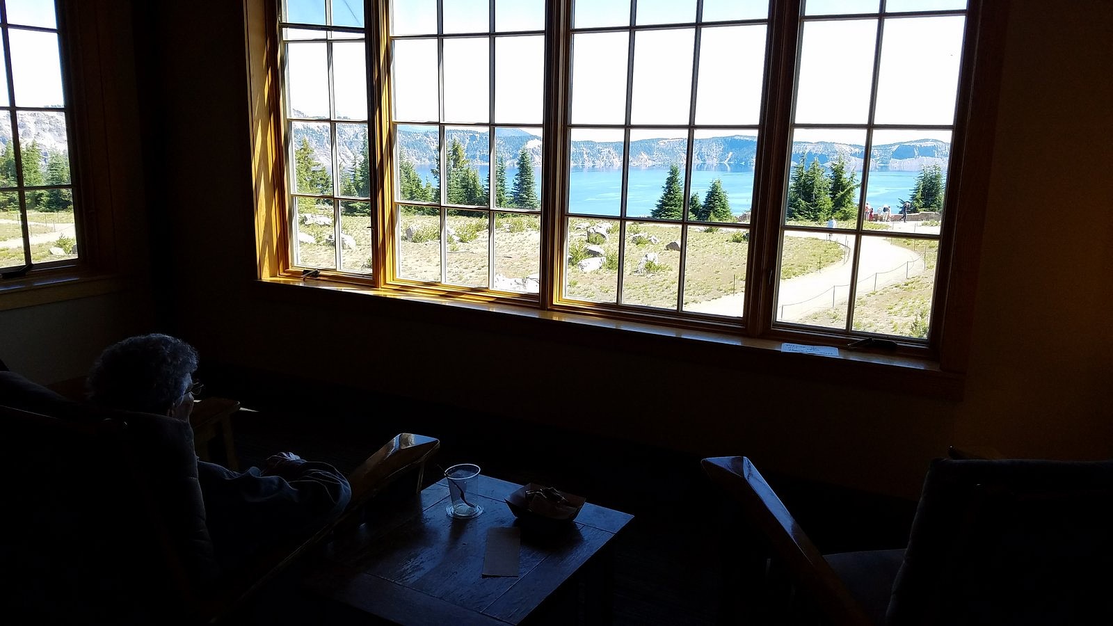
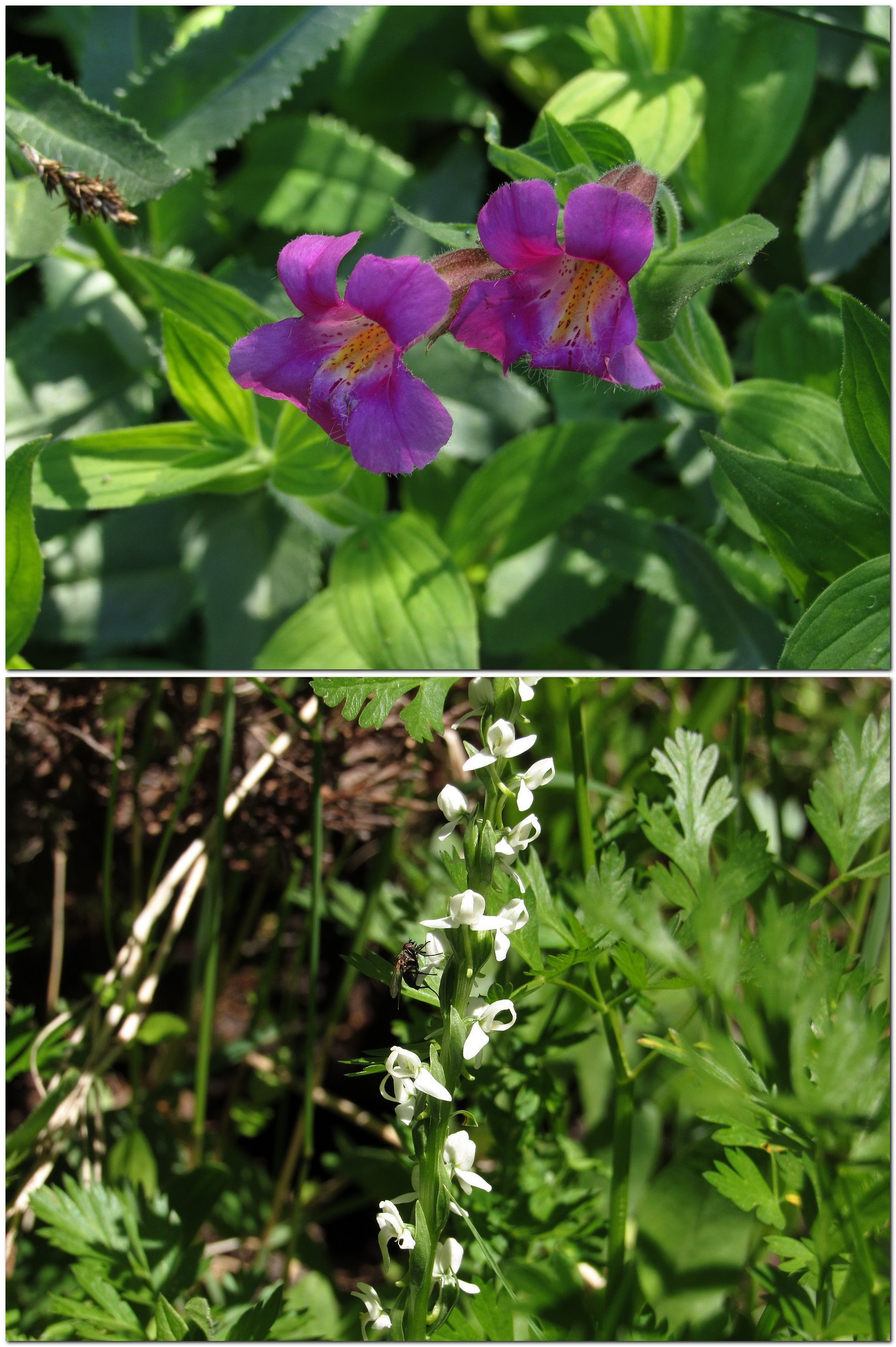
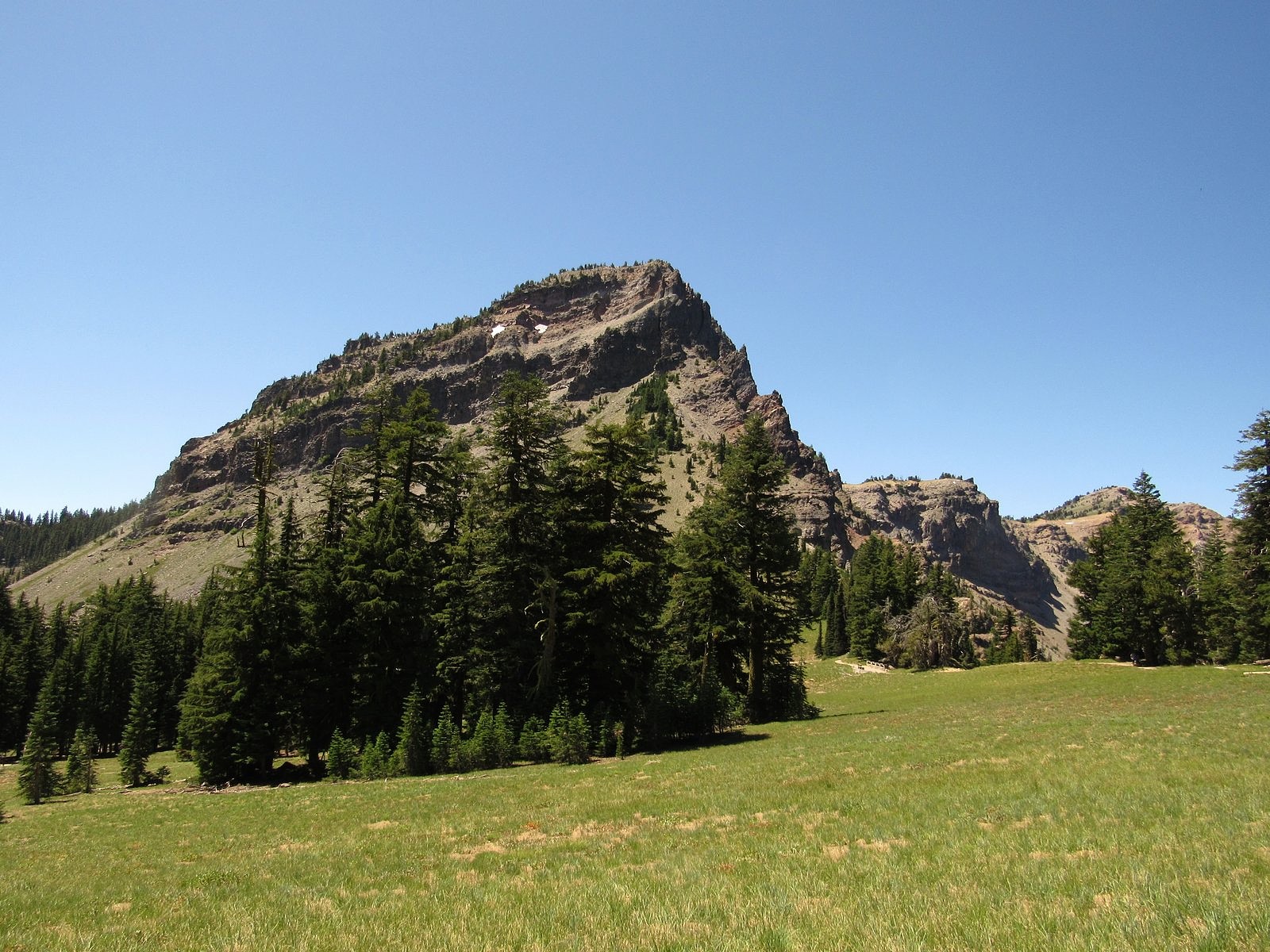
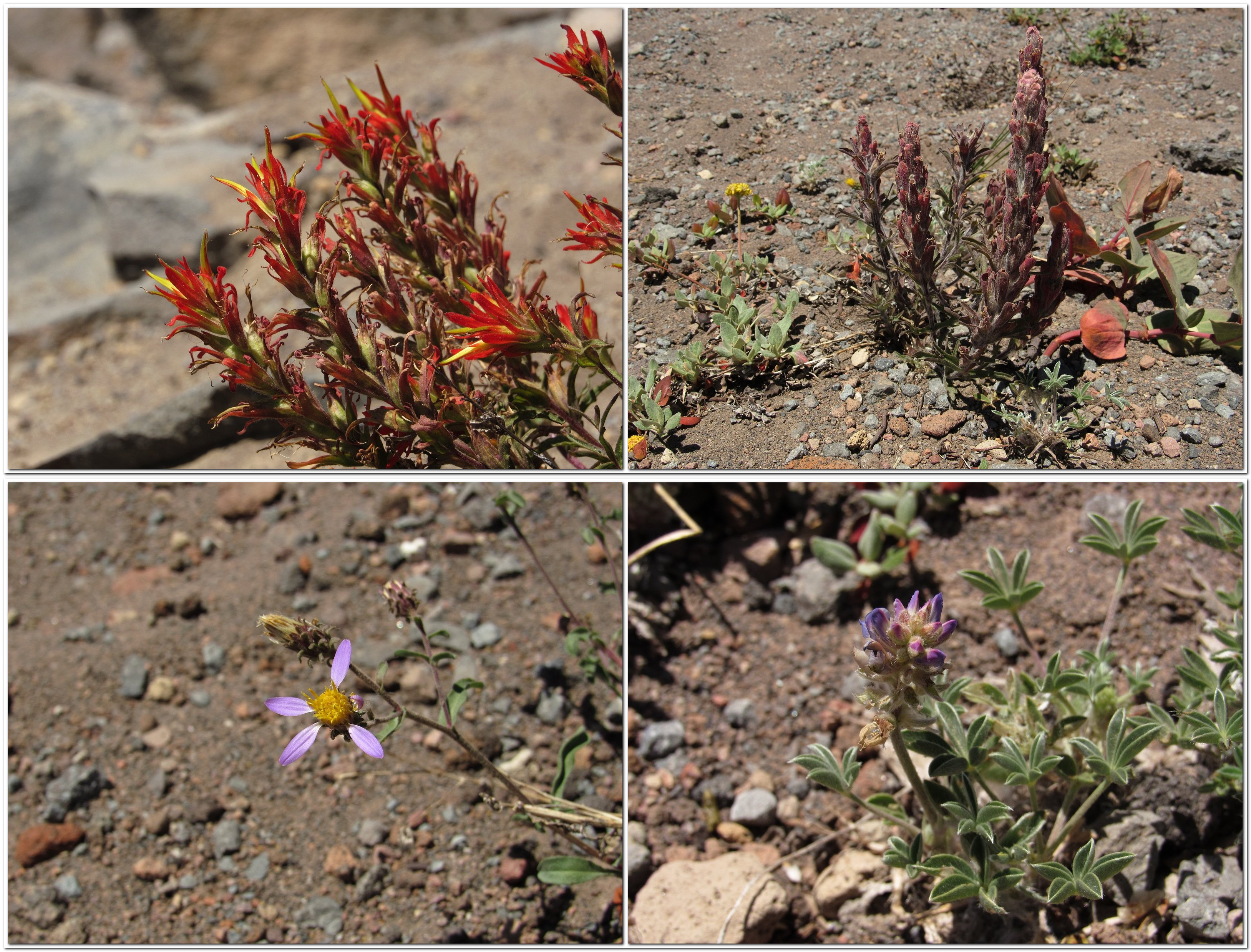
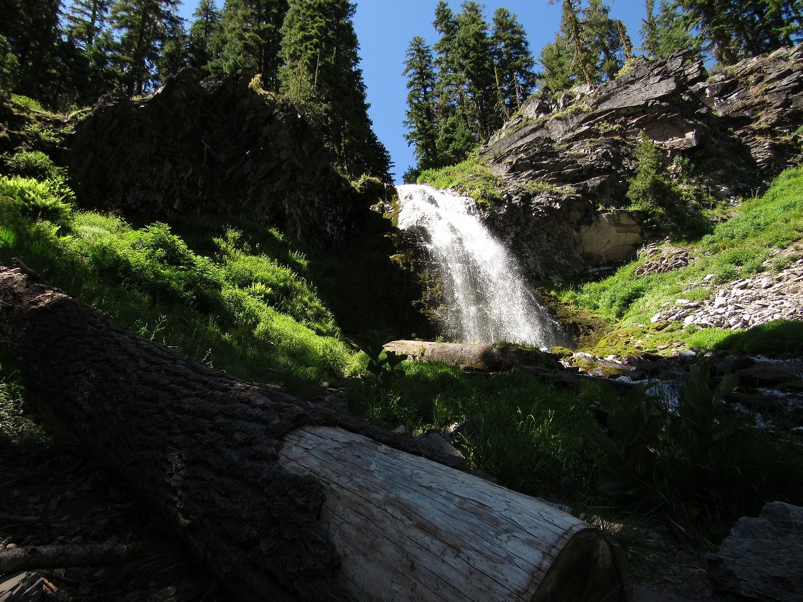
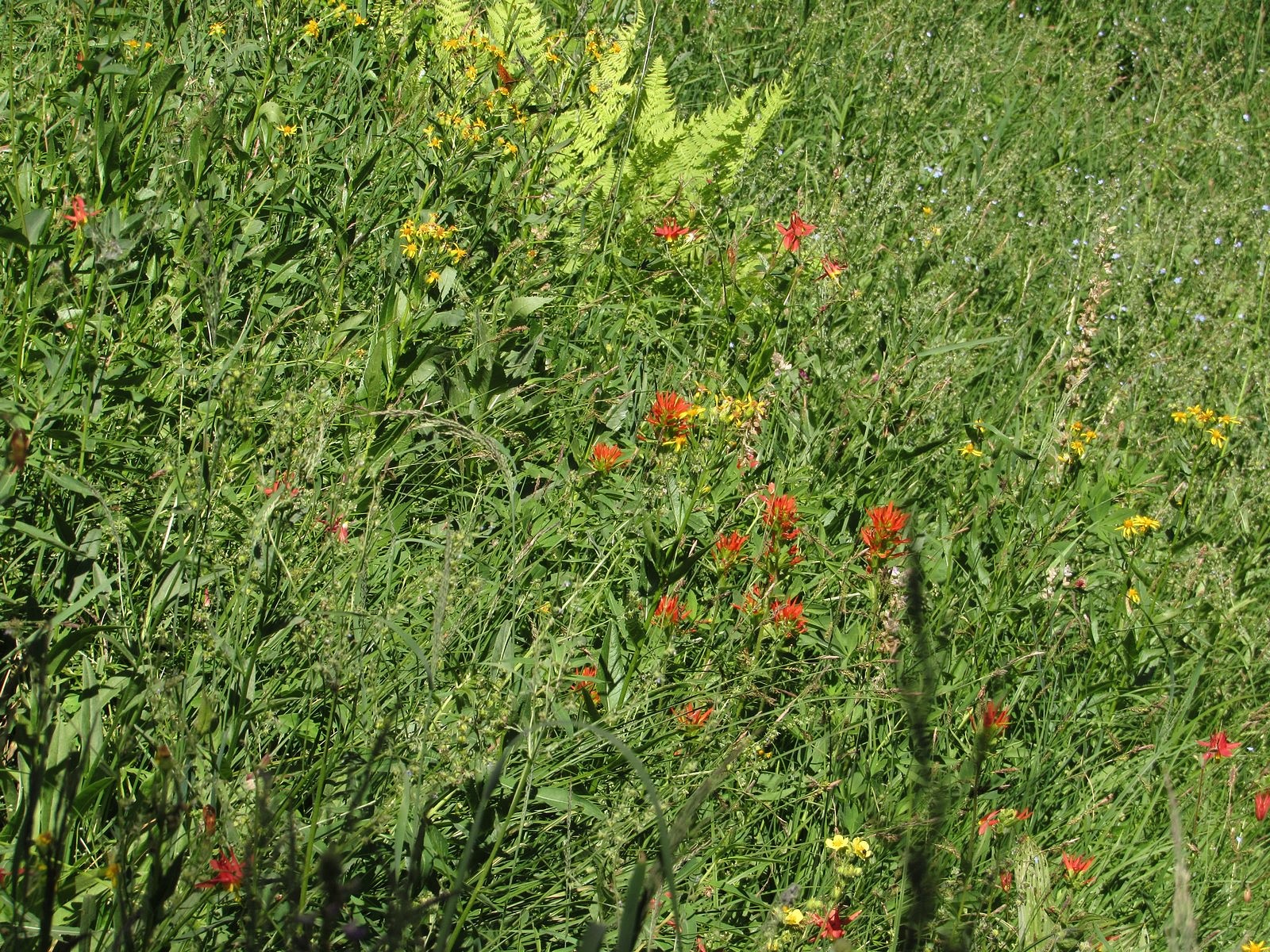
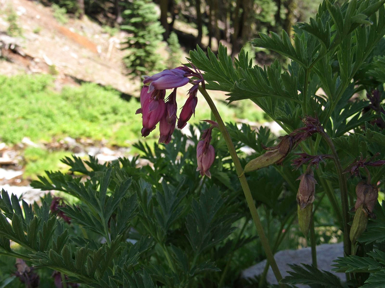
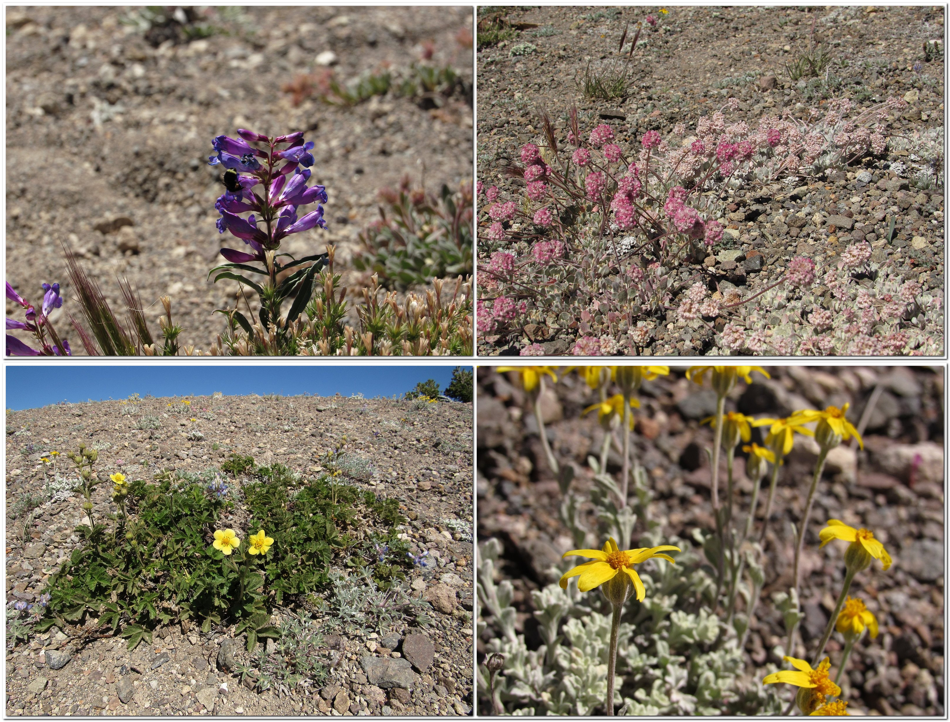
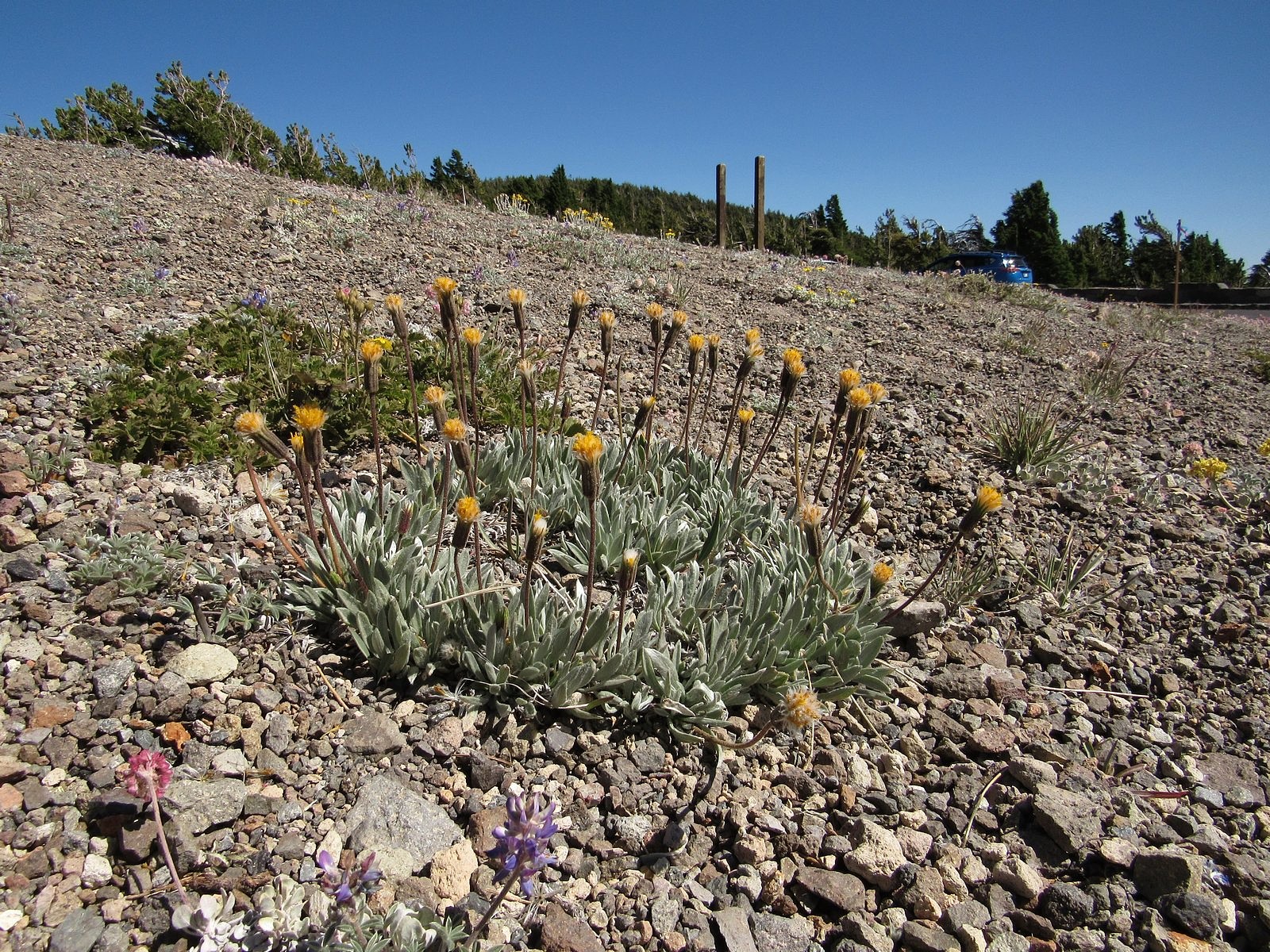
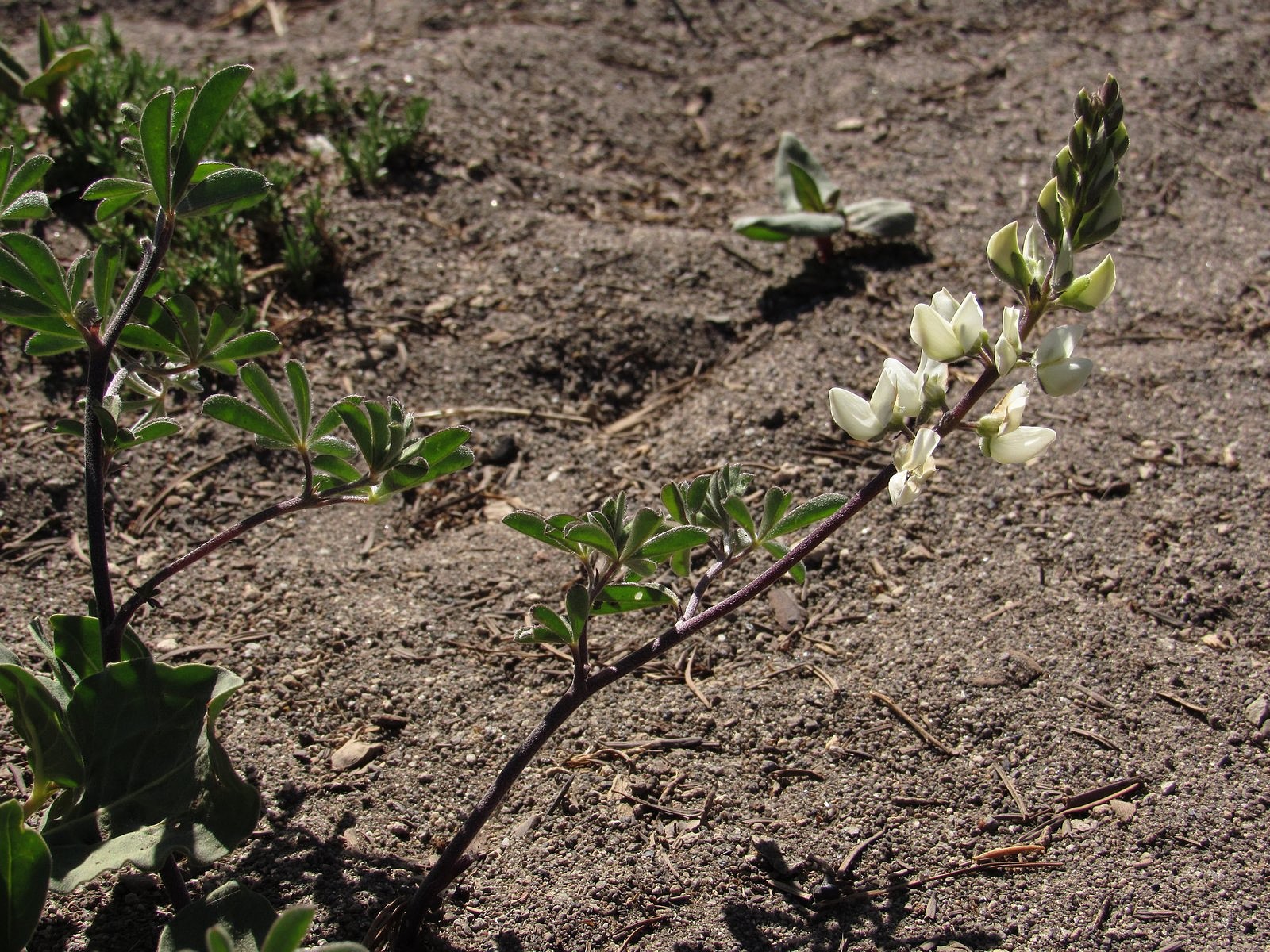
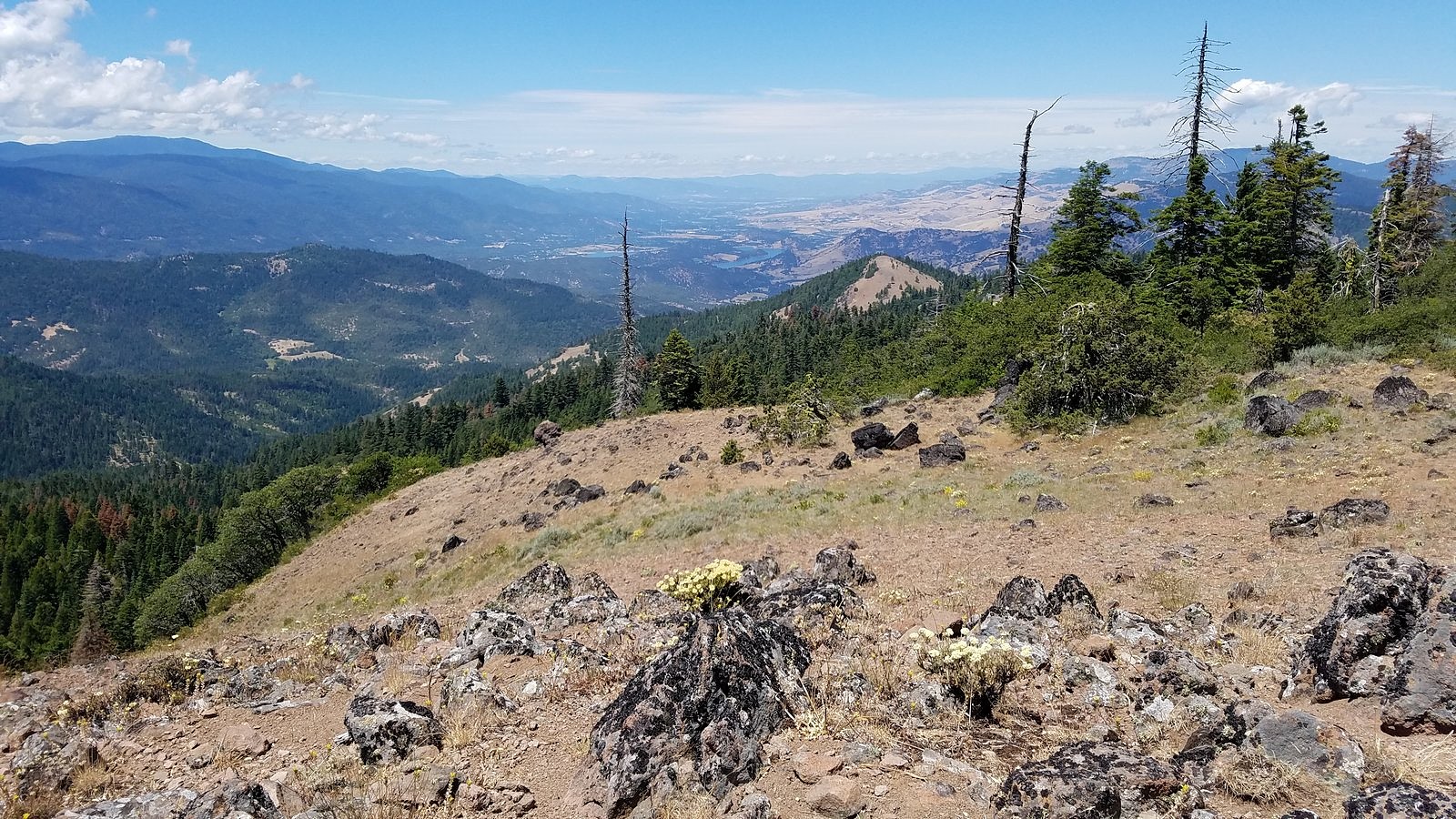
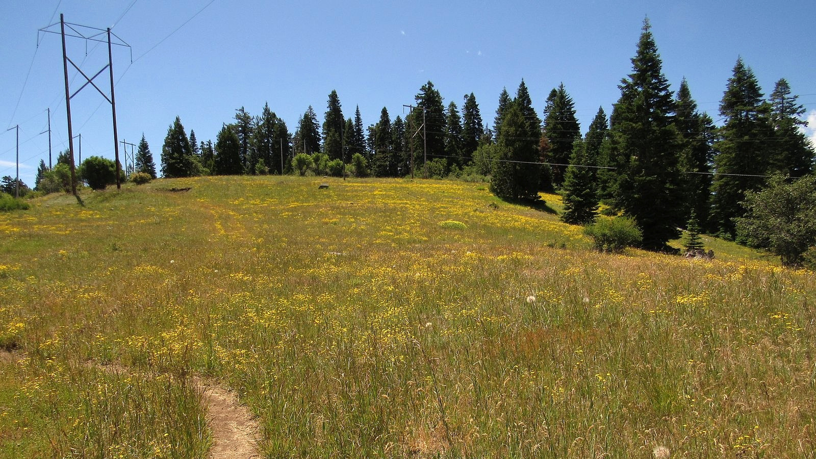
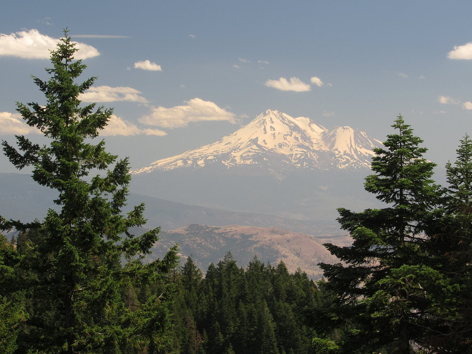
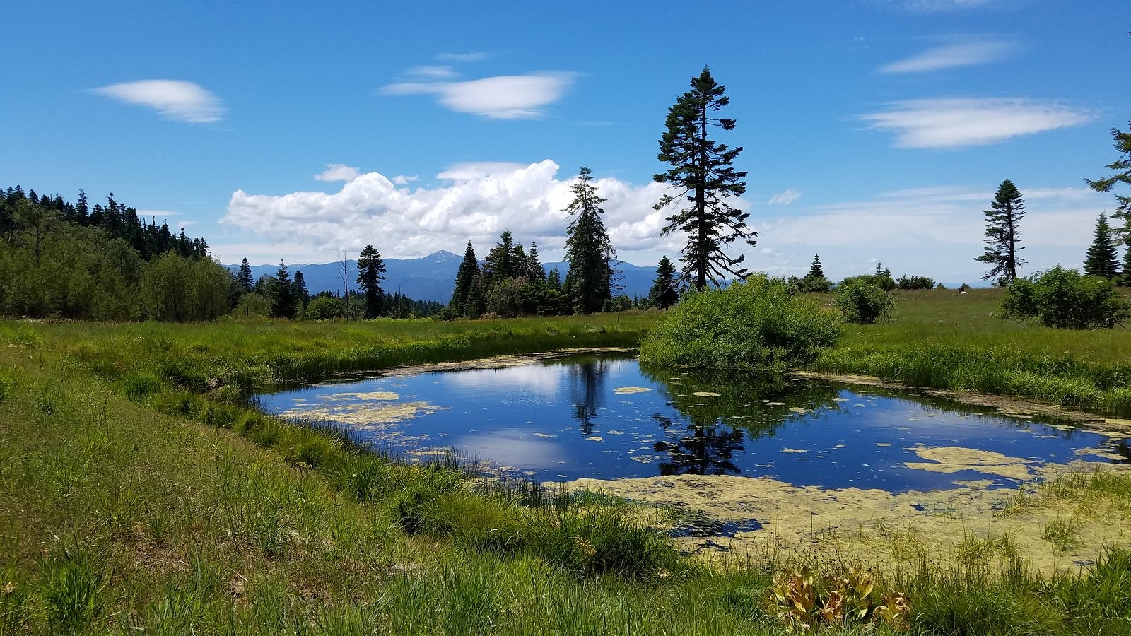
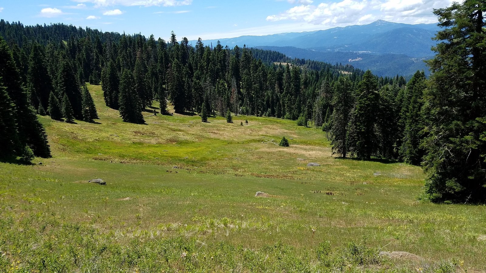
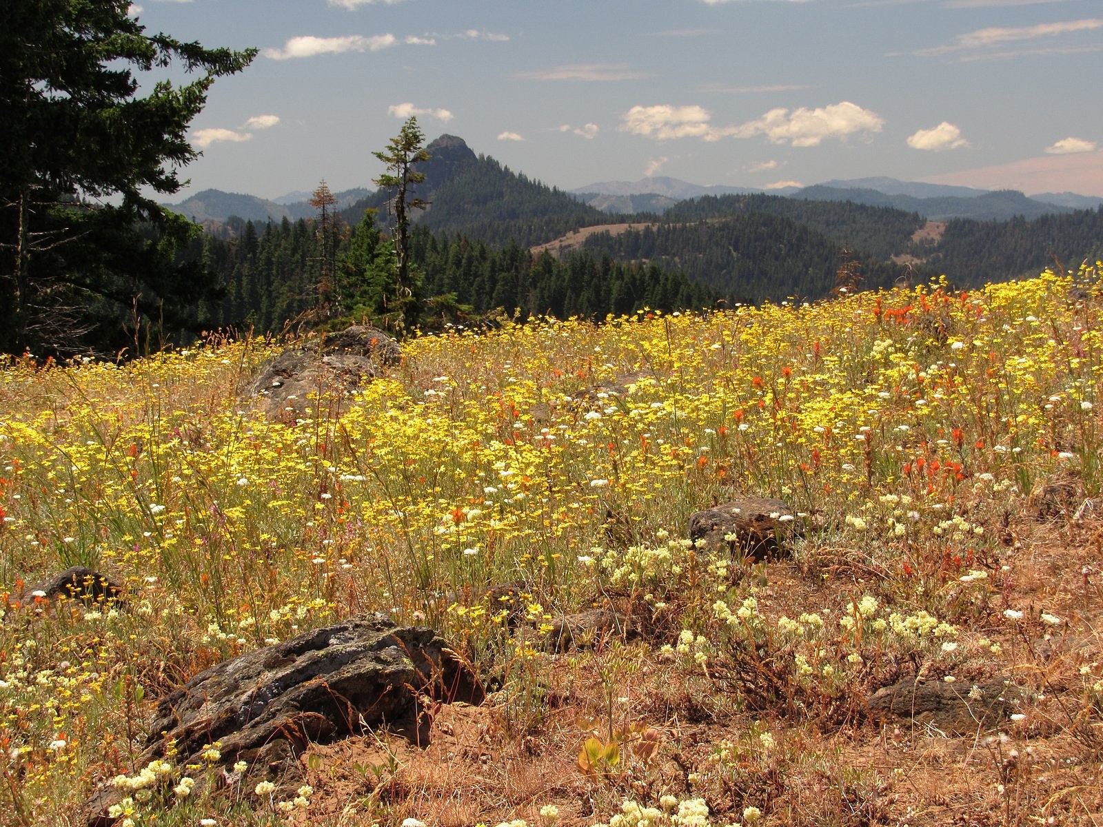
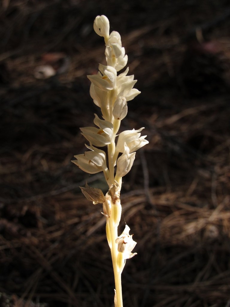
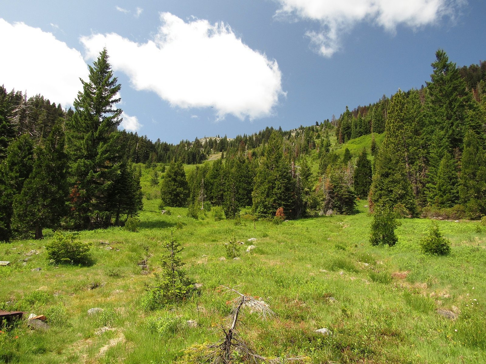
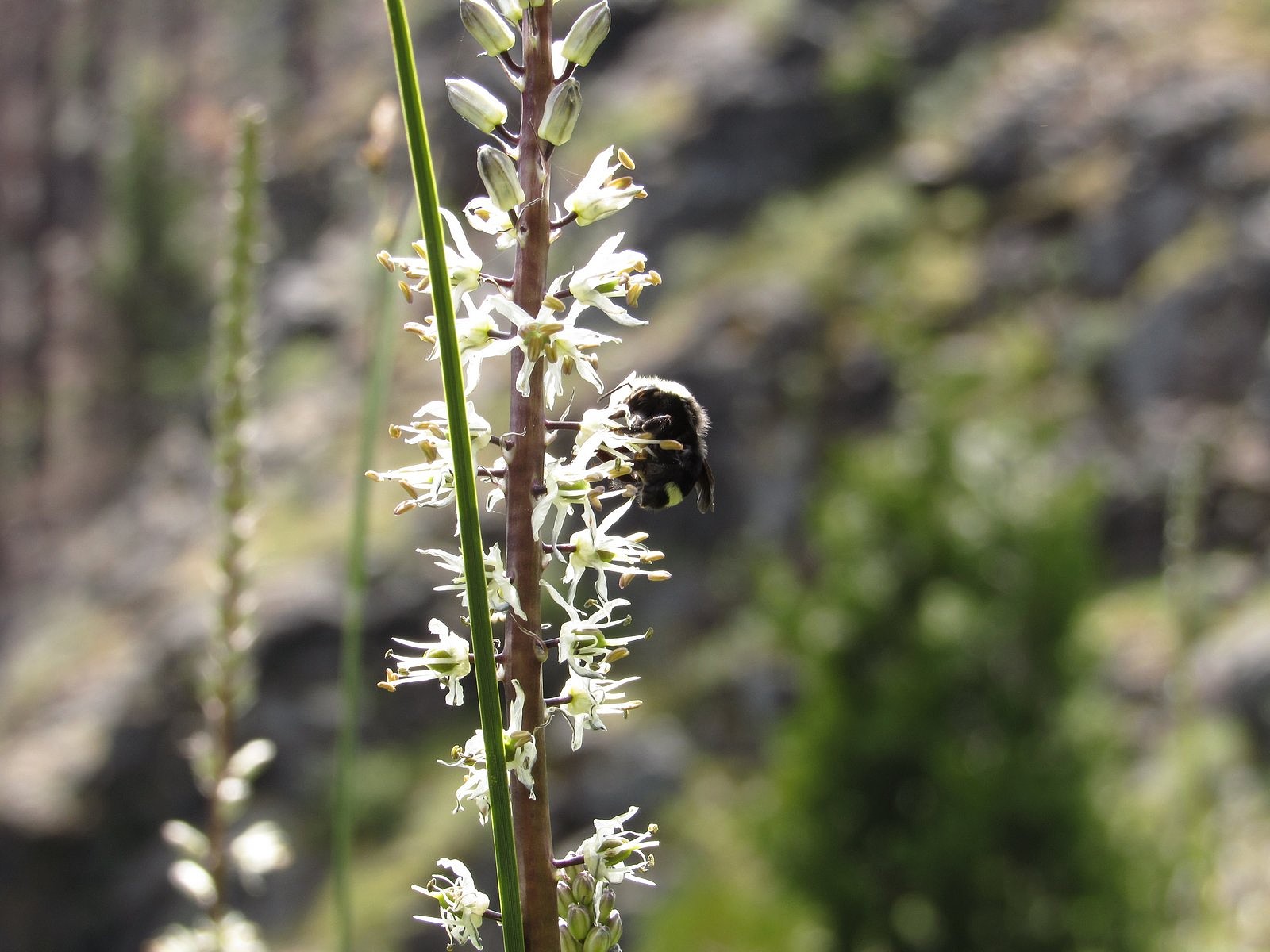
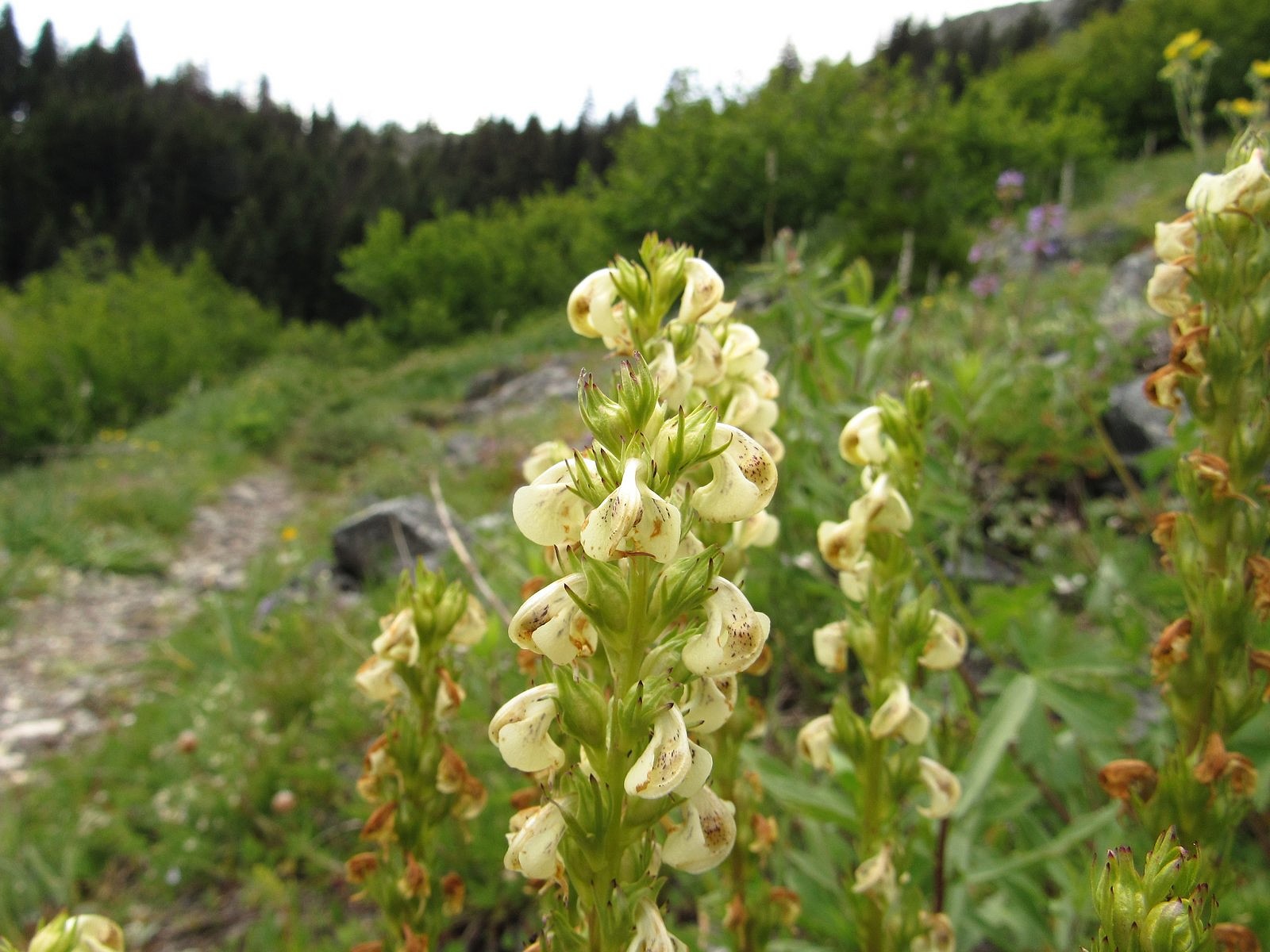
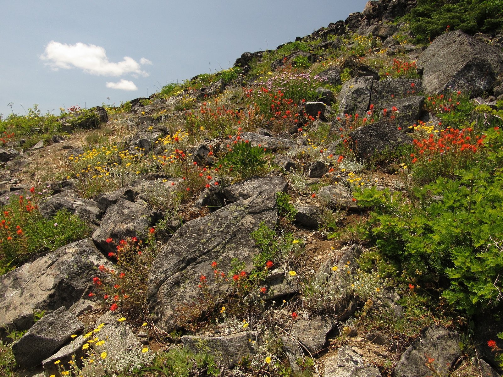
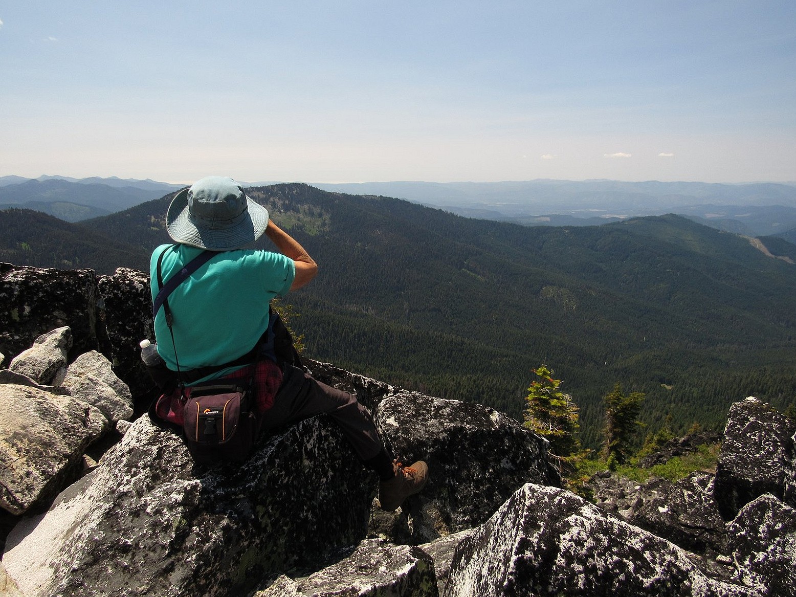
Otherwise, the trip was a mixed bag. We got to Mazama Village, where we had planned to have brunch, just as the breakfast line was closing. (We were standing by the counter preparing to order when they suddenly announced that breakfast was over and took all the food away. We were the only ones waiting.) The small collapsible tripod I was carrying to try out for flower photos kept pinching me, leaving me with a blood blister on one hand and a cut thumb on the other. I left my camera bag behind at one stop (the camera wasn’t in it, so I lost only my spare camera battery and cleaning cloth, but still…). But the scenery and the flowers overwhelmed all of that. Looked back on, it was a simply glorious ten hours. Enjoy the pictures. You can follow the course of our day in the captions.

Melody enjoying the view of the lake from the upper floor of the snack bar/gift shop in Rim Village. We put together a brunch from the snack bar and ate it here, looking out over the lake.
We took Rim Drive counter-clockwise, which put us at the Castle Crest Wildflower Garden first. This is not a tended garden, just a trail past a set of springs emerging from the base of Castle Crest. The upper picture is Lewis’s monkey flower; the lower is a white bog orchid. See also the picture inset into the last paragraph of the text.
Vidae Falls – our next stop.
The short trail to Sun Notch is probably my favorite in the park, and leads to a wonderful view of the lake. This is Applegate Peak from the Sun Notch meadow. The rim is marked by the line of trees at right.
The lake from Sun Notch, with the Phantom Ship front and center. You can see why the first Europeans to stumble upon the place, in 1853, named it Deep Blue Lake.
Where the Rim Drive crosses Dutton Ridge a mile or so beyond the Sun Notch parking area, it reaches its highest point (though not the highest point reached by road – keep reading). The flowers here are characteristic of alpine and subalpine areas. Clockwise from upper left: Applegate’s paintbrush, pumice paintbrush, dwarf mountain lupine, Cascade aster. Pumice paintbrush is found only high on volcanic peaks in the Cascade range.
Plaikni Falls is the destination of a relatively new trail off the side road to the Pinnacles, east of the lake. The flowers here are similar to those found at Castle Crest.
The red flowers here are of two different and unrelated species, western columbine and scarlet paintbrush. The yellow is arrow-leaf groundsel; the blue (upper right corner) is Jessica’s stickseed.
Bleeding heart at Plaikni Falls.
The highest point reachable by road in the park is the Cloudcap Overlook, at the end of a side road from the northeastern section of the Rim Road. Elevation here is 7960 feet. Naturally, I had to get a shot of the Bolt in the parking lot. For an unencumbered look at the view, see the photo at the head of this post.
Flowers at Cloudcap are decidedly alpine. Clockwise from upper left: royal penstemon, cushion buckwheat, woolly senicio, and Ashland cinquefoil, .
Silver raillardella is rare in Oregon; it’s found primarily in the high mountains of California and western Nevada. This one was growing by the Cloudcap parking lot.
Our last extensive stop was at the Merriam Point overlook, at the junction of the North Entrance Road and Rim Drive. It features a stunning view of Llao Rock.
One last flower shot: Anderson’s lupine in its white phase, photographed at Merriam Point.

Midsummer flowers on Soda Mountain

I promised a post on the hike I didn’t get around to blogging before we left town for a week, so here it is. It was a relatively short, relatively level walk on a stretch of the Pacific Crest Trail that traverses the northeastern slope of Soda Mountain near Ashland, Oregon. This section of the PCT is not known for its scenery – through-hikers usually just trudge through without stopping – but its mix of meadow and forest, with occasional views out to Ashland and the rest of the distant Bear Creek Valley, has a quiet charm about it. Streamlets abound in the meadows in early summer, and the mid-season flower displays can be spectacular, especially on one particular rocky knoll about a third of a mile in. It’s a great introduction to hiking in the the Cascade-Siskiyou National Monument for first-time visitors, and a relaxing afternoon stroll for old-timers like us who had just recently made the much stiffer climb up Grayback Mountain.

We parked the Bolt around 1:00 PM at the Hobart Bluff trailhead on the Soda Mountain Road, off Oregon Highway 66 at the Greensprings Summit, and headed south. The trailhead meadow was a yellow carpet of woolly sunflower under power lines; the knoll was spectacular, with woolly sunflower, paintbrush, buckwheat, and many other flowers covering nearly every square inch of ground beneath big views down the valley. After that, the flower displays were quieter but still lovely: hyacinths, columbine, honeysuckles, and many other plants in the woods; yampah and owls clover in the dry meadows; monkeyflowers and heals-all near the one small pond the trail passes in this stretch. We turned around at the saddle under Little Pilot Peak, a little less than three miles in, where there is a nice view south to Mt Shasta.

Clockwise from upper left: owl’s clover, Oregon geranium, honeysuckle, stonecrop.

It was 5:00 when we reached the car, so we headed for the Greensprings Inn, a small, old mountain restaurant and lodge a few miles east of the Greensprings Summit that has long been known among locals for the quality of its food. There is not much more to say. Enjoy the pictures.

Pilot Rock from the knoll. The predominant flowers are woolly sunflower, paintbrush, and buckwheat.

Grayback Mountain

Phantom orchid along the O’Brien Creek trail.

If I had to describe the O’Brien Creek trail in one word, it would be “brutal”. The trail, built long ago to supply a herders’ cabin in a large subalpine meadow in the Siskiyou Mountains, heads uphill abruptly from the trailhead and climbs 2000 thigh-challenging feet in two miles, all of it through dense, dark, mostly dry conifer forest. Not my normal idea of a good time. But it is also the best way to reach Grayback Mountain, and Grayback is definitely worth reaching. Grayback is the highest peak in Oregon’s Josephine County, and one of only a few Siskiyou summits to top 7,000 feet. The meadow spoken of a few minutes ago, Grayback Meadow, spreads up the bottom of a shallow bowl on the mountain’s steep east slope for nearly 1000 vertical feet – acres and acres of grass and little springs and wildflowers, edged by trees and capped by a lovely line of granite cliffs below the summit ridge. And from the summit, it is said, on a clear day you can see the ocean.

All of which is why Melody and I found ourselves in the Bolt last Friday morning, creeping up a road specified for high-clearance 4wd vehicles only, headed for the O’Brien Creek trailhead and that damned mountainside fall-line of a trail.

We didn’t quite get there – not in the car, anyway. Roughly half a mile before the road’s end, a fallen madrone had sprawled into the roadway. There was space to go around, but that space was occupied by a deep, rocky pothole followed immediately by a large rock. I had managed to work my way around all potholes and rocks until then, but I’d had the full width of the road to maneuver. This one looked impossible. So I backed the Bolt into a convenient flat area on a switchback 100 feet or so back down the road, locked it up, and we began walking. In fifteen minutes, we were on the trail.

The way up that steep, essentially switch-back-less two miles seemed very long. But there were woodland flowers to contemplate (wildflower photography is a great excuse to take rest stops), and there was a small side stream with a lovely little waterfall on it to cross, and eventually we broke out into the little clearing where O’Brien Creek itself tumbles across the trail. At that point the worst was over. It’s a half-mile from the creek crossing on a nearly level trail, past a small snow-survey cabin, to the site where the old Krause herders’ cabin stood at the foot of Grayback Meadow. The cabin burned down over a decade ago, but its stove is still there. So is its view.

Grayback Meadow.
White rushlily, Hastingsia alba. Not in the guidebooks.

We moved slowly up the meadow, savoring. The slope was even steeper than the trail had been, but here there was sunshine, and the cliff far above us (but growing nearer), and views out that grew longer and vaster as we climbed. And nearly every square inch under our feet was covered with flowers. The Siskiyou Mountains are part of the larger Klamath Mountain system, which is mostly made of ultramafic rock – peridotite, serpentine, and their relatives – and ultramafic soils grow unusual plants. Grayback is actually made of granite, but it has its share. One flower, in fact – prolific here – is rare enough that it doesn’t appear in either of the standard wildflower guidebooks I use (see the accompanying photo). Others are Klamath Mountains endemics that would probably be happier on serpentine, but will also grow on granite. Add to those the standard mountain-meadow flowers you find everywhere in the west, and you begin to get the idea.

Clockwise from upper left: tiger lily, cobwebby paintbrush, Davidson’s penstemon, Oregon checker mallow.
Coiled lousewort along the Boundary Trail.
Paintbrush and woolly sunflower on the summit ridge.

An hour later and two-thirds of the way up the meadow we hit the Boundary Trail, so named because it runs along the western and southern boundaries of the Rogue River National Forest, beginning at Windy Gap – a little over a mile north of where we hit it – and ending many miles away at Lily Pad Lake, near the eastern end of the Red Buttes Wilderness. We took the Boundary Trail south for a mostly level half mile to the mountain’s south ridge, left it, and started boulder-hopping up the ridge. An hour of that, and we were on top. On top of the world.

I’m sorry to say that we couldn’t see the ocean. The air was too hazy to make it out, although the pictures I took do show, on close examination, a level line separating two slightly different shades of blue that I wistfully hope is the ocean horizon. We were able to make out a white line of what were clearly coast-hugging clouds far off to the southwest, and we had to make do with that. That, and the rest of the tremendous, hundreds-of-square-miles view in every conceivable direction.

We were on top for roughly 20 minutes. Then we picked our way down the north ridge, found Windy Gap and the start of the Boundary Trail, and headed for the car. We were home and comforting two anxious cats by a little after 7:00 pm. The Bolt’s GOM said that we could still go 200 miles, if we wanted to.

I wasn’t tempted.