This just came in. For those who still suffer range anxiety, the 2020 Bolt has something new especially for you.
https://www.engadget.com/2019/08/22/chevy-2020-bolt-ev-longer-range/?fbclid=IwAR07rdvSikcVbTKNR24_OYDsgFe8zh5i5SeFFFnxqgTkNOYqLd9glO_oQco
Tag Archives: EV range
The Trail Less Traveled
Reply
Upper Ruffey Lake, near Etna, California
Two roads diverged in a wood, and I—
I took the one less traveled by,
And that has made all the difference.
Robert Frost’s advice about roads often applies to trails, too. It certainly applies to the trail to Upper Ruffey Lake, a side path off the Pacific Crest Trail just north of the Russian Peaks Wilderness in California’s Klamath Mountains.
I’ve known about the Ruffey Lakes for a while. I’ve even seen the sign on the PCT pointing to them – Melody and I walked right past it several years ago on our way to goggle over the spectacular granite scenery surrounding Smith Lake, two miles further down the trail. They’ve just never seemed much of a draw. The guidebooks haven’t been encouraging. Jeffrey Shaffer, in his guide to the PCT in Northern California, dismisses Upper Ruffey Lake as a “small cow-inhabited basin”; William L. Sullivan, in “100 Hikes in Southern Oregon” – a lot of which are actually in northern California – mentions it only in passing, as a “woodsy” lake which makes “an acceptable day-hike goal” if you run out of steam before reaching Paynes Lake, the destination he is actually describing. Few other guides, either in print or on line, even bother to mention the Ruffeys. People rarely seem to plan to go there.
Nor did we, at least in the beginning. The original idea was to try to catch a glimpse of Wicks Lake, a tiny, remote pond in a steep little cirque cut into a granite cliff high on a nameless peak above the tiny, remote town of Etna, California. No trail reaches Wicks Lake; no trail even goes within sight of it. The PCT runs along the other side of the mountain. Cliffs above and below the lake make getting to it a formidable task. I doubt that it gets three visitors in a decade. I didn’t expect to be among them, but I did want to see it. The best chance seemed to be to take the PCT south from the Etna Summit trailhead, veer off on the Ruffey Lakes trail for 300 yards or so to the saddle where the trail crosses the ridge above the upper lake, and follow that rugged ridge a mile or so north to the third of its three summits, where we could peer over the edge of the cliff and – hopefully – see Wicks Lake. Upper Ruffey Lake would be, to borrow Sullivan’s words, an “acceptable day-hike goal” if the Wicks Lake plan petered out.
That was the plan. By the time we left the house last Wednesday, though, it had morphed into something a little different. I’d been a bit under the weather all week – not enough to keep me from hiking, but enough so that choosing to bushwack a mile along a steep up-and-down ridge seemed, at best, questionable judgement. So the goal now became Upper Ruffey Lake. That way, we would at least get someplace. If I had enough energy left, we would tackle the traverse to the view of Wicks Lake on our way out.
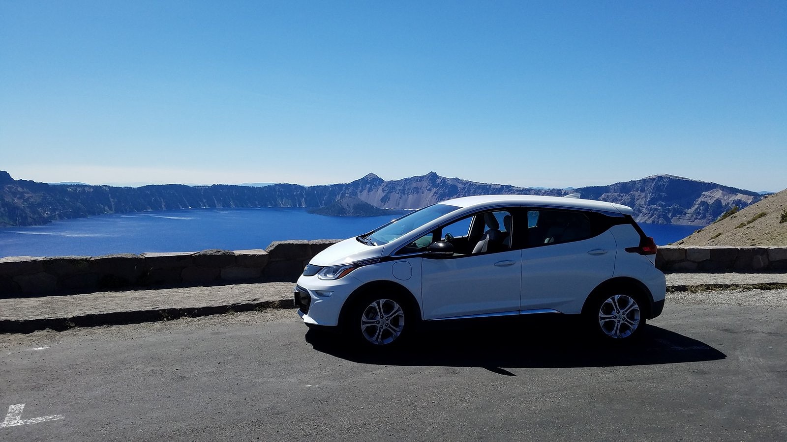
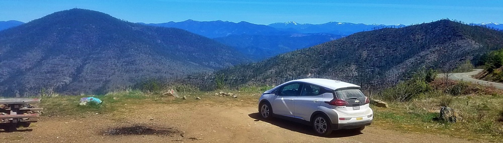
It’s a bit over 90 miles from our home in Medford to Etna Summit – about half on the freeway (over two passes), another third on a two-lane rural road (over another pass), and the rest up a winding, narrow mountain road (to the top of a 4th pass, this one 6000 feet high). I didn’t expect that to strain the Bolt’s range, but it would be interesting to see how well it did. The drive went smoothly, after a leisurely breakfast at Ashland’s Breadboard; I checked the dashboard display just before turning off the motor at the trailhead and found we had used 28 kwh of electricity to get there. That left us 32 kwh to get home. More than enough – especially since home was 4500 feet closer to sea level than our current location. We locked the car and set off up the trail.
The first quarter mile of the PCT south of Etna Summit is out in the open, with spectacular views across the upper Salmon River canyon to the rugged granite massif that holds Taylor, Hogan, and Big Blue Lakes. After that, though, you enter the forest, and the views disappear. The way is relentlessly uphill. Every few minutes, we met PCT through-hikers coming down. We spoke briefly to a young man from Germany who was looking for a ride into Etna (a regular reprovisioning stop for hikers doing the whole trail). I told him that if he was still waiting at the trailhead when we came out four or five hours later, he would have his ride.
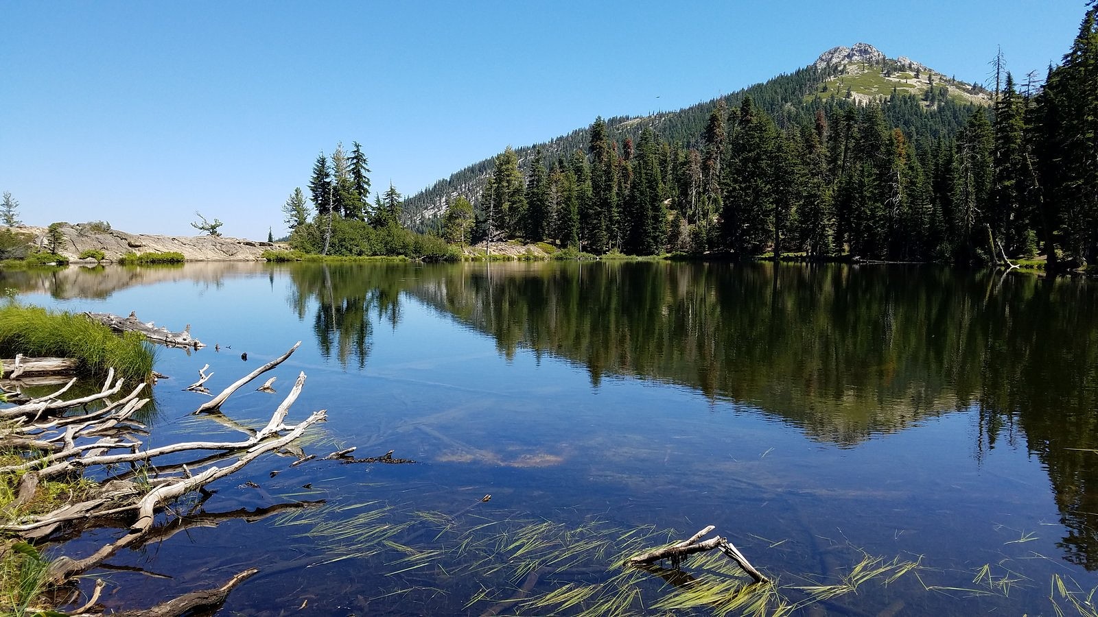
At around 11:30, we turned onto the Ruffey Lakes trail. A couple of hundred yards and less than 100 feet of elevation gain later, we broke out of the woods at the saddle above the upper lake. I’m not sure what I expected to see, but what did meet our eyes was certainly far more than just “acceptable”:
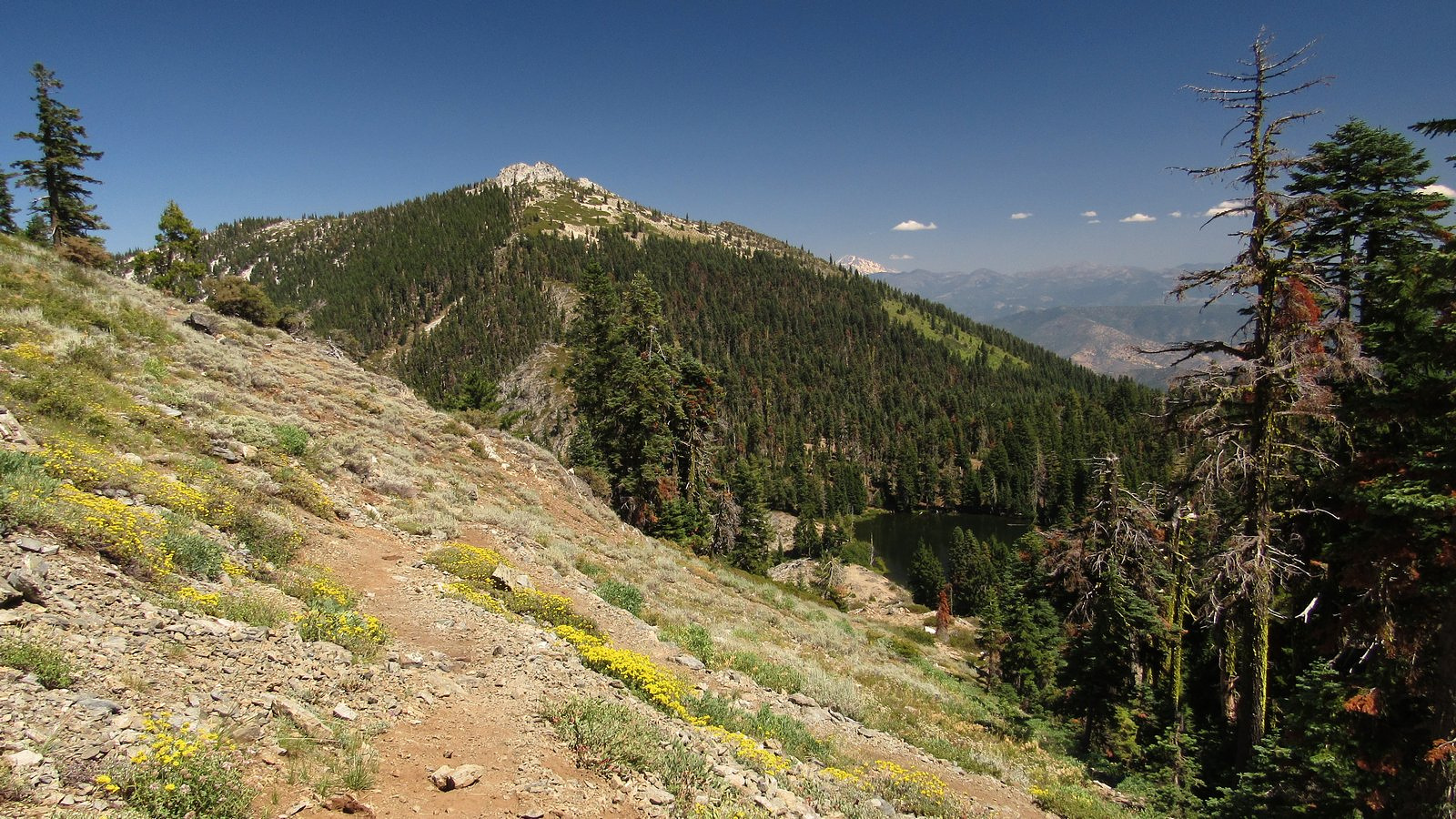
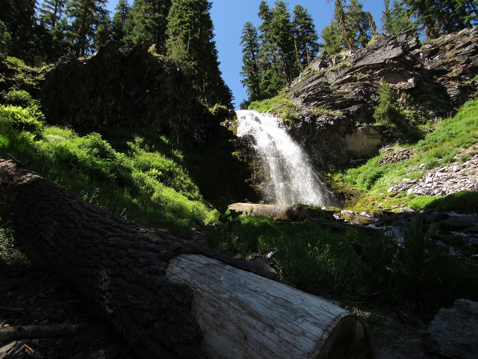
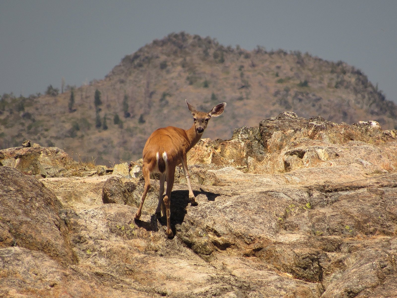
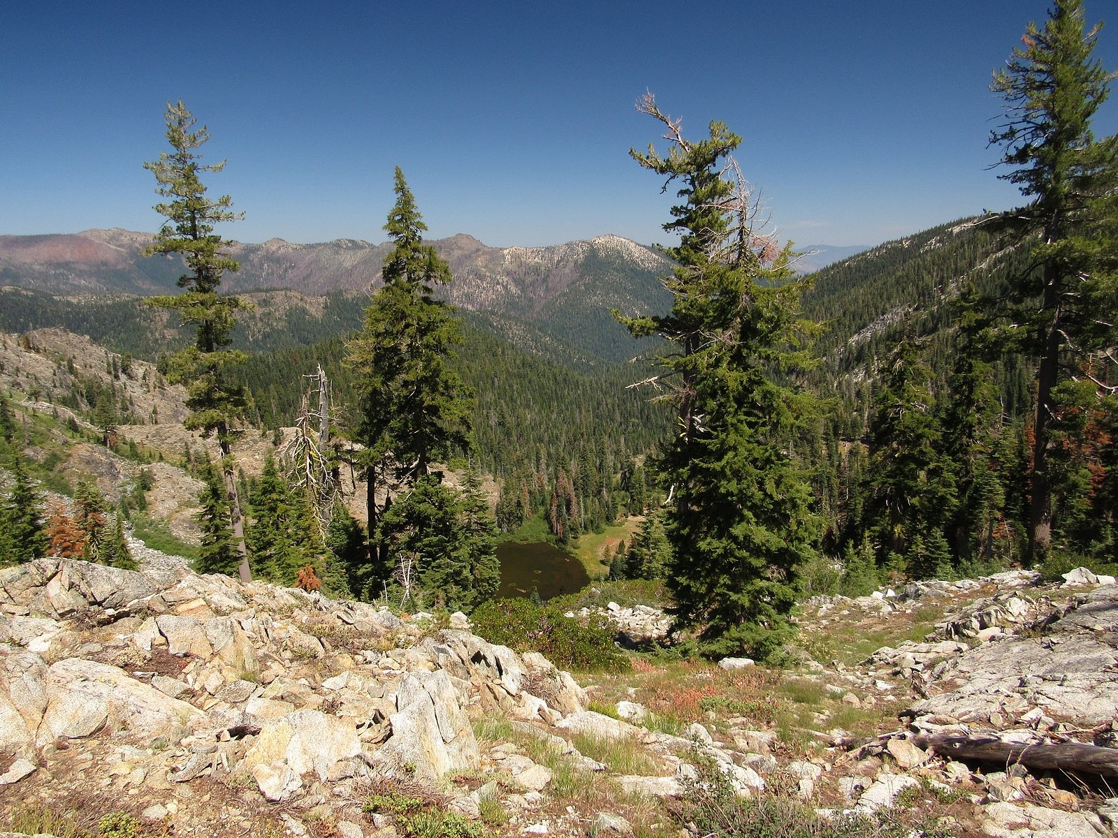
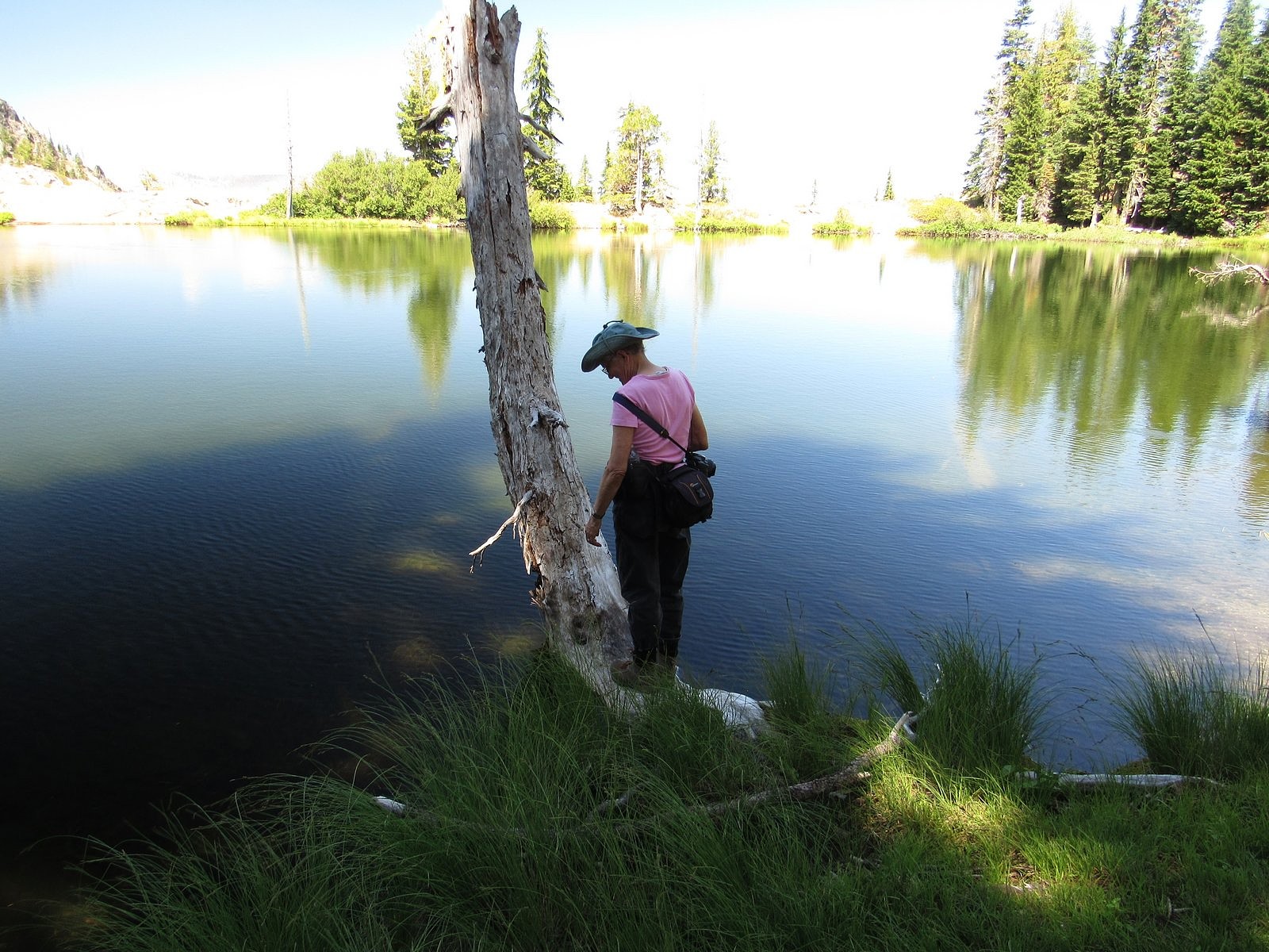
We descended, through flowers and open woods, to the lakeshore. The white double pyramid of Etna Mountain loomed over us. We circled the lake slowly, clockwise, beginning along the polished granite rim. That rim is perhaps 20 feet wide, and is bounded on the side away from the lake by a precipitous 600-foot drop to Lower Ruffey Lake, tucked so tightly against the bottom of the cliff that it was difficult to get a view of it. Back into the woods at the far end of the rim, with views across the lake to the sharp sawtooth knobs of the ridge we had crossed from the PCT. A deer stepped daintily out of the woods onto the rim, checked us out across the water, decided we were safe, and began to graze on something invisible growing from the granite.
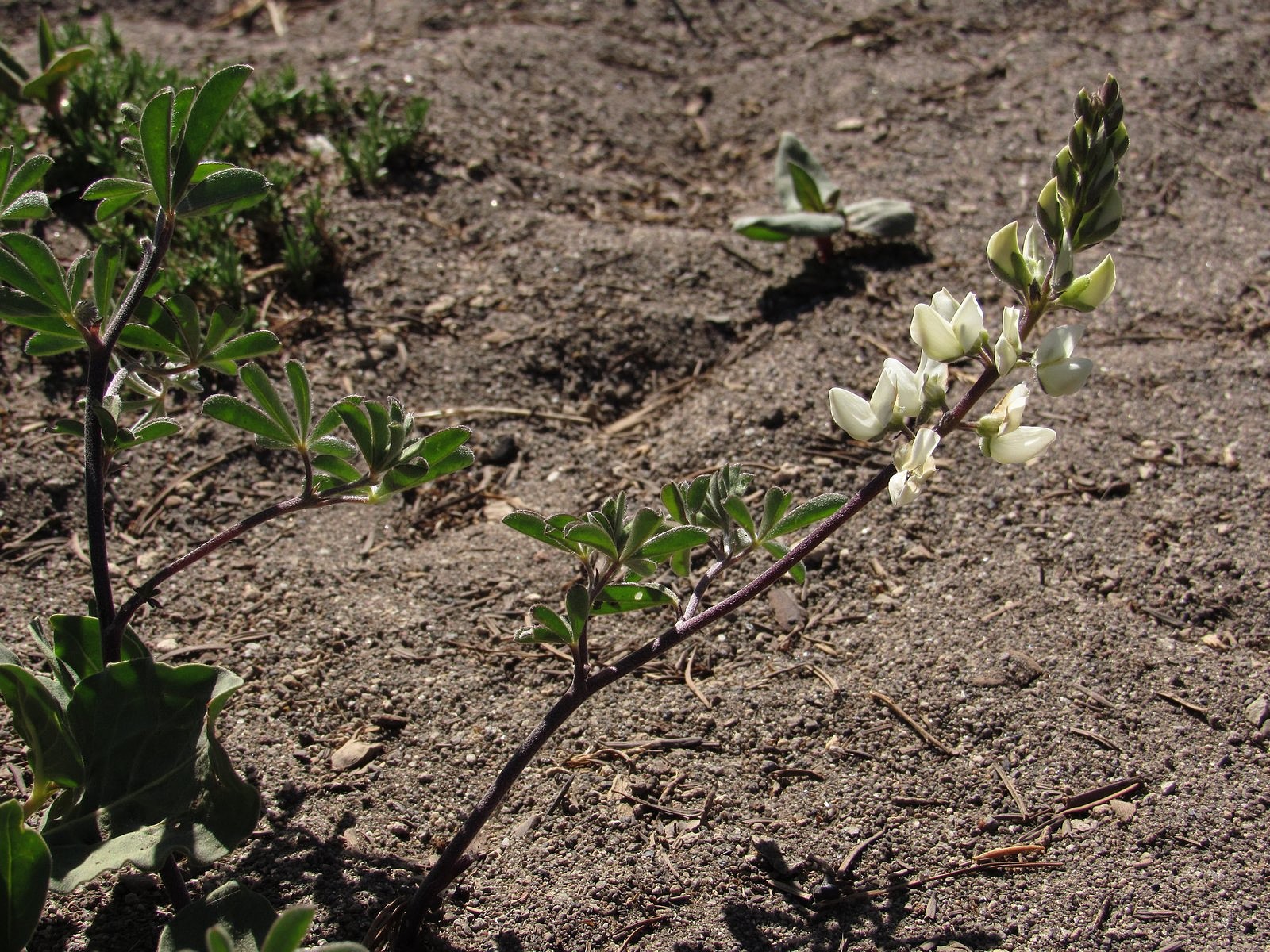
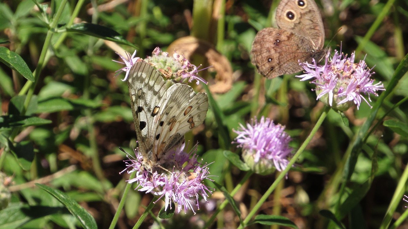
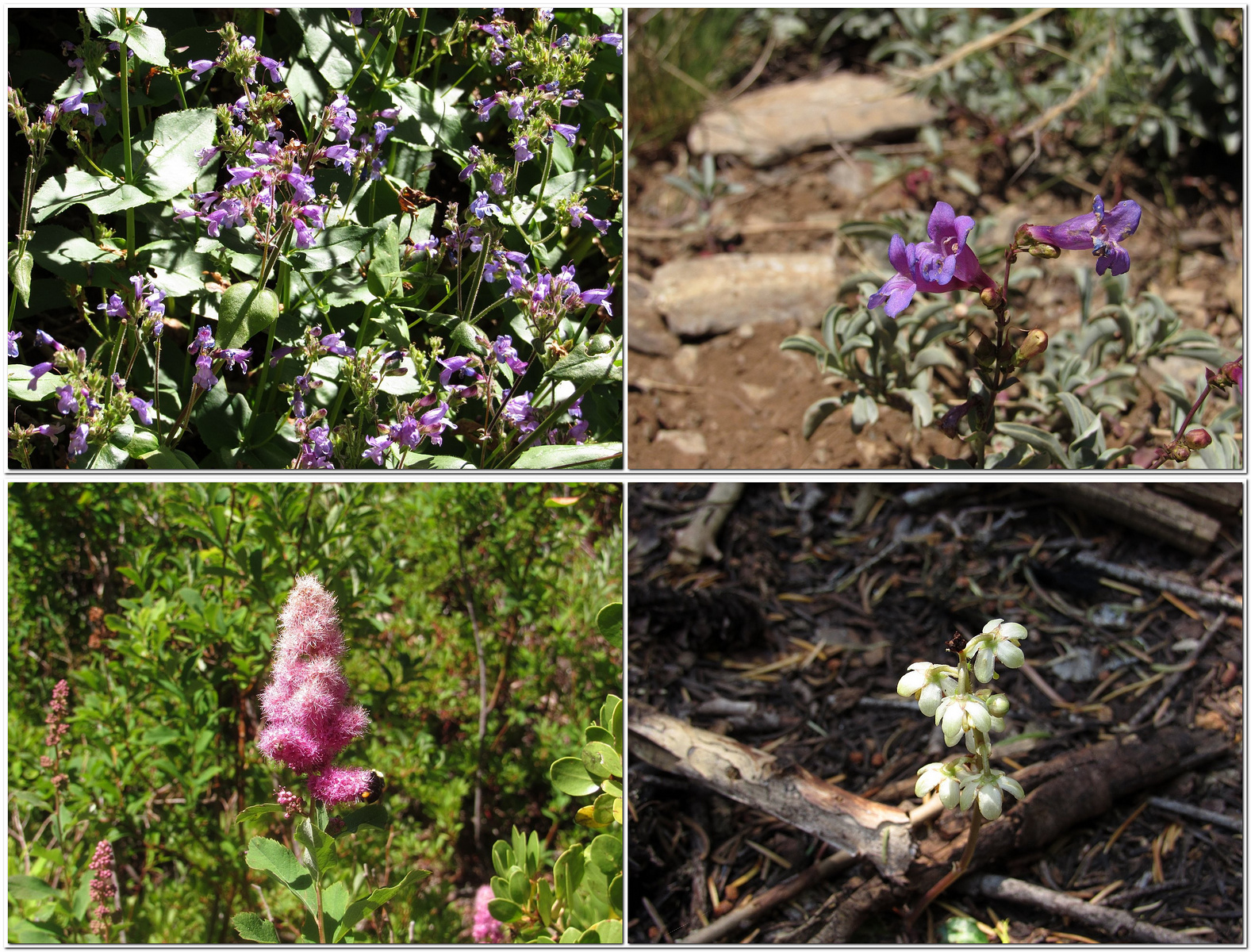
On around to a spring near the spot where we had first reached the shore. The spring’s small stream seeped into the lake through bright yellow monkey flowers and blue monkshoods. A reluctant departure from the shore, then; a slow climb out of the basin to the ridge again, through masses of coyote mint fluttering with butterflies. Since leaving the PCT more than two hours before, we had not seen a single other human being.

On the ridge we diverted, as planned, toward the unnamed summit that would give us a view of Wicks Lake; but it was a halfhearted diversion, and we gave it up after just a short distance and returned to the trail. Back on the PCT, we began once more to encounter through-hikers every few minutes. Hiker Grand Central. Most were traveling north, so they would come up behind us, pass us – sometimes with a greeting, mostly not – and stride rapidly on down the trail. It seemed a grim way to hike. Not for the first time, I wondered what they were seeing at that pace.
We reached the car around 4:30. The German hiker wasn’t waiting for a ride, but another hiker was. He turned out to be from Cleveland. He had never ridden in an electric car, and asked intelligent questions on the way down the hill. We dropped him at Etna’s small supermarket and headed for home. Rolled into the garage with 30% of the battery left, 77 miles showing on the GOM, and a new determination not to ignore “the trail less traveled by”.
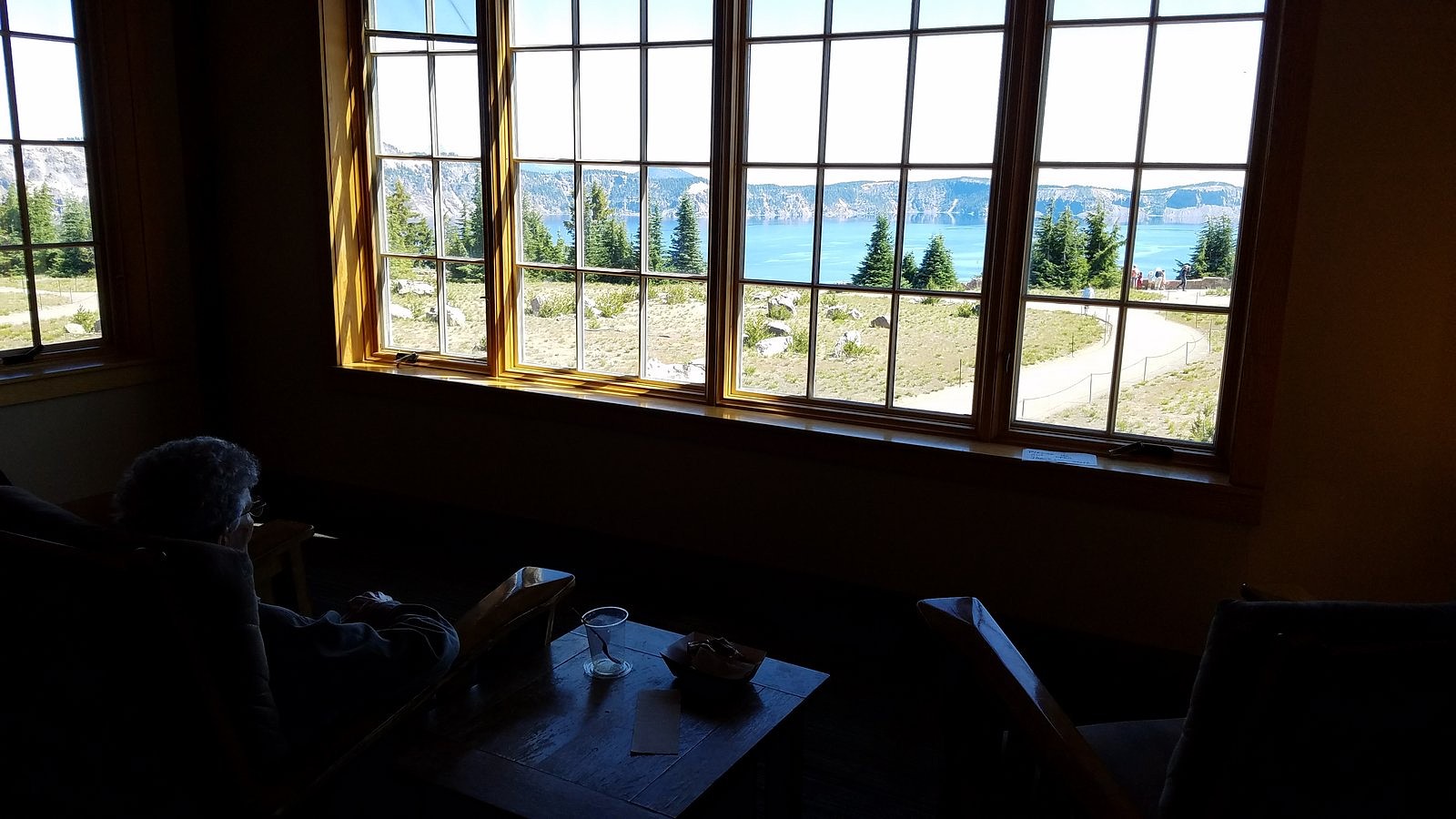
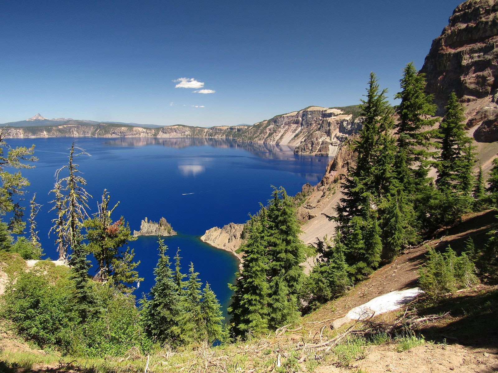
Deep Blue Lake
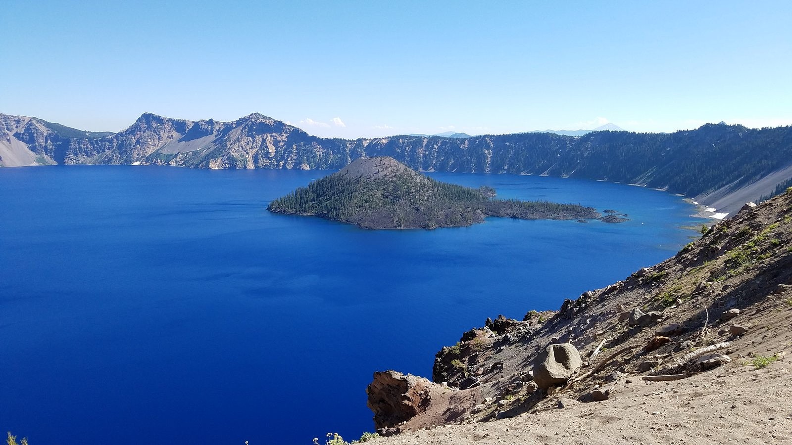
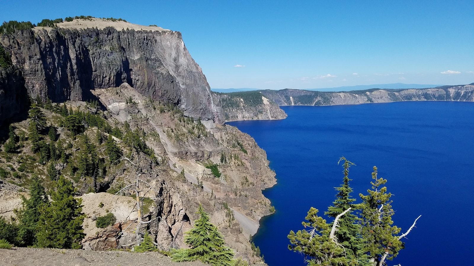
ON July 31 – the day before I was due to turn 77 – Melody and I spent a full-day touring Crater Lake National Park. We’re lucky to live less than 80 miles from this spectacular park, whose creation year (1902) puts it among the oldest national parks in the world, and we’ve been going there several times each year since 1970. We haven’t tired of it yet. I don’t think we ever will.
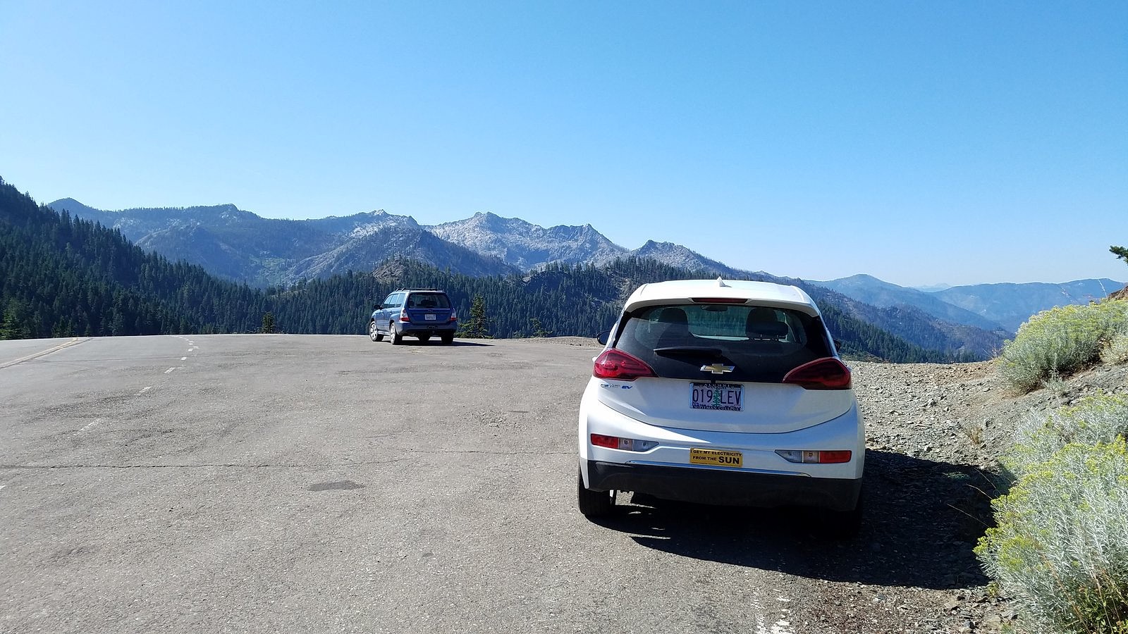
This particular trip was primarily planned because smoke from the Milepost 97 fire near Canyonville, Oregon had made the air unhealthy in many of the places we usually go, but had largely bypassed Crater Lake. But I’ve also been wondering, ever since we got the Bolt, how it would fare on a full Crater Lake day. We’d taken it to the Rim Village overlook and back (see https://drivingonsunlight.net/2019/05/06/the-story-so-far/), but the park includes much more than Rim Village. There is a road – Rim Drive – all the way around the rim of the caldera that holds the lake, with side roads to several other points of interest, including one of the highest spots reachable by car in the entire state of Oregon. Since buying the Bolt in December, I’ve preached that an EV is perfectly adequate for all uses anyone would normally put a car to. Taking Rim Drive its entire length, plus as many of the side roads as we could fit into one day, would add many extra miles over our previous visit; but for outdoor enthusiasts such as us, it would certainly qualify as “normal use”. How would the Bolt’s battery hold up?
So let’s deal with that question, first. We left home with less than a full battery – we usually charge to 95% instead of 100% (there are reasons), and I forgot to make my usual adjustment for longer trips. I drove the 72 highway miles between Medford and Crater Lake as I have always driven them, a few miles over the 55 mph speed limit, with bursts up to 75 and a bit over for passing out-of-state tourists gawking at the big trees. We covered almost every road in the park (we left out only the road from Rim Drive to the north entrance, and the last few miles of the road to the Pinnacles, neither of which we had time for) – a total distance of 195 miles. We got home with 30% of the battery remaining, and 103 miles left on the range indicator. If you have had any doubts about an electric car substituting perfectly for a gasoline car in all normal circumstances, please lay them aside.
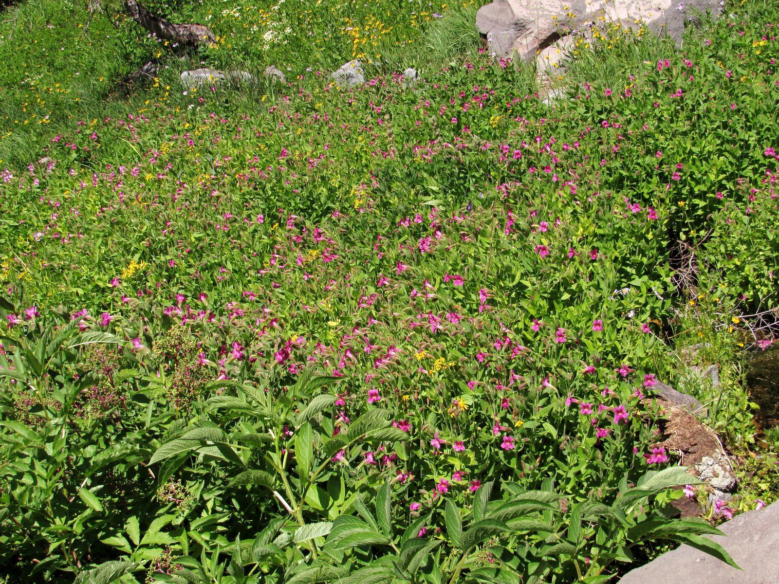
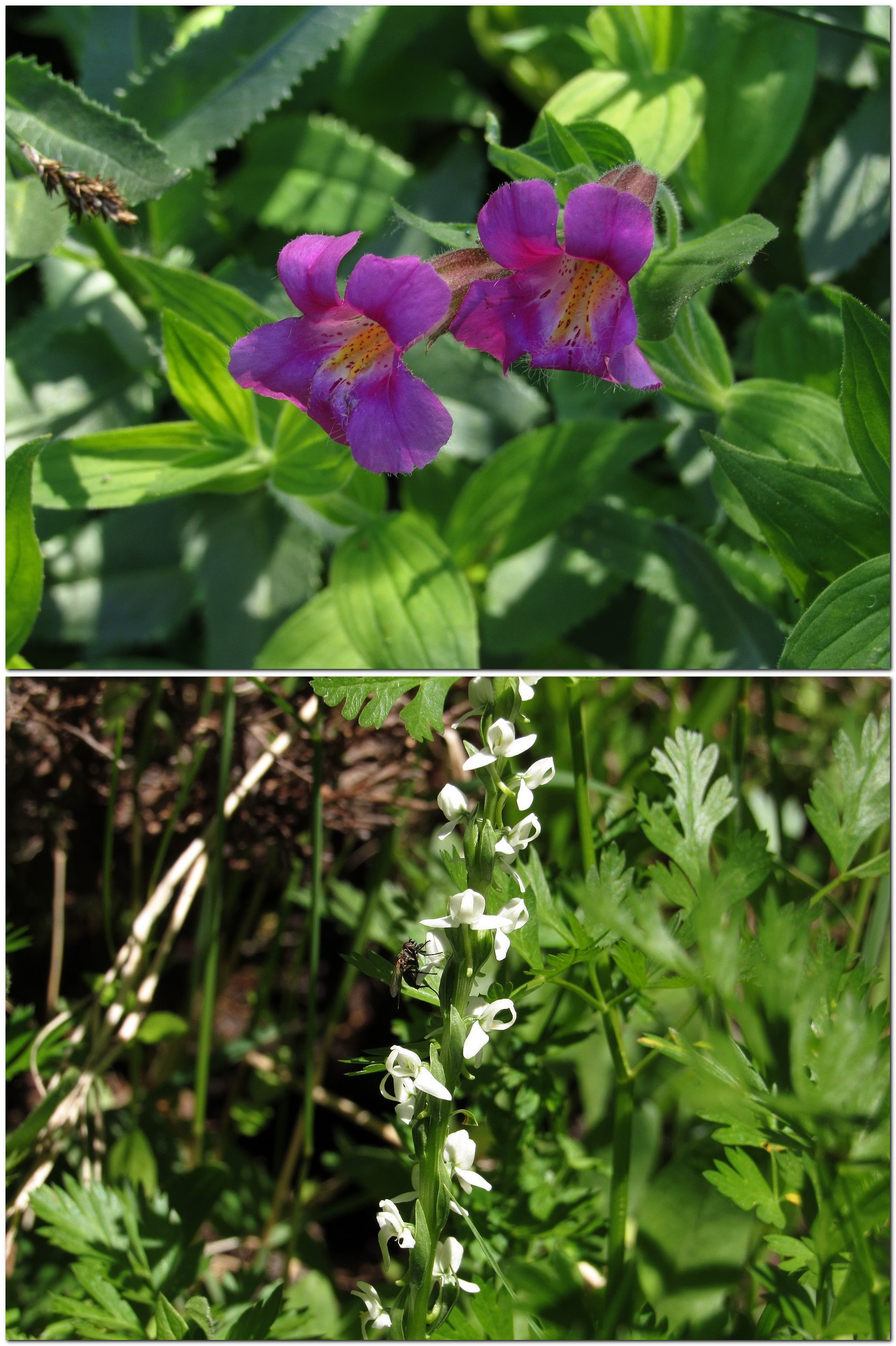
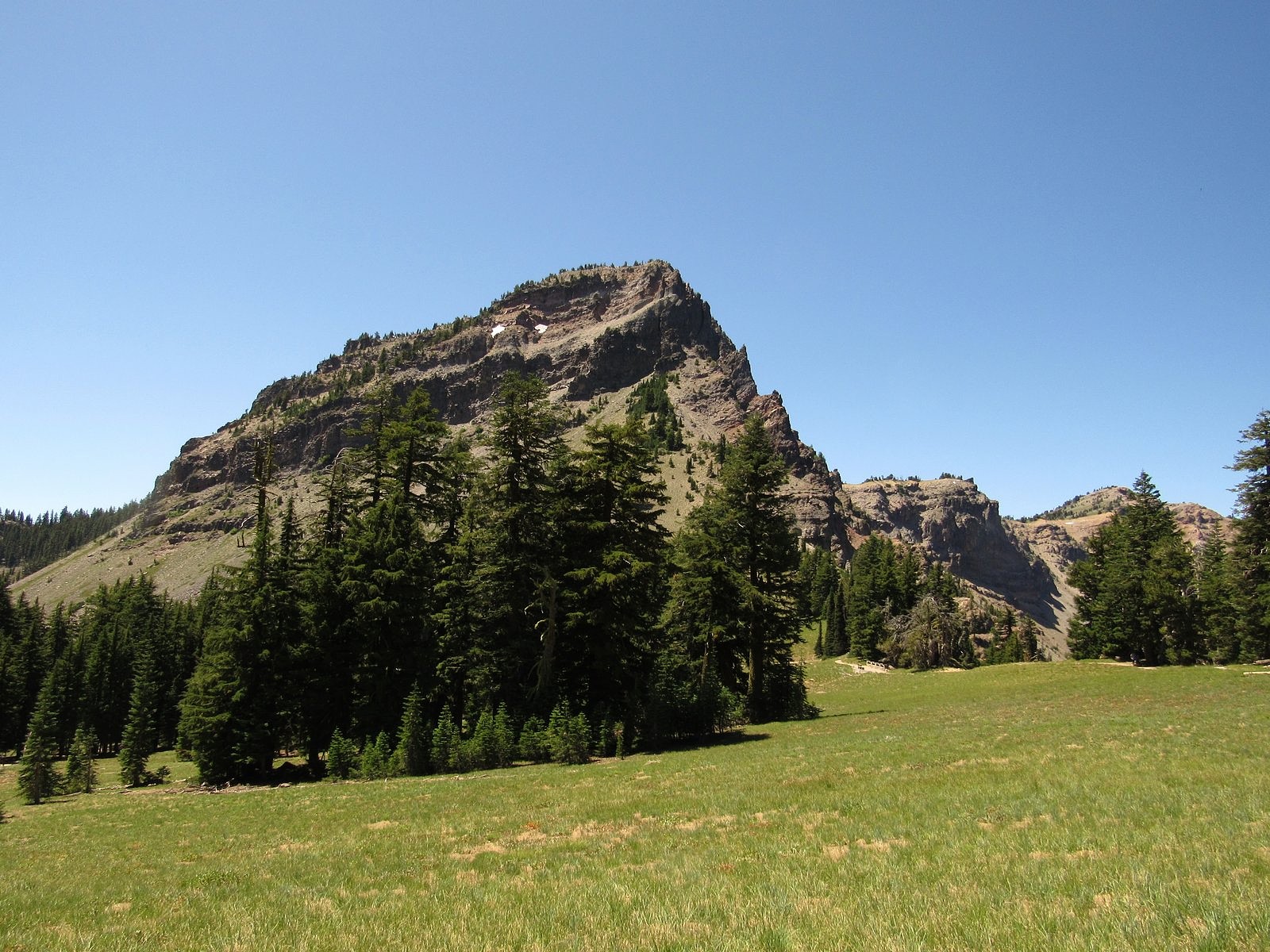
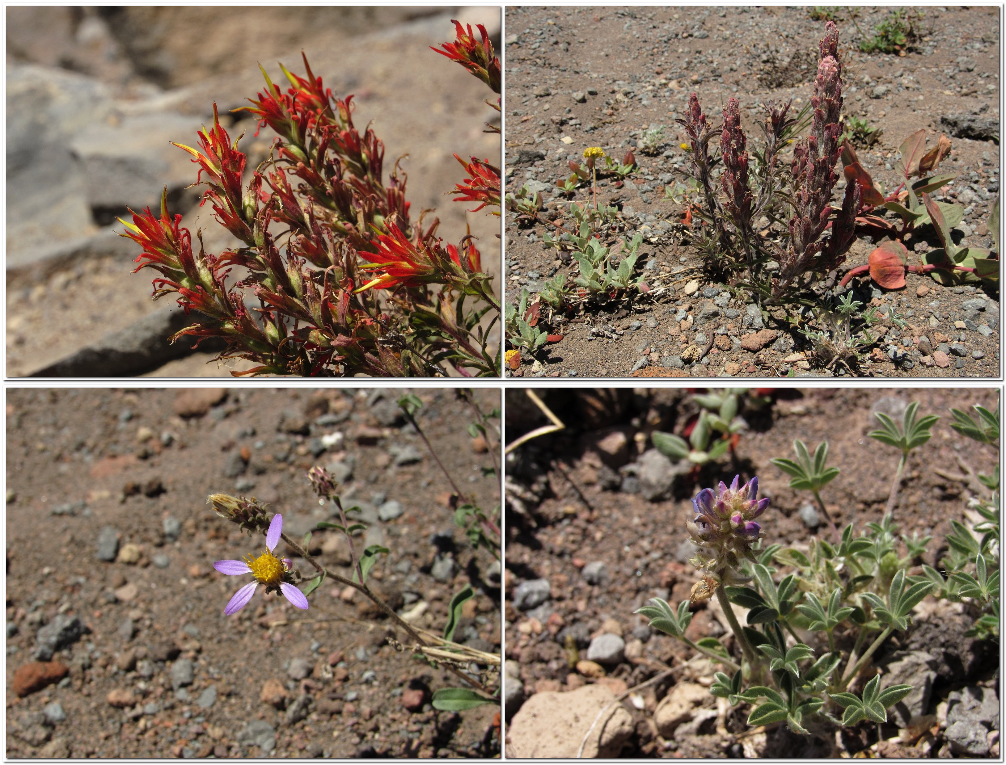
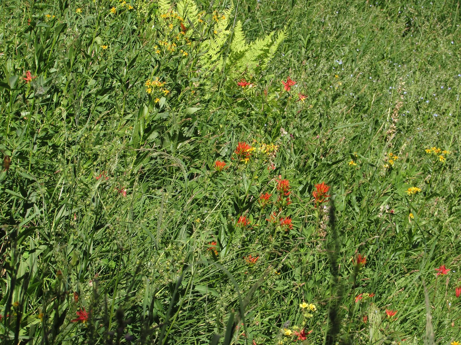
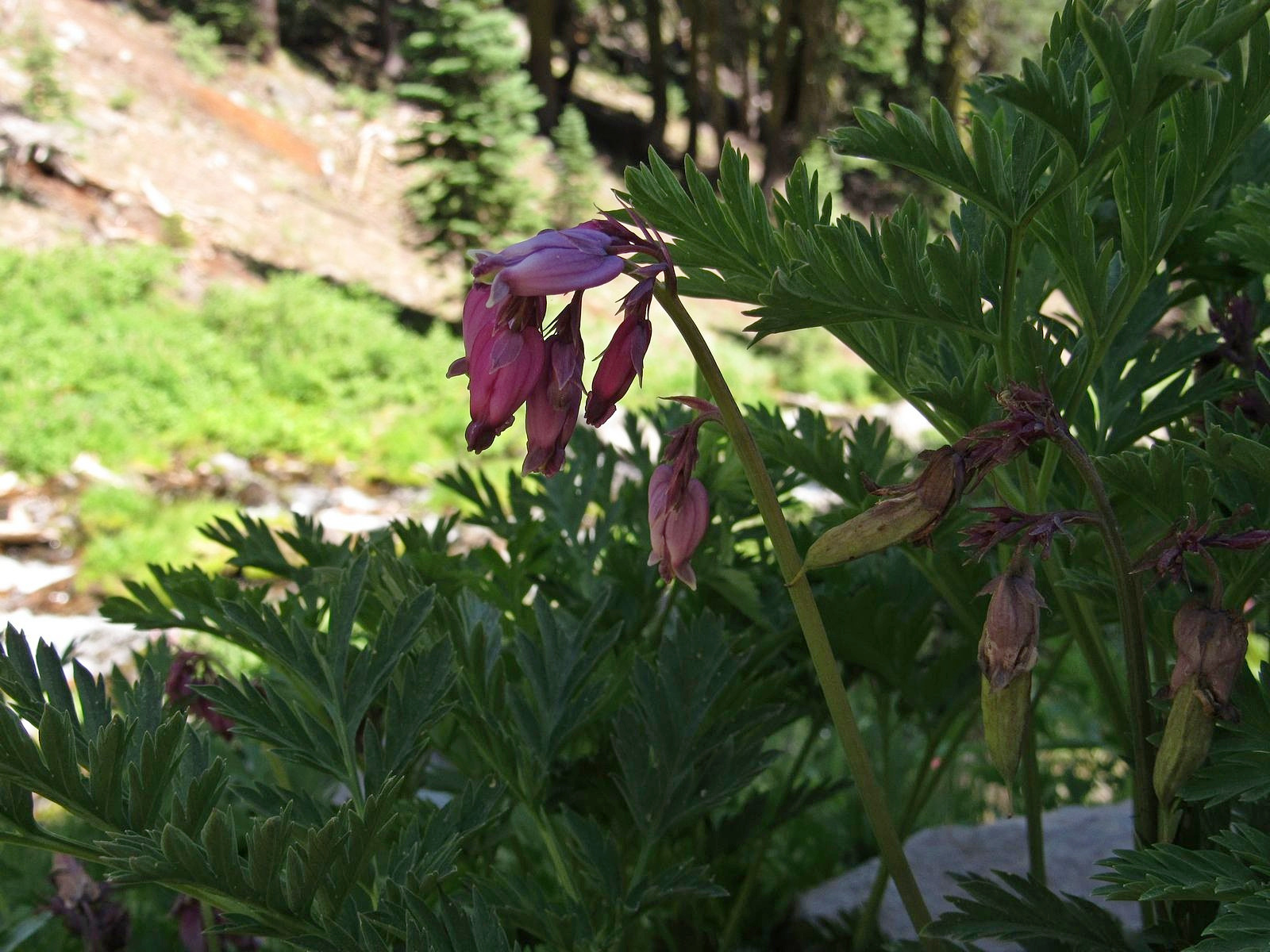
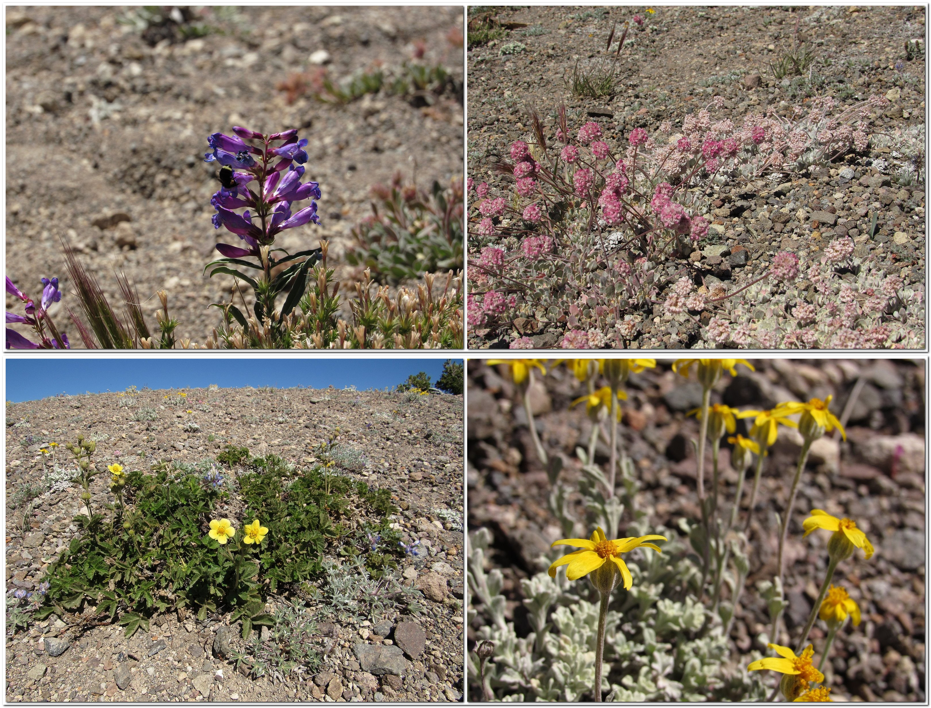
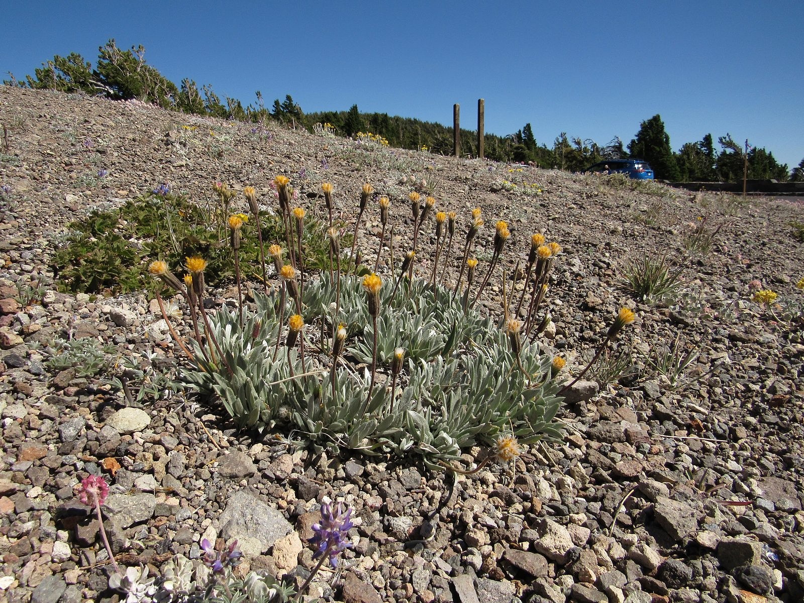
Otherwise, the trip was a mixed bag. We got to Mazama Village, where we had planned to have brunch, just as the breakfast line was closing. (We were standing by the counter preparing to order when they suddenly announced that breakfast was over and took all the food away. We were the only ones waiting.) The small collapsible tripod I was carrying to try out for flower photos kept pinching me, leaving me with a blood blister on one hand and a cut thumb on the other. I left my camera bag behind at one stop (the camera wasn’t in it, so I lost only my spare camera battery and cleaning cloth, but still…). But the scenery and the flowers overwhelmed all of that. Looked back on, it was a simply glorious ten hours. Enjoy the pictures. You can follow the course of our day in the captions.